


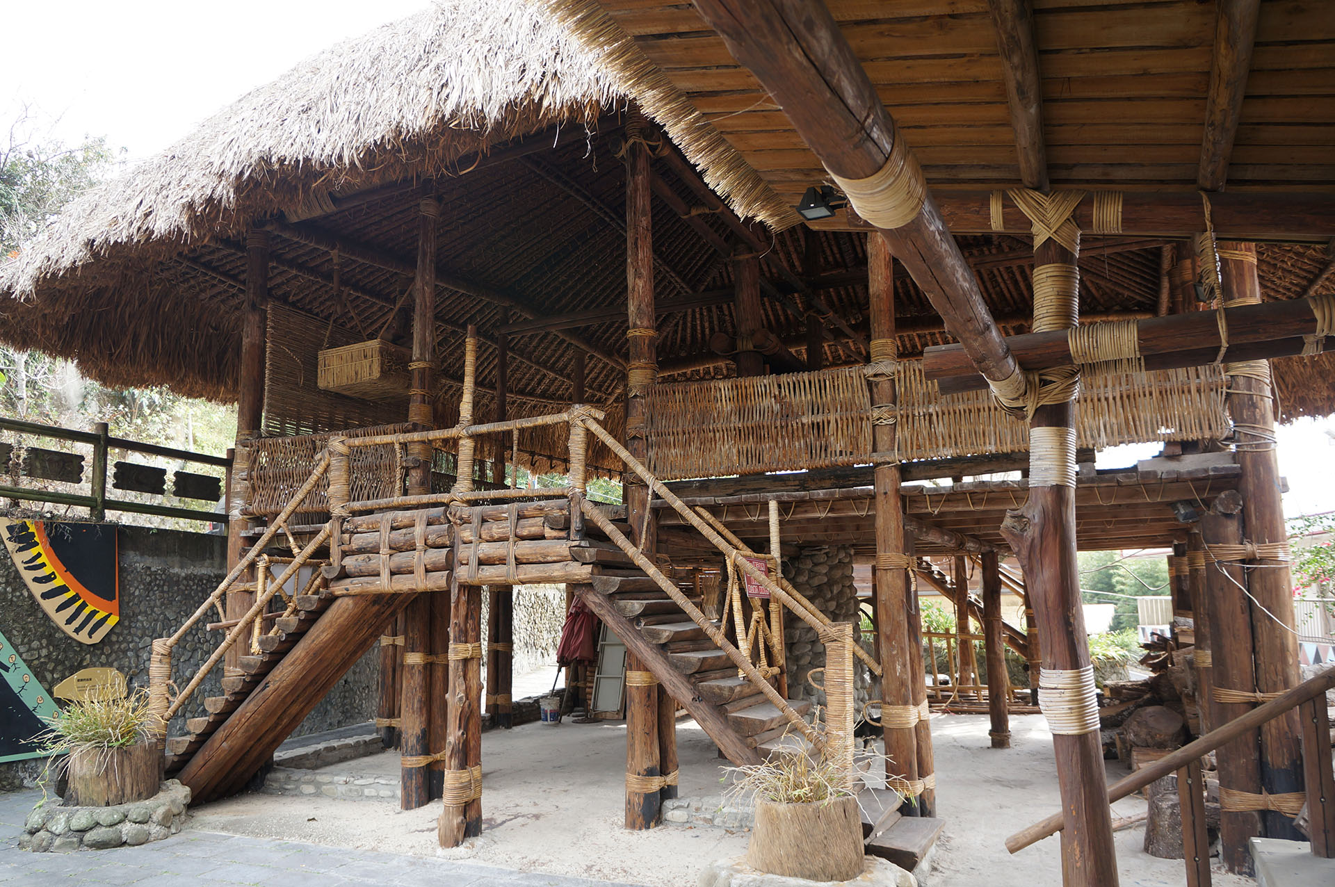


 Tribal Trail


Tribal Trail
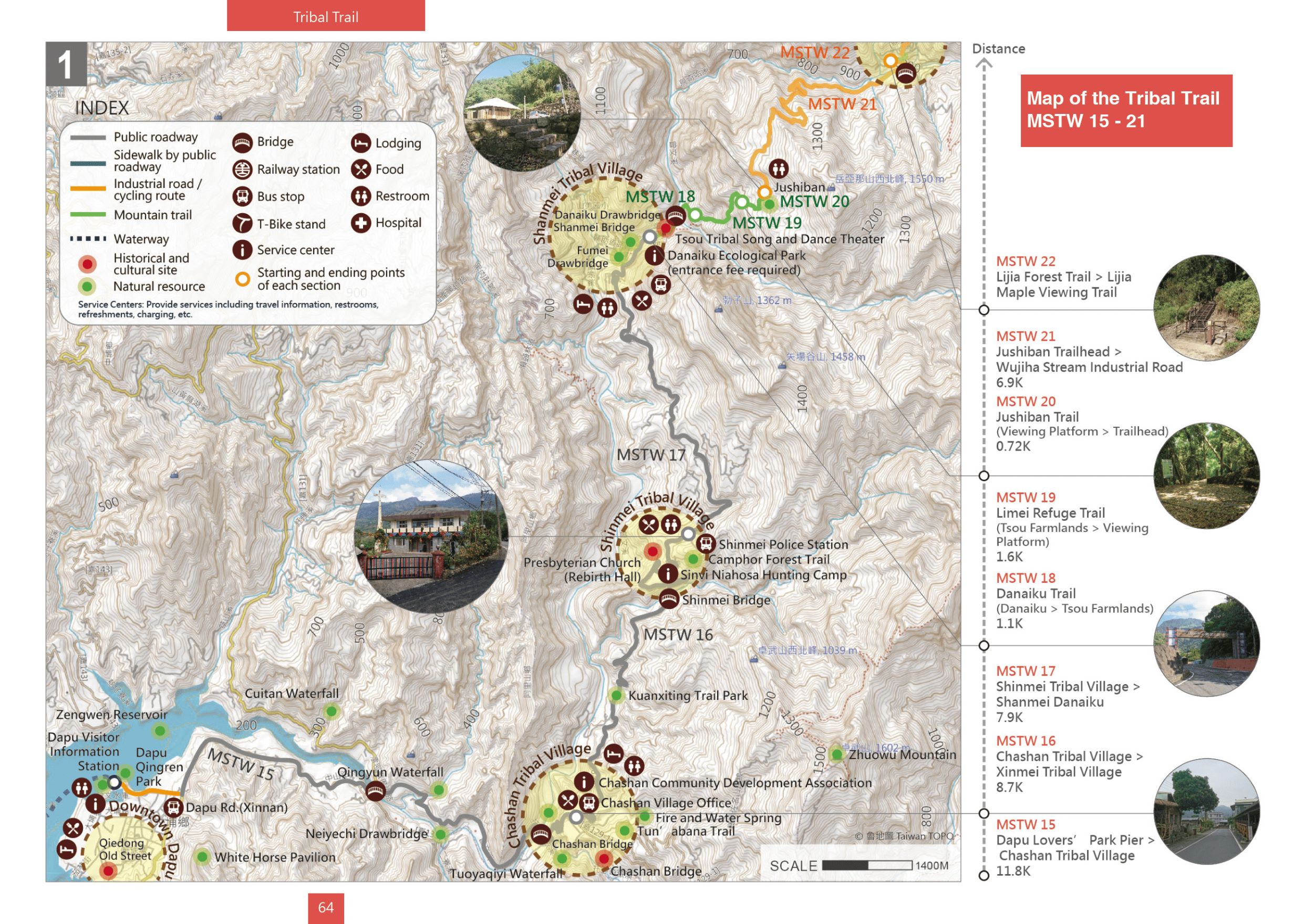
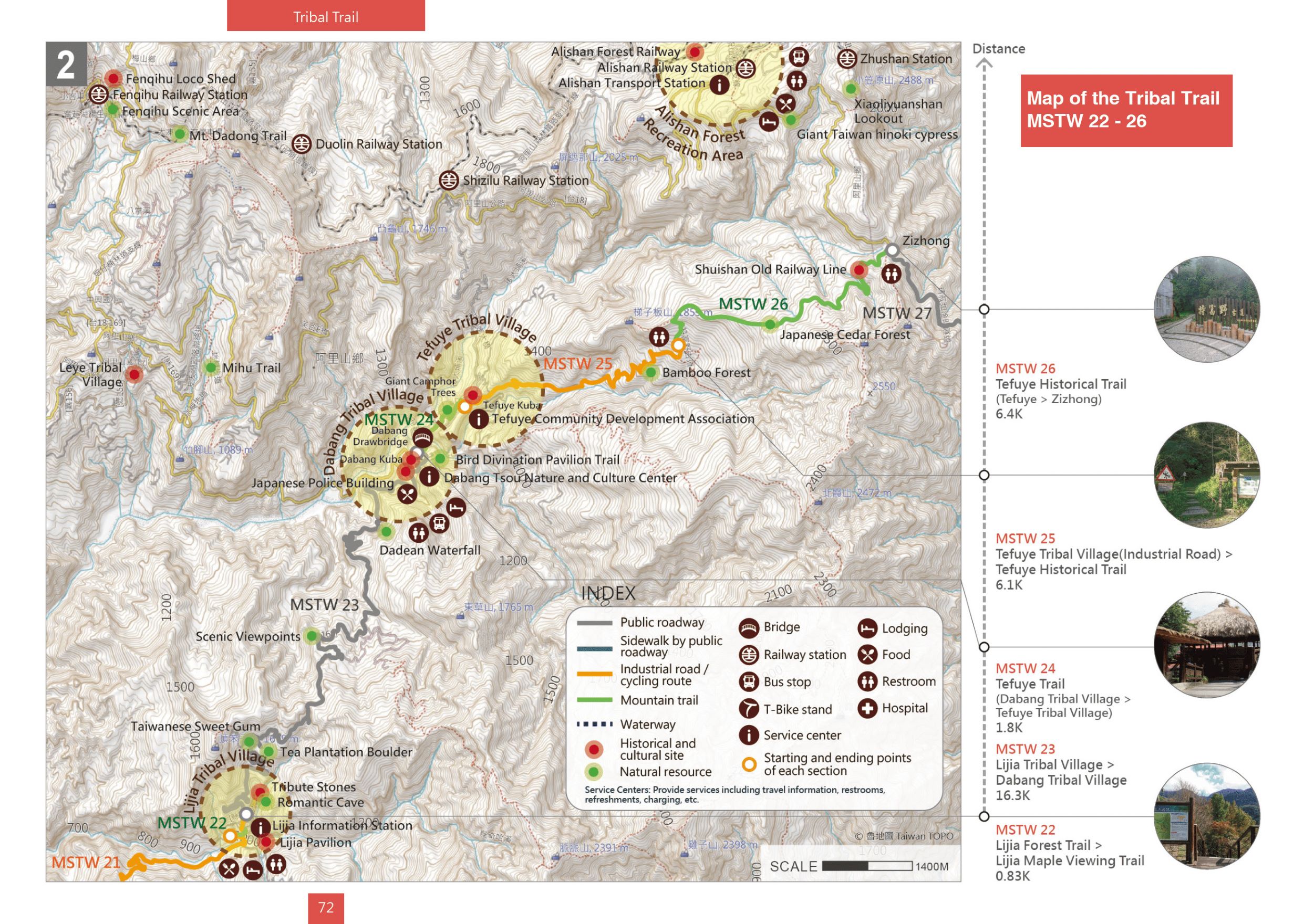
Elevation: Minimum 226 meters, maximum 2,303 meters | Total distance: 70.2 kilometers
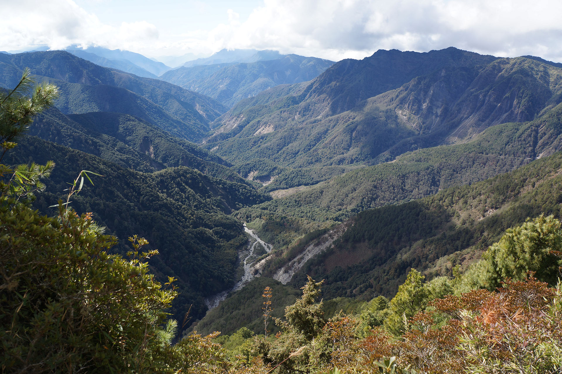
This route passes by Chashan, Xinmei, Shanmei, Lijia, Dabang, and Tefuye Tsou tribal villages, allowing hikers to experience the daily lives and culture of the Tsou People. The villages of Dabang and Tefuye still retain the “kuba,” a gathering place for Tsou men, and there are also a few churches along the route. Within the villages, Tsou ornament and wall paintings are commonly seen, and the surrounding areas have fruit, tea, coffee, and betel nut plantations as well as bamboo groves. This section of the trail marks a transition to a natural, pristine mountain region with more varied terrain. There are several viewpoints along the way where visitors can see the Zengwen River. From Tefuye to Zizhong, the trail follows a preserved section of the old Shuishan Forest Railway Line, which winds through a magnificent cedar forest.
Trails Map
Please select the type of points you wish to display:


No location is founded.
You can select the routes or services you wish to view.



Service Points
Do you wish to take a break during your trek across the MSTW or learn more about the history along the greenway? Visit these Service Points, where restrooms, drinking water, and charging stations are available. You can also obtain travel information about the MSTW and its surrounding attractions!
Dapu Visitor Information Station
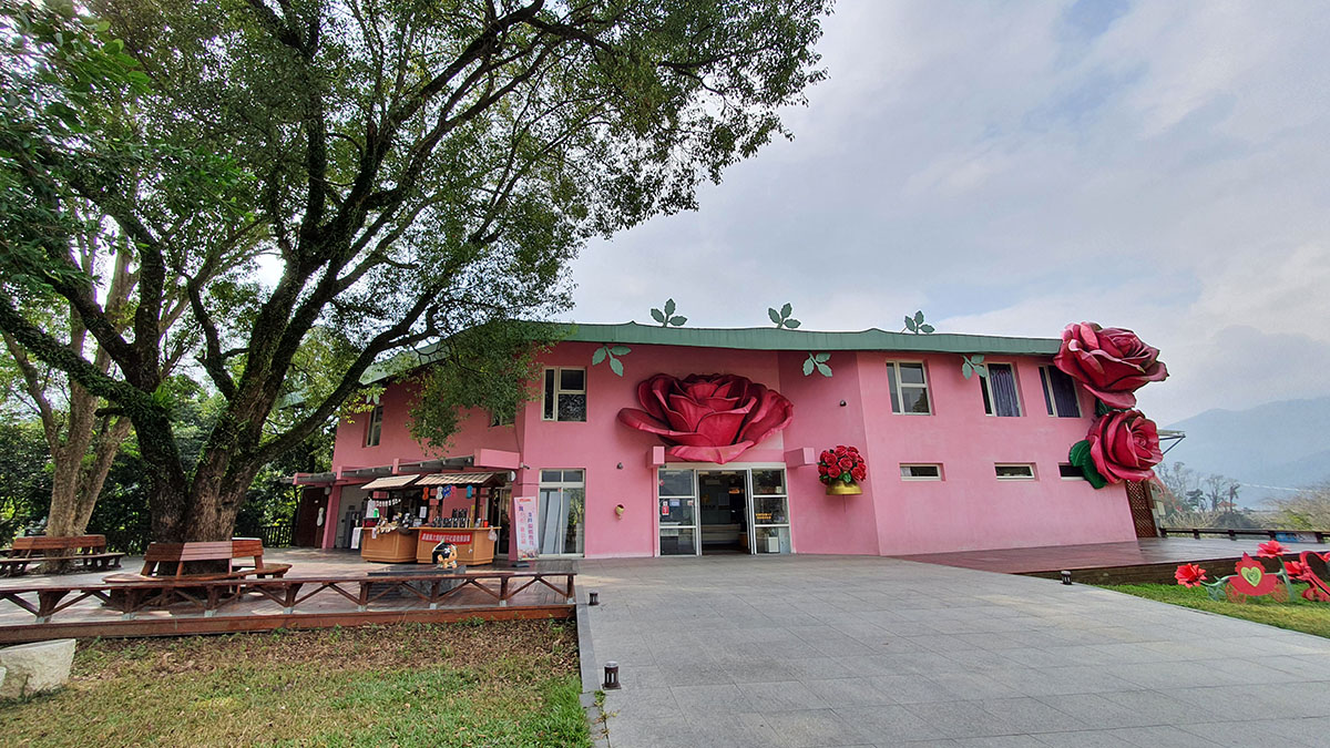
No. 100, Shuangxi, Heping Village, Dapu Township, Chiayi County
23.30172, 120.59002(Check on Google Maps)
09:00-17:00
( More Information )
Chashan Community Development Association
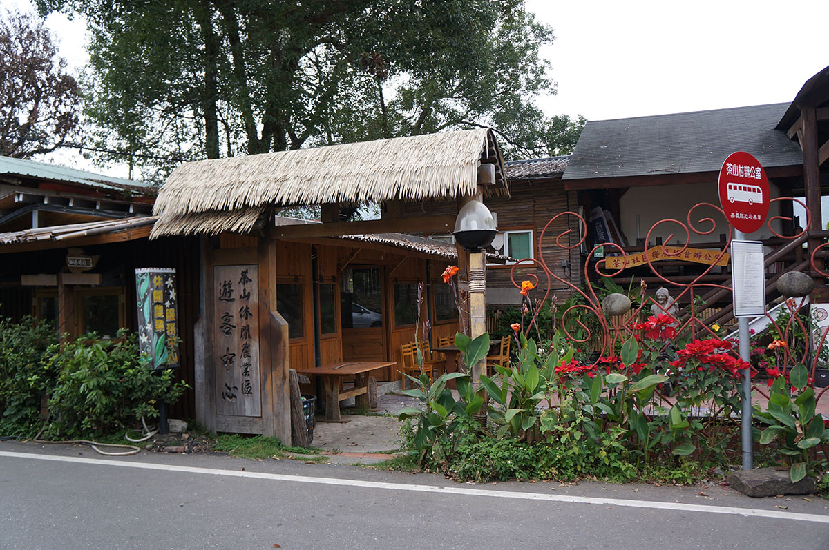
No. 60, Neighborhood 3, Chashan Village, Alishan Township, Chiayi County
23.29898, 120.66614(Check on Google Maps)
09:00-17:00 ; closed on Saturdays and Sundays
( More Information )
Danaiku Ecological Park(ticket required)
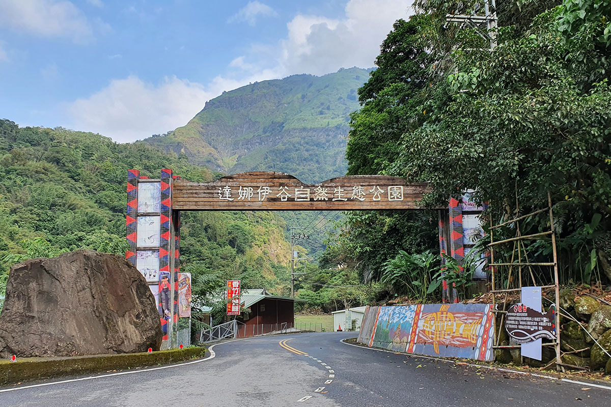
No. 51, Lane 3, Xinmei Village, Alishan Township, Chiayi County
23.37938, 120.67861(Check on Google Maps)
08:00-17:00 Closed on Wednesdays
( More Information )
Sinvi Niahosa Hunter Camp
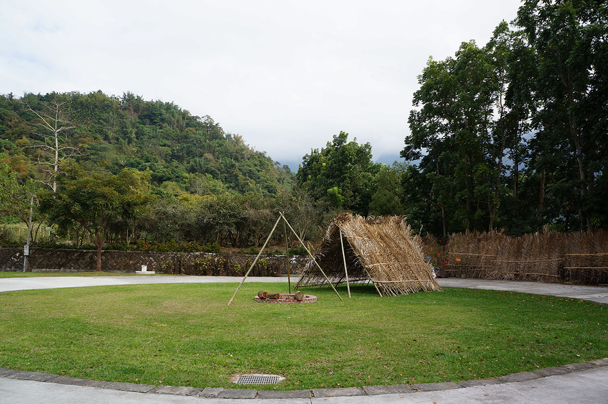
No. 88, Lane 5, Xinmei Village, Alishan Township, Chiayi County
23.33301, 120.68203(Check on Google Maps)
08:00-17:00 Closed on Saturdays
( More Information )
Lijia Information Station
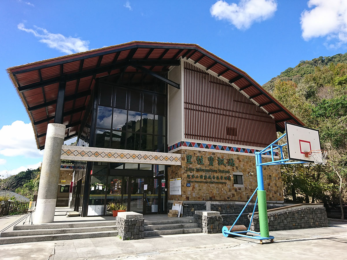
No. 31, Neighborhood 2, Lijia Village, Alishan Township, Chiayi County
23.40523, 120.72119(Check on Google Maps)
09:00-17:00
( More Information )
Dabang Tsou Nature and Culture Center
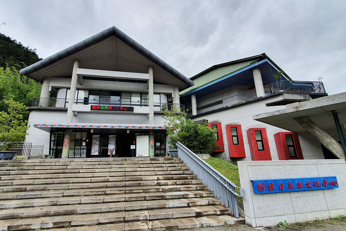
No. 21, Dabang Village, Alishan Township, Chiayi County
23.45402, 120.74944(Check on Google Maps)
09:00-17:00 Closed on Mondays, Tuesdays and public holidays
( More Information )
Tefuye Community Development Association
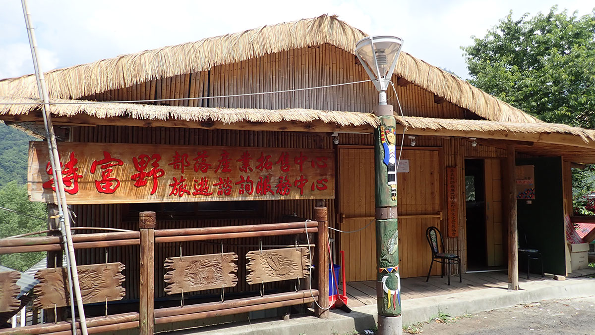
No. 196, Dabang Tefuye, Alishan Township, Chiayi County
23.4623, 120.75733(Check on Google Maps)
Monday to Friday; closed on Saturdays and Sundays
( More Information )
Trial Guide
MSTW 15 Dapu Lovers’ Park Pier → Chashan Tribal Village
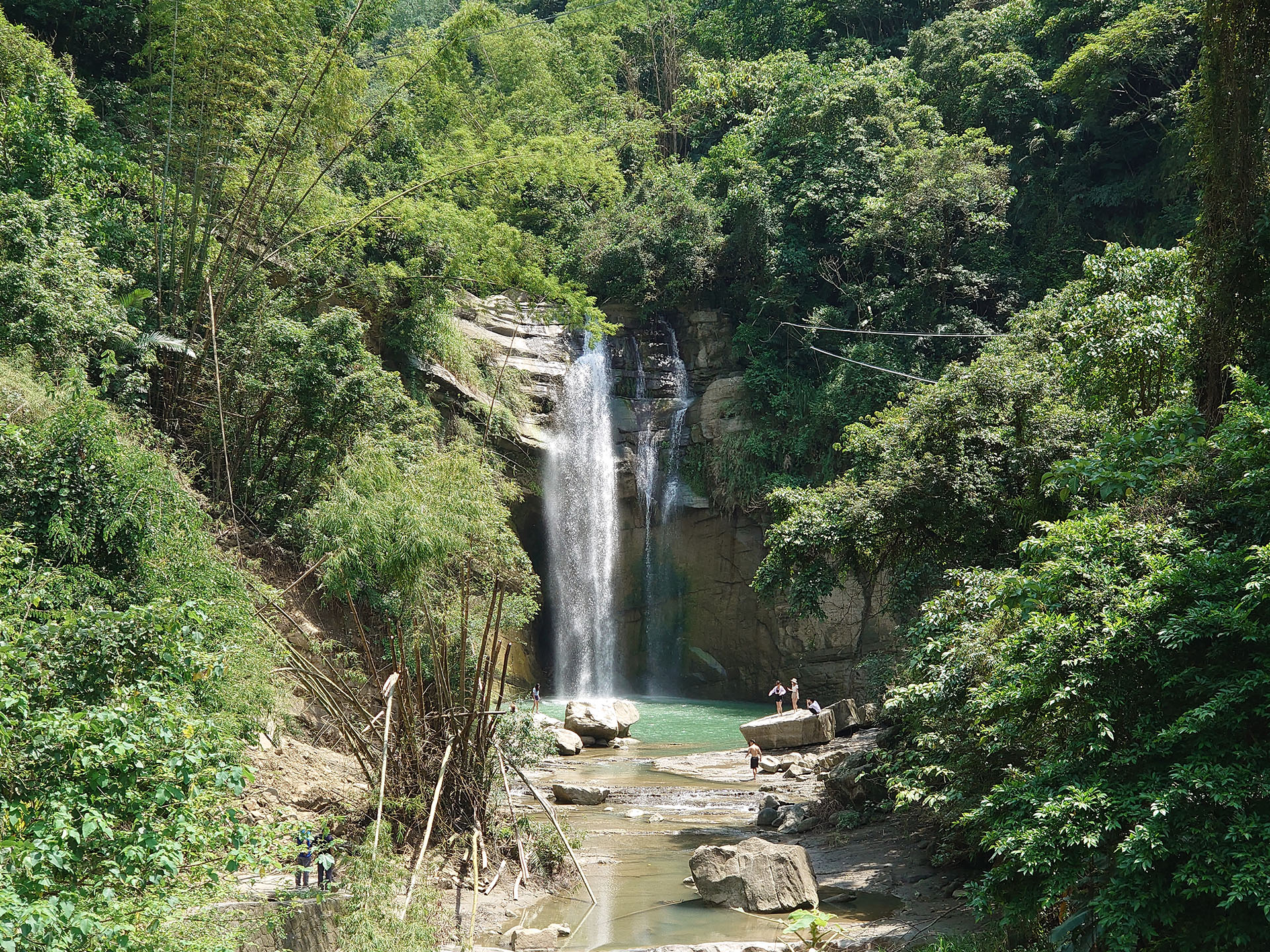
An Exploring Journey into Tsou Culture
Follwing the Zengwen River, hikers eventually leave behind the lowland, primarily Chinese cultural centers, and arrive at Chashan Tribal Village, the first in a series of villages inhabited by Tsou people. Here, the scenery changes into natural, mountainous terrain. Hikers can enjoy the pristine mountain views on the route to Chashan Tribal Village.
Distance
Industrial road 1.2 km; public roadway 10.6 km
Difficulty
Grade 0
(
Check Difficulty Level
)
Time required
2 hr 40 min. walk
Starting and ending points
Zengwen Reservoir Lovers’ Pier / Chashan Tribal Village
Transportation
For DapuBus stop: Take bus Green 25, 7301, or Happiness Dapu 2B to Tudi Gong Temple Station and walk from there.
For ChashanBus stop: Take the Happiness Alishan Route 1 bus and get off at Chashan Station to reach the destination.
For ChashanBus stop: Take the Happiness Alishan Route 1 bus and get off at Chashan Station to reach the destination.
Food
Visitors can find restaurants in Dapu Downtown (Dapu St.) as well as grocery stores and community kitchens in Chashan Tribal Village (Reservation prior visit is highly recommended).
Surrounding attractions
Dapu Qingren Park, Dapu Visitor Information Station , Lovers’ Waterfall, Neiyichi Drawbridge, and Tun’abana Trail
Route
Human activities in the Dapu area can be traced back to Taiwan’s prehistoric period, and the Chiayi Farm Ruins and Dapu Ruins excavated here date the Neolithic period. Later inhabitants of the Dapu region included the Tsou people and Han Chinese, the latter of whom settled in the region during the Qing Dynasty. To build the Zengwen Reservoir in 1967, Dapu residents were forced to move away from their homes, which, in addition to the fact that the region is a headwater area where excessive development is prohibited, has allowed the area to retain its beautiful natural environment. To visit Chashan Tribal Village, hikers depart from Dapu Lovers' Park Pier and go past the Dapu Visitor Information Station; take Gongyuan Rd. and continue along Provincial Highway 3; once past Dapu Bridge, take the Qingshan Industrial Road and pass by Qingyun Waterfall and Chashan Bridge.
Features
The transition from a Han Chinese village to a Tsou tribal village in this area allows visitors to experience the influences of these different cultures. Qingyun Waterfall, also known as Lovers’ Waterfall, gains its nickname because it is where two waterways meet and flow down to form a pool, resembling two lovers holding hands and committing themselves to the future.
Note
The fall is unsuitable for swimming since it is over 10 meters high and with a strong undercurrent.
MSTW 16 Chashan Tribal Village → Xinmei Tribal Village
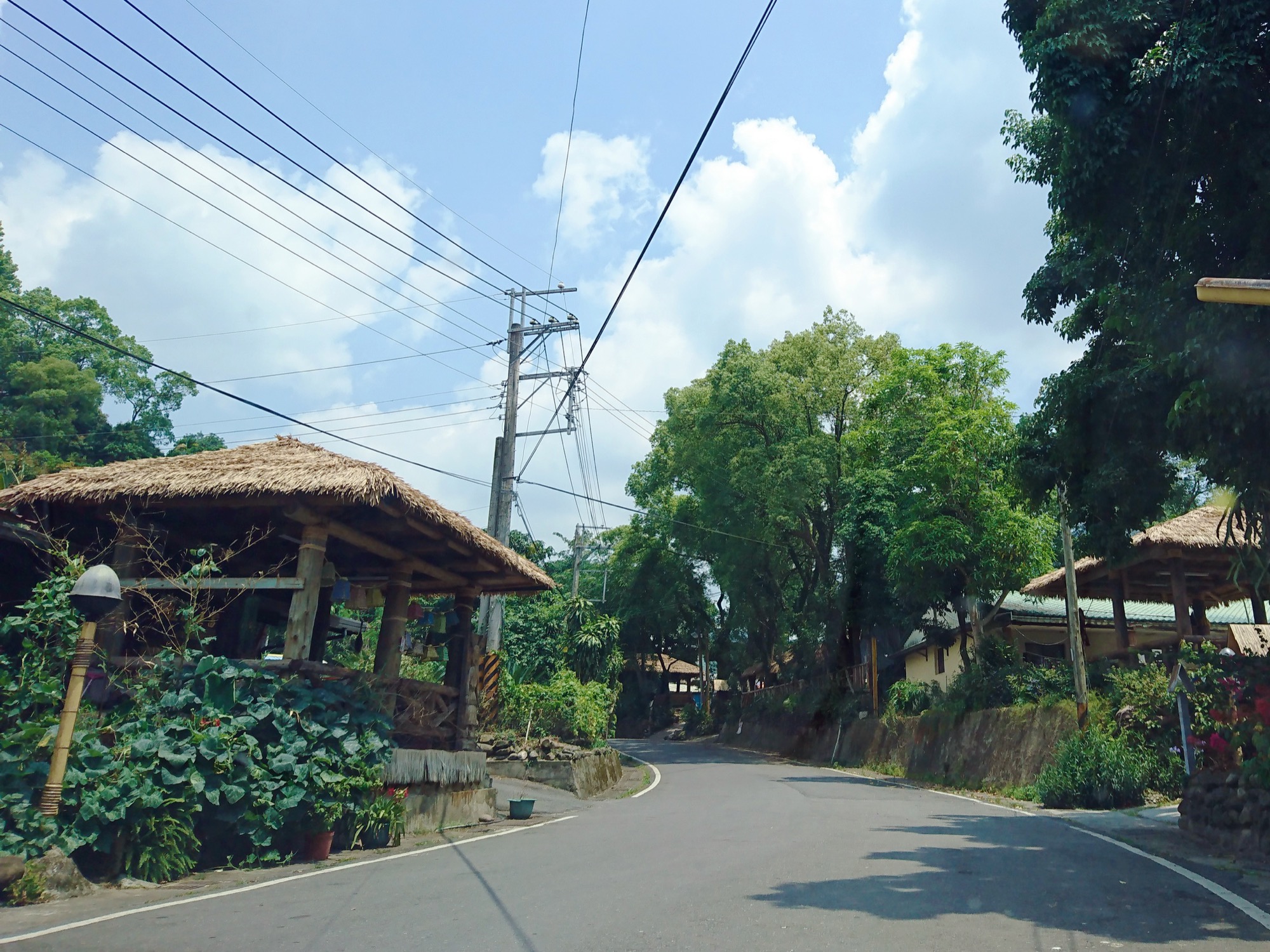
Aveoveoyu ! Experience the Hufu Pavilions of the Chashan Tribal Village
Chashan Tribal Village, located on a plateau halfway up the mountain, is inhabited by Tsou and Bunun indigenous peoples as well as Han Chinese. Every house has a porch or pavilion in front. Each has its own unique style, but collectively, they symbolize the spirit of sharing.
Distance
Public roadway 8.7 km
Difficulty
Grade 0
(
Check Difficulty Level
)
Time required
2 hr 10 min. walk
Starting and ending points
Chashan Tribal Village / Xinmei Tribal Village
Transportation
For ChashanBus stop: Take the Happiness Alishan Route 1 bus and get off at Chashan Station to reach the destination.
For XinmeiBus stop: Take the Happiness Alishan Route 1 bus and get off at Xinmei Station to reach the destination.
For XinmeiBus stop: Take the Happiness Alishan Route 1 bus and get off at Xinmei Station to reach the destination.
Food
Grocery stores and community kitchens in Chashan Tribal Village (Reservation prior visit is highly recommended); food stands and restaurants along the streets of Xinmei Tribal Village
Surrounding attractions
Tun’abana Trail, Kuanxiting Trail Park, Dagubuyanu Fish Watching Trail, Sinvi Niahosa Hunter's Camp, Shinmei Camphor Forest Trail, and Presbyterian Church (Rebirth Hall)
Route
Chashan is the first Tsou tribal village visitors reach along the trail and one of three southern villages. Located next to the Zengwen River, Chashan is the southernmost village of Alishan Township and was originally named “Cayamavana,” meaning “the plain on the mountainside.” Legend has it that the earliest settlers of Chashan were the vanished Dagubuyanu people. The current inhabitants of Chashan include the Tsou, the Bunun, and Han Chinese. In recent years, Chashan has become famous for its hufu (pavilions), many of which can be found in this area. Additionally, the Tun’abana Trail is known for its diverse ecosystems. When travelers visit Chashan Tribal Village via the greenway, take the industrial road past Chashan Village (1st Neighborhood), Kuanxiting Trail Park, the entrance of the Dagubuyanu Fish Watching Trail, Shinmei Bridge, and Sinvi Niahosa Hunter's Camp to arrive at Xinmei Tribal Village.
Features
In recent years, Chashan has become famous for its pavilion lifestyle, a variety of pavilions (hufu) can be seen in the village. The Chashan Hufu Pavilion Festival is held every November, allowing visitors to experience Tsou culture.
MSTW 17 Xinmei Tribal Village → Shanmei Danaiku Ecological Park
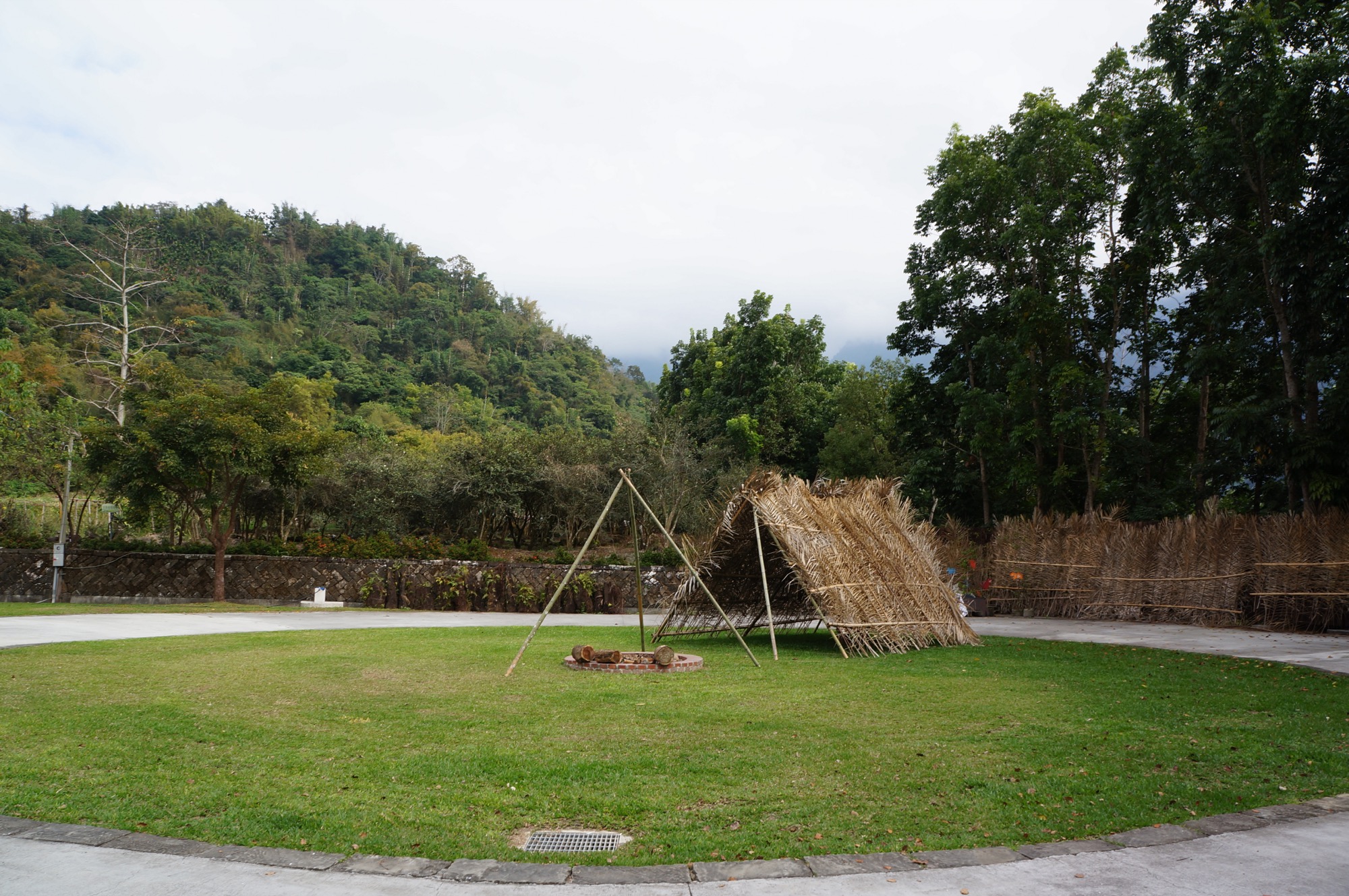
Follow the Footsteps of Xinmei Hunters to Learn about Tsou Hunting Customs
In the Tsou language, the phrase zhui zhui tsou ni means “to take a walk in the mountains.” These are the words that hunters say to their family before going hunting. Xinmei Tribal Village is the perfect place to learn about Taiwan’s natural world with Tsou hunters!
Distance
Public roadway 7.9 km
Difficulty
Grade 0
(
Check Difficulty Level
)
Time required
1 hr 50 min. walk
Starting and ending points
Xinmei Tribal Village / Shanmei Danaiku Ecological Park
Transportation
For XinmeiBus stop: Take the Happiness Alishan Route 1 bus and get off at Xinmei Station to reach the destination.
For DanaikuBus stop: Take the Happiness Alishan Route 1 bus and get off at Danaiku Station to reach the destination.
For DanaikuBus stop: Take the Happiness Alishan Route 1 bus and get off at Danaiku Station to reach the destination.
Food
Xinmei Tribal Village and Danaiku Ecological Park
Surrounding attractions
Sinvi Niahosa Hunter's Camp, Xinmei Camphor Forest Trail, Presbyterian Church (Rebirth Hall), Tsou tribe murals, and Fumei Drawbridge
Route
Located in the upper reaches of the Zengwen River, Xinmei Tribal Village is one of the three southern villages of the Tsou people. Legend has it that after Koxinga defeated the Dutch, Dutch soldiers f led through the area and stopped for mountain spring water here. The “Dutch Water” is now located in Yaisana. During Japanese ruling period, Xinmei land was used as farmland, and most local residents were from Dabang and Lijia tribes. Because of the lack of water resources, the local economy is currently dominated by the afforestation industry and under-forest economy. To visit the Xinmei Village via the greenway, depart from Xinmei Tribal Village and pass by Xinmei Catholic Church and Rongsan Shop; take the industrial road to see endless mountains with amazing views; enter Shanmei Tribal Village where you will see Tsou tribe murals all along the streets; and cross the Fumei Drawbridge to arrive at the entrance of Danaiku.
Features
Xinmei Tribal Village contains a Presbyterian Church (Rebirth Hall), the Dagubuyanu Fish Watching Trail, the Xinmei Camphor Forest Trail, a wealth of natural ecological resources, and the Sinvi Niahosa Hunter's Camp, which provides in-depth information on Tsou hunting practices.
MSTW 18 Shanmei Danaiku Ecological Park → Limei Refuge Trail
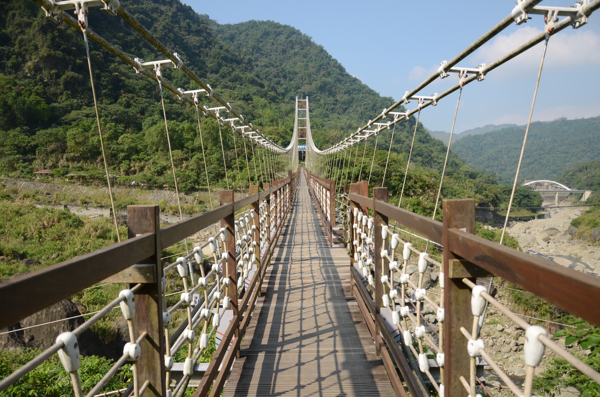
Visit Shanmei’s Danaiku Valley, the Holy Land of the Tsou People, and Count the Taiwan Shovel-jaw Carp in the Streams
Dannayiku (tanayiku) is the sacred land of the Tsou people. It is known as the valley where all worries are forgotten. The residents of Shanmei Tribal Village have committed themselves to protecting the ecosystem of this area where fish can be seen clearly in the crystalline rivers.
Distance
Mountain trail 1.1 km
Difficulty
Grade 2
(
Check Difficulty Level
)
Time required
Danaiku → Tsou Farmland, 1 hour 10 minutes walk
Tsou Farmland → Danaiku, 50 minutes walk
Tsou Farmland → Danaiku, 50 minutes walk
Starting and ending points
Danaiku / Tsou Farmland
Transportation
For DanaikuBus stop: Take the Happiness Alishan Route 1 bus and get off at Danaiku Station to reach the destination.
Food
Visitors are recommended to bring their own food and beverages or purchase them at Danaiku Ecological Park.
Surrounding attractions
Danaiku Ecological Park, Danaiku Drawbridge, pavilions, and scenic viewpoints
Route
Located in Shanmei Tribal Village, Alishan Township, Chiayi County, Danaiku (pronounced “tanayiku” in the Tsou language) means a place without anxiety. It is the first of best practices for community-based management of ecological park in Taiwan. Located at the upstream of the Zengwen River, Danaiku was once a popular tourist destination because of the majestic scenery yet the terrain was seriously destroyed due to Typhoon Morakot and other natural disasters. Local villagers devoted themselves and worked hand-in-hand to restore the enchanting natural landscape. Today, Danaiku Ecological Park is known for its conservation of Taiwan shovel-jaw carp. Visitors can spend their time wandering around the Danaiku Trail, crossing the Danaiku Drawbridge to arrive at Tsou Farmland.
Features
From the Danaiku Drawbridge, visitors can enjoy the fascinating scenery of the Zengwen River Valley and observe Taiwan shoveljaw carp swimming in the stream. On the either side of the mountain path are secondary forestland, bamboo groves, Taiwan sugar palms, and banana orchards.
MSTW 19 Limei Refuge Trail
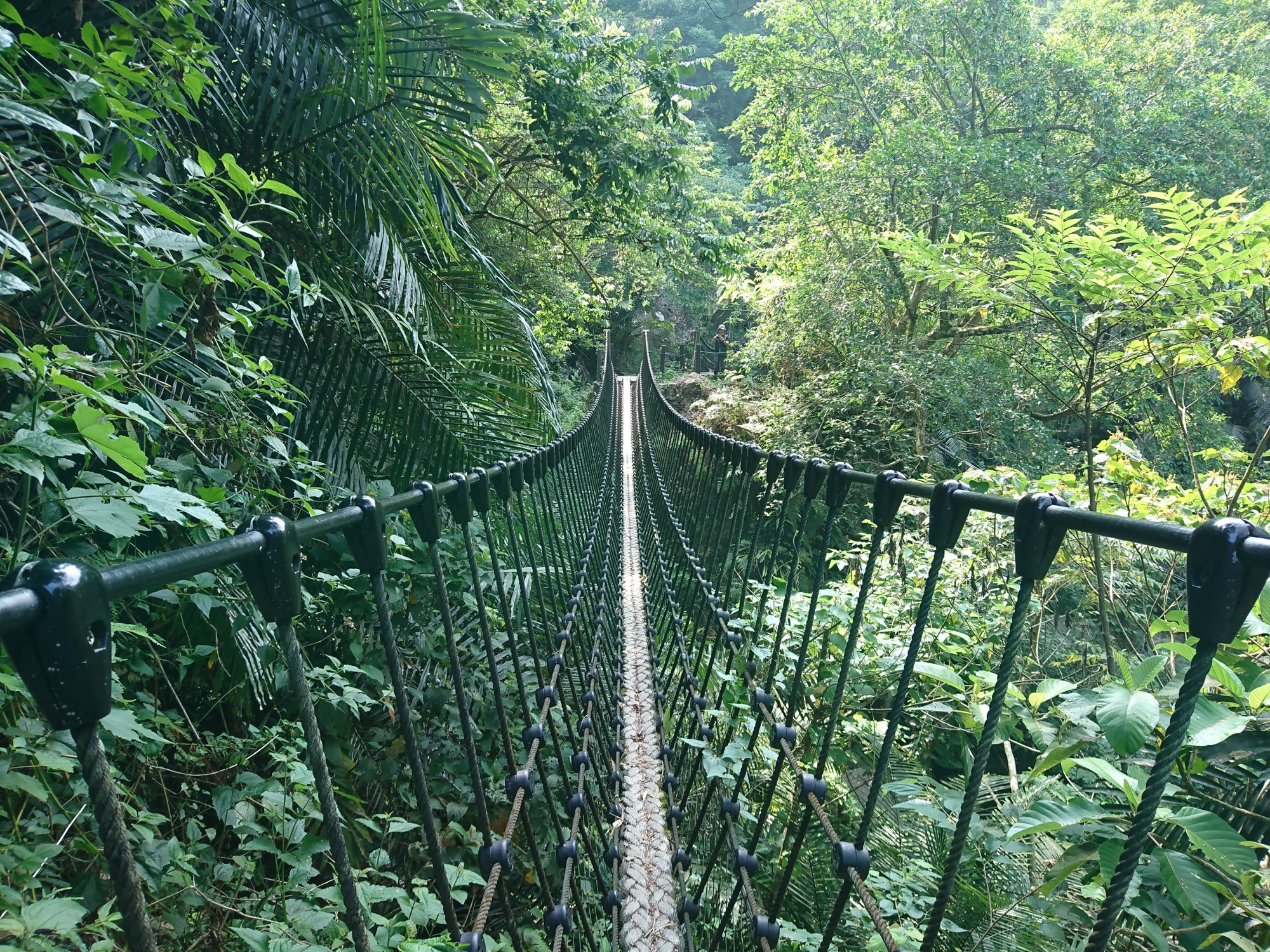
A Forest Path Connecting the Shanmei and Lijia Village
Upon leaving the open Tsou Farmland crossroads and entering the broad-leaf forest, hikers can enjoy the natural scenery of a subtropical forest and the challenge of crossing suspension bridges over the many ravines and gullies along the way. This route ends at a high point overlooking the Zengwen River Valley.
Distance
Mountain trail 1.6 km
Difficulty
Grade 4
(
Check Difficulty Level
)
Time required
Tsou Farmland → Viewing platform, 2 hr. walk
Viewing platform → Tsou Farmland, 1hr. 40 min. walk
Viewing platform → Tsou Farmland, 1hr. 40 min. walk
Starting and ending points
Tsou Farmland / Viewing platform
Food
Visitors are recommended to bring their own food and beverages since there is no shops along the way.
Surrounding attractions
suspension bridges, wood pavilions, and viewing platform
Route
The Limei Refuge Trail was originally a trail connecting Lijia and Shanmei Tribal Villages of the Tsou. During Japanese ruling period, a new trail was built, and the original trail was gradually abandoned. In 2009, Typhoon Morakot severely damaged the newer trail, severing the link between the two tribes. Local villagers subsequently came up with the idea of using the historical trail as a place of refuge and made a proposal to FANCA to repair and reopen it. The trail was thus restored and renamed the “Limei Refuge Trail.” The trail connects the Jushiban Trail and the Danaiku Trail, and is of high historical and tourism value; however, it cannot be reached by car. To reach it, visitors may depart from the Tsou Farmland crossroads. Along the trail, they will cross three suspension bridges and pass by wooden hunting pavilions before going uphill and arriving at the 0K viewing platform.
Features
The mountain path leads visitors into a jungle-like adventure in a subtropical broad-leaved forest. There, they can see Ma bamboo and a wealth of ecological resources. From the viewing platform, visitors can enjoy views of the Zengwen River Valley and two drawbridges.
Note
The slopes here are steep with a climb of approximately 500 meters. Visitors must assess whether they are physically fit for the climb.
MSTW 20 Jushiban Trail
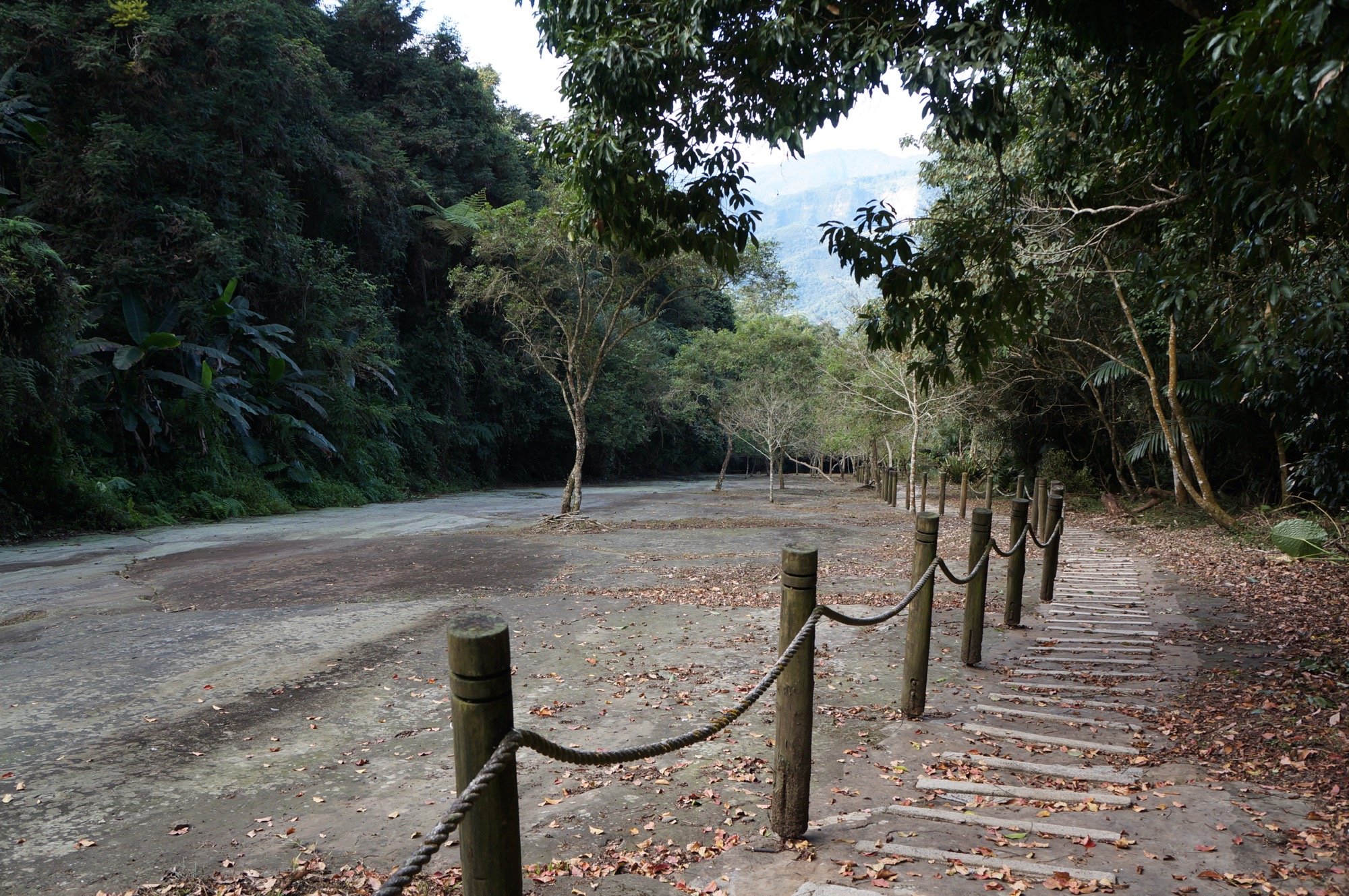
Lijia Jushiban, a Masterpiece in Stone
As hikers emerge from this hidden mountain trail, they come across a large sloping stone slab whose primarily smooth, flat surface is marked by intermittent depressions due to differential erosion. The higher one goes on the trail, the more breathtaking the scenery becomes.
Distance
Mountain trail 0.72 km
Difficulty
Grade 3
(
Check Difficulty Level
)
Time required
View platform → Jushiban Trailhead Parking, 50 min. walk
Jushiban Trailhead Parking → View platform, 40 min. walk
Jushiban Trailhead Parking → View platform, 40 min. walk
Starting and ending points
View platform / Jushiban Trailhead Parking
Food
Visitors are recommended to bring their own food and beverages since there is no shops along the way.
Surrounding attractions
Viewing platform and wooden arch bridge
Route
The flat and spectacular jushiban (literally “boulder plate”) is approximately 700 meters long and 30 meters wide, and sits at a 15° slope. Originally a densely forested area with watercourses, Jushiban came into being because of Typhoon Herb in 1996. Jushiban contains many naturally formed potholes, and visitors can stroll across it during the dry winter season. The Jushiban Trail starts at the 0K viewing platform. Once on the trail, visitors will pass through forest, and a bamboo grove before they arrive at Jushiban. Next, take the fork in the road along Jushiban to reach the top of jushiban and exit the area to enjoy great views. The other route leads visitors past a bamboo forest before arriving at a parking lot. The two routes are straightforward and without detours.
Features
Jushiban is a large sloping plate of bedrock that provides visitors with unique, extensive views. On either of the mountain path is thill bamboo (stone bamboo), a unique bamboo which grows in Alishan.
Note
The slope here is steep with a climb of approximately 130 meters. Visitors must assess whether they are physically fit for the climb.
MSTW 21 Jushiban Traild → Lijia Forest Trail
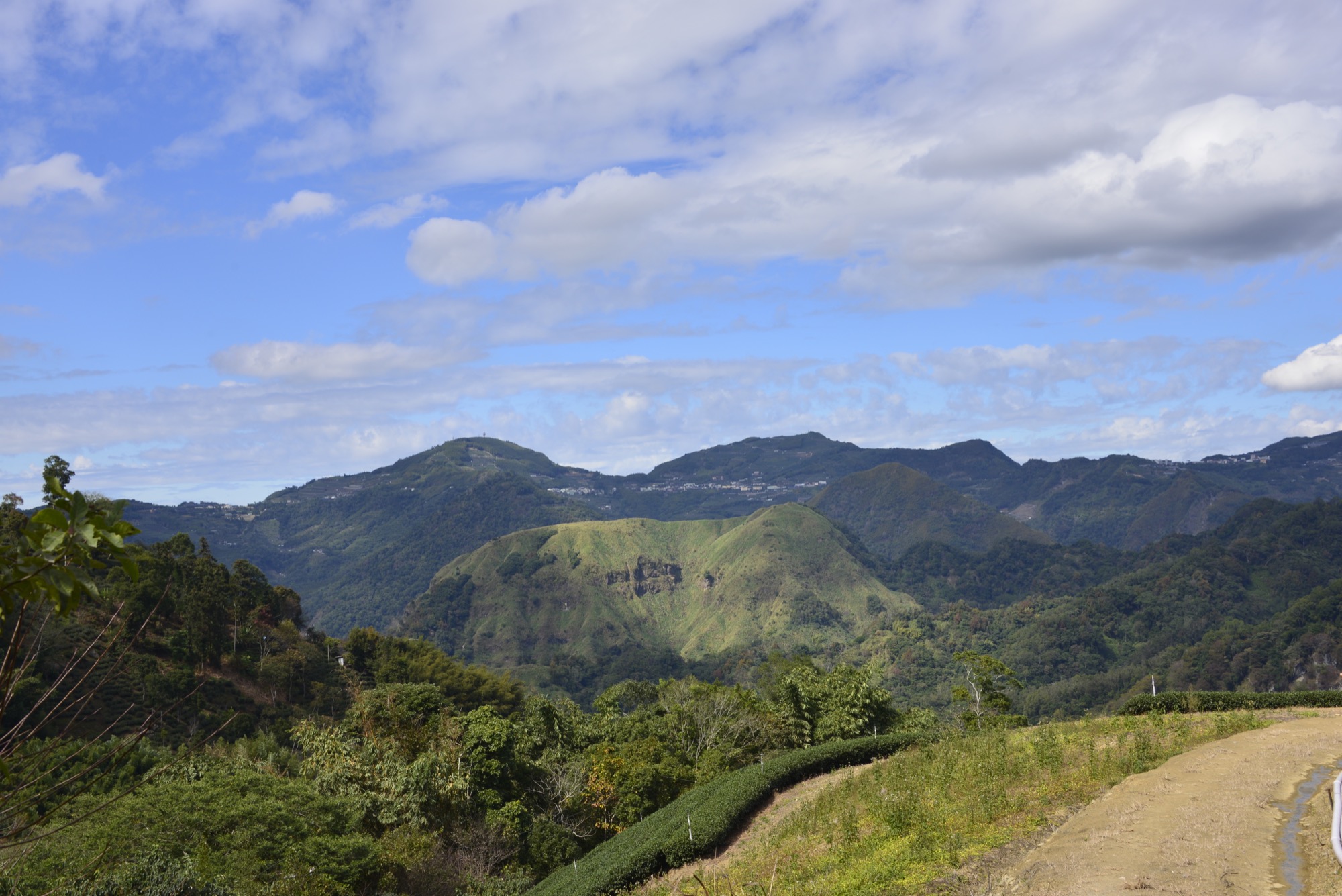
Explore the History of Lijia and See Xiang Mountain from Afar
After traversing the thill bamboo grove, hikers can emerge to a spectacular view across to Xiang Mountain and Xiding. Along this route, which has been marked on maps since the Japanese ruling period, tribe members harvest bamboo shoots for a living.
Distance
Industrial road 6.9 km
Difficulty
Grade 0
(
Check Difficulty Level
)
Time required
1 hr.40 min. walk
Starting and ending points
Jushiban Trailhead Parking / Lijia Forest Trail
Transportation
For LijiaBus stop: Take bus 7314 to Dabang Station, then transfer to Happiness Alishan Route 3 (Reservation Required) and get off at Lijia Station and walk there.
Or take bus 7322A (around Fenqihu) to Shihzih Station, then transfer to bus Happiness Alishan Route 3 (Reservation Required) to Lijia Station and walk from there.
*Note: The Lijia end is some distance from the trailhead; you can contact local operators for shuttle service.*
Or take bus 7322A (around Fenqihu) to Shihzih Station, then transfer to bus Happiness Alishan Route 3 (Reservation Required) to Lijia Station and walk from there.
*Note: The Lijia end is some distance from the trailhead; you can contact local operators for shuttle service.*
Food
Visitors are recommended to bring their own food and beverages since there is no shops along the way.
Surrounding attractions
Limei Refuge Trail (visitors must take the same route back) and scenic viewpoints
Route
Depart from the entrance of the Jushiban Trail, facing Lijia Village, you first wander through a bamboo forest and a mixed broad-leaved forest with two or three excellent scenic viewpoints, from which you can see Xiang Mountain and Xiding streets. Finally, you will arrive at the Limei Refuge Trailhead; currently, visitors to the trail must take the same route back. Then, take the Wujiha Stream Industrial Road where one will see silver grass and Taiwan hibiscus. Cross the bridge past the Far Land Camping Area to arrive at the trailhead of the Forest Trail.
Features
There are several locations where visitors have uninterrupted views of the magnificent Xiang Mountain and endless mountain ranges.
Note
This section of trail has steep ascending and descending slopes and a total climb of approximately 320 meters. Visitors must assess whether they are physically fit for the climb.
MSTW 22 Lijia Forest Trail → Lijia Village >Maple Viewing Trail
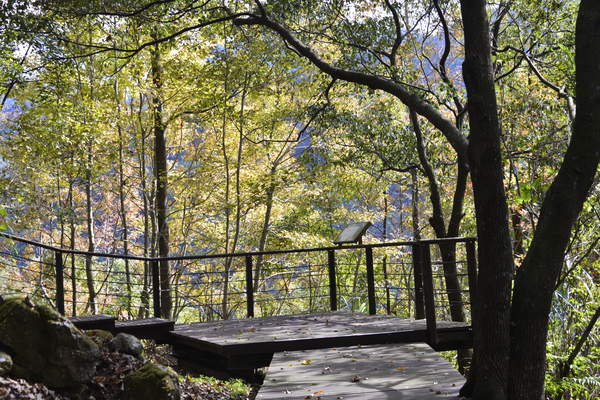
Lijia Village, the “Blue Tribe”: A Hidden Gem in the Remote Mountains
During the day, the sky is azure blue; at night, it’s filled with stars. The area is nicknamed the "blue tribe" due to the deep blue sheen of the night sky. On summer nights, fireflies dance among the trees.
Distance
Mountain trail 0.52 km, Industrial road 0.31 km
Difficulty
Grade 2
(
Check Difficulty Level
)
Time required
Industrial road → Lijia Maple Viewing Trail, 40 min. walk
Lijia Maple Viewing Trail → Industrial road 30 min. walk
Lijia Maple Viewing Trail → Industrial road 30 min. walk
Starting and ending points
Lijia Forest Trail / Maple Viewing Trail
Transportation
For LijiaBus stop: Take bus 7314 to Dabang Station, then transfer to Happiness Alishan Route 3 (Reservation Required) and get off at Lijia Station and walk there.
Or take bus 7322A (around Fenqihu) to Shihzih Station, then transfer to bus Happiness Alishan Route 3 (Reservation Required) to Lijia Station and walk from there.
Or take bus 7322A (around Fenqihu) to Shihzih Station, then transfer to bus Happiness Alishan Route 3 (Reservation Required) to Lijia Station and walk from there.
Food
Visitors are recommended to bring their own food and beverages or purchase them at Lijia Village.
Surrounding attractions
Alishan National Scenic Area Headquarters - Lijia Information Station and Fengdongliu Trail
Route
Lijia Village is one of the tribal villages in the Dabang community. It is a paradise-like village with fresh mountain air, crystal water streams, and rich ecological resources. At night, dazzling stars sparkle like diamonds in the sky. Thus, it is also known as the “blue tribe.” Legend has it that two brothers surnamed Wen discovered this place during a hunt. To visit Lijia Village, travelers have to depart from the Forest Trail by Wujiha Stream, then pass through bamboo groves and large camphor trees before arriving at the village. Strolling around the village is like reading a book about tribal customs, and the Maple Viewing Trail is in the vicinity. According to the legend, in ancient times, God Hamo descended to the top of Mt. Jade and shook maple trees. The seeds that fell down from the trees became human beings, and it is believed that they were the Tsou’s ancestors. Thus, the Tsou people love to plant maple trees in remembrance of their forefathers.
Features
In autumn, roaming along the Maple Viewing Trail, hikers can immerse themselves in the picturesque scenery as the Taiwanese sweet gum and maple leaves turn yellow and red. Lijia is a charming indigenous village with distinctive culture and social customs. The haverst season of jelly figs is between August to next January; during that time, visitors may have a chance to view the process of drying jelly figs.
MSTW 23 Maple Viewing Trail → Dabang Village
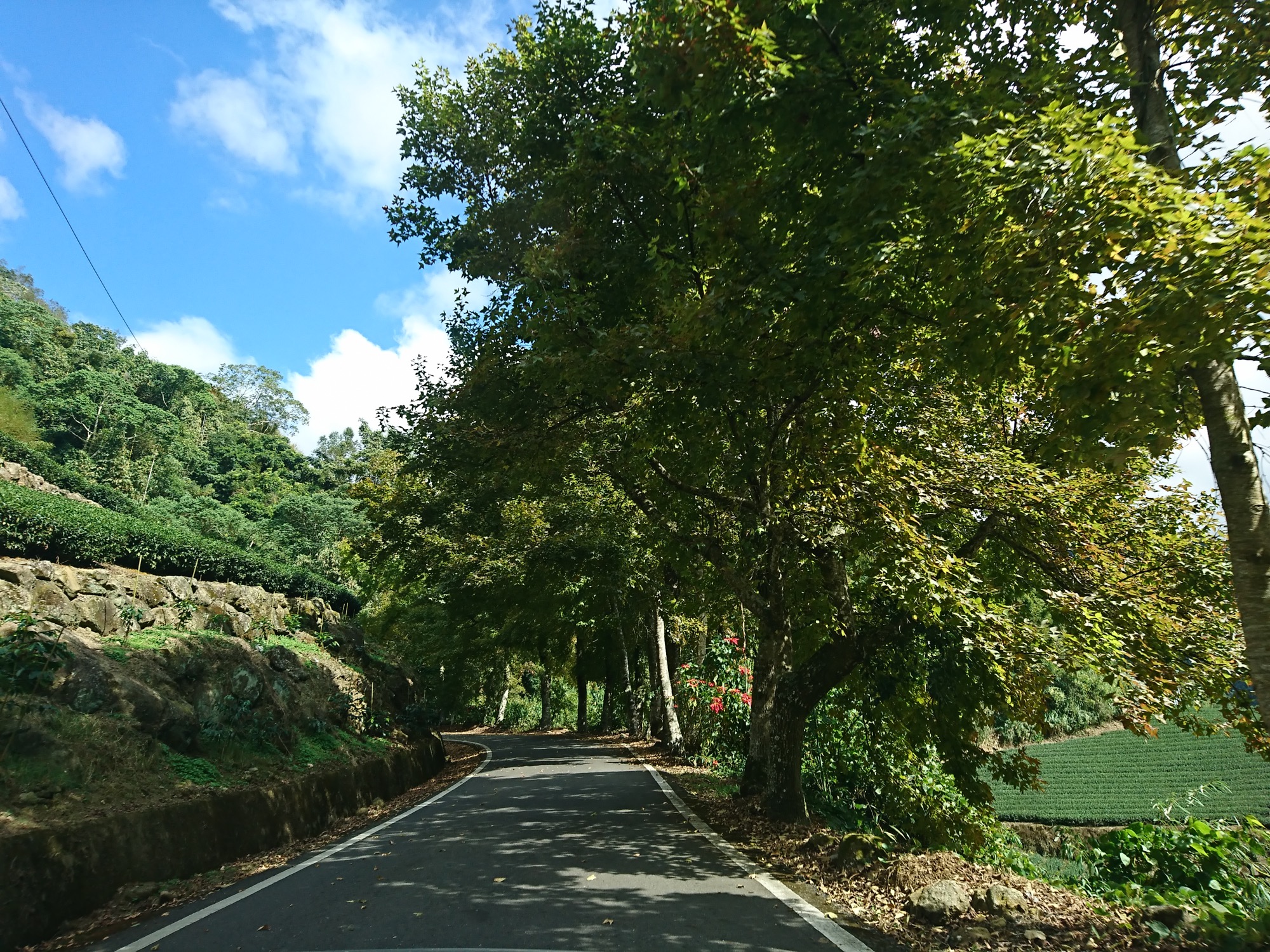
The Magical Lijia Tea Plantation Boulder and Mountainous Terrain
In autumn, the maple leaves turn gold and sway in the wind. On both sides of this route, hikers can find vibrant green tea plantations. Just as the tea plantations lie in the midst of the mountains, visitors may notice a large mountain boulder standing strong in the middle of a tea plantation.
Distance
Public roadway 16.3 km
Difficulty
Grade 0
(
Check Difficulty Level
)
Time required
3 hr 50 min. walk
Starting and ending points
Maple Viewing Trail / Dabang Village
Transportation
For LijiaBus stop: Take bus 7314 to Dabang Station, then transfer to Happiness Alishan Route 3 (Reservation Required) and get off at Lijia Station and walk there.
Or take bus 7322A (around Fenqihu) to Shihzih Station, then transfer to bus Happiness Alishan Route 3 (Reservation Required) to Lijia Station and walk from there.
For DabangBus stop: Take bus 7314 and get off at Dabang Station to reach the destination.
Or take bus 7322A (around Fenqihu) to Shihzih Station, then transfer to bus Happiness Alishan Route 3 (Reservation Required) to Lijia Station and walk from there.
For DabangBus stop: Take bus 7314 and get off at Dabang Station to reach the destination.
Food
Visitors are recommended to bring their own food and beverages or purchase them at Dabang Village.
Surrounding attractions
Tea Plantation Boulder, Japanese Police Building, Tsou Nature and Culture Center, and Dabang Kuba
Route
Depart from the entrance of the Maple Viewing Trail and take County Highway 169, one passes by the Lijia Tea Factory and Lijia Bamboo Shoot Processing Plant. The facilities were sponsored by the Taiwan Semiconductor Manufacturing Company to support the area after the devastation inflicted on Alishan’s agricultural industry by Typhoon Morakot. During the trip, visitors will see Taiwanese sweetgum trees as well as tea plantations, among which the Tea Plantation Boulder is most distinctive. Visitors can stop at a scenic viewpoint to enjoy views of endless mountains and tea plantations on the route to Dabang Village. The village was established more than 300 years ago. Its subsidiary tribes are the Shinmei, Chashan, and Shanmei, whose tribal villages are located near the confluence of the Hasegawa and Yisijianna streams in the upper reaches of the Zengwen River. Dabang and Tefuye, two villages on each side of the Yisijianna stream facing each other, both possess a Kuba. A kuba is a sacred place that is closely tied in with the culture and spiritual beliefs of the Tsou people. Only adult men of the tribe are allowed to enter the Kuba from its main entrance.
Features
Tribal bamboo shoot and tea industries, tea plantations, and Taiwanese sweet gum trees (which turn a flaming yellow, orange, and red in the fall) can be seen along the way. The kuba in Dabang Village is a major feature of the Tsou culture, and the Mayasvi of Tsou is great in strength and impetus.
Note
Because this region contains a long county highway, please pay attention when traveling on foot. When entering tribal areas, please refrain from entering the kuba out of respect for the cultural values of the Tsou people.
MSTW 24 Dabang Village → Tefuye Trail → Tefuye Village
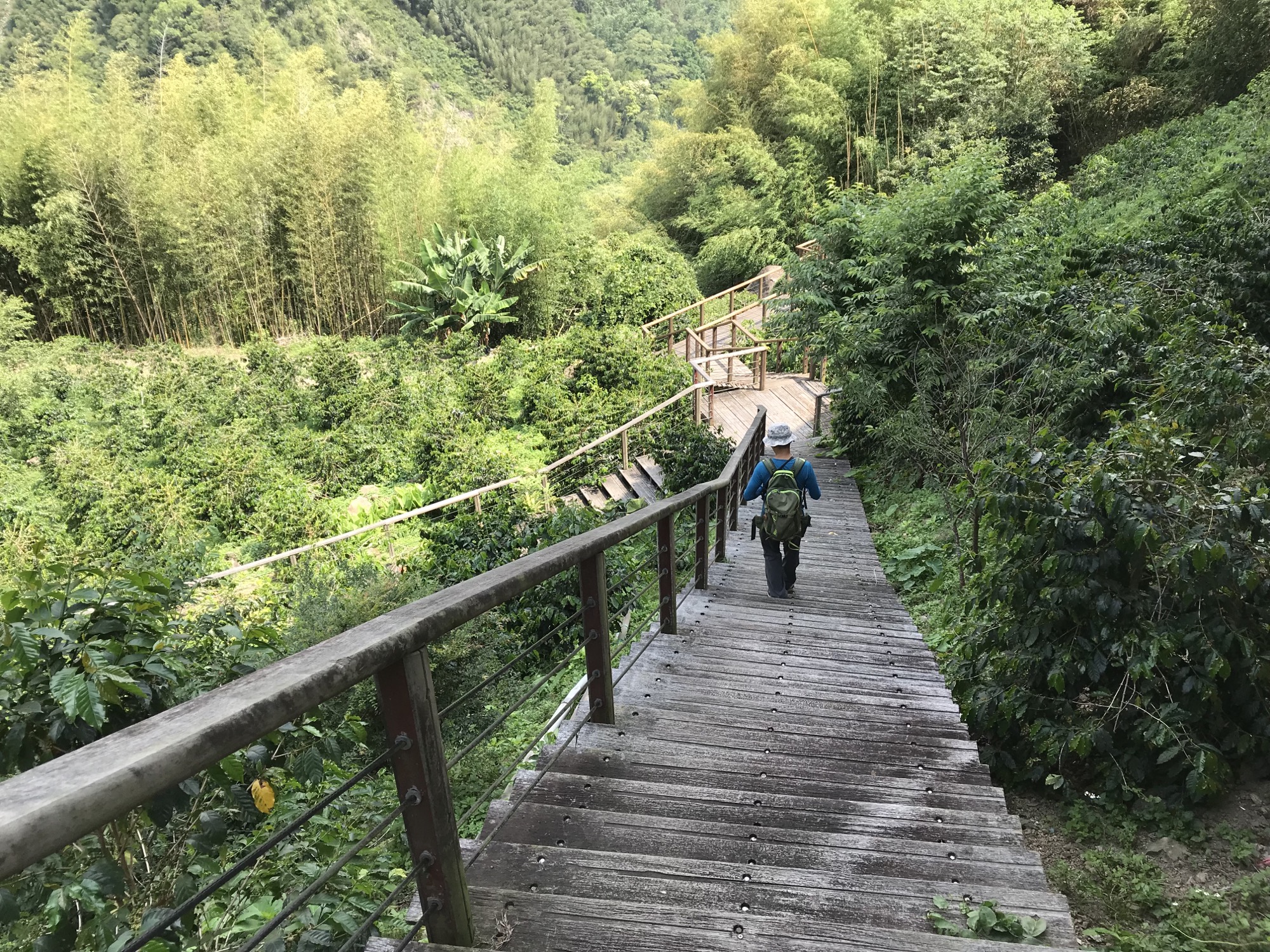
A Traditional Route Connecting Dabang and Tefuye Tribes of Tsou
This route from Dabang Village to Tefuye Village passes through dense bamboo groves, crosses the Zengwen River, and goes under massive camphor trees. Since ancient times, it has been an important communication route for the two tribes.
Distance
Mountain trail 1.6 km, Industrial road 0.2km
Difficulty
Grade 1
(
Check Difficulty Level
)
Time required
Dabang Village → Tefuye Village, 1 hr 10 min. walk
Tefuye Village → Dabang Village, 50 min. walk
Tefuye Village → Dabang Village, 50 min. walk
Starting and ending points
Dabang Village/Tefuye Village
Transportation
For DabangBus stop: Take bus 7314 and get off at Dabang Station to reach the destination.
For TefuyeBus stop: Take the 7322A (around Fenqihu) bus to Shihzih Station, then transfer to the Happiness Alishan Route 3 (Reservation Required) bus and get off at Tefuye Station.
For TefuyeBus stop: Take the 7322A (around Fenqihu) bus to Shihzih Station, then transfer to the Happiness Alishan Route 3 (Reservation Required) bus and get off at Tefuye Station.
Food
Visitors are recommended to bring their own food and beverages or purchase them at Dabang Village.
Surrounding attractions
The Dabang Drawbridge and Tefuye Kuba
Route
Enter from the Dabang Pavilion and cross the Dabang Drawbridge to see the Yisijianna Stream, valley, and red arch bridge.Continue hiking, the lush bamboo forest, giant camphor trees, and a tribute stone can be seen along the way. The tribute stone is large stone selected by the people of the tribe to pray to the God of soil and earth for protection when traveling between tribes. The trail runs through a large camphor tree forest before ending at Tefuye Village. From the mid-nineteenth century to the early twentieth century, camphor wood was one of Taiwan’s major export products due to its use in making camphor. At the time, the Alishan mountain area was a crucial place for camphor trees.
Features
From the Dabang Drawbridge, visitors will see awe-inspiring views of the Zengwen River valley in the distance; once on the path, they will enjoy the scenery presented by the bamboo groves and giant camphor trees.
Note
Please refrain from entering the kuba out of respect for the cultural values of the Tsou people.
MSTW 25 Tefuye Village (Industrial Road) → Tefuye Historical Trail
Tsou People Harvesting Fresh Thill Bamboo
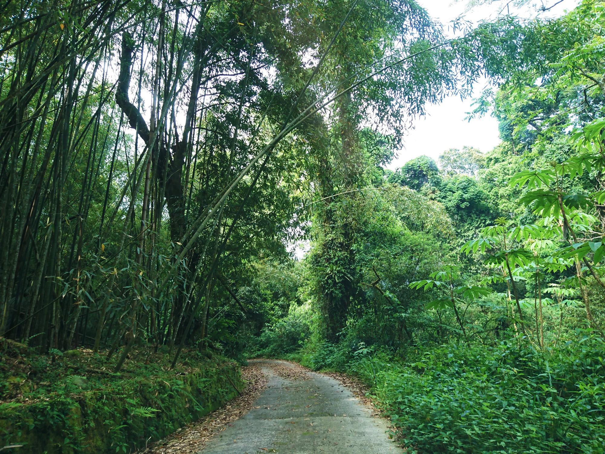
Winding paths connect Tefuye Village with the bamboo groves. During the bamboo shoot season, Taiwan stone bamboo, also known as thill bamboo, grows here. For the Tsou people, this season is a race against time to cut the bamboo shoots and prepare them in the bamboo huts.
Distance
Industrial road 6.1 km
Difficulty
Grade 0
(
Check Difficulty Level
)
Time required
2 hr 30 min. walk
Starting and ending points
Tefuye Village / Tefuye Historical Trailhead (6.2k)
Transportation
For TefuyeBus stop: Take the 7322A (around Fenqihu) bus to Shihzih Station, then transfer to the Happiness Alishan Route 3 (Reservation Required) bus and get off at Tefuye Station.
*Note: You can contact local operators for shuttle service to reach historical trailhead.*
*Note: You can contact local operators for shuttle service to reach historical trailhead.*
Food
Visitors are recommended to bring their own food and beverages or purchase them at Tefuye Village.
Surrounding attractions
Tefuye Kuba
Route
Legend has it that an ancient god trampled the mountains into two flat areas to form the Dabang and Tefuye communities.They are major communities of the Tsou people, and both have Kuba, a vital social, political, and cultural symbol among the Tsou. Tefuye is larger than Dabang, yet quieter and more rustic. Depart from the Tefuye Kuba and enter Tefuye Village; take the industrial road through a mixed broad-leaved forest and bamboo groves before arriving at the entrance of Tefuye Historical Trail.
Features
Stroll through Tefuye Village to see its Kuba, golden grassy dendrobium orchids, and sea fig. During the bamboo season, visitors can also see tribal people harvesting thill bamboo.
Note
Please refrain from entering the Kuba out of respect for Tsou cultural traditions. Because the route includes an industrial road with poor road conditions, only four-wheel drive vehicles are allowed. Alternatively, visitors may book community service to pick them up and drop them off at the designated locations.
MSTW 26 Tefuye Historical Trail (Tefuye → Zizhong)
A Hunting Trail for the Tsou People and the Forest Railway Shuishan Line
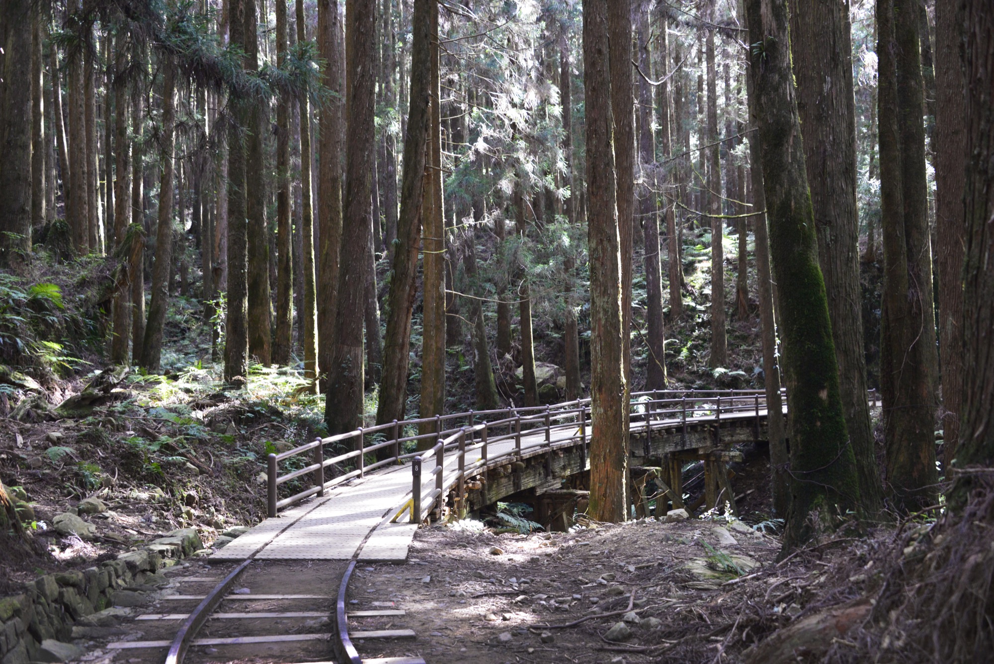
On this trail, it is easy to imagine a time when the Tsou people lived, hunted, and fought here. Then in the blink of an eye, Taiwan, and this area with it, was under Japanese ruling period. The Japanese used the Shuishan Line of the Forest Railway to utilize Alishan’s abundant forest resources.
Distance
Mountain trail 6.4 km
Difficulty
Grade 2
(
Check Difficulty Level
)
Time required
Tefuye Historical Trail (6.2k) → Zizhong, 3 hr 40 min. walk
Zizhong → Tefuye Historical Trail (6.2k), 2 hr 30 min. walk
Zizhong → Tefuye Historical Trail (6.2k), 2 hr 30 min. walk
Starting and ending points
Entrance of the Tefuye Historical Trail (6.2k) / Zizhong
Transportation
For TefuyeBus stop: Take the 7322A (around Fenqihu) bus to Shihzih Station, then transfer to the Happiness Alishan Route 3 (Reservation Required) bus and get off at Tefuye Station.
*Note: You can contact local operators for shuttle service to reach historical trailhead.*
For ZizhongBus Stop: take Yuanlin Bus 6739 bus and get off at Zizhong Station. (Please call Shuili Station to make a reservation 3 days in advance.)
*Note: You can contact local operators for shuttle service to reach historical trailhead.*
For ZizhongBus Stop: take Yuanlin Bus 6739 bus and get off at Zizhong Station. (Please call Shuili Station to make a reservation 3 days in advance.)
Food
Visitors are recommended to bring their own food and beverages since there is no shops along this route.
Surrounding attractions
Pavilions, the old Shuishan Railway, wooden trestle bridg
Route
Located in Alishan Township, Chiayi County, the route was initially a hunting path used by the Tsou people. During Japanese ruling period, the Japanese built a railway (the old Shuishan Railway) along the historical trail to transport red cypress and Taiwan cypress logged in the Alishan area, transforming the trail into a timber-transporting section of the Dongpu Railway Line. However, as the logging era came to an end, the railway was eventually demolished in 1971, leaving behind railroad tracks and wooden bridges. In 2001, the Chiayi Branch, Forestry and Nature Conservation Agency (reorganized from Chiayi Forest District Office) restored the historical trail while retaining some of the railway tracks and trestle bridges. Depart from Tefuye, climb a steep slope, and pass through a mixed coniferous and broadleaf forest to arrive at the Tiziban Mountain fork road. The historical trail then becomes less steep and the remains of the railway and a Japanese cedar forest are found along the way. At the end of the route is Provincial Highway 18 (Zizhong).
Features
In addition to the surrounding tall Japanese cedars and the old Shuishan Railway, leftover Taiwan cypress stumps and an ecologically rich virgin forest perfect for birdwatching can be found.
Note
The route from Tefuye to the Tiziban Mountain fork road is relatively steep. Visitors must assess whether they are in appropriate physical condition for the climb.
Travel Information
Lodging
It is recommended that visitors stay at local tribal B&Bs and camping grounds during their trip.
Local Specialties
Alishan Township
tea, wasabi, bamboo shoots, jelly fig, camellia oil, coffee
Notes
- Please follow proper etiquette and do not enter private houses, kubas, and gathering places without permission.
- Please check the weather forecast and stay updated on the latest typhoon information.
- Please stop walking when enjoying the beautiful scenery along the trail. Always maintain awareness of the route when walking.
- Please remain near the bottom of the slope when hiking along sloping surfaces and watch out for falling rocks, dead branches, and hidden gaps as you go.
- Please keep your distance from wild animals and do not feed them.
- There is always risks in outdoor activities. Please be aware of your surroundings and stay safe.


Trail difficulty level
The Forestry and Nature Conservation Agency has established a five-level trail classification system based on factors such as elevation, walking time, required equipment, and trail difficulty, matching each trail with suitable users. Level 1 is the easiest, while Level 5 is the most difficult. In addition to providing hikers with information on trail characteristics and difficulty, the classification system allows them to assess in advance whether a trail is suitable for them, thereby enhancing trail safety.
The National Greenway of Mountain and Sea (Shanhai National Greenway) adopts the trail classification system established by the Forestry and Nature Conservation Agency. However, because the route includes various types of paths, additional classifications have been introduced. Roads, industrial roads—including industrial roads, bicycle paths, trails along irrigation channels, and riverside embankment roads—roadside pedestrian paths, and waterways are classified as Level 0, representing routes generally suitable for the general public.
| Hiking Level |
|
|
|
|
|
|
|
||||||||||||||||||||||||||||||||||||||||||
|---|---|---|---|---|---|---|---|---|---|---|---|---|---|---|---|---|---|---|---|---|---|---|---|---|---|---|---|---|---|---|---|---|---|---|---|---|---|---|---|---|---|---|---|---|---|---|---|---|---|
| Target | General Public | General Public | Those who have better physical energy | Beginner mountain climber with good physical energy and map literacy. | Open to those who have good physical strength, map reading skills, and wild survival skills. | Open to well-trained mountain climbers. | Open to well-trained mountain climbers. | ||||||||||||||||||||||||||||||||||||||||||
| Elevation | Gently sloping area | In recreational areas, close to settlements or about 1,000 meters above sea level. | In recreational areas, close to settlements or between 1,000~2,000 meters above sea level. | Remote areas or between 2,000 to 3,000 meters above sea level | Remote areas, wilderness, or between 2,000 to 3,000 meters above sea level | Remote areas, wilderness, or more than 3,000 meters above sea level | Remote areas, wilderness, or more than 3,000 meters above sea level | ||||||||||||||||||||||||||||||||||||||||||
| Required Time | It takes half to one day. | It takes half to one day. | It can be done within one day. | It takes one or more days. | Overnight preparation required. | It takes up to three days. | It takes up to three days. | ||||||||||||||||||||||||||||||||||||||||||
| Equipment | Light backpacking (water and small amount of food) | Light backpacking (water and small amount of food) | Light backpacking (water and proper amount of food) | Overnight preparation required. (e.g. drinking water, food, map, warm clothing, first-aid medicine, etc.) Application for entrance permission in advance is required if there is access control. | Comprehensive Mountaineering Gear Required. (e.g. food, drinking water, cooking utensils, map, warm clothing, flashlight, sleeping bag, tent, etc.) Application for entrance permission in advance is required if there is access control. | Comprehensive Mountaineering Gear Required. (e.g. food, drinking water, cooking utensils, map, warm clothing, flashlight, sleeping bag, tent, etc.) Application for entrance permission in advance is required if there is access control. | Comprehensive Mountaineering Gear Required. (e.g. food, drinking water, cooking utensils, map, warm clothing, flashlight, sleeping bag, tent, etc.) Application for entrance permission in advance is required if there is access control. | ||||||||||||||||||||||||||||||||||||||||||
| Description | Flat hiking trails. Relatively even slopes with comprehensive facilities and smooth road surface. Accessible for handicapped assistive devices or baby strollers. | An open hiking trail with easy access. Relatively even slopes with comprehensive facilities and smooth road surface. It takes half a day or less than one day to complete. | An open hiking trail with easy access. Somewhat steep slope with some difficult sections, but has comprehensive facilities and smooth road surface. It takes less than one day to complete. | A hiking trail locates at remote area or with part of the route is in area which requires entrance permission. Application in advance is required. Part of the route is in relatively bad condition with steeper slopes, but basic facilities are provided. It takes one day or between one to three days to complete. | A hiking trail locates at remote area or with part of the route is in area which requires entrance permission. It’s located in high-altitude areas (higher than 3000 meters above sea level). The trail is relatively primitive, with steeper slopes and unstable weather conditions. Part of the route may be dangerous or difficult for climbers. It takes two to three days to complete. Lead from professionals is recommended. | A hiking trail locates at area with inconvenient traffic, and mostly with routes in area which requires entrance permission. It’s located in high-altitude areas (higher than 3000 meters above sea level). The trail is located at primitive area, with bad condition, steeper slopes, and unstable weather conditions. Many parts of the route may be dangerous or difficult for climbers. It takes three or more days to complete. Lead from professionals is recommended. | 1. Level 3, 4 or 5 trails when snow or ice accumulating 2. Informal trails, without clear subgrades or paths, belong to special routes such as original mountain trails, ancient trail relics, prospecting, or technical climbing. |
Hiking Level
Target
General Public
Elevation
Gently sloping area
Required Time
It takes half to one day.
Equipment
Light backpacking (water and small amount of food)
Description
Flat hiking trails. Relatively even slopes with comprehensive facilities and smooth road surface. Accessible for handicapped assistive devices or baby strollers.
Hiking Level
Target
General Public
Elevation
In recreational areas, close to settlements or about 1,000 meters above sea level.
Required Time
It takes half to one day.
Equipment
Light backpacking (water and small amount of food)
Description
An open hiking trail with easy access. Relatively even slopes with comprehensive facilities and smooth road surface. It takes half a day or less than one day to complete.
Hiking Level
Target
Those who have better physical energy
Elevation
In recreational areas, close to settlements or between 1,000~2,000 meters above sea level.
Required Time
It can be done within one day.
Equipment
Light backpacking (water and proper amount of food)
Description
An open hiking trail with easy access. Somewhat steep slope with some difficult sections, but has comprehensive facilities and smooth road surface. It takes less than one day to complete.
Hiking Level
Target
Beginner mountain climber with good physical energy and map literacy.
Elevation
Remote areas or between 2,000 to 3,000 meters above sea level
Required Time
It takes one or more days.
Equipment
Overnight preparation required. (e.g. drinking water, food, map, warm clothing, first-aid medicine, etc.)
Application for entrance permission in advance is required if there is access control.
Description
A hiking trail locates at remote area or with part of the route is in area which requires entrance permission. Application in advance is required. Part of the route is in relatively bad condition with steeper slopes, but basic facilities are provided. It takes one day or between one to three days to complete.
Hiking Level
Target
Open to those who have good physical strength, map reading skills, and wild survival skills.
Elevation
Remote areas, wilderness, or between 2,000 to 3,000 meters above sea level
Required Time
Overnight preparation required.
Equipment
Comprehensive Mountaineering Gear Required. (e.g. food, drinking water, cooking utensils, map, warm clothing, flashlight, sleeping bag, tent, etc.)
Application for entrance permission in advance is required if there is access control.
Description
A hiking trail locates at remote area or with part of the route is in area which requires entrance permission. It’s located in high-altitude areas (higher than 3000 meters above sea level). The trail is relatively primitive, with steeper slopes and unstable weather conditions. Part of the route may be dangerous or difficult for climbers. It takes two to three days to complete. Lead from professionals is recommended.
Hiking Level
Target
Open to well-trained mountain climbers.
Elevation
Remote areas, wilderness, or more than 3,000 meters above sea level
Required Time
It takes up to three days.
Equipment
Comprehensive Mountaineering Gear Required. (e.g. food, drinking water, cooking utensils, map, warm clothing, flashlight, sleeping bag, tent, etc.)
Application for entrance permission in advance is required if there is access control.
Description
A hiking trail locates at area with inconvenient traffic, and mostly with routes in area which requires entrance permission. It’s located in high-altitude areas (higher than 3000 meters above sea level). The trail is located at primitive area, with bad condition, steeper slopes, and unstable weather conditions. Many parts of the route may be dangerous or difficult for climbers. It takes three or more days to complete. Lead from professionals is recommended.
Hiking Level
Target
Open to well-trained mountain climbers.
Elevation
Remote areas, wilderness, or more than 3,000 meters above sea level
Required Time
It takes up to three days.
Equipment
Comprehensive Mountaineering Gear Required. (e.g. food, drinking water, cooking utensils, map, warm clothing, flashlight, sleeping bag, tent, etc.)
Application for entrance permission in advance is required if there is access control.
Description
1. Level 3, 4 or 5 trails when snow or ice accumulating
2. Informal trails, without clear subgrades or paths, belong to special routes such as original mountain trails, ancient trail relics, prospecting, or technical climbing.
Total Page Views:114
 {action_date}
 {position}


