


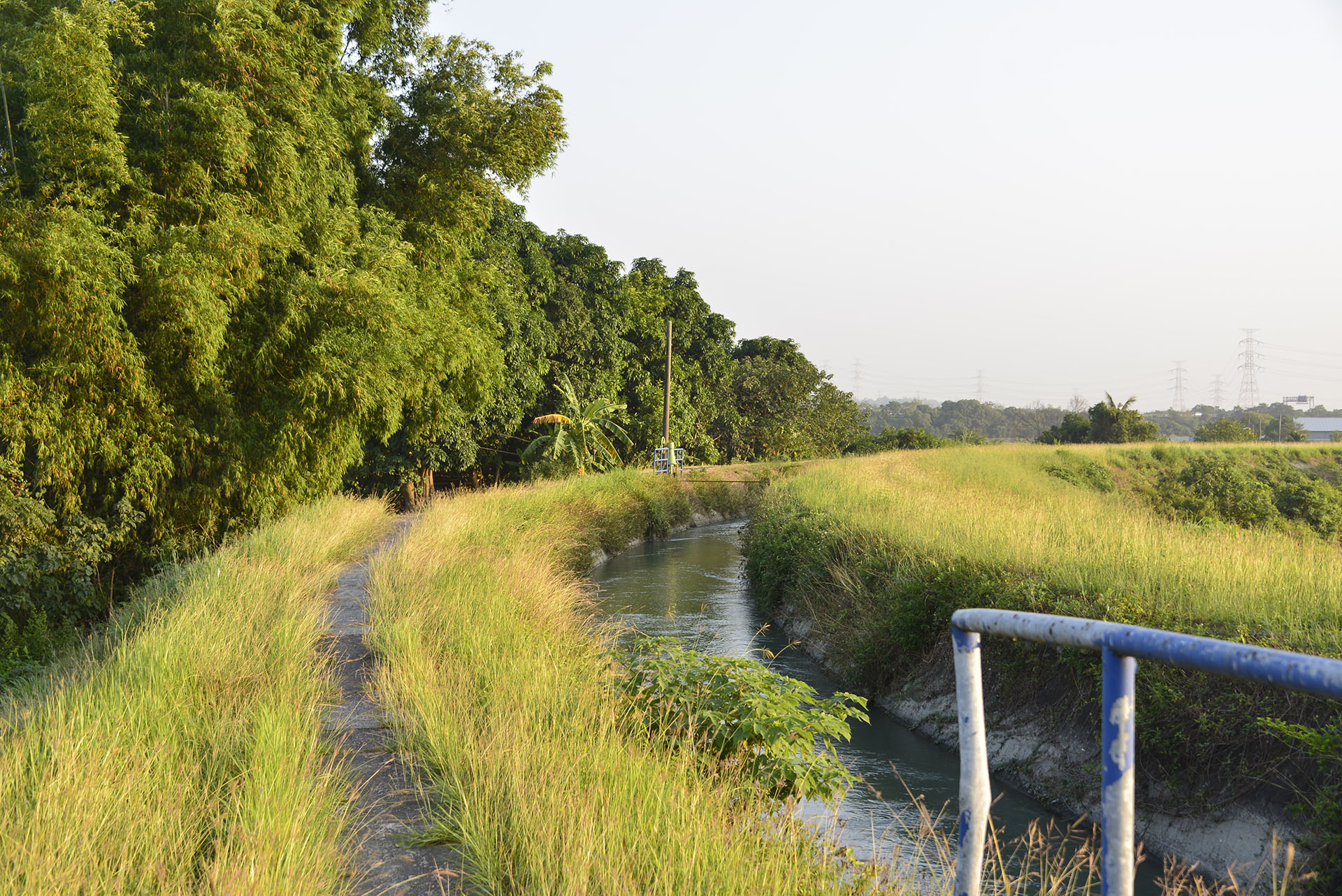


 Canal Trail


Canal Trail
Altitude: Minimum 3 meters, maximum 527 meters | Total distance: 49.8 kilometers
Yoichi Hatta's Chianan Canal hydraulic engineering project transformed the Chianan Plain from paddy fields, which relied entirely on the weather for the harvest, into year-round fertile land. The canal thus serves links the stories of generations of Taiwanese farmers and their abundant harvests. This route follows the Wushantou Reservoir and the Chianan Canal, which were built during Taiwan’s Japanese colonial rule by Yoichi Hatta. The route first runs along the Canal, Zengwen River Aqueduct, Duzaitou River Aqueduct, and Guantian River Aqueduct, after which it connects the Wushantou Reservoir and Wushanling Diversion Tunnel, and finally arrives at the Zengwen Reservoir, Taiwan’s largest reservoir, completed in 1973.
Trails Map
Please select the type of points you wish to display:


No location is founded.
You can select the routes or services you wish to view.



Service Points
Do you wish to take a break during your trek across the MSTW or learn more about the history along the greenway? Visit these Service Points, where restrooms, drinking water, and charging stations are available. You can also obtain travel information about the MSTW and its surrounding attractions!
Jiaba Tianhou Temple
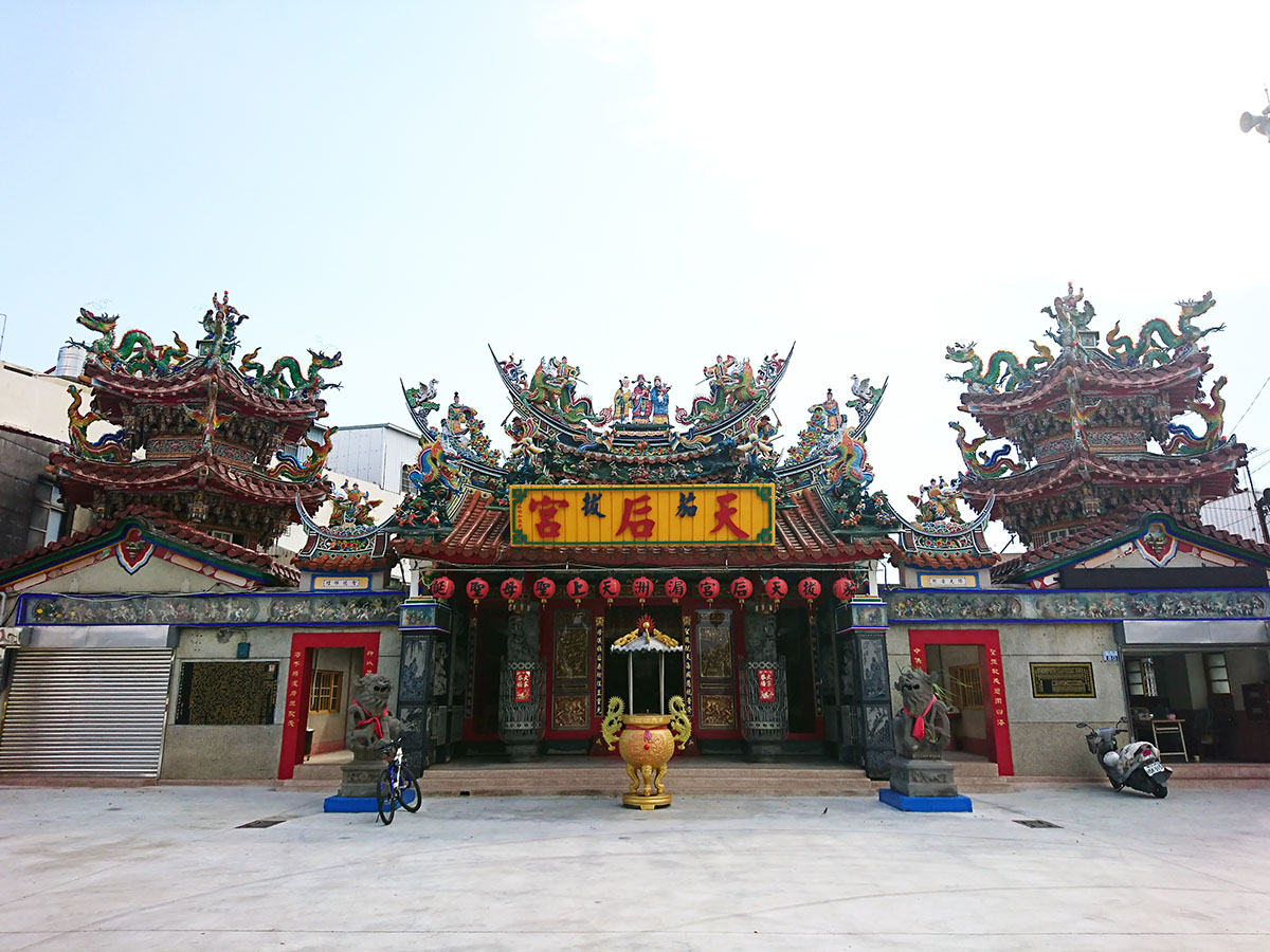
No. 80, Jianan Village, Shanhua Dist., Tainan City
23.13532, 120.32693(Check on Google Maps)
06:00-20:00
( More Information )
Guantian Visitor Center
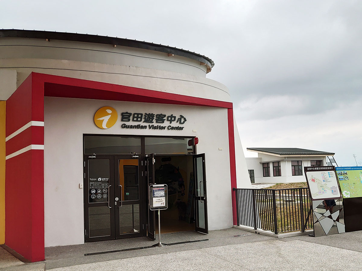
No. 99, Futian Rd., Guantian Village, Guantian Dist., Tainan City
23.18834, 120.33632(Check on Google Maps)
09:00-17:00
( More Information )
Wushantou Reservoir Scenic Area
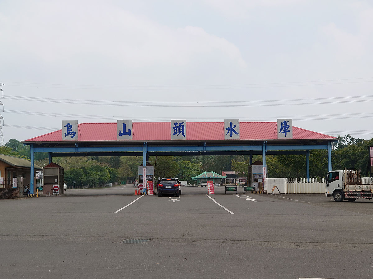
No. 68-2, Jianan, Wushantou Village, Guantian District, Tainan City
23.20795, 120.36273(Check on Google Maps)
08:00-17:30
( More Information )
Yoichi Hatta Memorial Park(ticket required)
.JPG)
No. 66, Jianan Village, Guantian District, Tainan City
23.21367, 120.36546(Check on Google Maps)
09:00-17:30 Closed on Wednesdays
( More Information )
Liujia Zhennan Temple
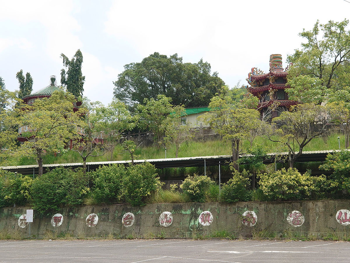
No. 2, Gongyan Road, Liujia District, Tainan City
23.22096, 120.36606(Check on Google Maps)
08:00-17:00
( More Information )
Xikou Station (Chianan Management Office, Irrigation Agency, Ministry of Agriculture)
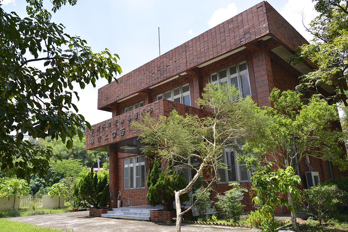
No. 71, Xiananshi, Nanshi Village, Dongshan Dist., Tainan City
23.23172, 120.44787(Check on Google Maps)
Monday to Friday 08:00-17:00
Dongkou Station (Chianan Management Office, Irrigation Agency, Ministry of Agriculture)
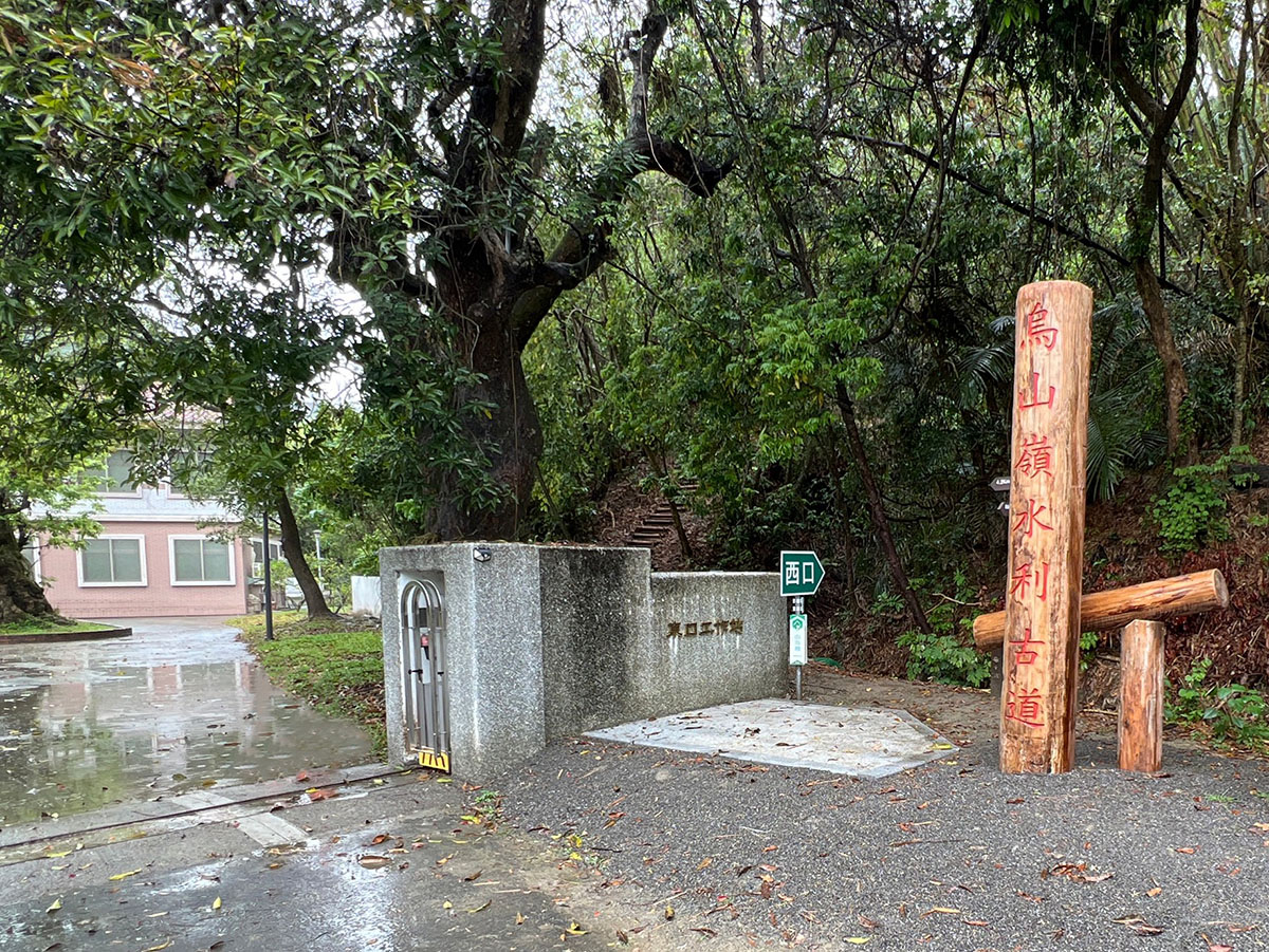
No. 6, Xingbei, Zhaoxing Village, Nanxi Dist., Tainan City
23.22008, 120.49215(Check on Google Maps)
Monday to Friday 08:00-17:00
Zengwen Reservoir Information Center
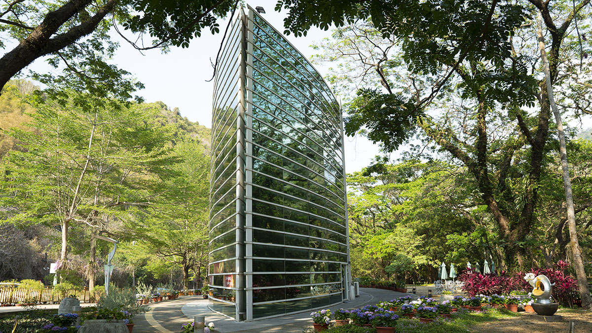
No. 41-30, Dayang, Nanshi Village, Dongshan Dist., Tainan City
23.24149, 120.51916(Check on Google Maps)
08:00-17:00
( More Information )
Zengwen Reservoir Lookout Tower
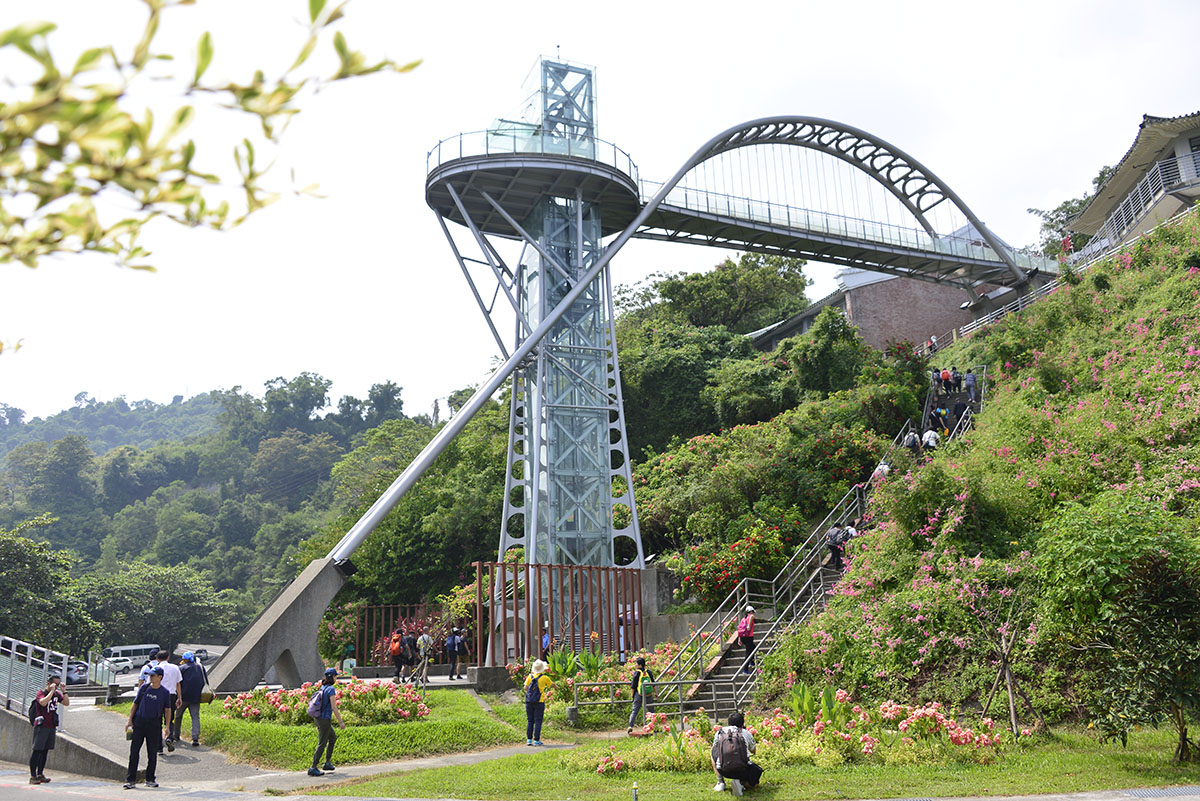
2F, No. 7, Tanping, Xixing Village, Dapu Township, Chiayi County
23.24134, 120.54442(Check on Google Maps)
Restaurant service hours: 09:00-17:00 (Weekdays) 08:30-17:00 (Holidays)
Trial Guide
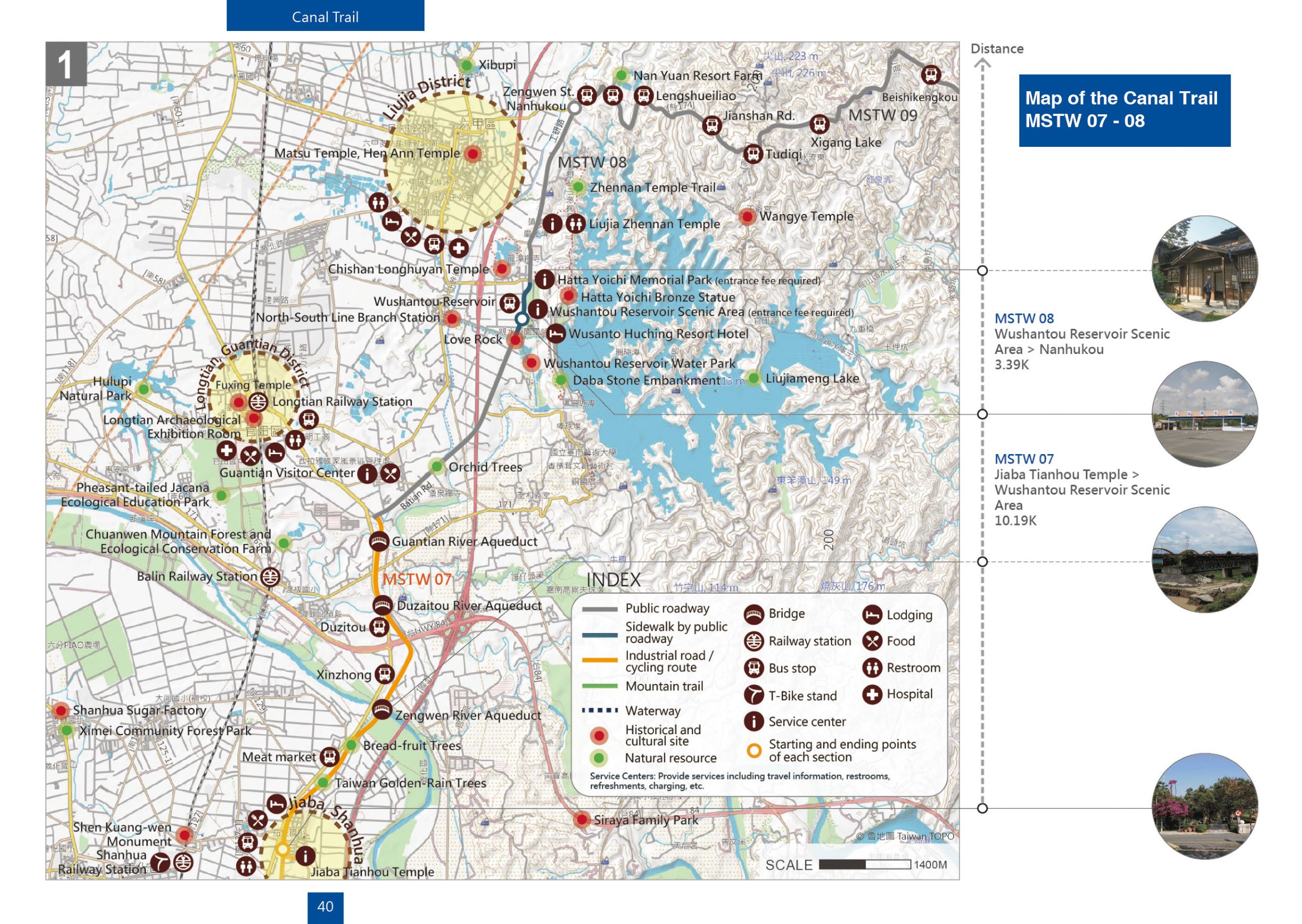
MSTW 07 Jiaba Tianhou Temple → Wushantou Reservoir Scenic Area
Three Major Aqueduct Bridges in the Hydraulic Engineering History of the Chianan Irrigation System
During Japanese ruling period, these three major aqueducts of the southern main route of the Chianan Canal were built with riveted trusses and steel girders to serve as transportation routes and water channels.
Distance
Industrial road 6.2 km, public roadway 3.6 km, pedestrian walkway 0.39 km
Difficulty
Grade 0
(
Check Difficulty Level
)
Time required
2 hr 20 min. walk
Starting and ending points
Jiaba Tianhou Temple / Wushantou Reservoir Scenic Area
Transportation
For JiabaBus stop: Take Orange 2, Orange 5 and get off at Jiaba (Provincial Highway) Station and walk there.
For WushantouBus stop: Take Orange 10, Yellow 1 Extension to Xinying Transfer Station, Nanyit University, Tourist Shuttle Lingbo Guantian Line and get off at Wushantou Reservoir Station.
For WushantouBus stop: Take Orange 10, Yellow 1 Extension to Xinying Transfer Station, Nanyit University, Tourist Shuttle Lingbo Guantian Line and get off at Wushantou Reservoir Station.
Food
Jiaba streets and Provincial Highway 1
Surrounding attractions
Zengwen River Aqueduct, Duzaitou River Aqueduct, and the Guantian River Aqueduct
Route
Depart from the Jiaba Tianhou Temple fork in the road and travel along the Chianan Irrigation System south branch line paralleled to Provincial Highway 1; along the way, hikers will enjoy the landscape scenery of the dairy farms, Zengwen River, Zengwen Bridge, and old and new aqueducts; continue along the levee to past the farmland on either side and then pass beneath the Duzaitou River Aqueduct and Guantian River Aqueduct (the Zengwen River, Duzaitou River, and Guantian River Aqueduct Bridges are important historical and cultural monuments built by Hatta Yoichi During Japanese ruling period). Visitors will pass by longan and mango orchards before arriving at Batian Rd. (City Highway 171). Following the route, the landscape change to crops such as rice and water caltrops. Hikers eventually will reach the Wushantou Reservoir after passing by the starting point of the Chianan Canal.
Features
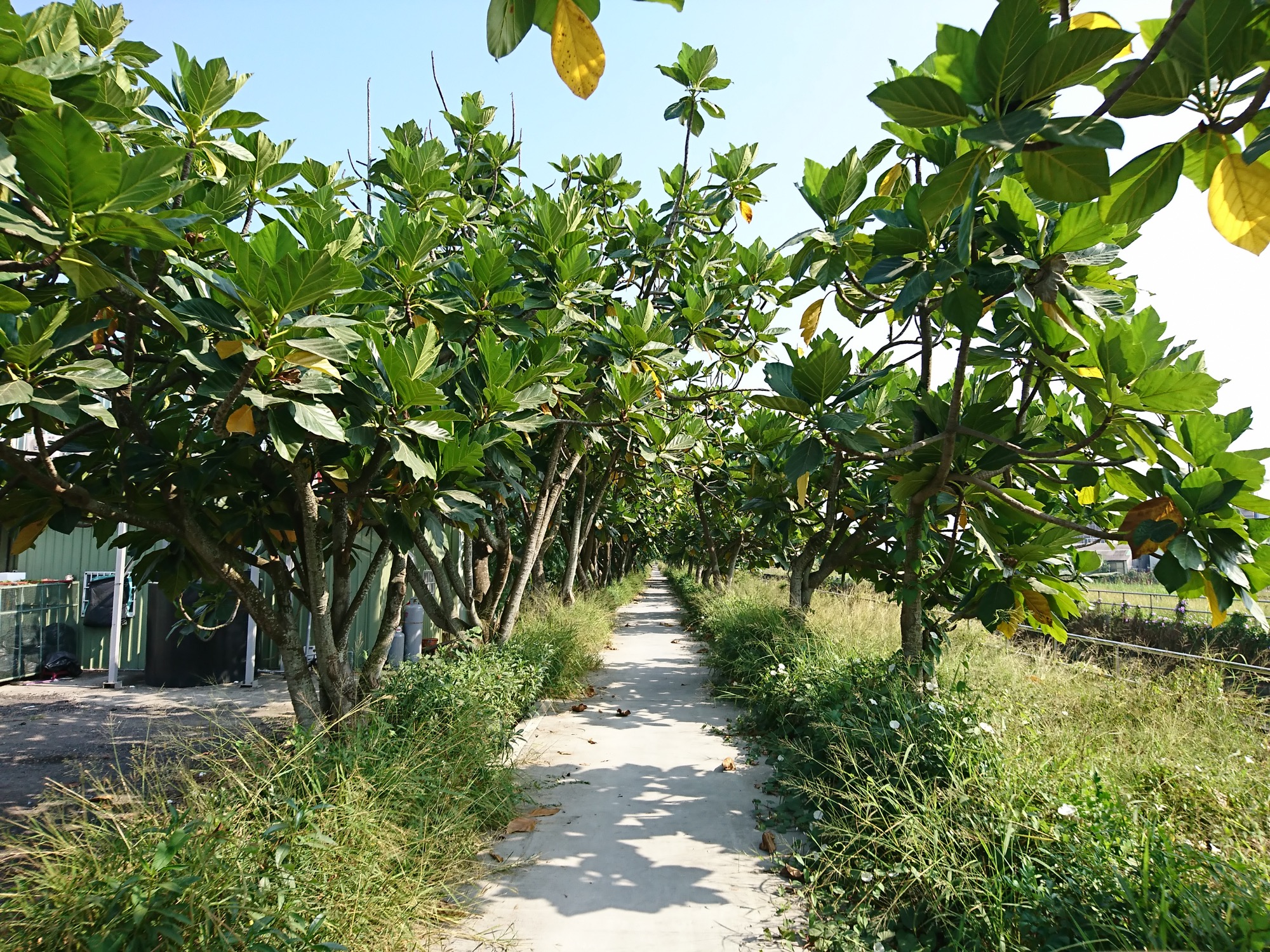
In addition to enjoying the pleasant view of breadfruit trees along both sides of the road, visitors can see how three major aqueducts serve both as roads and as water pipelines, and feature construction methods that are rare to this day.
MSTW 08 Wushantou Reservoir Scenic Area → Nanhukou
Coral Lake and Yoichi Hatta
During Japanese ruling period, Yoichi Hatta designed and built the Wushantou Reservoir, which transformed paddy fields whose harvests had been completely dependent on the weather into land that was fertile year round. He implemented a 3-year rotational irrigation system that turned the Chianan Plain into an area rich with abundant crops.
Distance
Pedestrian walkway 0.59 km; public roadway 2.8 km
Difficulty
Grade 0
(
Check Difficulty Level
)
Time required
50 min. walk
Starting and ending points
Wushantou Reservoir Scenic Area / Nanhukou
Transportation
For WushantouBus stop: Take Orange 10, Yellow 1 Extension to Xinying Transfer Station, Nanyit University, Tourist Shuttle Lingbo Guantian Line and get off at Wushantou Reservoir Station.
For NanhukouBus stop: Take Yellow 2, Yellow 2 Extension and get off at Second Prison.
For NanhukouBus stop: Take Yellow 2, Yellow 2 Extension and get off at Second Prison.
Food
Visitors are recommended to bring their own food and beverages or purchase refershments and snacks in Liujia District.
Surrounding attractions
The Canal of the Chianan Irrigation System, Wushantou Reservoir Scenic Area, and Liujia Zhennan Temple.
Route
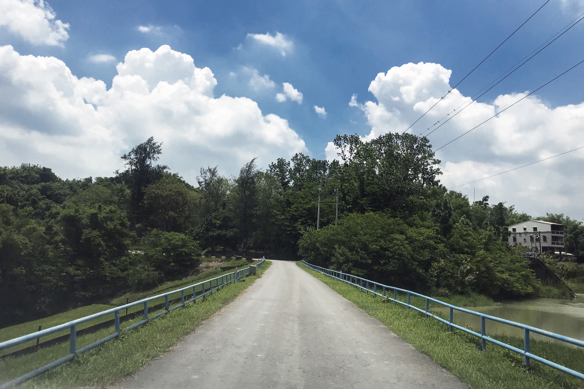
Completed in 1930, Wushantou Reservoir is one of the central elements of the Chianan Irrigation System hydraulic engineering project. Because it resembles coral in shape, the reservoir has been referred to as the Coral Lake. Wushantou Reservoir is now the last surviving semi-hydro-silting rock-fill dam; it supplies irrigation water to farmland in the Chianan region. Additionally, the reservoir supplies water for public and industrial use in the greater Tainan area. For this route, go north from the Wushantou Reservoir Scenic Area ticket counter along Batian Rd. and pass Yoichi Hatta Memorial Park. Continuing along Gongyan Rd then pass by Liujia Zhennan Temple, hikers will arrive at Nanhukou. During the trip, one can enjoy the view of the fruit trees in the surroundings.
Features
Wushantou Reservoir boasts a beautiful shape and breathtaking scenery. To see bronze statue of Yoichi Hatta and learn about relevant history, please pay to enter Wushantou Reservoir; hikers can also arrange a tour to Yoichi Hatta Memorial Park and enjoy themselves in Hatta’s former residence.
MSTW 09 Nanhukou → Xikou
An Area in the Foothills Known for Water Conservation
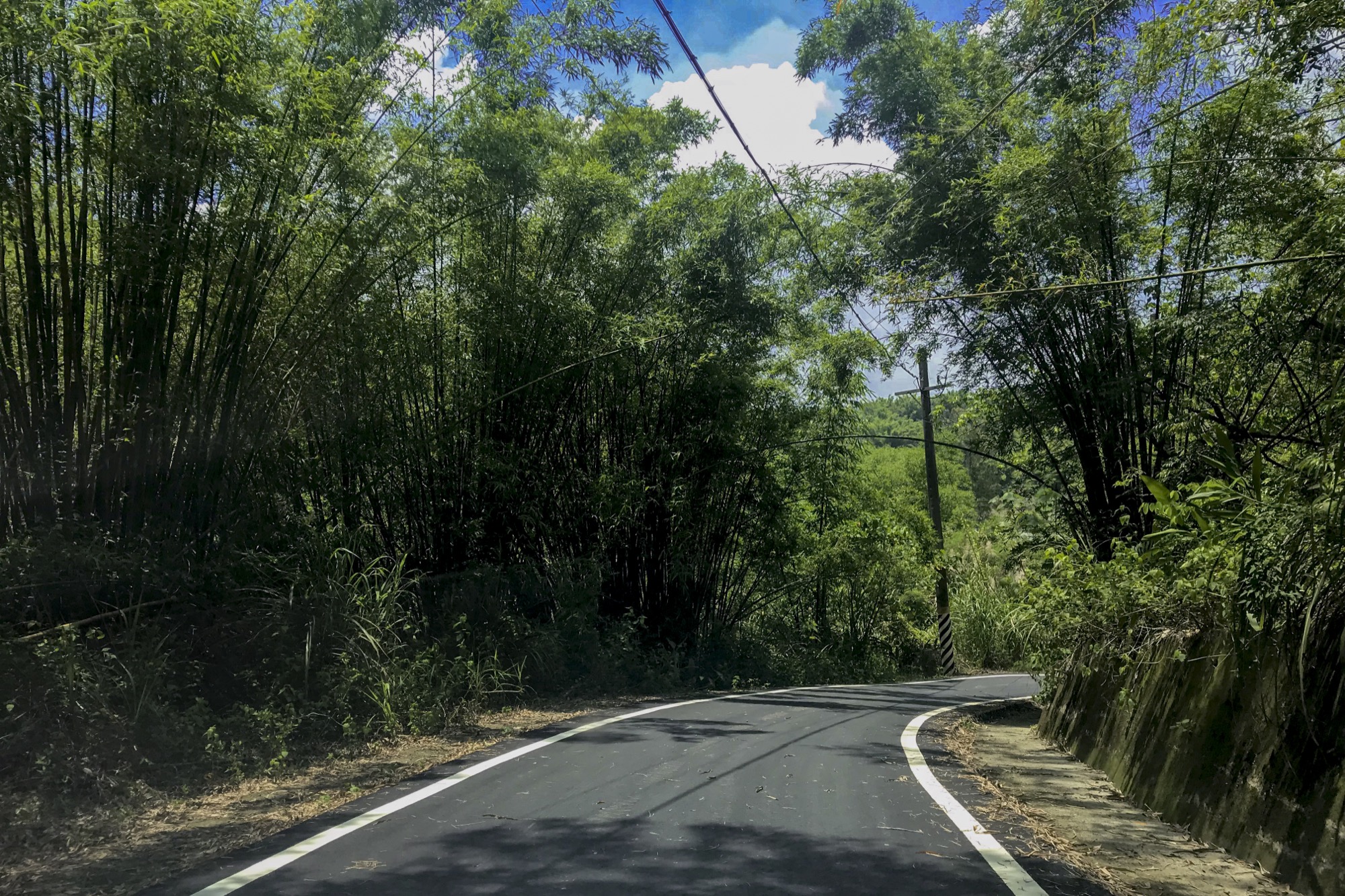
When walking along this greenway through groves of trees and bamboo, it is easy to imagine the falling rain flowing into the Wushantou Reservoir and making this area spring into life in a burst of green.
Distance
Industrial road 0.63 km, public roadway 10.5 km
Difficulty
Grade 0
(
Check Difficulty Level
)
Time required
2 hr 30 min. walk
Starting and ending points
Nanhukou / Xikou
Transportation
For NanhukouBus stop: Take Yellow 2, Yellow 2 Extension and get off at Second Prison.
For Xikou Bus stop: Take bus Yellow 2 Extended to Daqiuli and get off at Xikou Little Switzerland Station.
For Xikou Bus stop: Take bus Yellow 2 Extended to Daqiuli and get off at Xikou Little Switzerland Station.
Food
Visitors are recommended to bring their own food and beverages or purchase them at Xikou Little Switzerland.
Surrounding attractions
Courtyard (Tianjing) Whirlpool, stone tablet (a record of the building of the Chianan Irrigation System), Xikou Little Switzerland
Route
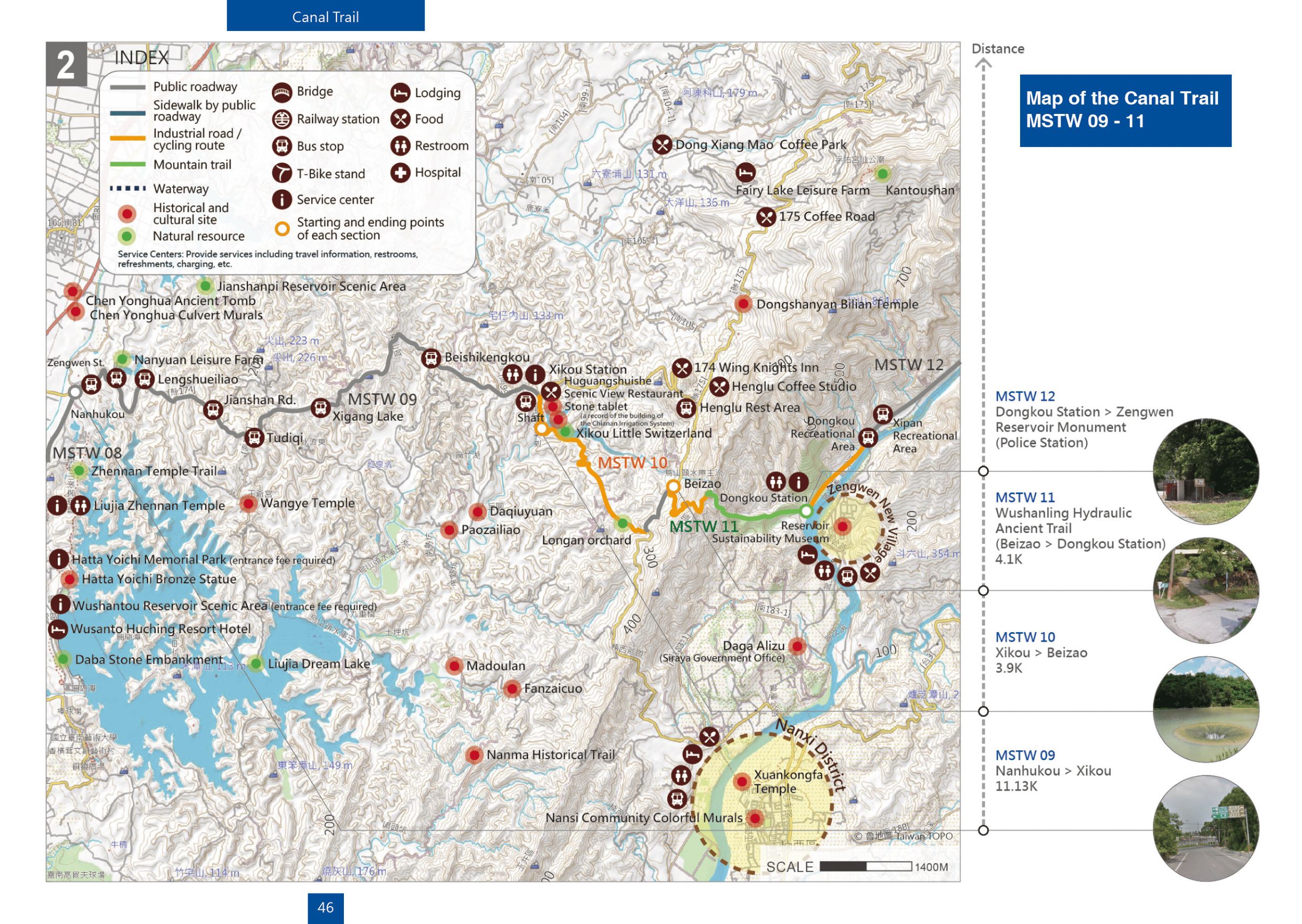
Depart from Nanhukou and travel along City Highway 174, visitors will past Nan Yuan Resort Farm, Zhenwu Temple and arrive at the Pingyuanzi fork road. Follow the industrial road and pass several rural villages, visitors will reach Xikou Little Switzerland, which contains the Xikou Station, Xikou Hydropower Plant, and the Courtyard Whirlpool. The other option is to take the daily bus to enjoy the scenery leisurely; however, visitors are recommended to check bus schedules in advance since there are only few Route Yellow 2 in service every day.
Features
This region features a low-to-mid altitude natural mixed forest with lush trees. At Xikou Station, visitors will see a stone tablet with a record of the building of the Chianan Irrigation System and the amazing scenery of Courtyard (Tianjing) Whirlpool. Because the drop in elevation is large, a rapidly swirling hole is created in the water, which became known as the “courtyard whirlpool”.
MSTW 10 Xikou → Beizao
Spectacular Scenery of the Courtyard Whirlpool and Xikou Little Switzerland
At this scenic spot in Xikou, where the Zengwen River flows into the Zengwen Reservoir, the water pours and forms a rapidly swirling hole due to the difference in height, attracting thousands of people to come and witness the extraordinary sight.
Distance
Industrial road 3.0 km, public roadway 0.9 km
Difficulty
Grade 0
(
Check Difficulty Level
)
Time required
1 hr 10 min. walk
Starting and ending points
Xikou / Beizao (City Highway 175)
Transportation
For Xikou Bus stop: Take bus Yellow 2 Extended to Daqiuli and get off at Xikou Little Switzerland Station.
For Beizao Bus stop: Take bus Yellow 11-2 via Shuangxi or Yellow 11-2 via Dayang to Henglu Rest Area and walk from there.
For Beizao Bus stop: Take bus Yellow 11-2 via Shuangxi or Yellow 11-2 via Dayang to Henglu Rest Area and walk from there.
Food
Visitors are recommended to bring their own food and beverages or purchase them at Xikou Little Switzerland.
Surrounding attractions
Stone tablet (a record of the building of the Chianan Irrigation System), Xikou Little Switzerland Spillway, and Beizao
Route
Yoichi Hatta constructed the Chianan Irrigation System during Japanese ruling period. To increase the water source for the Wushantou Reservoir, Hatta built the Wushanling Diversion Tunnel, altering the water from Zengwen River to flow into the Dongkou (East Gate) and then passed through the tunnel before entering the Xikou (West Gate) of Wushantou Reservoir. It took seven years to complete the construction. Xikou Little Switzerland, located on the upstream side of Wushantou Reservoir, was once a famous tourist attraction featuring tall trees and a carpet of green grass by the river. Later, a power plant was constructed. After departing from Xikou and taking the industrial road, visitors will pass longan and mango plantations before arriving at City Highway 175.
Features
Xikou Little Switzerland is known for its dam and spillway, as well as its pictureque scenery. In summer and fall, the mango and longan trees in the area are heavy with fruit. Beizao, the traditional processing equipment for longan drying, can still be found here.
Note
Because this section of the industrial road is somewhat steep, visitors are highly recommended to reserve more time for traveling.
MSTW 11 Beizao → Wushanling Hydraulic Historic Trail → Dongkou Station
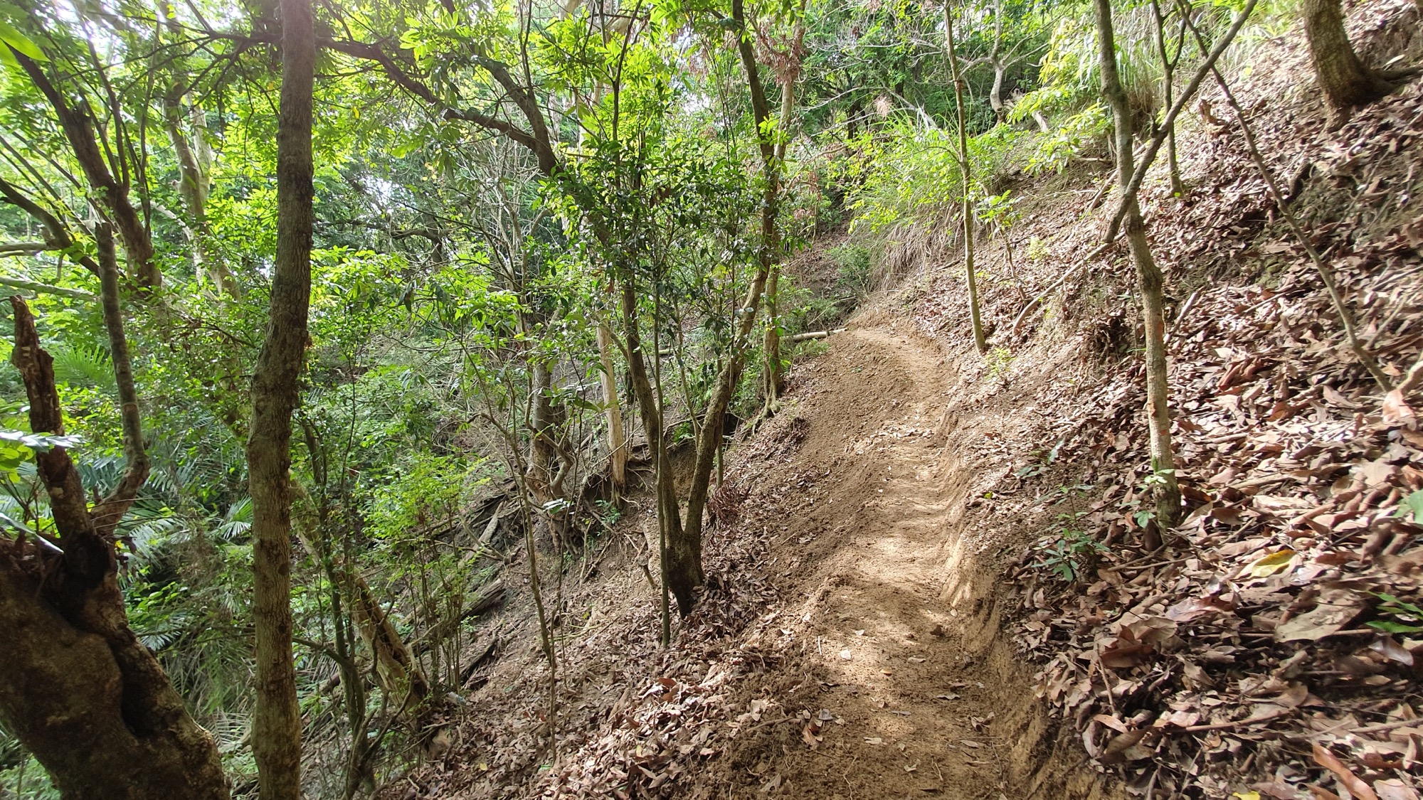
Traversing Wushanling to visit Dongkou and Xikou of Wushanling Diversion Tunnel
To channel more water into the Wushantou Reservoir, Yoichi Hatta excavated the Dongkou and Xikou at Wushanling and built Wushanling Diversion Tunnel. Through this laborious effort, his team managed to alter the water from the Zengwen River to flow into the Reservoir.
Distance
Mountain trail 2.5 km, industrial road 1.6 km
Difficulty
Grade 3
(
Check Difficulty Level
)
Time required
Xikou → Dongkou – 4 hr. walk
Dongkou → Xikou – 5 hr. walk
Dongkou → Xikou – 5 hr. walk
Starting and ending points
Beizao (City highway 175) / Dongkou Station
Transportation
For Beizao Bus stop: Take bus Yellow 11-2 via Shuangxi or Yellow 11-2 via Dayang to Henglu Rest Area and walk from there.
For DongkouBus stop: Take Green 25 and get off at Dongkou Recreation Area Station and walk there.
For DongkouBus stop: Take Green 25 and get off at Dongkou Recreation Area Station and walk there.
Food
Visitors must bring their own food and beverages
Surrounding attractions
Zengwen Reservoir Benchmark (No. 50)
Route
During Japanese ruling period, Yoichi Hatta constructed the Chianan Irrigation System. To prevent the Wushantou Reservoir from experiencing water shortages, a diversion tunnel approximately 3.2 km was built with Xikou and Dongkou on either end. In early days, traversing Wushanling from Xikou to Zengwen Reservoir was a popular route; however, natural disasters subsequently altered the terrain and the trail was damaged. Trail maintenance and construction adopted the hand-made approach. Hikers take the uphill route from City Highway 175 and travel along a steep industrial road. Before reaching the mountain path, hikers will meet longan plantation. The path passes by Zengwen Reservoir Benchmark No. 50, transmission towers, an orchid tree forest with mesmerizing scenery, and the collapsed hills. Visitors can exit the mountain path at Dongkou Station.
Features
This region contains a natural mountain path where visitors can explore the forest ecology of the foothills. While traveling along the mountain path, visitors can see the scenery shift from orchards to natural forest and enjoy the shade of trees. Taiwan acacia, silvergrass, bamboo bushes, and orchid trees can be seen in this hilly terrain.
Note
Visitors are recommended to reserve more traveling time and be wellprepared for this section because of the steep industrial road and the primitive trail.
MSTW 12 Dongkou Station → Zengwen Reservoir Monument
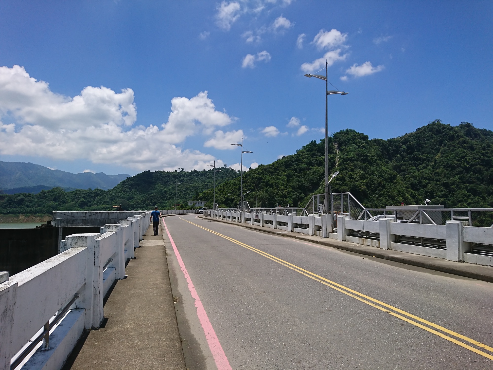
Zengwen Reservoir Information Center
This route passes the Zengwen Reservoir Information Center, which blends into the surrounding greenery that is reflected in its windows. At the center, visitors can find a detailed display about the history of the reservoir.
Distance
Industrial road 1.5 km, public roadway 4.8 km
Difficulty
Grade 0
(
Check Difficulty Level
)
Time required
1 hr 20 min. walk
Starting and ending points
Dongkou Station / Zengwen Reservoir Monument
Transportation
For DongkouBus stop: Take Green 25 and get off at Dongkou Recreation Area Station and walk there.
For Dam Top Bus stop: Take the Green 24 Extended Viewing Platform bus and get off at Dam Top to reach the destination.
For Dam Top Bus stop: Take the Green 24 Extended Viewing Platform bus and get off at Dam Top to reach the destination.
Food
Visitors are recommended to bring their own food and beverages or purchase them at the Zengwen Reservoir Information Center.
Surrounding attractions
Zengwen Reservoir Information Center, Zengwen Reservoir Monument, and top of dam
Route
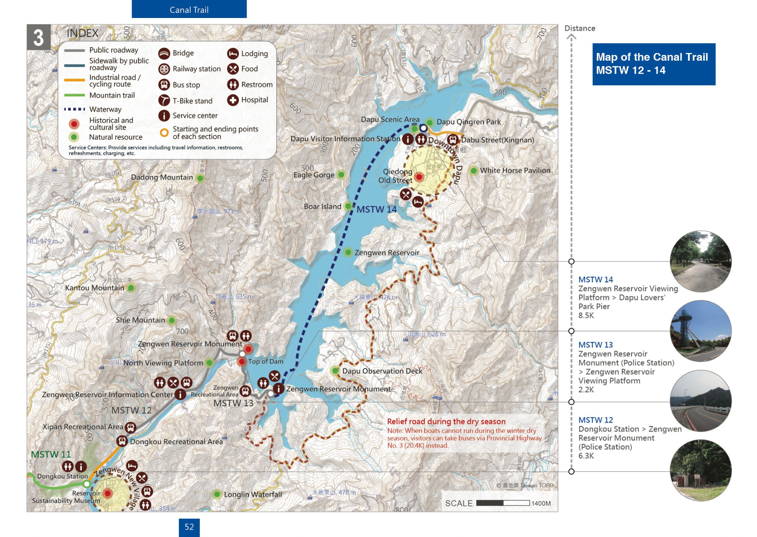
Depart from Dongkou Station and go north along the industrial road to connect to Zengku Rd., passing by a lawn area on either side (previously the Dongkou Camping Area) and the Zengwen Reservoir Information Center. The information center features a unique architectural design including a glass curtain on the outside; inside the information center is an area offering consultation services, travel advice, and light meals, as well as a briefing room that plays tourism and avian ecology videos on holidays. This section ends at the Zengwen Reservoir Monument.
Features
The glass curtain at the Zengwen Reservoir Information Center reflects the verdant green trees, making it blend in beautifully with the surrounding environment. Visitors traveling along Zengku Rd. can see the magnificent dam and the spillway of the Zengwen Reservoir.
MSTW 13 Zengwen Reservoir Monument → Zengwen Reservoir Viewing Platform
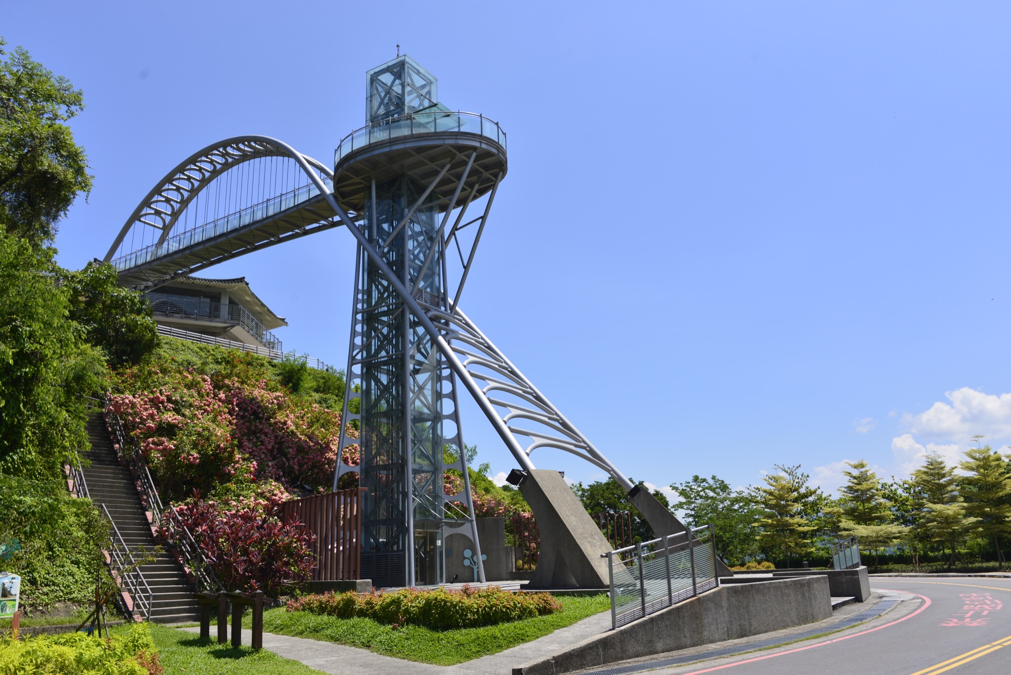
Zengwen Dam Top
Visitors arriving at the Zengwen Dam after their arduous trip can stop here to view the Zengwen Reservoir in the distance and enjoy the magnificent scenery.
Distance
Public roadway 2.2 km
Difficulty
Grade 0
(
Check Difficulty Level
)
Time required
30 min. walk
Starting and ending points
Zengwen Reservoir Monument / Zengwen Reservoir Lookout Tower
Transportation
For Dam Top Bus stop: Take the Green 24 Extended Viewing Platform bus and get off at Dam Top to reach the destination.
For Viewing Platform Bus stop: Take the Green 24 Extended to Viewing Platform bus and get off at Viewing Platform Station to reach the destination.
For Viewing Platform Bus stop: Take the Green 24 Extended to Viewing Platform bus and get off at Viewing Platform Station to reach the destination.
Food
Visitors are recommended to bring their own food and beverages or purchase them at the Zengwen Reservoir Lookout Tower.
Surrounding attractions
Zengwen Reservoir Monument , top of dam, Zengwen Reservoir Lookout Tower, and Zengwen Reservoir Lookout Tower Pier
Route
Depart from the Zengwen Reservoir Monument to see the aweinspiring Zengwen Dam top, the spillway and spillway gates; take Zengku Rd. across the top of dam and travel along the Zengwen Reservoir to see the well-designed Zengwen Reservoir Viewing Platform; head up to the platform to enjoy the beautiful views of the Zengwen Reservoir and find food and beverages; and go to the Zengwen Reservoir Lookout Tower Pier to take a boat on the lake.
Features
Looking down from the top of Zengwen Dam, visitors can see the scenery from a variety of angles. At the Zengwen Reservoir Lookout Tower, visitors can appreciate the majestic architecture of the dam and wonderful views of Zengwen Reservoir.
MSTW 14 Zengwen Reservoir Viewing Platform → Dapu Lovers’ Park Pier
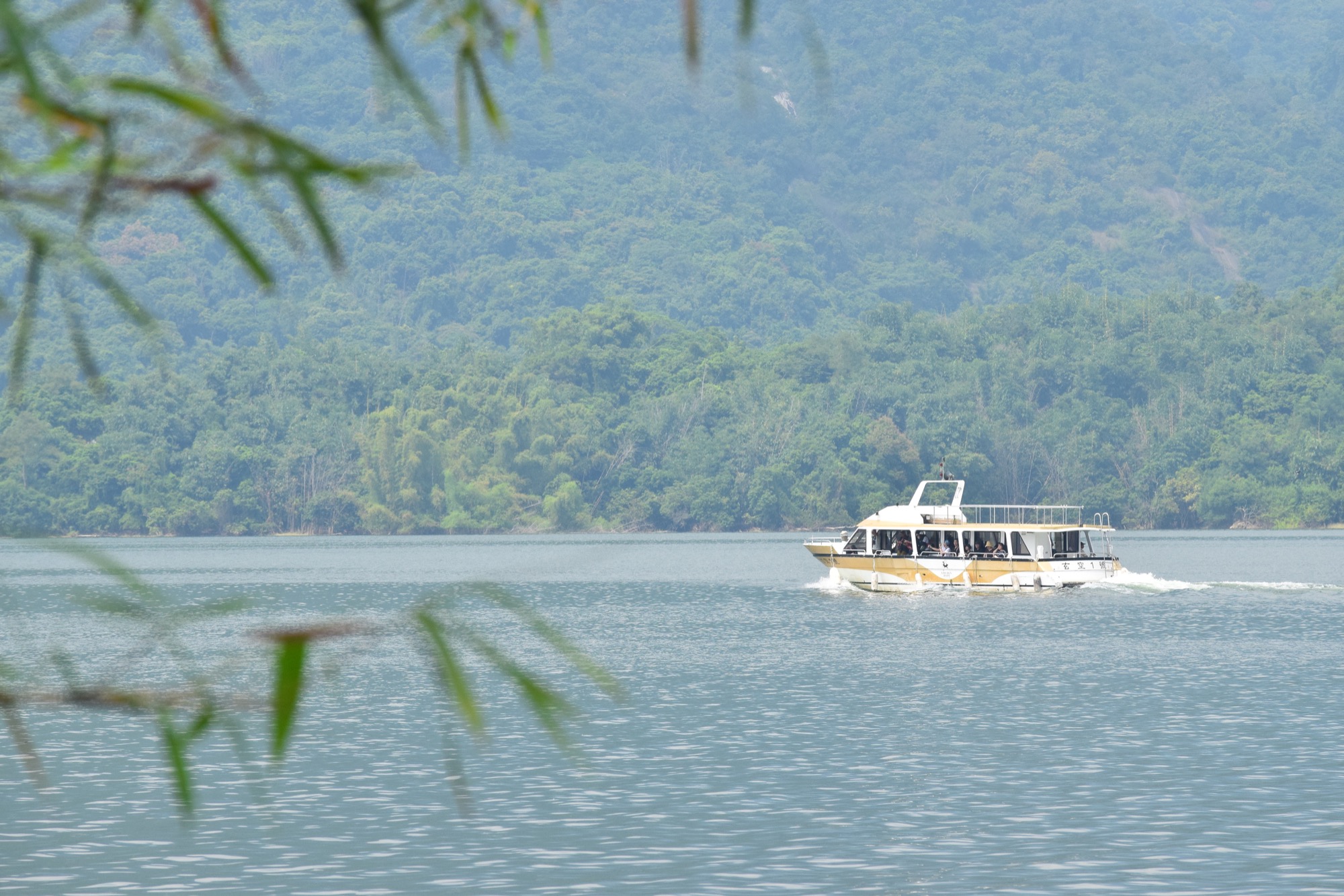
Taking a Boat Trip on the Largest Reservoir in Taiwan
As the breeze blows and black kites hover, visitors can enjoy the picturesque scenery of the Zengwen Reservoir and the surrounding mountains on this beautiful boat ride.
Distance
Waterway 8.5 km. No fixed schedule. (or public roadway 20.4 km)
Difficulty
Grade 0
(
Check Difficulty Level
)
Time required
1 hr 10 min by boat
Starting and ending points
Zengwen Reservoir Viewing Platform / Dapu Lovers’ Park Pier
Transportation
For Viewing Platform Bus stop: Take the Green 24 Extended to Viewing Platform bus and get off at Viewing Platform Station to reach the destination.
For DapuBus stop: Take bus Green 25, 7301, or Happiness Dapu 2B to Tudi Gong Temple Station and walk from there.
For DapuBus stop: Take bus Green 25, 7301, or Happiness Dapu 2B to Tudi Gong Temple Station and walk from there.
Food
Visitors are recommended to bring their own food and beverages or purchase them at the Zengwen Reservoir Viewing Platform or in Dapu District (Dabu Rd.)
Surrounding attractions
Zengwen Reservoir Viewing Platform, Zengwen Reservoir Viewing Platform Pier, Wild Boar Island, Eagle Gorge, Dapu Lovers’ Park
Route
Located at the junction of Chiayi County and Tainan City, the construction project of Zengwen Reservoir begun in 1967 and completed in 1973. The reservoir provides irrigation water to the Chianan area. Additionally, it is used for power generation, flood control, and tourism purposes. The reservoir is the largest reservoir in terms of area in Taiwan. Visitors can board a boat at the Zengwen Reservoir Viewing Platform Pier. During the trip, they will stop at Wild Boar Island and enter Eagle Gorge before arriving at Dapu Lovers’ Park Pier.
Features
Visitors taking a boat trip can enjoy the views from the reservoir. A trip from the Chianan Irrigation System to Zengwen Reservoir will enrich visitors’ knowledge of hydraulic engineering. The reservoir also possesses a rich natural ecosystem where visitors may be treated to a view of black kites circling overhead.
Note
Currently, there is no fixed boat route schedule between the Zengwen Reservoir Viewing Platform Pier and Dapu Lovers’ Park Pier. Custom boat tours are available only for tourist groups. During the dry winter season, boat tours are not offered if the water level is too low. Alternatively, visitors may take Provincial Highway 3 (20.4 km). The Green 25 bus runs from Fengchuiling Bus Stop to Dabu Rd.; it departs four times a day.
Travel Information
Lodging
There are hills in the vicinity and many orchards, villages, and forests nearby. Visitors are recommended to make the reservation on resorts or camping grounds prior to their visit.
Local Specialties
Guantian District
water caltrops
Liujia District
Makino bamboo, thorny bamboo, rice, mushrooms, oranges, longans, and marble goby
Nanxi District
carambolas, plums, longans, mangoes, lychees, and Indian jujubes
Dapu Township
ma bamboo shoots, manjack, bananas, papayas, lychees, longans, and mangoes
Notes
- Protect yourself from the sun during summer to prevent heatstroke and remember to stay hydrated.
- Follow proper etiquette when entering temples.
- Actively watch both sides of the road when cycling along levee paths to prevent yourself from falling. Remember to wear a helmet when cycling.
- Look out for cars behind you and use hand signals when turning.
- Watch out for leaves, branches, and fallen fruit on pedestrian walkway to prevent slips and falls.
- Watch out for low-hanging branches on roadside trees that may hit your head or eyes.
- Please stop walking or dismount from your bike when enjoying the beautiful scenery along the trail. Do not take your eyes off the road when walking or cycling.
- The approaches to some canal paths are steep or connect to motor vehicles throughways. It is recommended that you dismount from your bike and walk it across these areas when necessary.

Trail difficulty level
The Forestry and Nature Conservation Agency has established a five-level trail classification system based on factors such as elevation, walking time, required equipment, and trail difficulty, matching each trail with suitable users. Level 1 is the easiest, while Level 5 is the most difficult. In addition to providing hikers with information on trail characteristics and difficulty, the classification system allows them to assess in advance whether a trail is suitable for them, thereby enhancing trail safety.
The National Greenway of Mountain and Sea (Shanhai National Greenway) adopts the trail classification system established by the Forestry and Nature Conservation Agency. However, because the route includes various types of paths, additional classifications have been introduced. Roads, industrial roads—including industrial roads, bicycle paths, trails along irrigation channels, and riverside embankment roads—roadside pedestrian paths, and waterways are classified as Level 0, representing routes generally suitable for the general public.
| Hiking Level |
|
|
|
|
|
|
|
||||||||||||||||||||||||||||||||||||||||||
|---|---|---|---|---|---|---|---|---|---|---|---|---|---|---|---|---|---|---|---|---|---|---|---|---|---|---|---|---|---|---|---|---|---|---|---|---|---|---|---|---|---|---|---|---|---|---|---|---|---|
| Target | General Public | General Public | Those who have better physical energy | Beginner mountain climber with good physical energy and map literacy. | Open to those who have good physical strength, map reading skills, and wild survival skills. | Open to well-trained mountain climbers. | Open to well-trained mountain climbers. | ||||||||||||||||||||||||||||||||||||||||||
| Elevation | Gently sloping area | In recreational areas, close to settlements or about 1,000 meters above sea level. | In recreational areas, close to settlements or between 1,000~2,000 meters above sea level. | Remote areas or between 2,000 to 3,000 meters above sea level | Remote areas, wilderness, or between 2,000 to 3,000 meters above sea level | Remote areas, wilderness, or more than 3,000 meters above sea level | Remote areas, wilderness, or more than 3,000 meters above sea level | ||||||||||||||||||||||||||||||||||||||||||
| Required Time | It takes half to one day. | It takes half to one day. | It can be done within one day. | It takes one or more days. | Overnight preparation required. | It takes up to three days. | It takes up to three days. | ||||||||||||||||||||||||||||||||||||||||||
| Equipment | Light backpacking (water and small amount of food) | Light backpacking (water and small amount of food) | Light backpacking (water and proper amount of food) | Overnight preparation required. (e.g. drinking water, food, map, warm clothing, first-aid medicine, etc.) Application for entrance permission in advance is required if there is access control. | Comprehensive Mountaineering Gear Required. (e.g. food, drinking water, cooking utensils, map, warm clothing, flashlight, sleeping bag, tent, etc.) Application for entrance permission in advance is required if there is access control. | Comprehensive Mountaineering Gear Required. (e.g. food, drinking water, cooking utensils, map, warm clothing, flashlight, sleeping bag, tent, etc.) Application for entrance permission in advance is required if there is access control. | Comprehensive Mountaineering Gear Required. (e.g. food, drinking water, cooking utensils, map, warm clothing, flashlight, sleeping bag, tent, etc.) Application for entrance permission in advance is required if there is access control. | ||||||||||||||||||||||||||||||||||||||||||
| Description | Flat hiking trails. Relatively even slopes with comprehensive facilities and smooth road surface. Accessible for handicapped assistive devices or baby strollers. | An open hiking trail with easy access. Relatively even slopes with comprehensive facilities and smooth road surface. It takes half a day or less than one day to complete. | An open hiking trail with easy access. Somewhat steep slope with some difficult sections, but has comprehensive facilities and smooth road surface. It takes less than one day to complete. | A hiking trail locates at remote area or with part of the route is in area which requires entrance permission. Application in advance is required. Part of the route is in relatively bad condition with steeper slopes, but basic facilities are provided. It takes one day or between one to three days to complete. | A hiking trail locates at remote area or with part of the route is in area which requires entrance permission. It’s located in high-altitude areas (higher than 3000 meters above sea level). The trail is relatively primitive, with steeper slopes and unstable weather conditions. Part of the route may be dangerous or difficult for climbers. It takes two to three days to complete. Lead from professionals is recommended. | A hiking trail locates at area with inconvenient traffic, and mostly with routes in area which requires entrance permission. It’s located in high-altitude areas (higher than 3000 meters above sea level). The trail is located at primitive area, with bad condition, steeper slopes, and unstable weather conditions. Many parts of the route may be dangerous or difficult for climbers. It takes three or more days to complete. Lead from professionals is recommended. | 1. Level 3, 4 or 5 trails when snow or ice accumulating 2. Informal trails, without clear subgrades or paths, belong to special routes such as original mountain trails, ancient trail relics, prospecting, or technical climbing. |
Hiking Level
Target
General Public
Elevation
Gently sloping area
Required Time
It takes half to one day.
Equipment
Light backpacking (water and small amount of food)
Description
Flat hiking trails. Relatively even slopes with comprehensive facilities and smooth road surface. Accessible for handicapped assistive devices or baby strollers.
Hiking Level
Target
General Public
Elevation
In recreational areas, close to settlements or about 1,000 meters above sea level.
Required Time
It takes half to one day.
Equipment
Light backpacking (water and small amount of food)
Description
An open hiking trail with easy access. Relatively even slopes with comprehensive facilities and smooth road surface. It takes half a day or less than one day to complete.
Hiking Level
Target
Those who have better physical energy
Elevation
In recreational areas, close to settlements or between 1,000~2,000 meters above sea level.
Required Time
It can be done within one day.
Equipment
Light backpacking (water and proper amount of food)
Description
An open hiking trail with easy access. Somewhat steep slope with some difficult sections, but has comprehensive facilities and smooth road surface. It takes less than one day to complete.
Hiking Level
Target
Beginner mountain climber with good physical energy and map literacy.
Elevation
Remote areas or between 2,000 to 3,000 meters above sea level
Required Time
It takes one or more days.
Equipment
Overnight preparation required. (e.g. drinking water, food, map, warm clothing, first-aid medicine, etc.)
Application for entrance permission in advance is required if there is access control.
Description
A hiking trail locates at remote area or with part of the route is in area which requires entrance permission. Application in advance is required. Part of the route is in relatively bad condition with steeper slopes, but basic facilities are provided. It takes one day or between one to three days to complete.
Hiking Level
Target
Open to those who have good physical strength, map reading skills, and wild survival skills.
Elevation
Remote areas, wilderness, or between 2,000 to 3,000 meters above sea level
Required Time
Overnight preparation required.
Equipment
Comprehensive Mountaineering Gear Required. (e.g. food, drinking water, cooking utensils, map, warm clothing, flashlight, sleeping bag, tent, etc.)
Application for entrance permission in advance is required if there is access control.
Description
A hiking trail locates at remote area or with part of the route is in area which requires entrance permission. It’s located in high-altitude areas (higher than 3000 meters above sea level). The trail is relatively primitive, with steeper slopes and unstable weather conditions. Part of the route may be dangerous or difficult for climbers. It takes two to three days to complete. Lead from professionals is recommended.
Hiking Level
Target
Open to well-trained mountain climbers.
Elevation
Remote areas, wilderness, or more than 3,000 meters above sea level
Required Time
It takes up to three days.
Equipment
Comprehensive Mountaineering Gear Required. (e.g. food, drinking water, cooking utensils, map, warm clothing, flashlight, sleeping bag, tent, etc.)
Application for entrance permission in advance is required if there is access control.
Description
A hiking trail locates at area with inconvenient traffic, and mostly with routes in area which requires entrance permission. It’s located in high-altitude areas (higher than 3000 meters above sea level). The trail is located at primitive area, with bad condition, steeper slopes, and unstable weather conditions. Many parts of the route may be dangerous or difficult for climbers. It takes three or more days to complete. Lead from professionals is recommended.
Hiking Level
Target
Open to well-trained mountain climbers.
Elevation
Remote areas, wilderness, or more than 3,000 meters above sea level
Required Time
It takes up to three days.
Equipment
Comprehensive Mountaineering Gear Required. (e.g. food, drinking water, cooking utensils, map, warm clothing, flashlight, sleeping bag, tent, etc.)
Application for entrance permission in advance is required if there is access control.
Description
1. Level 3, 4 or 5 trails when snow or ice accumulating
2. Informal trails, without clear subgrades or paths, belong to special routes such as original mountain trails, ancient trail relics, prospecting, or technical climbing.
Total Page Views:132
 {action_date}
 {position}


