


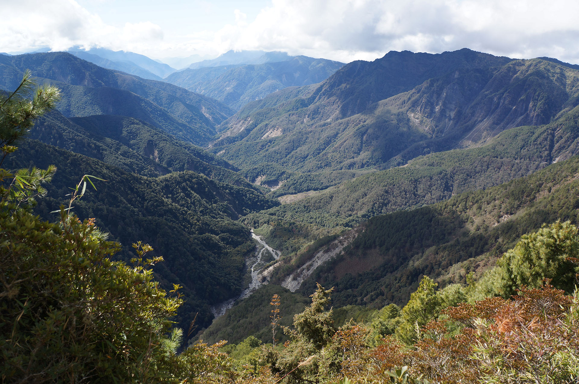


 Mountains to Sea Greenway, TW


Mountains to Sea National Greenway, Taiwan
Mountains to Sea Greenway, TW
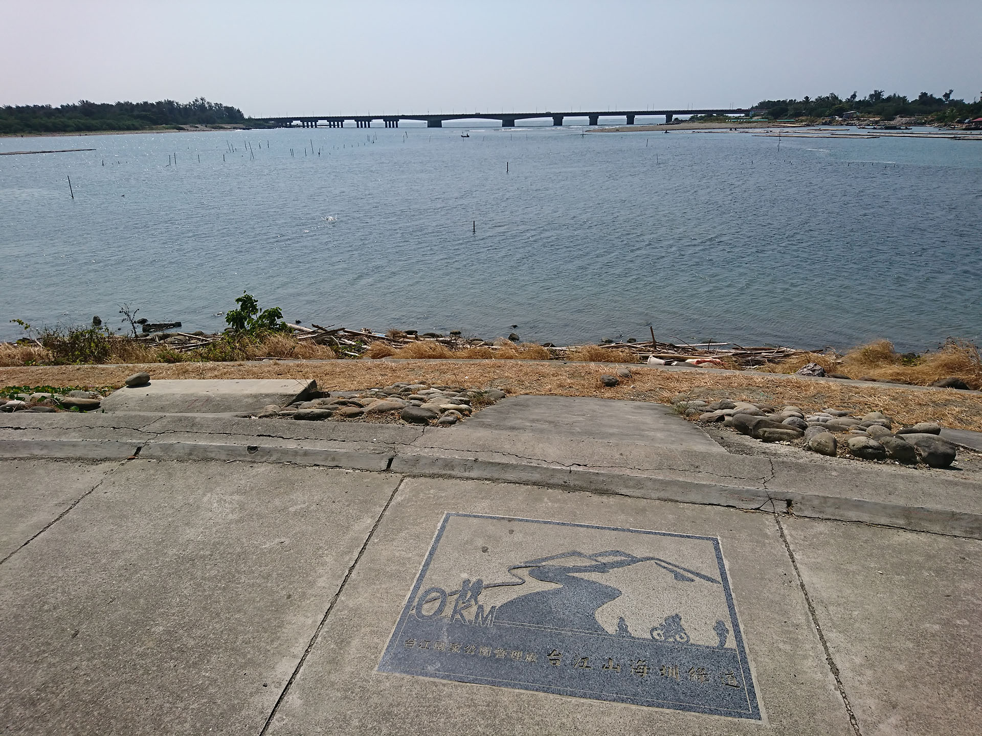
The Greenway was first proposed in 2007 through a local initiative (Tainan Community College, Taijiang). The idea was to connect the cultural centers of the Bunun Tribe, Taijing Campus, Tainan Community College, Tsou Tribe, Siraya Tribe, and Han people, as well as other areas of note in the plains that extend between the mountains and the sea.
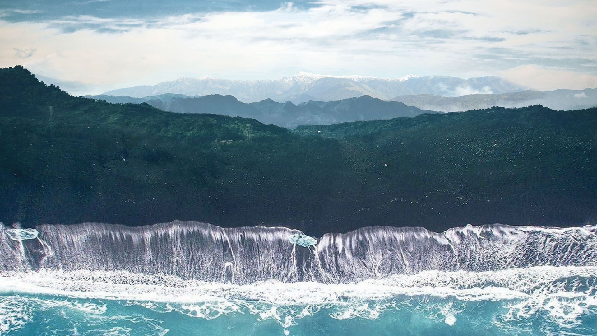
The Greenway is also "a cultural route tracing the origins of local customs and traditions," utilizing diverse modes of transportation—hiking, cycling, taking public transportation, and boating. It extends from Taijiang Inner Sea to Mt. Jade (the highest peak in Northeast Asia), forming a cultural green corridor of Taiwan. In terms of the natural environment, it encompasses different types of climate zones, forest landscapes, and aquatic ecosystems. In terms of the cultural environment, it traverses the four major cultural and living areas of the Taijiang, Siraya, Tsou, and Bunun tribes, becoming a national-level greenway representing the local life and culture of Taiwan.
About


Background
What is a greenway?
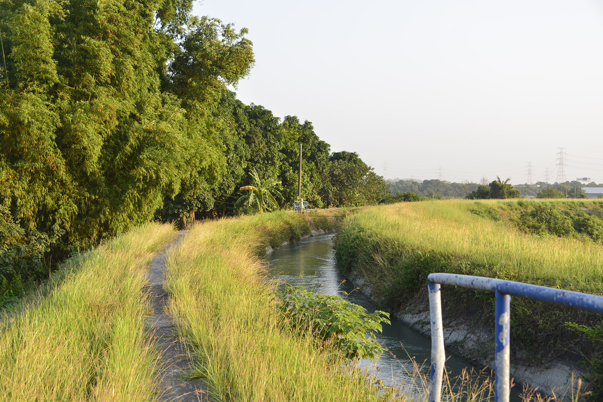
A greenway is a linear open space that connects people with nature. It comes in many forms, and can be a trail, bikeway, levee route, canal, or decommissioned rail line. Greenways have their own distinctive attributes depending on their particular urban or rural setting. As a continuous linear space, they connect parks, nature reserves, cultural centers, historical ruins, and residential areas.
History and Development of the Mountains to Sea Greenway, TW
The Tainan City Government completed the Tainan section of Mountains to Sea Greenway, TW in 2016.This 45 km greenway extends from Taijiang National Park to Wushantou Reservoir, crossing the Chianan Irrigation Canal. In 2017, the National Development Council (NDC) completed the Greenway Network Construction Strategic Plan and approved the initial implementation of 3 greenways. The MSTW was one of them.
The Greenway extends across two counties and cities (Tainan City, Chiayi County) and connects three National Scenic Areas (Southwest Coast, Siraya, Alishan), two National Parks (Taijiang, Yushan), two forest reserves (Chiayi Branch, Forestry and Nature Conservation Agency and the NTU experimental forest), and two reservoirs (Wushantou, Zengwen).
The Greenway extends across two counties and cities (Tainan City, Chiayi County) and connects three National Scenic Areas (Southwest Coast, Siraya, Alishan), two National Parks (Taijiang, Yushan), two forest reserves (Chiayi Branch, Forestry and Nature Conservation Agency and the NTU experimental forest), and two reservoirs (Wushantou, Zengwen).
English Name
The Mountains to Sea Greenway, TW (MSTW) extends from Mt. Jade Main Peak to Taijing Inner Sea. Its name ends with TW, the abbreviation of Taiwan, to indicate the greenway’s location.
Historical Background
As MSTW winds through the Chianan Plain, the greenway is witness to the traces of Taiwan’s prehistoric cultures, as well as 400 years of recorded history, spanning the island’s Dutch colonial period, Zheng kingdom, Qing dynasty, and Japanese ruling period. Each time period offers its own history and stories. Together, they encompass Taiwan's entire history of development, from the migrations of the indigenous Tsou and Siraya tribes, to historical efforts in mountaineering, forestry, railroad, hydraulic development, and water conservancy.
Service Points
Do you wish to take a break during your trek across the MSTW or learn more about the history along the greenway? Visit these Service Points, where restrooms, drinking water, and charging stations are available. You can also obtain travel information about the MSTW and its surrounding attractions!
Inner Sea Trail
Taijiang National Park Administration Visitor Center
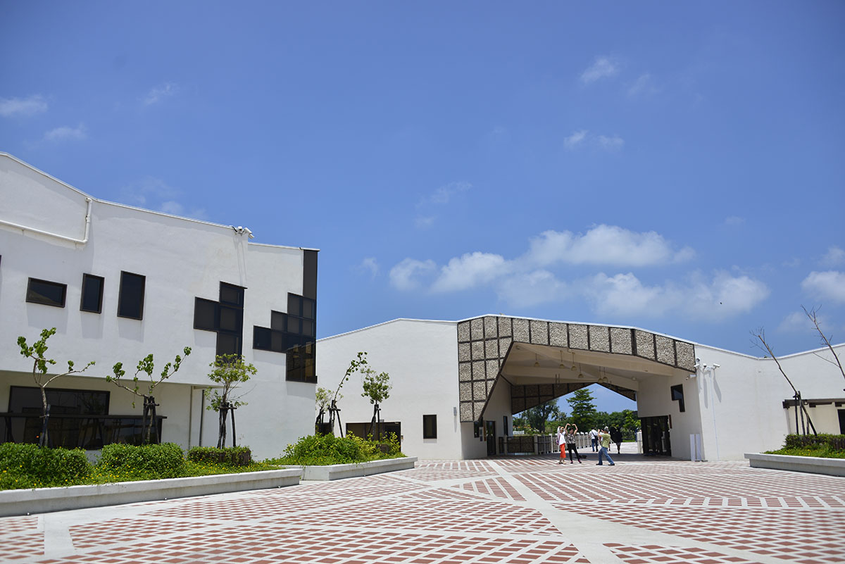
No. 118, Sicao Blvd., Annan Dist., Tainan City
23.0022, 120.1385(Check on Google Maps)
09:00-17:00 ; closed on Mondays
( More information )
Haiweiliao Jhaohuang Temple
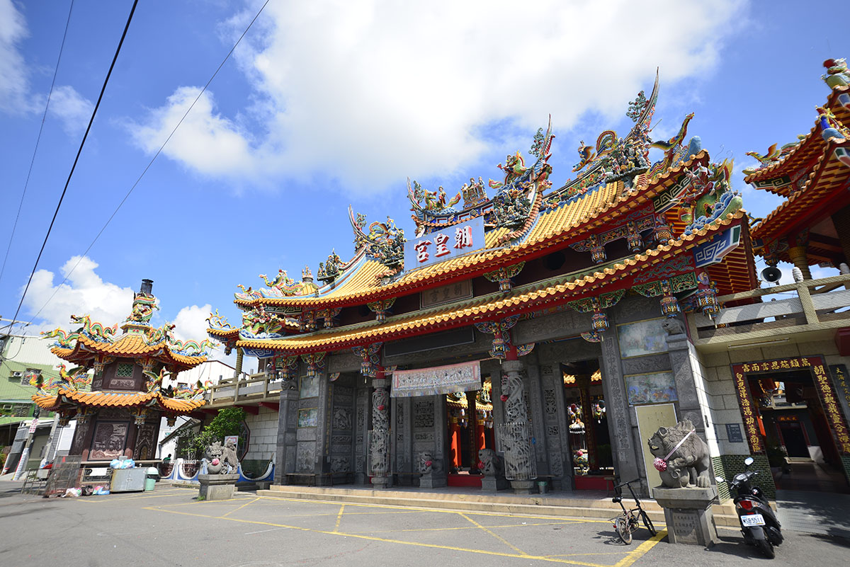
No. 10, Ln. 101, Haijhong Rd., Annan Dist., Tainan City
23.04047, 120.18402(Check on Google Maps)
05:30-21:30
( More information )
Taikang Cultural Center
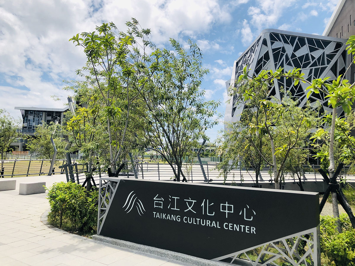
No. 205 & 207, Section 1, Anji Road, Annan District, Tainan City
23.04616, 120.18811(Check on Google Maps)
Open Monday, Wednesday to Sunday 08:00-17:30, closed on Tuesdays.
( More information )
Sidingliao Bao-an Temple
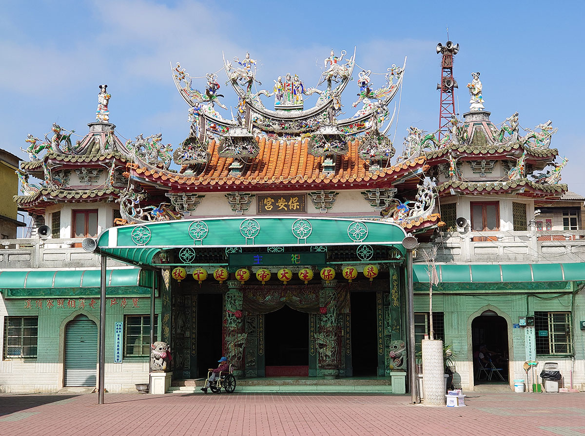
No. 52, Lane 220, Section 1, Anhe Road, Annan District, Tainan City
23.03158, 120.21421(Check on Google Maps)
06:00-21:00
( More information )
National Museum of Taiwan History

No.250, Sec. 1, Changhe Rd., Annan District, Tainan City
23.05831, 120.23504(Check on Google Maps)
09:00-17:00 ; closed on Mondays
( More information )
Xingan Community Culture Museum
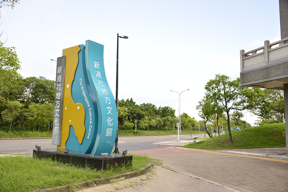
No. 3, Daoye Road, Xinshi District, Tainan City
23.09169, 120.26793(Check on Google Maps)
09:00-17:00 ; closed on Mondays
( More information )
Tainan Branch of National Museum of Prehistory
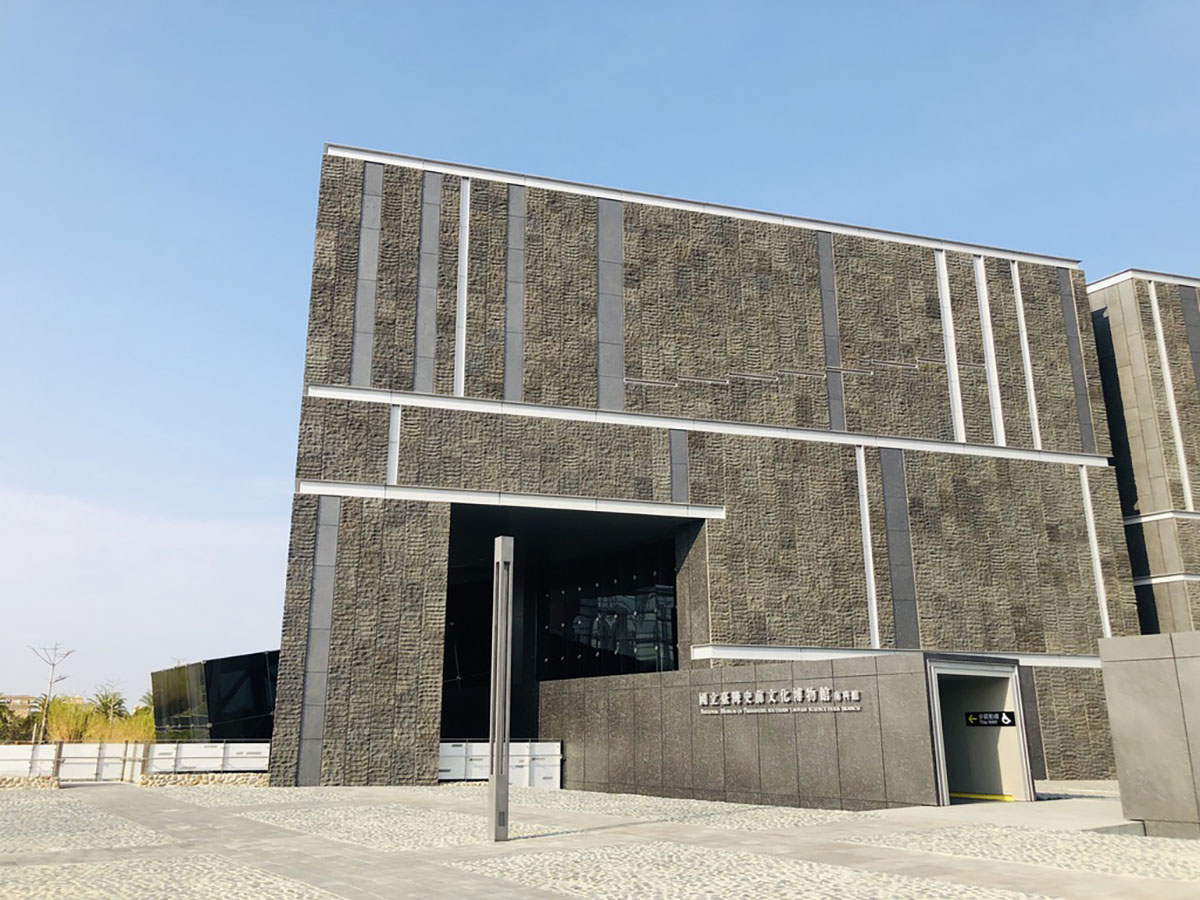
No. 10, Nanke 3rd Road, Xinshi District, Tainan City
23.10094, 120.28353(Check on Google Maps)
09:00-17:00 ; closed on Mondays
( More information )
Tribal Trail
Dapu Visitor Information Station
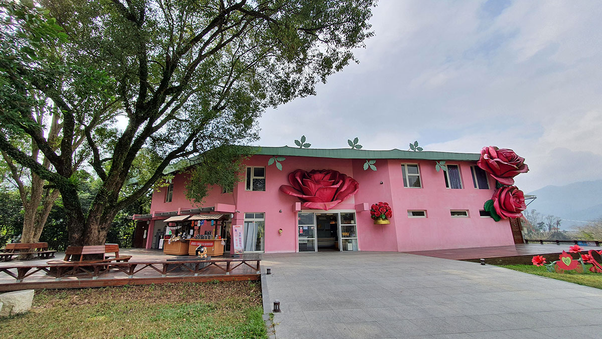
No. 100, Shuangxi, Heping Village, Dapu Township, Chiayi County
23.30172, 120.59002(Check on Google Maps)
09:00-17:00
( More information )
Chashan Community Development Association
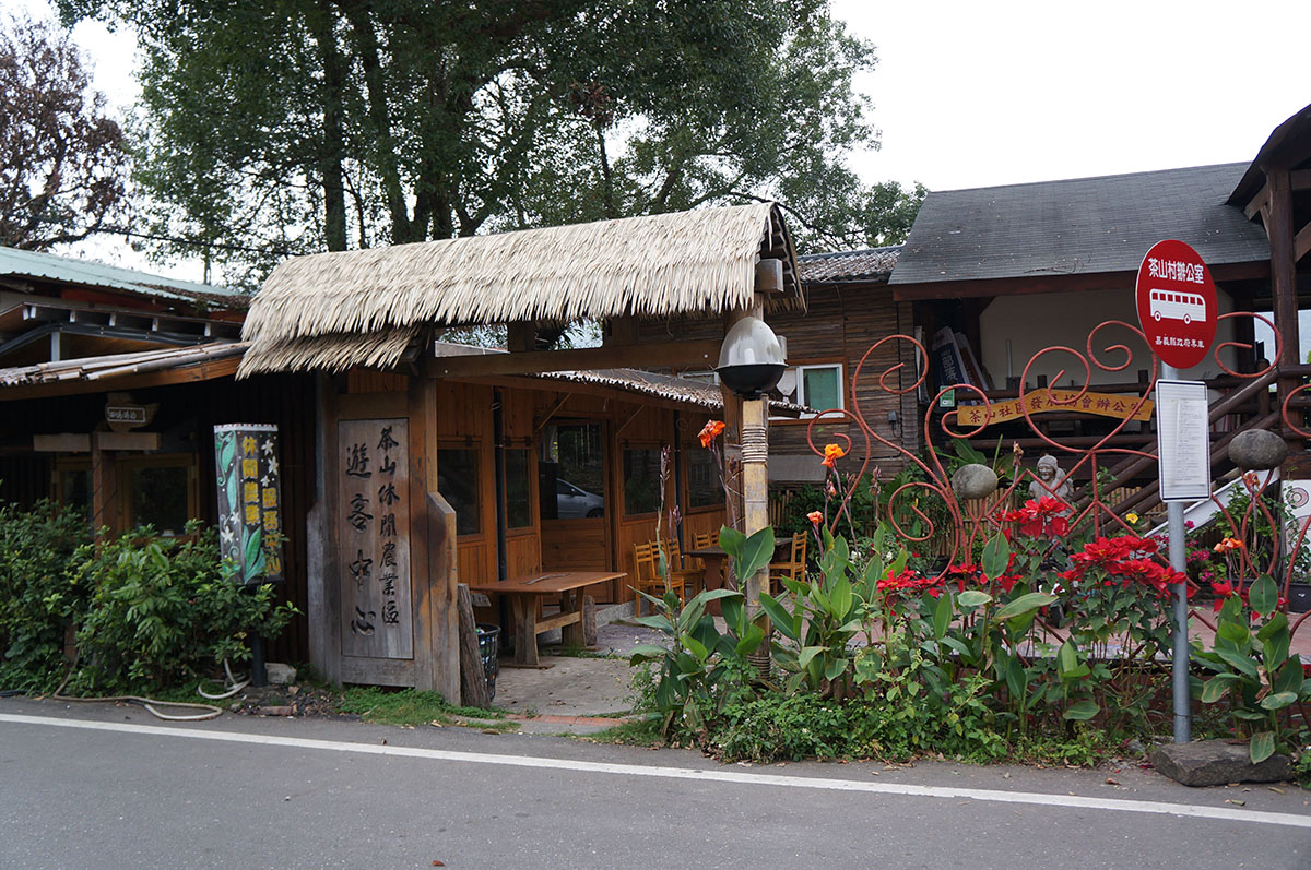
No. 60, Neighborhood 3, Chashan Village, Alishan Township, Chiayi County
23.29898, 120.66614(Check on Google Maps)
09:00-17:00 ; closed on Saturdays and Sundays
( More information )
Danaiku Ecological Park(ticket required)
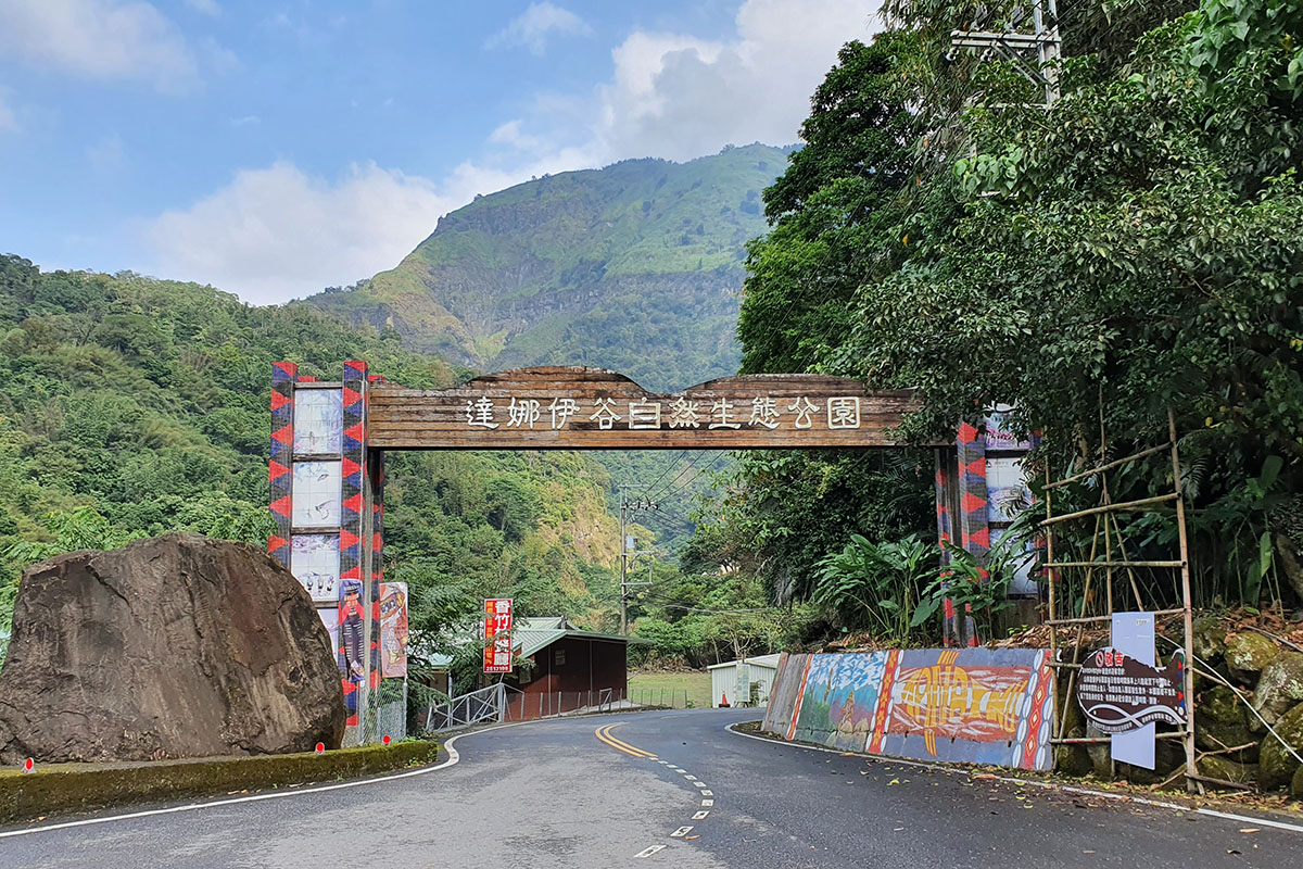
No. 51, Lane 3, Xinmei Village, Alishan Township, Chiayi County
23.37938, 120.67861(Check on Google Maps)
08:00-17:00 Closed on Wednesdays
( More information )
Sinvi Niahosa Hunter Camp
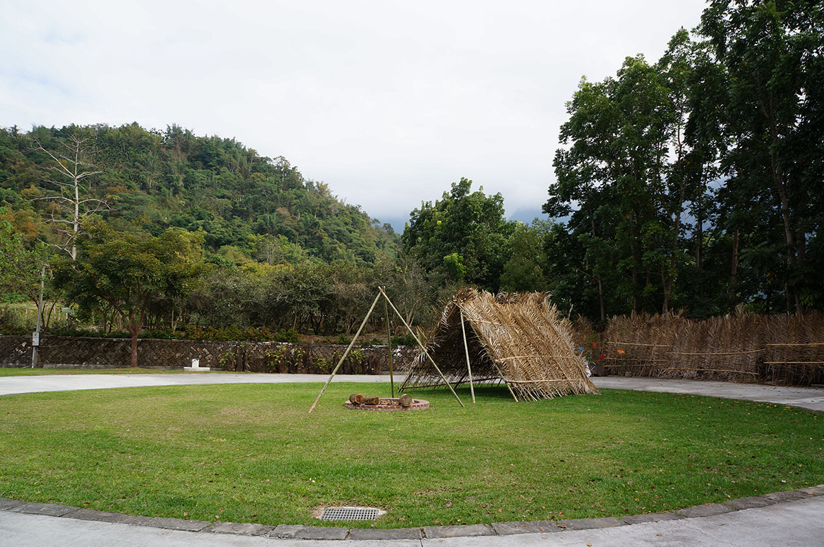
No. 88, Lane 5, Xinmei Village, Alishan Township, Chiayi County
23.33301, 120.68203(Check on Google Maps)
08:00-17:00 Closed on Saturdays
( More information )
Lijia Information Station
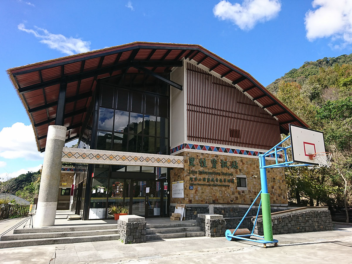
No. 31, Neighborhood 2, Lijia Village, Alishan Township, Chiayi County
23.40523, 120.72119(Check on Google Maps)
09:00-17:00
( More information )
Dabang Tsou Nature and Culture Center
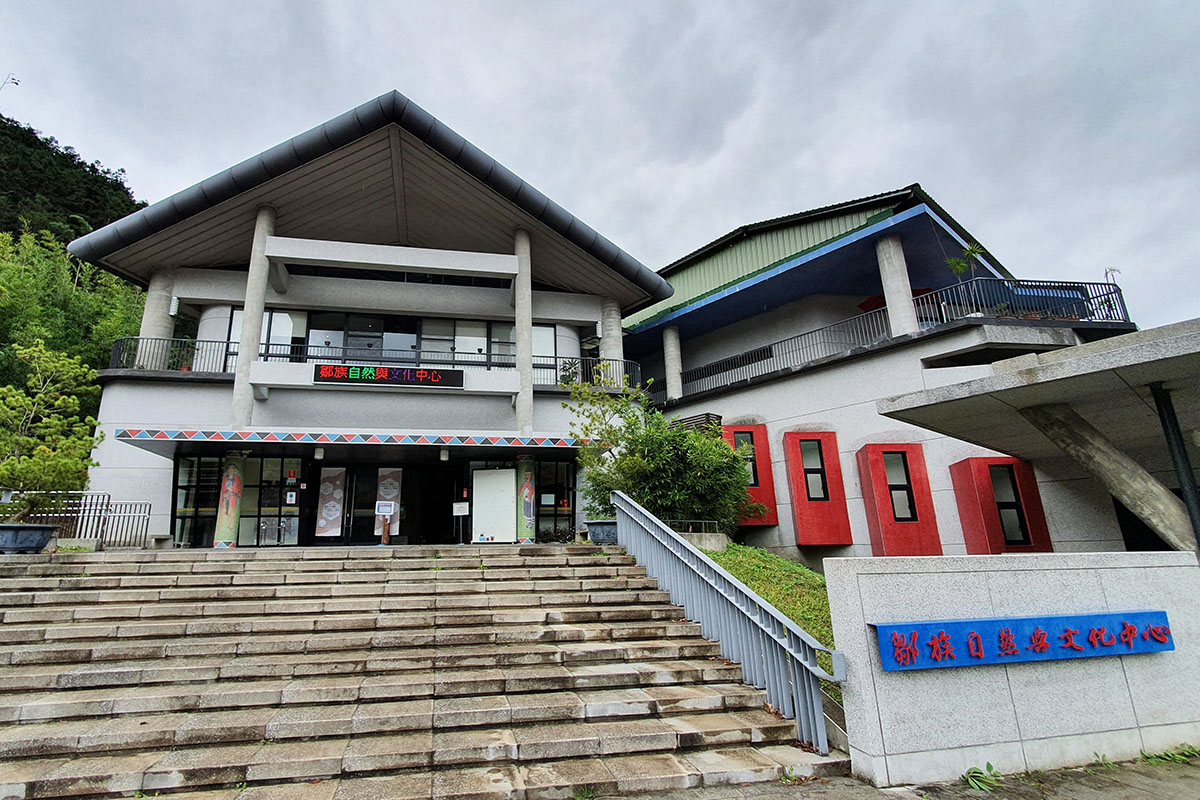
No. 21, Dabang Village, Alishan Township, Chiayi County
23.45402, 120.74944(Check on Google Maps)
09:00-17:00 Closed on Mondays, Tuesdays and public holidays
( More information )
Tefuye Community Development Association
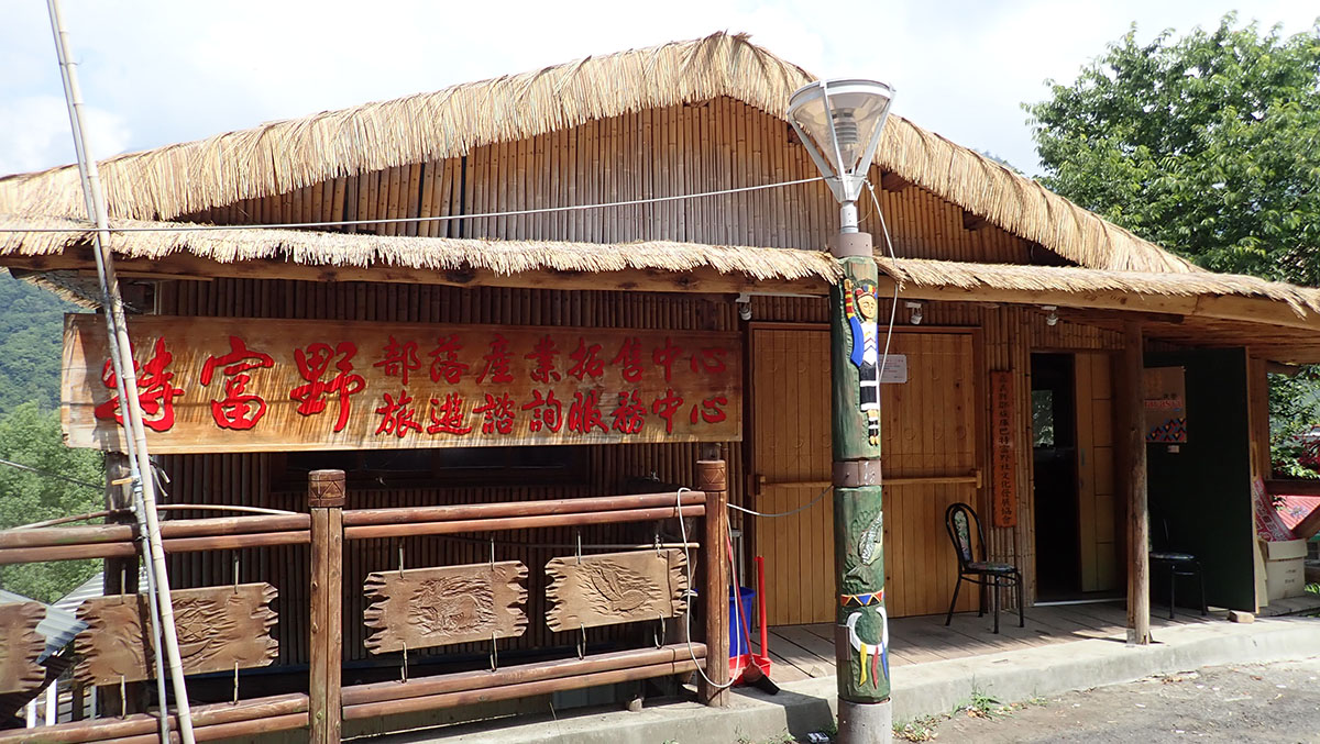
No. 196, Dabang Tefuye, Alishan Township, Chiayi County
23.4623, 120.75733(Check on Google Maps)
Monday to Friday; closed on Saturdays and Sundays
( More information )
Canal Trail
Jiaba Tianhou Temple
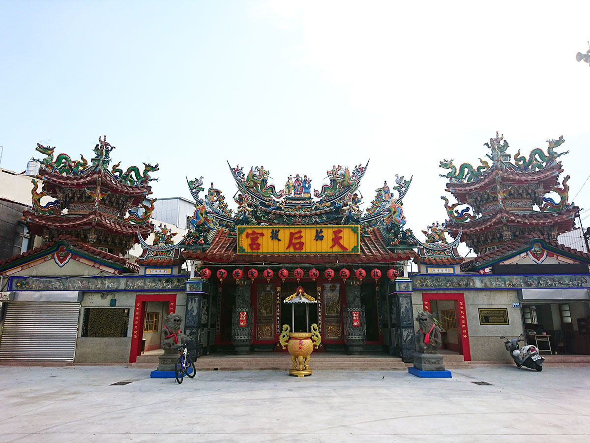
No. 80, Jianan Village, Shanhua Dist., Tainan City
23.13532, 120.32693(Check on Google Maps)
06:00-20:00
( More information )
Guantian Visitor Center
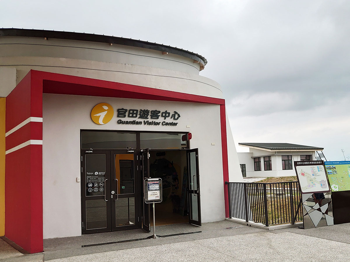
No. 99, Futian Rd., Guantian Village, Guantian Dist., Tainan City
23.18834, 120.33632(Check on Google Maps)
09:00-17:00
( More information )
Wushantou Reservoir Scenic Area
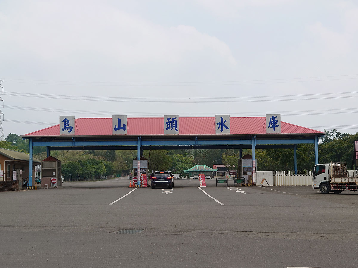
No. 68-2, Jianan, Wushantou Village, Guantian District, Tainan City
23.20795, 120.36273(Check on Google Maps)
08:00-17:30
( More information )
Yoichi Hatta Memorial Park(ticket required)
.JPG)
No. 66, Jianan Village, Guantian District, Tainan City
23.21367, 120.36546(Check on Google Maps)
09:00-17:30 Closed on Wednesdays
( More information )
Liujia Zhennan Temple
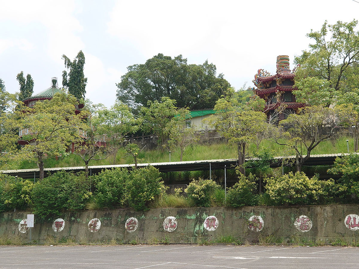
No. 2, Gongyan Road, Liujia District, Tainan City
23.22096, 120.36606(Check on Google Maps)
08:00-17:00
( More information )
Xikou Station (Chianan Management Office, Irrigation Agency, Ministry of Agriculture)
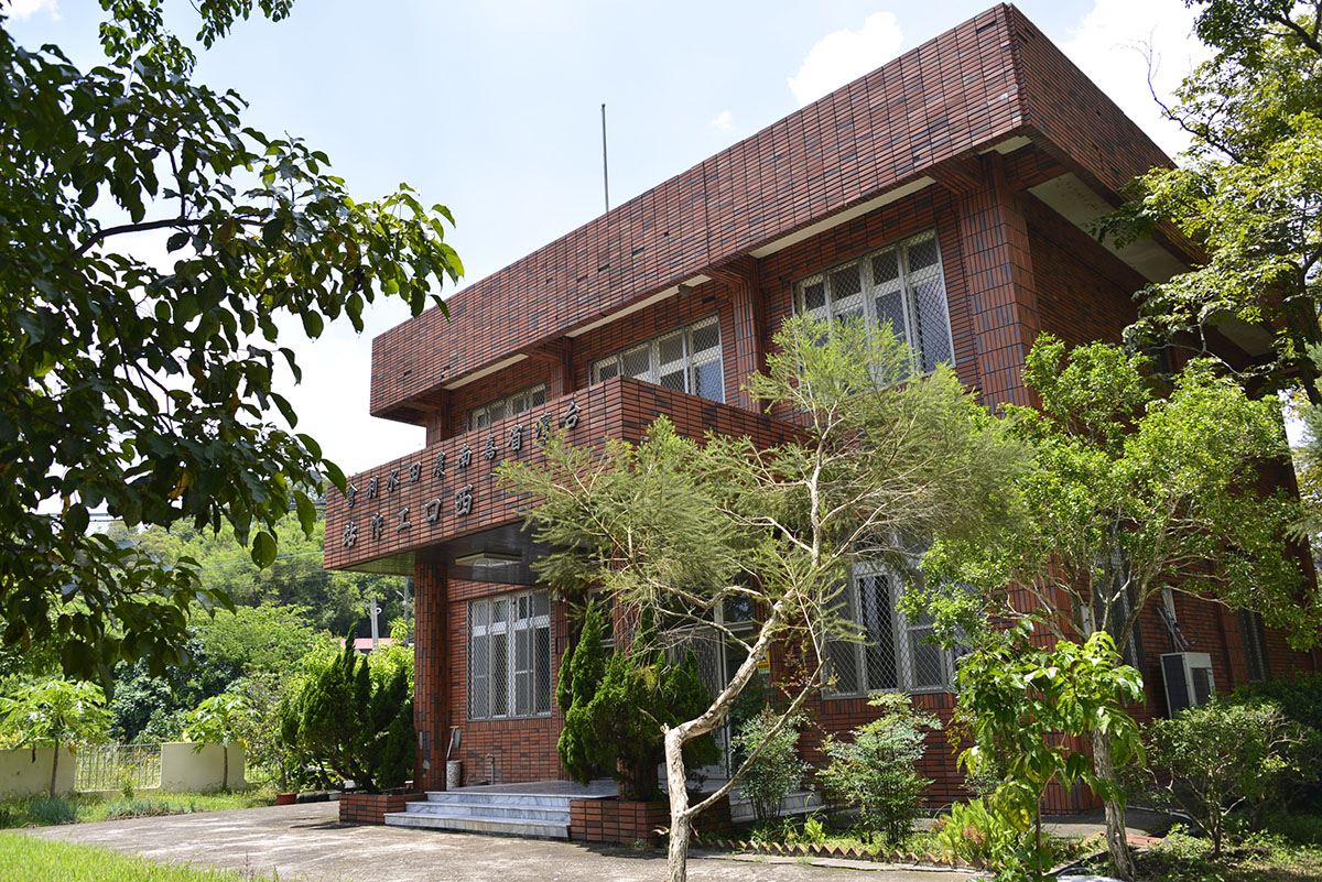
No. 71, Xiananshi, Nanshi Village, Dongshan Dist., Tainan City
23.23172, 120.44787(Check on Google Maps)
Monday to Friday 08:00-17:00
Dongkou Station (Chianan Management Office, Irrigation Agency, Ministry of Agriculture)
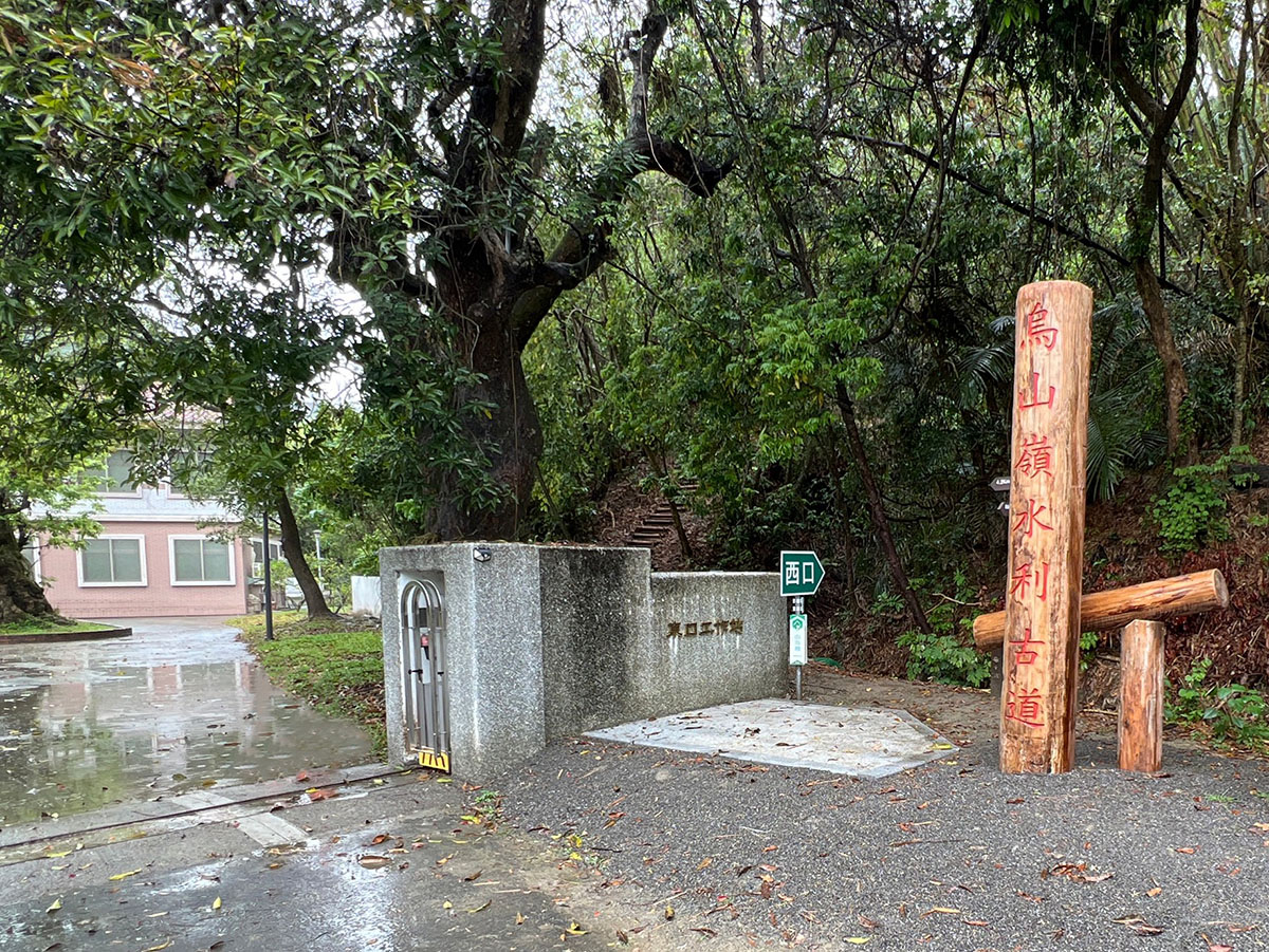
No. 6, Xingbei, Zhaoxing Village, Nanxi Dist., Tainan City
23.22008, 120.49215(Check on Google Maps)
Monday to Friday 08:00-17:00
Zengwen Reservoir Information Center
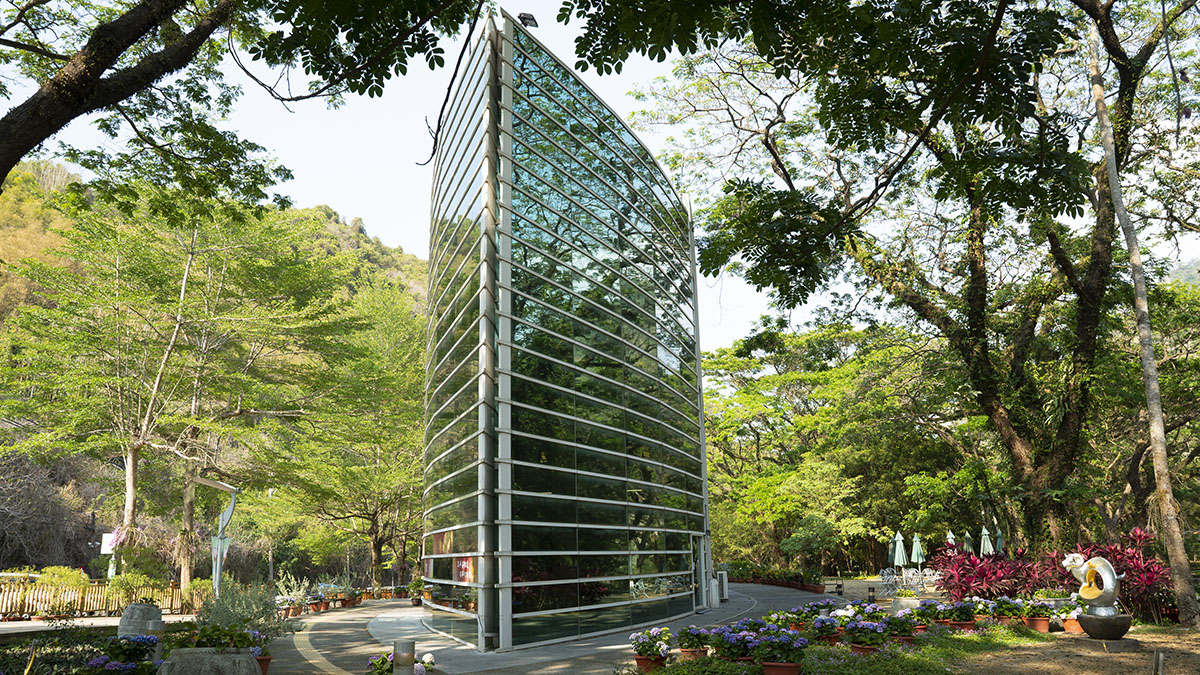
No. 41-30, Dayang, Nanshi Village, Dongshan Dist., Tainan City
23.24149, 120.51916(Check on Google Maps)
08:00-17:00
( More information )
Zengwen Reservoir Lookout Tower
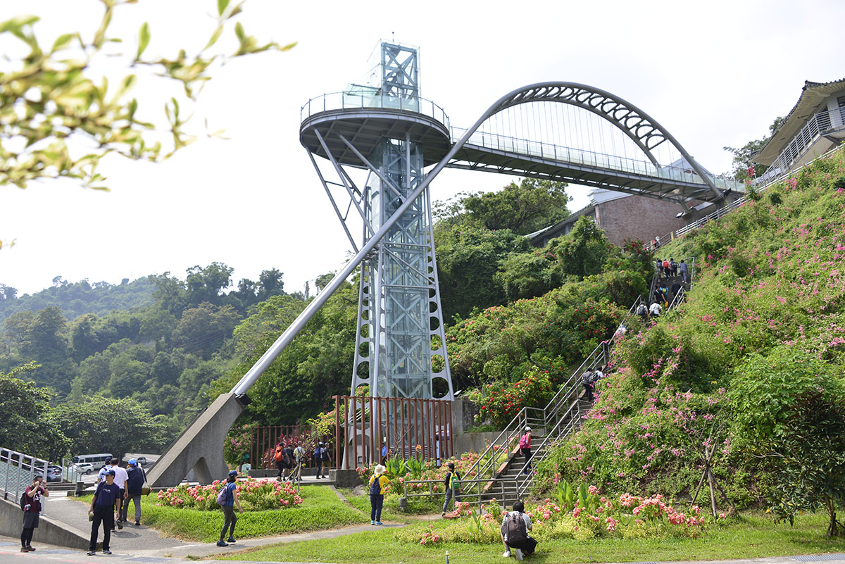
2F, No. 7, Tanping, Xixing Village, Dapu Township, Chiayi County
23.24134, 120.54442(Check on Google Maps)
Restaurant service hours: 09:00-17:00 (Weekdays) 08:30-17:00 (Holidays)
Sacred Mountain Trail
Alishan Transport Station
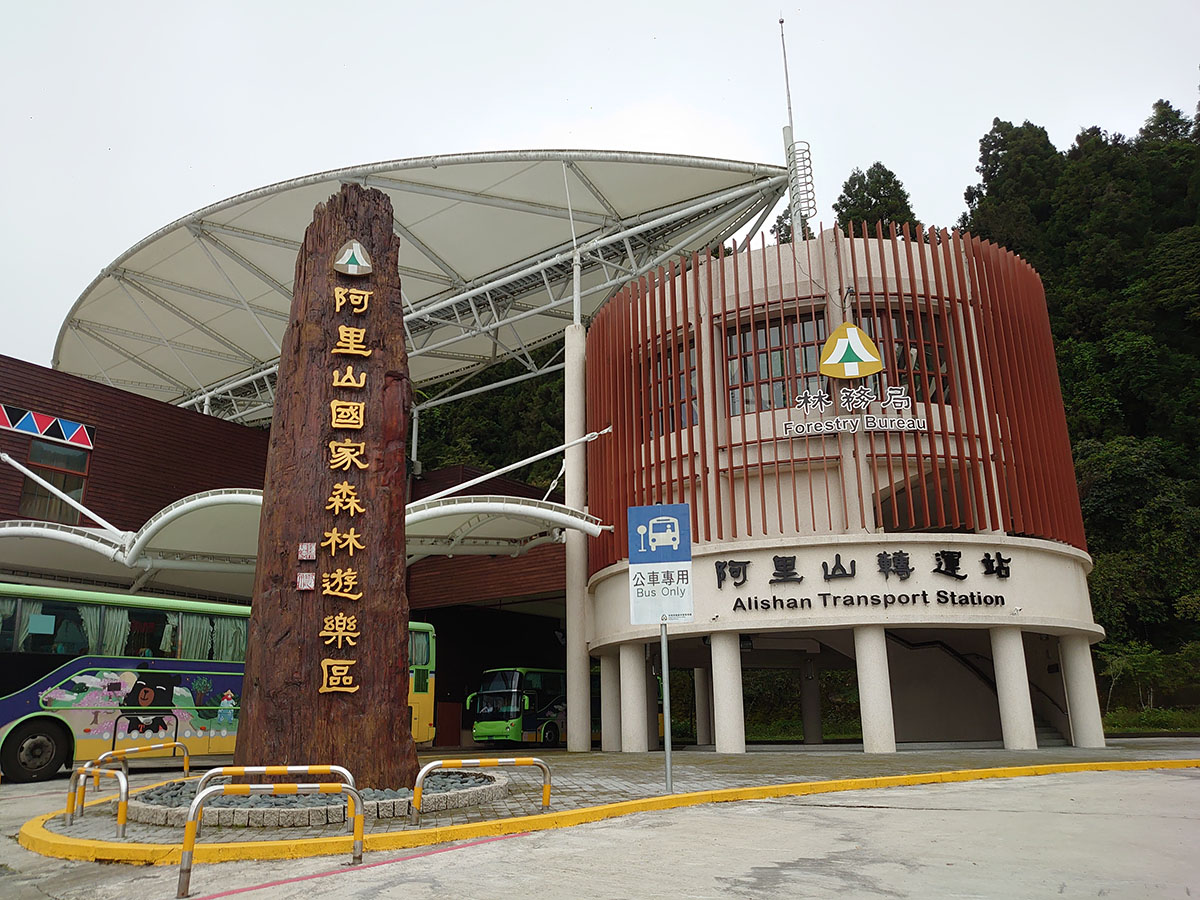
No. 55, Southern Alishan, Neighborhood 1, Zhongshan Village, Alishan Village, Chiayi County
23.50847, 120.80161(Check on Google Maps)
08:00-17:00
Dongpu Lodge
No. 77, Zizhong, Zhongshan Village, Xinyi Township, Nantou County
23.48437, 120.88611(Check on Google Maps)
( More information )
Paiyun Trailhead Service Center

No. 151, Taiping Lane, Xinyi Township, Nantou County
23.48164, 120.88699(Check on Google Maps)
06:30-16:30
( More information )
Tataka Visitor Center
No. 118, Taiping Lane, Tongfu Village, Xinyi Township, Nantou County
23.48736, 120.89173(Check on Google Maps)
09:00-16:30. Closed on Lunar New Year's Eve and the second Tuesday of each month. If the closing date falls on a public holiday, the closing date will be extended by one day.
Route Type
Route Type
It can be divided into waterways, mountain trails, industrial roads, roadside pedestrian walkways, and public roadways. The mountain trails section includes ancient trails, walking trails, and natural mountain trails; the industrial roads section includes industrial roads, bicycle paths, irrigation canal paths, and riverbank roads; and finally, the public roadways section includes provincial and county roads, some sections of which already have pedestrian walkways.
Route Numbering System
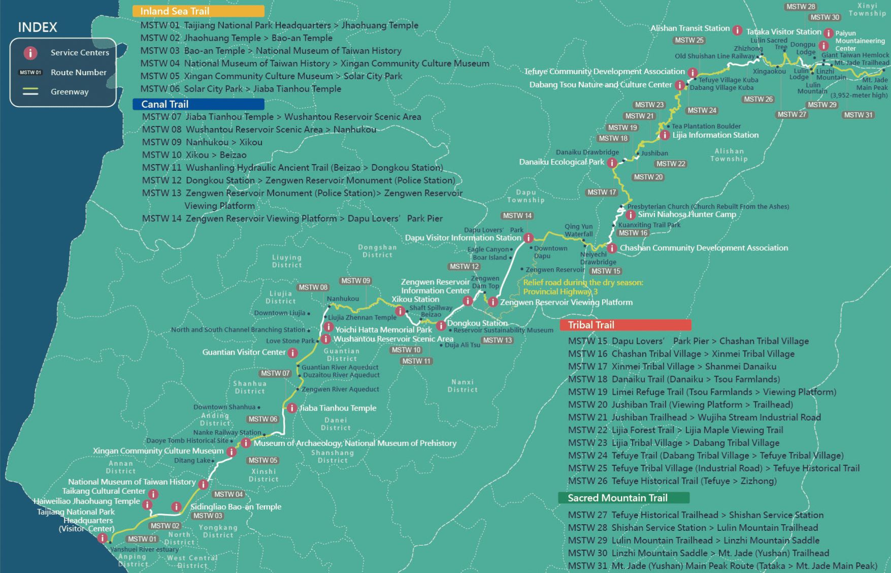
The 31 greenway sections from the Taijiang National Park Headquarters (0K) to Mt. Jade Main Peak are numbered in ascending order and prefixed with MSTW: from MSTW 01 to MSTW 31.
Stamp Passport
To coincide with the unveiling and opening of the stamp collection and service points, the MSTW Stamp Passport was also launched, allowing users to collect eight exquisite stamps at eight locations along the route as souvenirs: Taijiang Inner Sea, Haiweiliao Jhaohuang Temple, Wushantou Reservoir, Xikou Little Switzerland, Siraya, Tsou, Alishan Forest Railway, and Yushan Main Peak. An electronic stamp collection and completion certificate are also available through the Taiwan Forest Recreation Line@ E-Stamp for the public to collect.
Where to Buy Stamp Passport?
- Taijiang National Park Visitor Center(Physical sales:"LiKEE Taijiang Specialty store")
- Chashan Community Development Association(Physical sales)
- 3F, Alishan Transfer Station(Physical sales:"Alishan 2488m" Brand Store)
- Lijia jiana Arts Workshop(Physical sales)
- Danaiku(Physical sales)
- Peisu coffee(Physical sales)
- Taiwan Thousand Miles Trail Association(Physical and online),Purchase Link:https://neti.cc/rmPyyJ7
- ROCKLAND Taipei | Gongguan Store, Taipei Arena Store, Shin Kong Mitsukoshi A11, Hsinchu | Big City Store, Taichung | Caowu Store, Kaohsiung | Dream Mall Store, Fjällräven Store (National Taiwan University Store) (Physical sales)
Discounts With Passport
Stamp Passport Discounts (until 2026.12.31)
| Location Type | Location Name | Address | Discount Program | Discount Notes |
|---|---|---|---|---|
| Stamp Station | Taijiang National Park Visitor Center | No. 118, Sicao Blvd., Annan Dist., Tainan City | Holders of the MSTW Passport can enjoy a 10% discount when purchasing publications from the Taijiang branch at the store. | |
| Stamp Station | Wusanto Reservoir Scenic Area | No. 500, Section 3, Batian Road, Guantian District, Tainan City | Those who qualify for full-price tickets can enjoy a discounted admission fee of NT$40 when purchasing tickets on-site. | Ticketing Information:+886-6-698-2103 |
| Service Point | National Museum of Taiwan History | No.250, Sec. 1, Changhe Rd., Annan District, Tainan City | One NT$50 discounted ticket can be purchased daily. | Ticketing Information:+886-6-356-8889#8801 |
| Service Point | Museum of Archaeology, Tainan Branch of National Museum of Prehistory | No.10, Nanke 3rd Rd.,Xinshi Dist., Tainan City | Those who qualify for full-price tickets can enjoy a discounted ticket of NT$60 when purchasing tickets on-site (limited to one entry on the same day). | Ticketing Information:+886-6-505-0905#8101、8102 |
| Service Point | Alishan National Forest Recreation Area | No. 55, South Alishan, Neighborhood 1, Alishan Township, Chiayi County |
(1) Purchase the MSTW Passport at the entrance transfer station of Alishan National Forest Recreation Area. Taiwanese citizens holding a ticket stub can enjoy a discounted ticket price of NT$150 when taking public transportation. Non-Taiwanese students holding an International Student ID and children (aged 7 to 12) can enjoy a discounted ticket price of NT$100, while non-Taiwanese citizens can enjoy a discounted ticket price of NT$200. (2) Those who purchase the MSTW Passport through other channels and complete the stamp collection at least 2 places will also enjoy the above benefits. |
Chiayi Branch of the Forestry ans Nature Conservation Agency +886-5-278-7006#146 |
| Friendly Store | Lijia jiana Arts Workshop | No. 61, Lijia, Alishan Township, Chiayi County | Show your passport for a 15% discount on beverages and agricultural products. | |
| Friendly Store | Danaiku | No. 51, Neighborhood 3, Alishan Township, Chiayi County | Visitors holding a MSTW Passport can enjoy a full-price discount of NT$100 (one discount per passport). | Ticket Booth +886-5-251-3246 |
| Friendly Store | Wusanto Huching Resort Hotel | No. 45, Sakura Lane, Section 3, Batian Road, Guantian District, Tainan City |
Visitors holding a MSTW Passport enjoy the following accommodation discounts: Lake View/Mountain View Double Room $2475 Lake View/Mountain View Quadruple Room $3300 ※Limited to 3 rooms per day on weekdays (Sunday to Friday), not applicable to group bookings; not applicable on weekends (Saturday) and national holidays. ※Promotion period: From January 1, 2026 to December 31, 2026 ※Visitors to the park need to purchase tickets for Wusanto Reservoir on their own. |
|
| Friendly Store | Heping Community Development Association, Dapu Township, Chiayi County | No. 100, Dapu Township, Chiayi County | 5% off drinks at Yonghao Boutique (black tea, high mountain tea, grapefruit tea, cold brew coffee) | |
| Friendly Store | Tongda Dapu Villa | No. 200-1, Dapu Village, Dapu Township, Chiayi County | 20% off for each room type/number of rooms, discount will continue after renovations in March 2016. | |
| Friendly Store | Zengwen Reservoir Lookout Tower Restaurant | 2F, No. 7, Tanping, Xixing Village, Dapu Township, Chiayi County | Show your MSTW Passport at the Zengwen Reservoir Lookout Tower Restaurant to redeem a free cup of green tea or an equivalent beverage. | |
| Friendly Store | Tefuye B&B | No. 220-1, Tefuye, Balin, Dabang Village, Alishan Township | Accommodation discount: Suite price is NT$1,500 per person (no room type selection) / Meal order includes a complimentary jelly figs or specialty coffee. | |
| Friendly Store | Gui Shi Origin Workshop/Shanmei Community Development Association | No. 51, Neighborhood 3, Shanmei Village, Alishan Township, Chiayi County(Shanmei Danaiku Ecological Park) | Show the MSTW passport, and each passport will be credited as a NT$30 discount on one meal. | |
| Friendly Store | Zengwen Youth Activity Center | No. 70-1, Mizhi Village, Nanxi District, Tainan City | Visitors holding a MSTW Passport can enjoy a 20% discount on accommodation for one year starting from December 2024. |
Location Type
Location Name
Taijiang National Park Visitor Center
Address
No. 118, Sicao Blvd., Annan Dist., Tainan City
Discount Program
Holders of the MSTW Passport can enjoy a 10% discount when purchasing publications from the Taijiang branch at the store.
Discount Notes
Location Type
Location Name
Wusanto Reservoir Scenic Area
Address
No. 500, Section 3, Batian Road, Guantian District, Tainan City
Discount Program
Those who qualify for full-price tickets can enjoy a discounted admission fee of NT$40 when purchasing tickets on-site.
Discount Notes
Ticketing Information:+886-6-698-2103
Location Type
Location Name
National Museum of Taiwan History
Address
No.250, Sec. 1, Changhe Rd., Annan District, Tainan City
Discount Program
One NT$50 discounted ticket can be purchased daily.
Discount Notes
Ticketing Information:+886-6-356-8889#8801
Location Type
Location Name
Museum of Archaeology, Tainan Branch of National Museum of Prehistory
Address
No.10, Nanke 3rd Rd.,Xinshi Dist., Tainan City
Discount Program
Those who qualify for full-price tickets can enjoy a discounted ticket of NT$60 when purchasing tickets on-site (limited to one entry on the same day).
Discount Notes
Ticketing Information:+886-6-505-0905#8101、8102
Location Type
Location Name
Alishan National Forest Recreation Area
Address
No. 55, South Alishan, Neighborhood 1, Alishan Township, Chiayi County
Discount Program
(1) Purchase the MSTW Passport at the entrance transfer station of Alishan National Forest Recreation Area. Taiwanese citizens holding a ticket stub can enjoy a discounted ticket price of NT$150 when taking public transportation. Non-Taiwanese students holding an International Student ID and children (aged 7 to 12) can enjoy a discounted ticket price of NT$100, while non-Taiwanese citizens can enjoy a discounted ticket price of NT$200.
(2) Those who purchase the MSTW Passport through other channels and complete the stamp collection at least 2 places will also enjoy the above benefits.
(2) Those who purchase the MSTW Passport through other channels and complete the stamp collection at least 2 places will also enjoy the above benefits.
Discount Notes
Chiayi Branch of the Forestry ans Nature Conservation Agency +886-5-278-7006#146
Location Type
Location Name
Lijia jiana Arts Workshop
Address
No. 61, Lijia, Alishan Township, Chiayi County
Discount Program
Show your passport for a 15% discount on beverages and agricultural products.
Discount Notes
Location Type
Location Name
Danaiku
Address
No. 51, Neighborhood 3, Alishan Township, Chiayi County
Discount Program
Visitors holding a MSTW Passport can enjoy a full-price discount of NT$100 (one discount per passport).
Discount Notes
Ticket Booth +886-5-251-3246
Location Type
Location Name
Wusanto Huching Resort Hotel
Address
No. 45, Sakura Lane, Section 3, Batian Road, Guantian District, Tainan City
Discount Program
Visitors holding a MSTW Passport enjoy the following accommodation discounts:
Lake View/Mountain View Double Room $2475
Lake View/Mountain View Quadruple Room $3300
※Limited to 3 rooms per day on weekdays (Sunday to Friday), not applicable to group bookings; not applicable on weekends (Saturday) and national holidays.
※Promotion period: From January 1, 2026 to December 31, 2026
※Visitors to the park need to purchase tickets for Wusanto Reservoir on their own.
Lake View/Mountain View Double Room $2475
Lake View/Mountain View Quadruple Room $3300
※Limited to 3 rooms per day on weekdays (Sunday to Friday), not applicable to group bookings; not applicable on weekends (Saturday) and national holidays.
※Promotion period: From January 1, 2026 to December 31, 2026
※Visitors to the park need to purchase tickets for Wusanto Reservoir on their own.
Discount Notes
Location Type
Location Name
Heping Community Development Association, Dapu Township, Chiayi County
Address
No. 100, Dapu Township, Chiayi County
Discount Program
5% off drinks at Yonghao Boutique (black tea, high mountain tea, grapefruit tea, cold brew coffee)
Discount Notes
Location Type
Location Name
Tongda Dapu Villa
Address
No. 200-1, Dapu Village, Dapu Township, Chiayi County
Discount Program
20% off for each room type/number of rooms, discount will continue after renovations in March 2016.
Discount Notes
Location Type
Location Name
Zengwen Reservoir Lookout Tower Restaurant
Address
2F, No. 7, Tanping, Xixing Village, Dapu Township, Chiayi County
Discount Program
Show your MSTW Passport at the Zengwen Reservoir Lookout Tower Restaurant to redeem a free cup of green tea or an equivalent beverage.
Discount Notes
Location Type
Location Name
Tefuye B&B
Address
No. 220-1, Tefuye, Balin, Dabang Village, Alishan Township
Discount Program
Accommodation discount: Suite price is NT$1,500 per person (no room type selection) / Meal order includes a complimentary jelly figs or specialty coffee.
Discount Notes
Location Type
Location Name
Gui Shi Origin Workshop/Shanmei Community Development Association
Address
No. 51, Neighborhood 3, Shanmei Village, Alishan Township, Chiayi County(Shanmei Danaiku Ecological Park)
Discount Program
Show the MSTW passport, and each passport will be credited as a NT$30 discount on one meal.
Discount Notes
Location Type
Location Name
Zengwen Youth Activity Center
Address
No. 70-1, Mizhi Village, Nanxi District, Tainan City
Discount Program
Visitors holding a MSTW Passport can enjoy a 20% discount on accommodation for one year starting from December 2024.
Discount Notes
User Guide
Greenway Signs
The Mountains to Sea Greenway, TW is 177 kms long. How does one follow the greenway?
Along the greenway are identifying signs that mark important locations and provide directions for hikers.
Along the greenway are identifying signs that mark important locations and provide directions for hikers.




Greenway Signs
These signs are located at the start and end of each section of the greenway. It shows the section number (MSTW-01 to MSTW-31) and difficulty level (0 to 5).
The two different colors indicate the direction of travel:
Green signs are on paths that travel from the sea to the mountains, and point toward Mt. Jade Main Peak.
Blue signs are on paths that travel from the mountains to the sea, and point toward Taijiang Inner Sea.
The two different colors indicate the direction of travel:
Green signs are on paths that travel from the sea to the mountains, and point toward Mt. Jade Main Peak.
Blue signs are on paths that travel from the mountains to the sea, and point toward Taijiang Inner Sea.
Identifying Signs
These signs are marked with the greenway’s logo to enhance the visibility of the route for hikers.
The two different colors indicate the direction of travel:
Green signs are on paths that travel from the sea to the mountains, and point toward Mt. Jade Main Peak.
Blue signs are on paths that travel from the mountains to the sea, and point toward Taijiang Inner Sea.
The two different colors indicate the direction of travel:
Green signs are on paths that travel from the sea to the mountains, and point toward Mt. Jade Main Peak.
Blue signs are on paths that travel from the mountains to the sea, and point toward Taijiang Inner Sea.
Difficulty Levels
FANCA has rated each trail with one of five difficulty levels based on altitude, hiking time, trail difficulty, and the necessary gear. Grade 1 is the easiest, and Grade 5 is the most difficult. The rating scale provides hikers with information on the trail characteristics and its difficulty level, and also allows hikers to determine whether they are in the appropriate physical condition and properly equipped to hike on the trails, thereby improving trail safety.
Since the greenway includes other routes that may be used by the general public—public roadways, industrial roads, cycling routes, canal paths, levee pathways, pedestrian walkway, and waterways—an additional level of difficulty, Grade 0, has been added to indicate such routes.
Since the greenway includes other routes that may be used by the general public—public roadways, industrial roads, cycling routes, canal paths, levee pathways, pedestrian walkway, and waterways—an additional level of difficulty, Grade 0, has been added to indicate such routes.
| Grade |
|
|
|
|
|
|
|
||||||||||||||||||||||||||||||||||||||||||
|---|---|---|---|---|---|---|---|---|---|---|---|---|---|---|---|---|---|---|---|---|---|---|---|---|---|---|---|---|---|---|---|---|---|---|---|---|---|---|---|---|---|---|---|---|---|---|---|---|---|
| Suitable For | General Public | General Public | Those who have better physical energy | Beginner mountain climber with good physical energy and map literacy. | Open to those who have good physical strength, map reading skills, and wild survival skills. | Open to well-trained mountain climbers. | Open to well-trained mountain climbers. | ||||||||||||||||||||||||||||||||||||||||||
| Altitude | Gently sloping area | In recreational areas, close to settlements or about 1,000 meters above sea level. | In recreational areas, close to settlements or between 1,000~2,000 meters above sea level. | Remote areas or between 2,000 to 3,000 meters above sea level | Remote areas, wilderness, or between 2,000 to 3,000 meters above sea level | Remote areas, wilderness, or more than 3,000 meters above sea level | Remote areas, wilderness, or more than 3,000 meters above sea level | ||||||||||||||||||||||||||||||||||||||||||
| Hiking Time | It takes half to one day. | It takes half to one day. | It can be done within one day. | It takes one or more days. | Overnight preparation required. | It takes up to three days. | It takes up to three days. | ||||||||||||||||||||||||||||||||||||||||||
| Necessary Gear | Light backpacking (water and small amount of food) | Light backpacking (water and small amount of food) | Light backpacking (water and proper amount of food) | Overnight preparation required. (e.g. drinking water, food, map, warm clothing, first-aid medicine, etc.) Application for entrance permission in advance is required if there is access control. | Comprehensive Mountaineering Gear Required. (e.g. food, drinking water, cooking utensils, map, warm clothing, flashlight, sleeping bag, tent, etc.) Application for entrance permission in advance is required if there is access control. | Comprehensive Mountaineering Gear Required. (e.g. food, drinking water, cooking utensils, map, warm clothing, flashlight, sleeping bag, tent, etc.) Application for entrance permission in advance is required if there is access control. | Comprehensive Mountaineering Gear Required. (e.g. food, drinking water, cooking utensils, map, warm clothing, flashlight, sleeping bag, tent, etc.) Application for entrance permission in advance is required if there is access control. | ||||||||||||||||||||||||||||||||||||||||||
| Trail Difficulty | Flat hiking trails. Relatively even slopes with comprehensive facilities and smooth road surface. Accessible for handicapped assistive devices or baby strollers. | An open hiking trail with easy access. Relatively even slopes with comprehensive facilities and smooth road surface. It takes half a day or less than one day to complete. | An open hiking trail with easy access. Somewhat steep slope with some difficult sections, but has comprehensive facilities and smooth road surface. It takes less than one day to complete. | A hiking trail locates at remote area or with part of the route is in area which requires entrance permission. Application in advance is required. Part of the route is in relatively bad condition with steeper slopes, but basic facilities are provided. It takes one day or between one to three days to complete. | A hiking trail locates at remote area or with part of the route is in area which requires entrance permission. It’s located in high-altitude areas (higher than 3000 meters above sea level). The trail is relatively primitive, with steeper slopes and unstable weather conditions. Part of the route may be dangerous or difficult for climbers. It takes two to three days to complete. Lead from professionals is recommended. | A hiking trail locates at area with inconvenient traffic, and mostly with routes in area which requires entrance permission. It’s located in high-altitude areas (higher than 3000 meters above sea level). The trail is located at primitive area, with bad condition, steeper slopes, and unstable weather conditions. Many parts of the route may be dangerous or difficult for climbers. It takes three or more days to complete. Lead from professionals is recommended. | 1. Level 3, 4 or 5 trails when snow or ice accumulating 2. Informal trails, without clear subgrades or paths, belong to special routes such as original mountain trails, ancient trail relics, prospecting, or technical climbing. |
Grade
Suitable For
General Public
Altitude
Gently sloping area
Hiking Time
It takes half to one day.
Necessary Gear
Light backpacking (water and small amount of food)
Trail Difficulty
Flat hiking trails. Relatively even slopes with comprehensive facilities and smooth road surface. Accessible for handicapped assistive devices or baby strollers.
Grade
Suitable For
General Public
Altitude
In recreational areas, close to settlements or about 1,000 meters above sea level.
Hiking Time
It takes half to one day.
Necessary Gear
Light backpacking (water and small amount of food)
Trail Difficulty
An open hiking trail with easy access. Relatively even slopes with comprehensive facilities and smooth road surface. It takes half a day or less than one day to complete.
Grade
Suitable For
Those who have better physical energy
Altitude
In recreational areas, close to settlements or between 1,000~2,000 meters above sea level.
Hiking Time
It can be done within one day.
Necessary Gear
Light backpacking (water and proper amount of food)
Trail Difficulty
An open hiking trail with easy access. Somewhat steep slope with some difficult sections, but has comprehensive facilities and smooth road surface. It takes less than one day to complete.
Grade
Suitable For
Beginner mountain climber with good physical energy and map literacy.
Altitude
Remote areas or between 2,000 to 3,000 meters above sea level
Hiking Time
It takes one or more days.
Necessary Gear
Overnight preparation required. (e.g. drinking water, food, map, warm clothing, first-aid medicine, etc.)
Application for entrance permission in advance is required if there is access control.
Trail Difficulty
A hiking trail locates at remote area or with part of the route is in area which requires entrance permission. Application in advance is required. Part of the route is in relatively bad condition with steeper slopes, but basic facilities are provided. It takes one day or between one to three days to complete.
Grade
Suitable For
Open to those who have good physical strength, map reading skills, and wild survival skills.
Altitude
Remote areas, wilderness, or between 2,000 to 3,000 meters above sea level
Hiking Time
Overnight preparation required.
Necessary Gear
Comprehensive Mountaineering Gear Required. (e.g. food, drinking water, cooking utensils, map, warm clothing, flashlight, sleeping bag, tent, etc.)
Application for entrance permission in advance is required if there is access control.
Trail Difficulty
A hiking trail locates at remote area or with part of the route is in area which requires entrance permission. It’s located in high-altitude areas (higher than 3000 meters above sea level). The trail is relatively primitive, with steeper slopes and unstable weather conditions. Part of the route may be dangerous or difficult for climbers. It takes two to three days to complete. Lead from professionals is recommended.
Grade
Suitable For
Open to well-trained mountain climbers.
Altitude
Remote areas, wilderness, or more than 3,000 meters above sea level
Hiking Time
It takes up to three days.
Necessary Gear
Comprehensive Mountaineering Gear Required. (e.g. food, drinking water, cooking utensils, map, warm clothing, flashlight, sleeping bag, tent, etc.)
Application for entrance permission in advance is required if there is access control.
Trail Difficulty
A hiking trail locates at area with inconvenient traffic, and mostly with routes in area which requires entrance permission. It’s located in high-altitude areas (higher than 3000 meters above sea level). The trail is located at primitive area, with bad condition, steeper slopes, and unstable weather conditions. Many parts of the route may be dangerous or difficult for climbers. It takes three or more days to complete. Lead from professionals is recommended.
Grade
Suitable For
Open to well-trained mountain climbers.
Altitude
Remote areas, wilderness, or more than 3,000 meters above sea level
Hiking Time
It takes up to three days.
Necessary Gear
Comprehensive Mountaineering Gear Required. (e.g. food, drinking water, cooking utensils, map, warm clothing, flashlight, sleeping bag, tent, etc.)
Application for entrance permission in advance is required if there is access control.
Trail Difficulty
1. Level 3, 4 or 5 trails when snow or ice accumulating
2. Informal trails, without clear subgrades or paths, belong to special routes such as original mountain trails, ancient trail relics, prospecting, or technical climbing.
Greenway Safety Rules
When hiking in the mountains, please choose routes that match your skills and physical fitness and respect local residents and the natural environment. Avoid disturbing flora and fauna, and be friendly and polite when interacting with others. Please refrain from trespassing onto private property, making noise, littering, or picking crops. Obtain permission before photographing others. Always prioritize safety, stay on designated trails, wear bright clothing, and work together to maintain a pleasant hiking experience.
Ethnic Groups and Cultures
Han Chinese
Today, the descendants of early Han Chinese settlers, who crossed the strait to Taiwan, dwell in the area of the greenway between Annan District, Tainan City and Dapu Township, Chiayi County primarily. These settlers cultivated the land, established communities, and worshiped the deities whose josses they brought along with them. As the settlers’ wealth increased, they built temples, developing the temple culture characteristic of Han Chinese.
Siraya
The members of the Siraya tribe mostly reside in Tainan City. The tribe is comprised of four major communities: Mattau, Soulang, Xingan, and Backoloan. The religions of Siraya people are animism and the worship of ancestral spirits. In Siraya culture, ancestors and ancestral spirits are referred to as “Alid ” or “Ali Tsu ,” (“Ali Mu ,”or “Tai Tsu ” in some communities). The Siraya people also build Kuwa (Kuva), meeting houses which serve as places for gatherings, religious ceremonies, and youth meetings. Today, the major traditional festivals celebrated by the Siraya people include the Night Festival and Kabua Sea Howling Festival.
Tsou
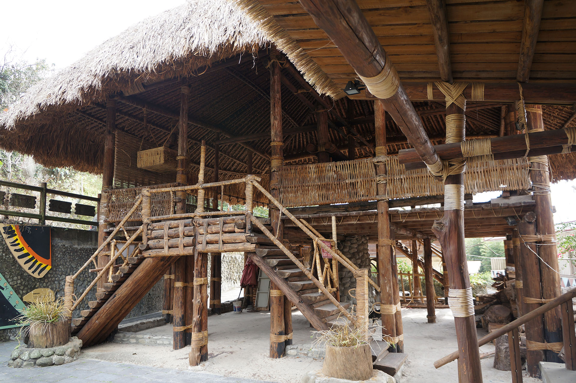
The Tsou people are a patriarchal clan society that is separated into large and small communities. The coalition formation aims to deal with the political issues primarily. Men’s gathering places, referred to as “Kuba,” are used to discuss community matters and hold religious rituals. The most important tribal ritual of the Tsou people is Mayasvi (the War Ritual). This complicated ritual entails the renovation of the gathering place, trimming the sacred tree, welcoming the spirits, feasting the spirits, and finally sending the spirits off. The ritual is renowned for its musicality and rhythm.
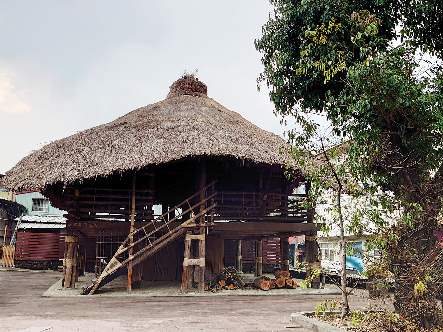
Tsou culture - the Kuba
Friendship Trail
The Bruce Trail, Canada
The Bruce Trail, with a main route of approximately 900 kilometers, is located in south-central Ontario and is the longest and oldest hiking trail on Canada's east coast. The trail stretches along the Niagara Escarpment, a landscape formed between the Late Ordovician and Silurian periods, representing the oldest forest ecosystem in eastern North America. At its end in Queenston, the trail connects to Niagara Falls, the world's largest transnational waterfall. "Niagara" means "Thunder God's Water" in the Indigenous language, as local Indigenous peoples believed the roar of the falls was the voice of the Thunder God. The unique landscape and ecosystem of the Niagara Escarpment have been designated a UNESCO World Biosphere Reserve. The Bruce Trail begins in Queenston, Ontario, and passes through several protected areas and provincial parks before ending in Tobermory. Hikers can enjoy countless white waterfalls, shimmering golden beaches, tranquil lakeside rock formations, gently flowing streams, lush forests, and cliffs, and also have the opportunity to see many unique plants and animals.
Bruce Trail Conservancy Introduction
The Bruce Trail Conservancy (BTC) is the primary management body for the Bruce Trail and one of Ontario's largest land trusts. Its main funding sources are private donations and membership fees, and it currently has approximately 10,700 members. The Bruce Trail is divided into nine sections, each maintained, managed, volunteered, and promoted by one of the nine Bruce Trail Clubs affiliated with the conservancy. About one-third of the trail traverses private land, with over 700 landowners entrusting their land to the Bruce Trail Conservancy for management, covering a total area of approximately 10,600 hectares. This public-private partnership and community involvement ensure the smooth implementation of trail maintenance and management, enabling the trail to be sustainably operated and used in an environmentally friendly manner.
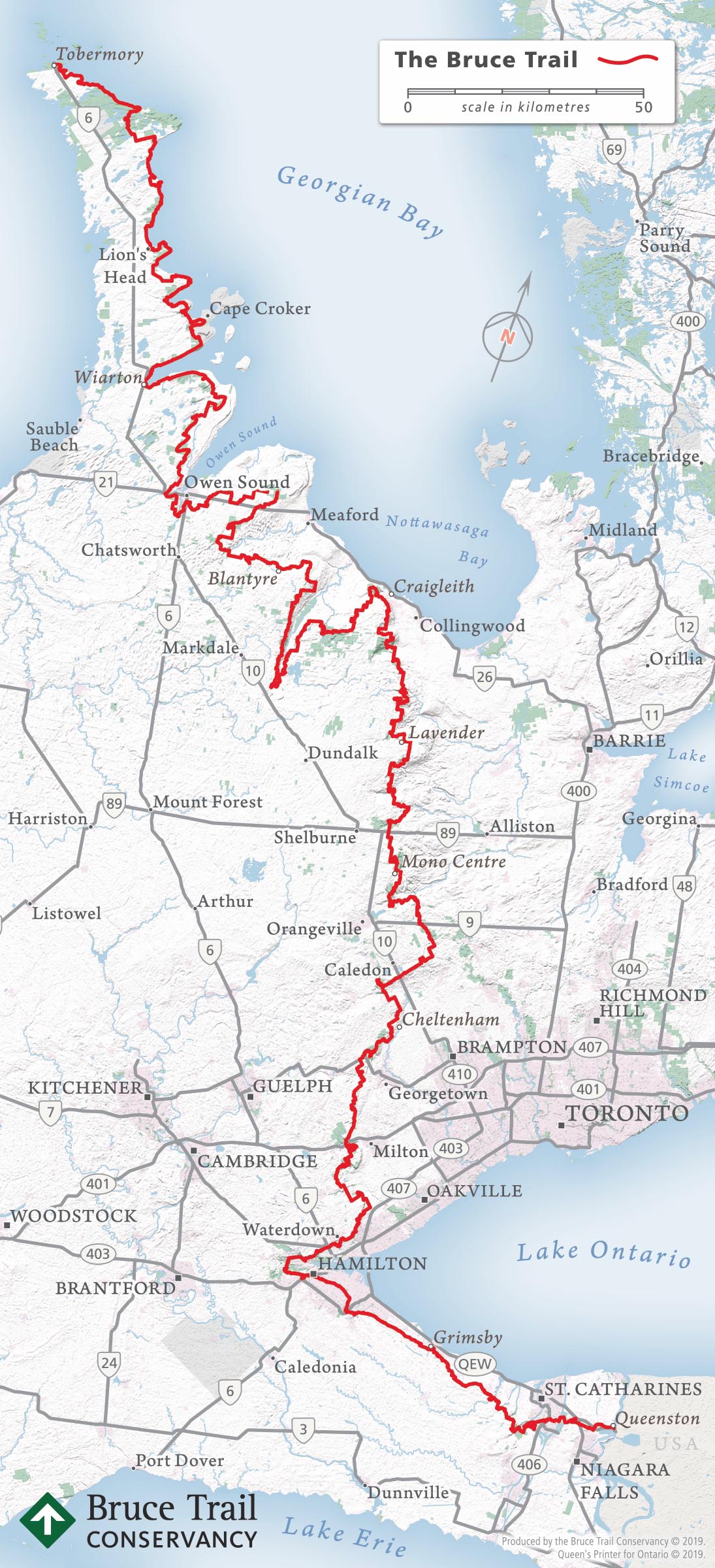
Courtesy of Bruce Trail Conservancy, BTC
The section connecting the Mountains to Sea Greenway, TW and the Bruce Trail, Canada
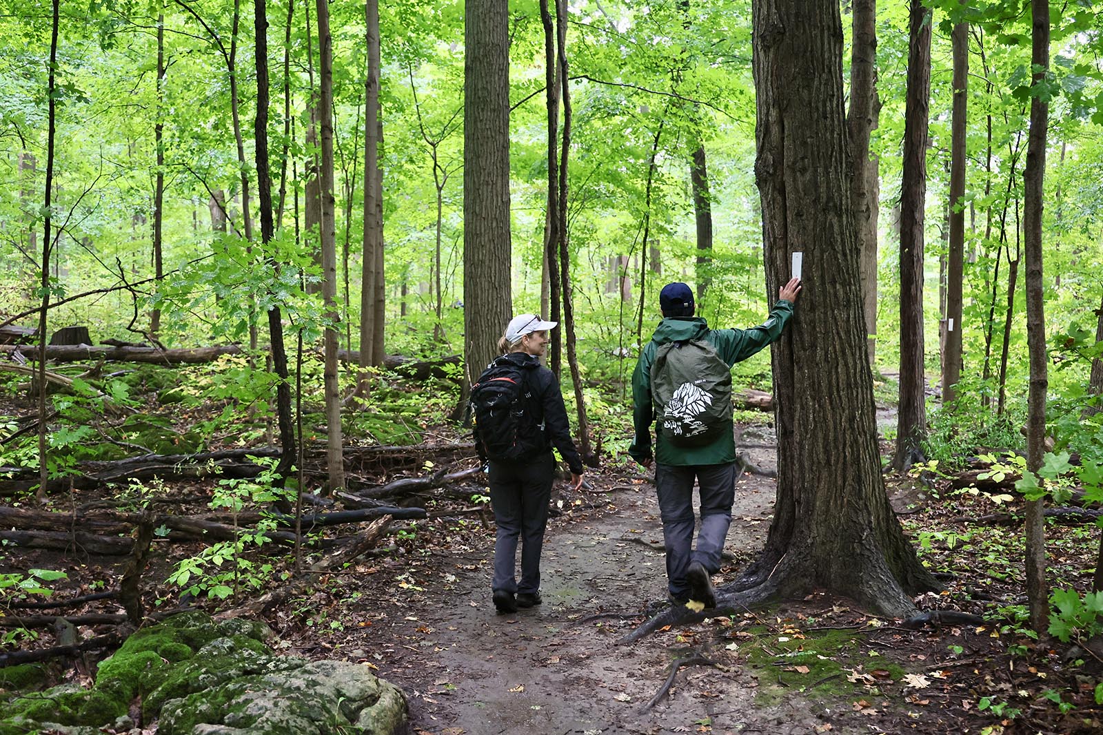
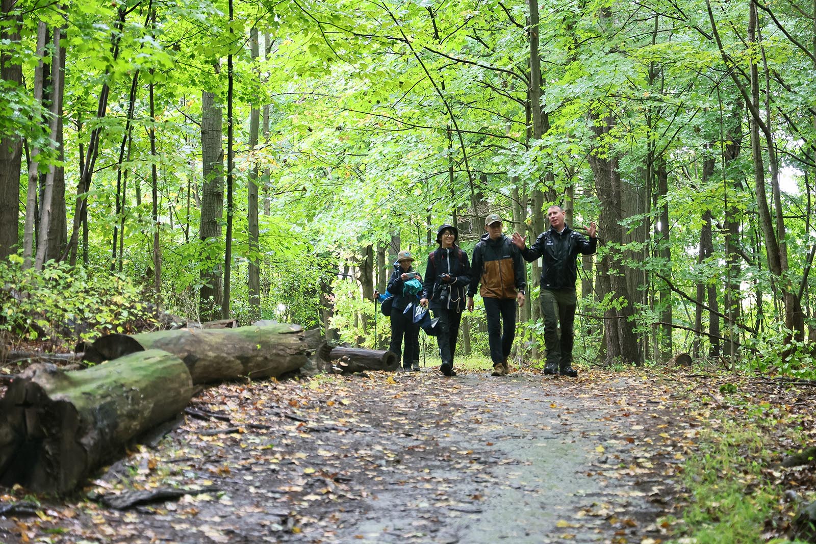
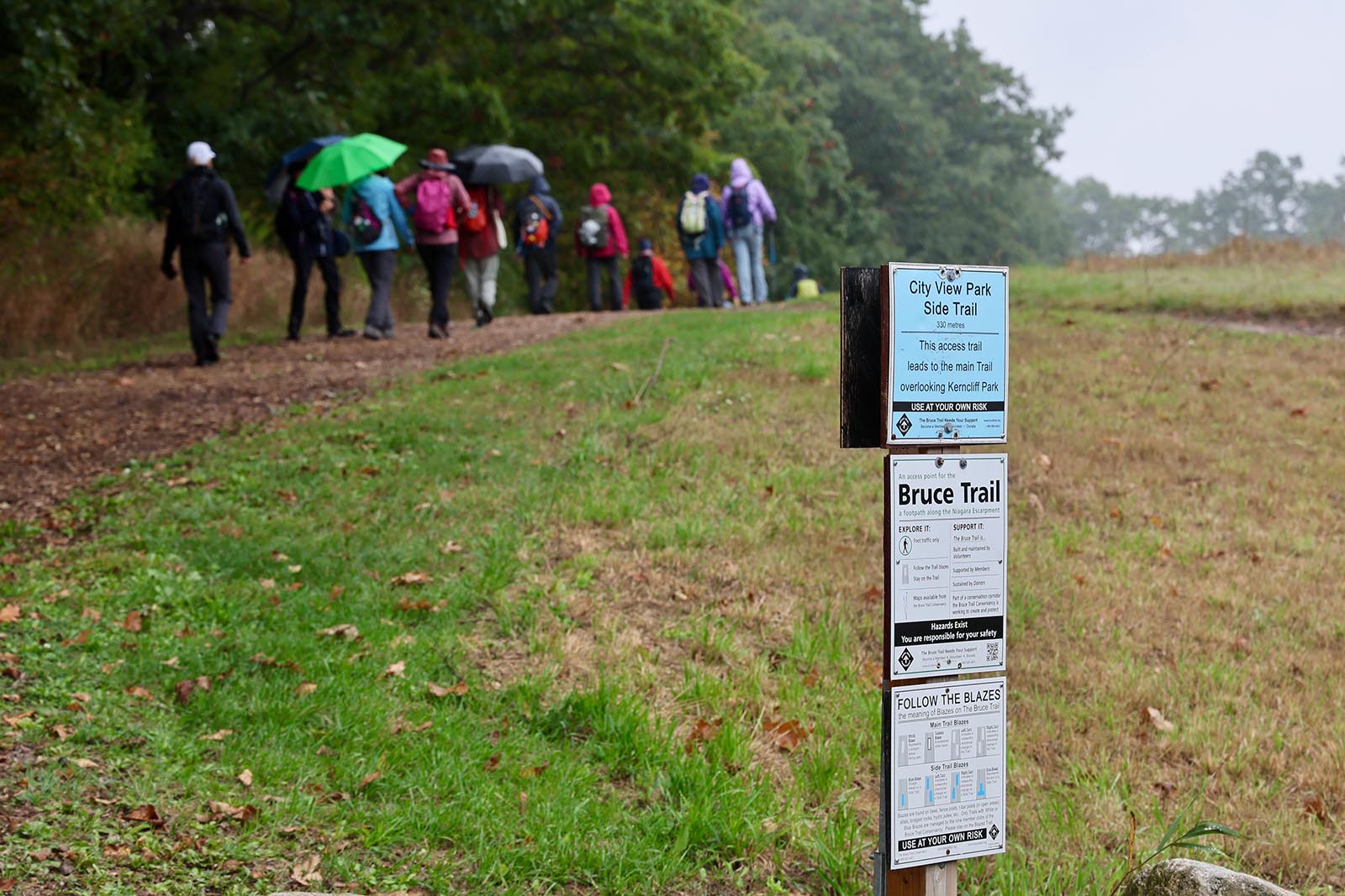
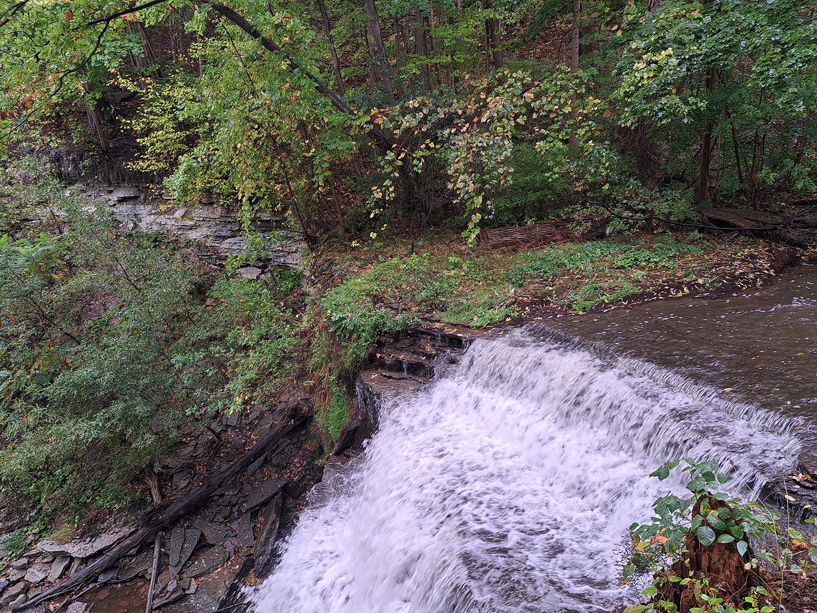
The Tefuye Historical Trail (MSTW 26) of the Mountains to Sea Greenway Greenway, TW and the second section of the Bruce Trail in Waterdown, located at the Iroquoia Bruce Trail Club, officially became a friendship trail in 2022. Signs were installed on each other's trails in 2022 and 2024 as a testament to their friendship and international cooperation, and also as a milestone in international trail exchanges.
The second section of the Bruce Trail stretches approximately 10 kilometers from Smokey Hollow to City View Park. The trail includes original dirt tracks, gravel roads, old racetracks, highways, and private roads, passing waterfalls, canyons, forests, grasslands, and the McNally Nature Reserve. Meanwhile, the Tefuye Historical Trail, rich in Tsou indigenous culture and forestry railway landscapes, echoes the ecological and cultural principles upheld by the Bruce Trail in Canada.
.png)
Courtesy of Bruce Trail Conservancy, BTC
Natural Environment
Flora
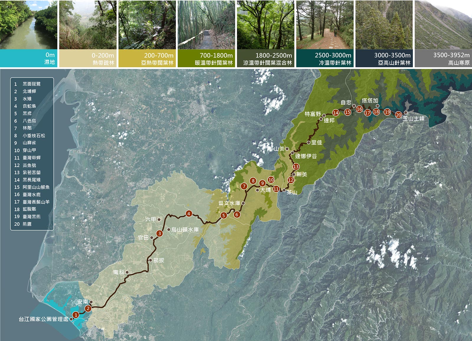
Based on the altitude, the flora along the greenway follows the classification set by the Forestry and Nature Conservation Agency (FANCA): alpine tundra, subalpine coniferous forest , cool temperate coniferous forest, temperate broadleaf and mixed forest, warm temperate broadleaf and mixed forest, subtropical broadleaf forest, and tropical savanna. Due to early development in the foothills, the subtropical broadleaf forest and tropical savanna have largely been cleared for orchards, with only a small amount of secondary forest and artificially created woodlands remaining. Large areas of wetlands, including mangrove swamps, can be found near the coast.
Fauna
A diverse range of fauna can be found along the greenway. People can find the black-faced spoonbill and Beipu cicada in the Taijiang National Park located at the coast; in Guantian, the elegant pheasanttailed jacana can be seen; and at Zengwen Reservoir, people may catch the sight of a black kite or russet sparrow (an endangered species in Taiwan). In the foothills, people may chance upon a pangolin or Formosan Reeve’s muntjac. As altitude ascends , the areas at high alttitude are important habitats of the Mikado pheasant, Alishan salamander, Formosan sambar deer, Taiwan serow, Swinhoe’s pheasant, and Formosan black bear. If people are fortunate enough to encounter any of these animals, please keep your distance and refrain from disturbing them.
Downloads
Trails Map

No location is founded.
You can select the routes or services you wish to view.


Route Map
The Mountains to Sea Greenway, TW (MSTW) extends from Mt. Jade Main Peak to Taijing Inner Sea. Its name ends with TW, the abbreviation of Taiwan, to indicate the greenway’s location. The 31 greenway sections from the Taijiang National Park Headquarters (0K) to Mt. Jade Main Peak are numbered in ascending order and prefixed with MSTW: from MSTW 01 to MSTW 31.
Video Story


Related Links
Exhibition Information
Online Photo Exhibition: Revisiting Wushanling and Traveling to Dongxikou
Go to
Media Report
Openbook Special Collaboration: Reading a Section of Mountains to Sea while Traveling
Go to
Media Report
VERSE Magazine: Mountains to Sea Greenway, TW - A Pilgrimage Route for Taiwanese People
Go to
Electronic "Complete Certificate" Application
Please provide basic information and upload a photo of the "MSTW Passport".
Participants who complete the "Taiwan Forest Recreation" electronic stamp collection can also export their certificates from the「Member Area」.
Participants who complete the "Taiwan Forest Recreation" electronic stamp collection can also export their certificates from the「Member Area」.
Total Page Views:445
 {action_date}
 {position}


