


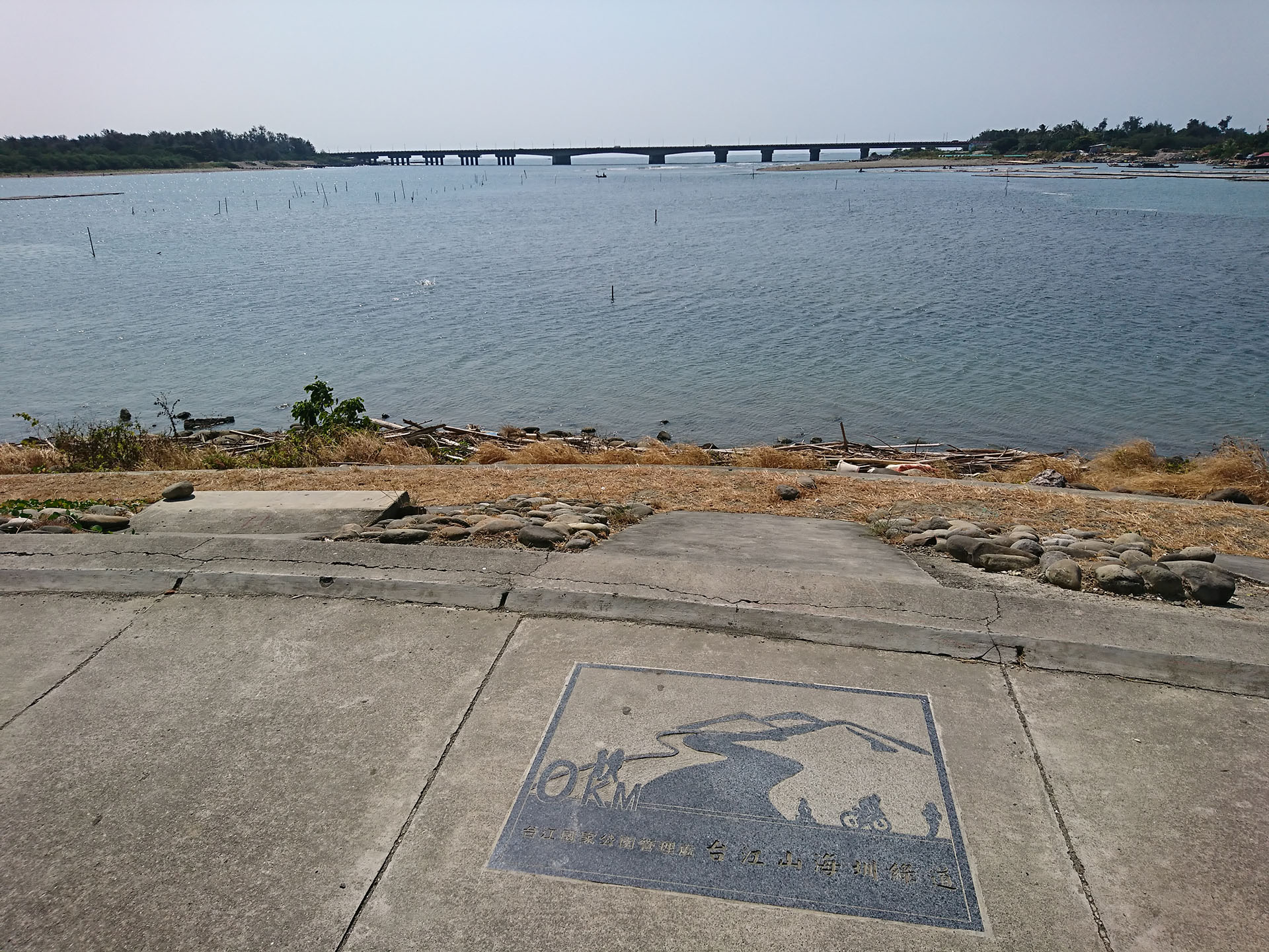


 Inner Sear Trail


Inner Sea Trail
Altitude: Minimum 0 meters, maximum 21 meters | Total distance: 31.1 kilometers
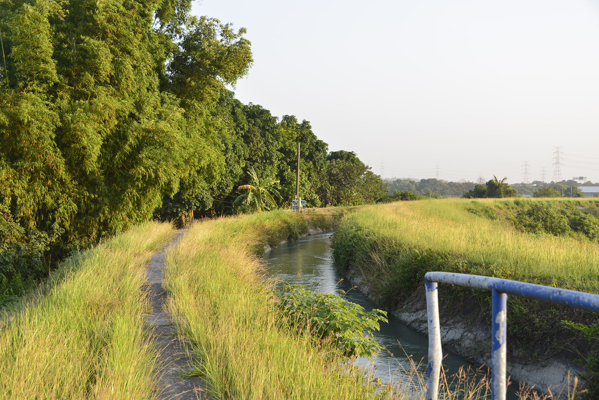
In ancient times, the Southwest shore of Taiwan was bordered by a body of water known as Taijiang Inner Sea. This shallow bay was separated from the Taiwan Strait by sandy shoals, which formed navigable channels. Over hundreds of years, repeated flooding of the Tainan Plain and the rechanneling of the Zengwen River gradually silted up the bay, forming new lands. Several tribes have left historical traces in this region, and the history of Taijiang Inner Sea is a record of fascinating historical and cultural developments. The so-called Taijiang Inner Sea has by now mostly been turned into wetlands due to soil accretion or has been used for aquaculture. In the river estuaries, visitors will find rich natural ecosystems with sandy beaches, wetlands, oyster beds, waterfowl reserves, and mangrove forests. Nearer to the shore, the area is dotted with fish farms. The traditional architectural heritages and temples remain in this settlement area. Many of the local communities are associated with major historical events. Additionally, this section of the MSTW is within the region irrigated by the Chianan Canal, and local industries such as salt farms can be seen along the way.
Trails Map
Please select the type of points you wish to display:


No location is founded.
You can select the routes or services you wish to view.



Service Points
Do you wish to take a break during your trek across the MSTW or learn more about the history along the greenway? Visit these Service Points, where restrooms, drinking water, and charging stations are available. You can also obtain travel information about the MSTW and its surrounding attractions!
Taijiang National Park Administration Visitor Center
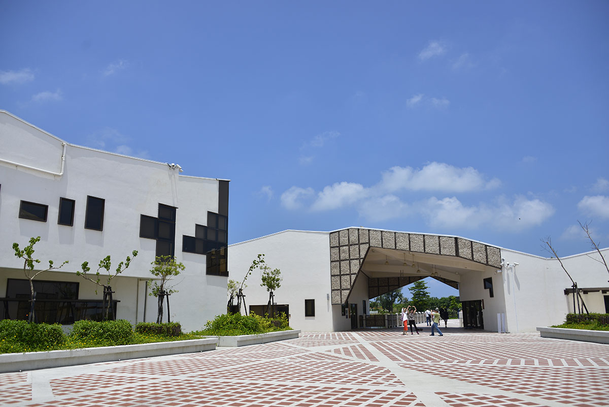
No. 118, Sicao Blvd., Annan Dist., Tainan City
23.0022, 120.1385(Check on Google Maps)
09:00-17:00 ; closed on Mondays
( More Information )
Haiweiliao Jhaohuang Temple
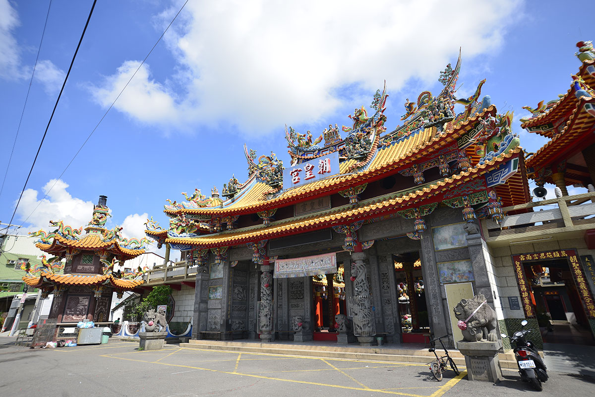
No. 10, Ln. 101, Haijhong Rd., Annan Dist., Tainan City
23.04047, 120.18402(Check on Google Maps)
05:30-21:30
( More Information )
Taikang Cultural Center
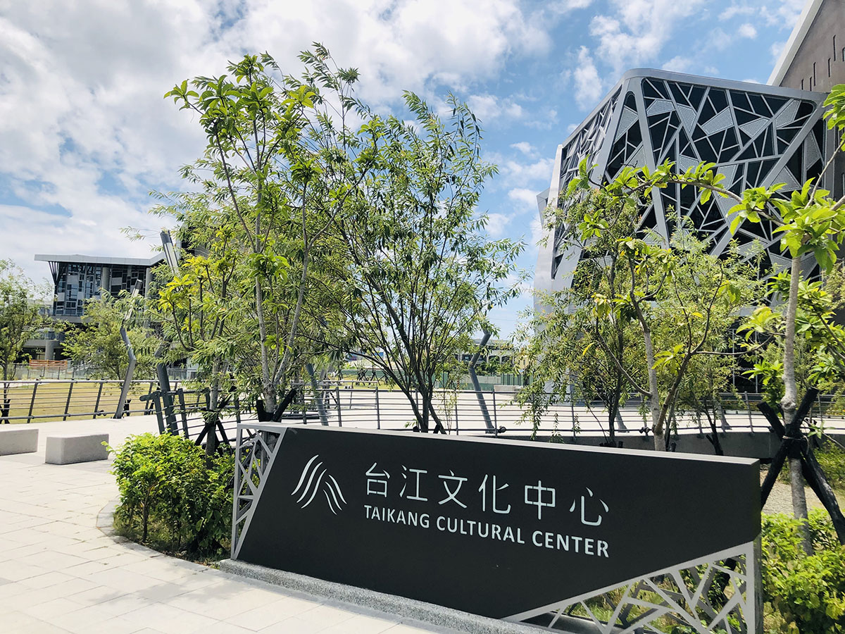
No. 205 & 207, Section 1, Anji Road, Annan District, Tainan City
23.04616, 120.18811(Check on Google Maps)
Open Monday, Wednesday to Sunday 08:00-17:30, closed on Tuesdays.
( More Information )
Sidingliao Bao-an Temple
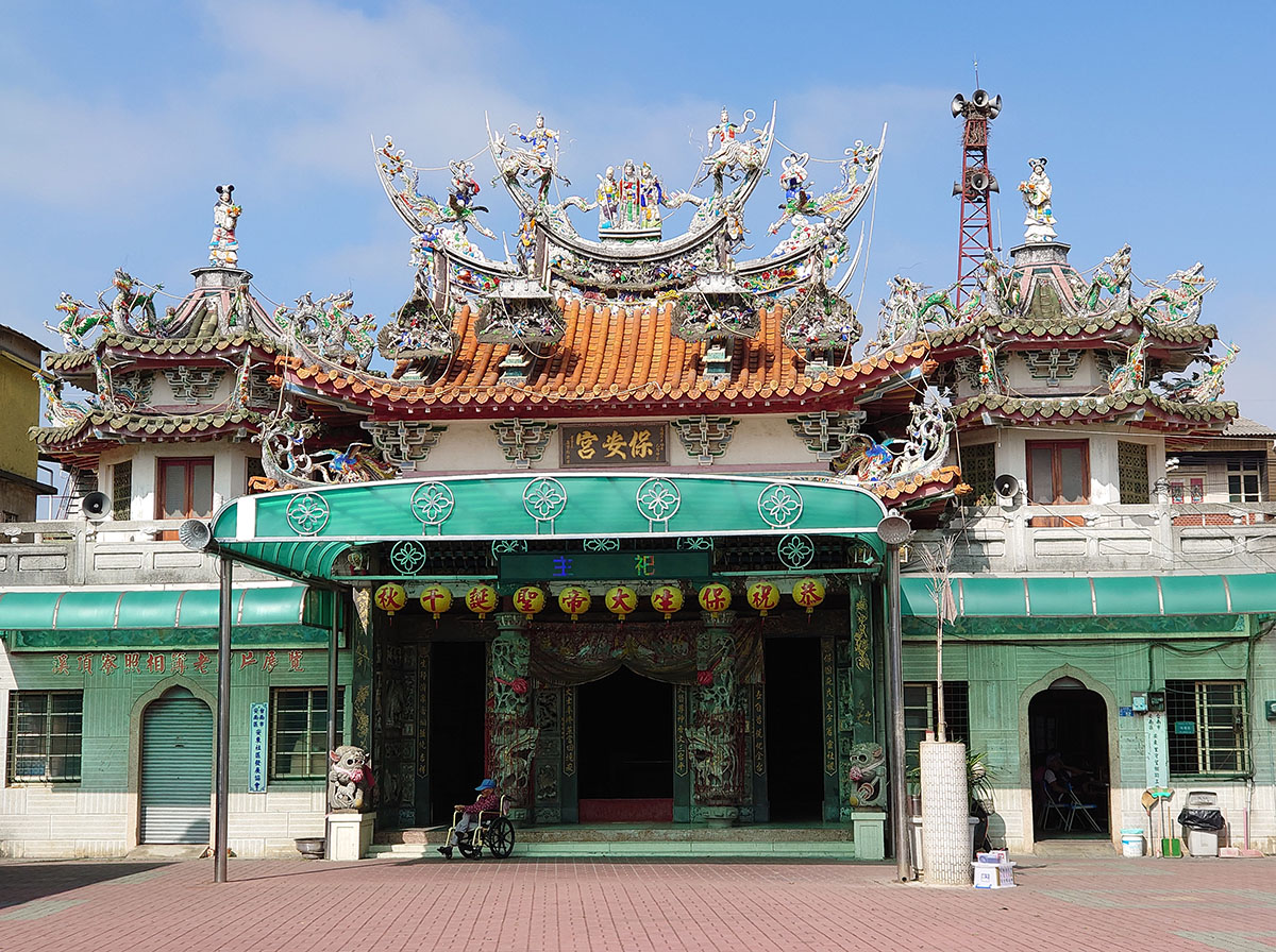
No. 52, Lane 220, Section 1, Anhe Road, Annan District, Tainan City
23.03158, 120.21421(Check on Google Maps)
06:00-21:00
( More Information )
National Museum of Taiwan History
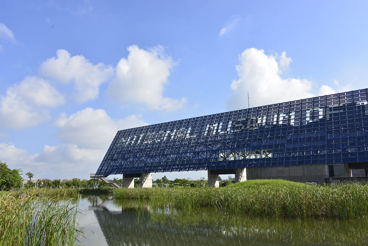
No.250, Sec. 1, Changhe Rd., Annan District, Tainan City
23.05831, 120.23504(Check on Google Maps)
09:00-17:00 ; closed on Mondays
( More Information )
Xingan Community Culture Museum
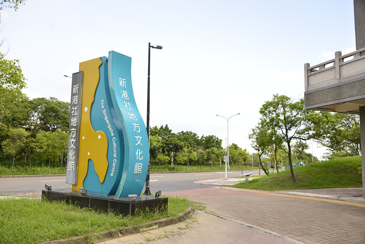
No. 3, Daoye Road, Xinshi District, Tainan City
23.09169, 120.26793(Check on Google Maps)
09:00-17:00 ; closed on Mondays
( More Information )
Tainan Branch of National Museum of Prehistory
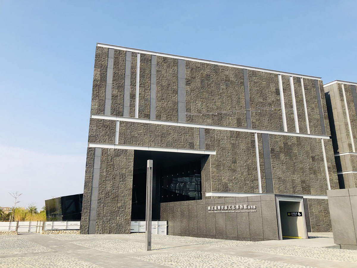
No. 10, Nanke 3rd Road, Xinshi District, Tainan City
23.10094, 120.28353(Check on Google Maps)
09:00-17:00 ; closed on Mondays
( More Information )
Trial Guide
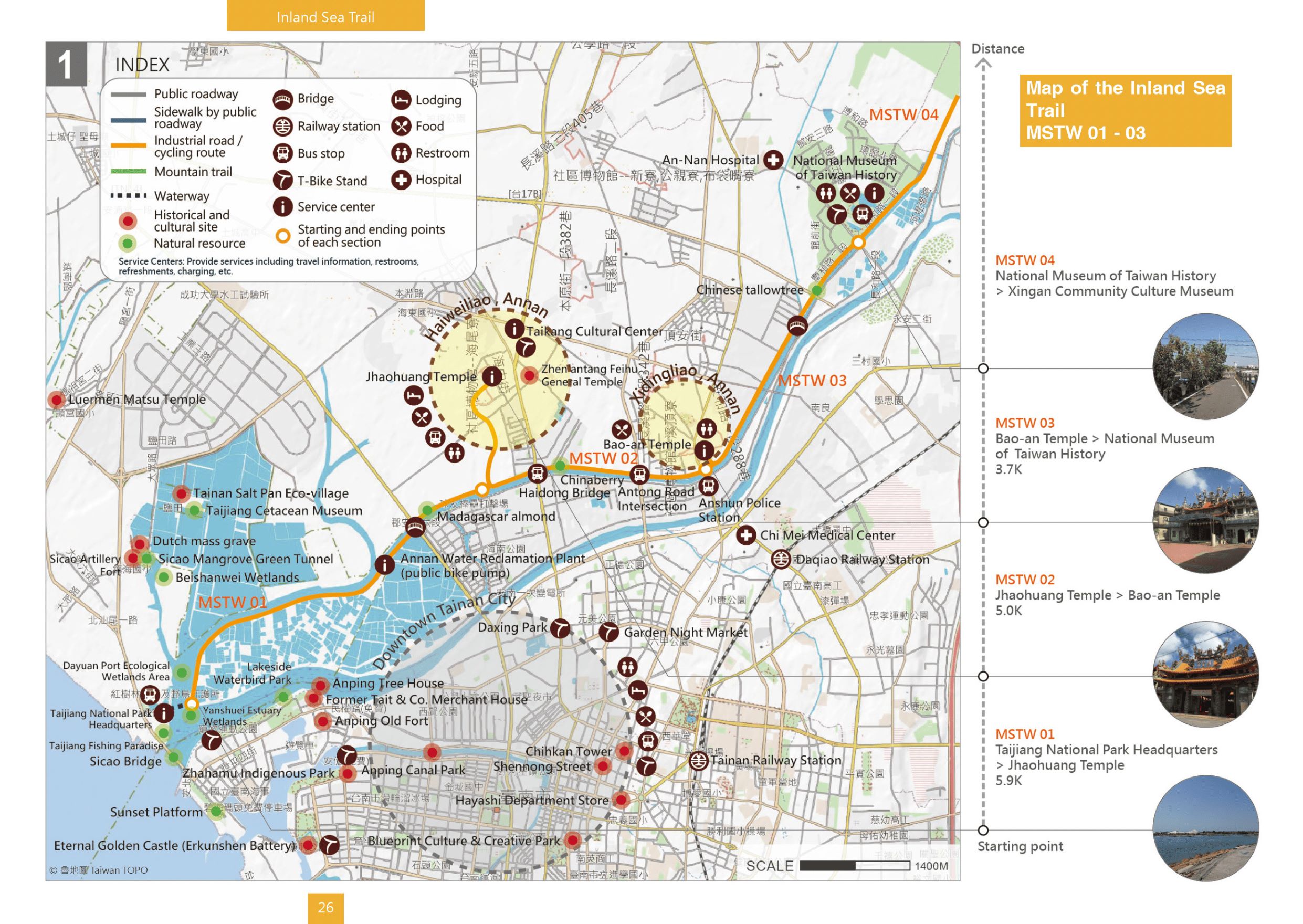
MSTW 01 Taijiang National Park Headquarters → Jhaohuang Temple
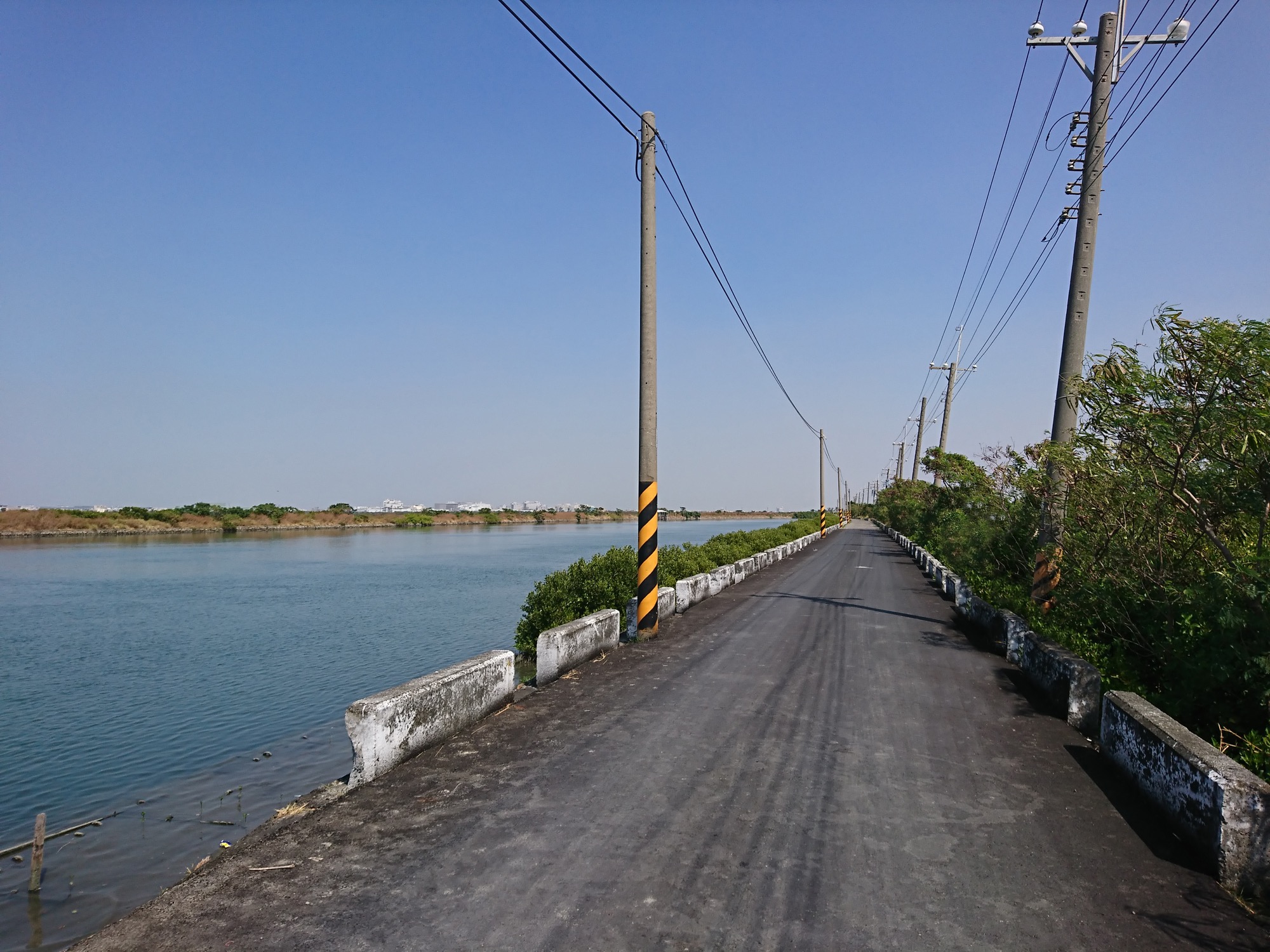
Traveling From Taijiang Inner Sea
Listen to the sounds of the waves and imagine how different ethnic groups sailed across the sea in the past to settle in“Formosa,” alias of Taiwan.
Distance
Waterway 300 meters (there is no fixed schedule for ferry service currently), industrial road 5.6 km.
Difficulty
Grade 0
(
Check Difficulty Level
)
Time required
1 hr. 10 min. walk
Starting and ending points
Taijiang National Park Headquarters / Jhaohuang Temple
Transportation
For Jhaohuang TempleBus stop: Take 3, 10, Blue 23, Blue 24 and get off at Haidongqiao Station and walk there.
T-Bike stations: Taijiang Cultural Center Station, Daxing Park Station.
T-Bike stations: Taijiang Cultural Center Station, Daxing Park Station.
Food
Bring your own food or dine at one of the restaurants near Jhaohuang Temple.
Surrounding attractions
Taijiang National Park, wetlands at the Yanshuei River estuary
Route
This section starts at the Taijiang National Park Headquarters, which is located at where the Yanshuei River estuary meets the Chianan Irrigation Canal’s drainage channel. From here, you can see Sicao Bridge. Prior to its silting in, this spot used to be a part of the protected bay known as the Taijiang Inner Sea. To get from the starting point to the Yanshuei River estuary, you will need to cross the river by ferry and go along the drainage channel of the Chianan Irrigation Canal. Along the way, you can enjoy the view of fishponds and the drainage channel. After passing the Annan Water Reclamation Center and crossing the Binhai Bridge, take the cycling route on the levee to reach the crossroads near Jhaohuang Temple.
Features
This section features a view of fishponds and the wetlands ecosystem near the river estuary, where you can sometimes see black-winged stilts, pied avocets, and other shore birds; from October to March, you can also see black-faced spoonbills. Trees along the route include the Indian almond, Poonga Oil Tree, and Madagascar almond.
Note
The ferry timetable is currently unavailable. It is recommended that hikers start at the Yanshuei River estuary (kilometer zero of the MSTW).
MSTW 02 Jhaohuang Temple → Bao-an Temple
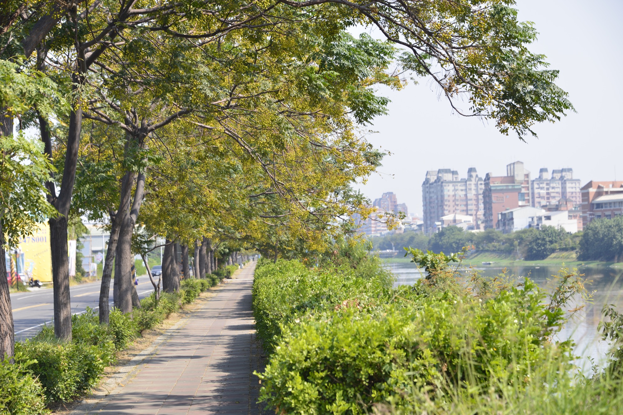
Haiwei Community Temple School—the Cradle of Taijiang Culture
The first inhabitants of the area built a thatched shrine and temple school here. They passed down their traditions of “fishing and studying” through generations to establish Taijiang Culture. The people of the Taijiang region adhered to traditional belief systems, with the temple functioning both as cultural focus and learning center in the community. Haiweiliao Jhaohuang Temple’s belief in the value of devoting oneself and doing good within the community stems from the wisdom of Baosheng Dadi (the God of Medicine).
Distance
Industrial road 5.0 km
Difficulty
Grade 0
(
Check Difficulty Level
)
Time required
1 hr. walk
Starting and ending points
Haiweiliao Jhaohuang Temple/ Bao-an Temple
Transportation
For Jhaohuang Temple Bus stop: Take 3, 10, Blue 23, Blue 24 and get off at Haidongqiao Station and walk there.
T-Bike stations: Taijiang Cultural Center Station, Daxing Park Station.
For Bao-an TempleBus stop: Take Line 9, 18, Blue Line and get off at Anshun Police Station Station and walk there.
T-Bike stations: Taijiang Cultural Center Station, Daxing Park Station.
For Bao-an TempleBus stop: Take Line 9, 18, Blue Line and get off at Anshun Police Station Station and walk there.
Food
Jhaohuang Temple, Section 2, Haidian Road, or Section 1, Anhe Road.
Surrounding attractions
Jhaohuang Temple, Taikang Cultural Center, and Feihu General Temple
Route
Haiweiliao Jhaohuang Temple was rebuilt from the Caoliao Mansion into a temple in 1878; since then, the temple has long served as the political, economic, and cultural center of Annan District. Starting from the temple, visitors then pass by the residential area and head to the industrial road along the fishponds to return to the Chianan Canal’s drainage channel, before finally reaching the crossroads near Bao-an Temple.
Features
This section features a view of fishponds as well as the chance to experience Han Chinese communities and temple culture. In March, clusters of pastel purple flowers bloom on the chinaberry trees. Trees along the route include the chinaberry tree, sacred fig tree, and Indian almond.
MSTW 03 Bao-an Temple → National Museum of Taiwan History
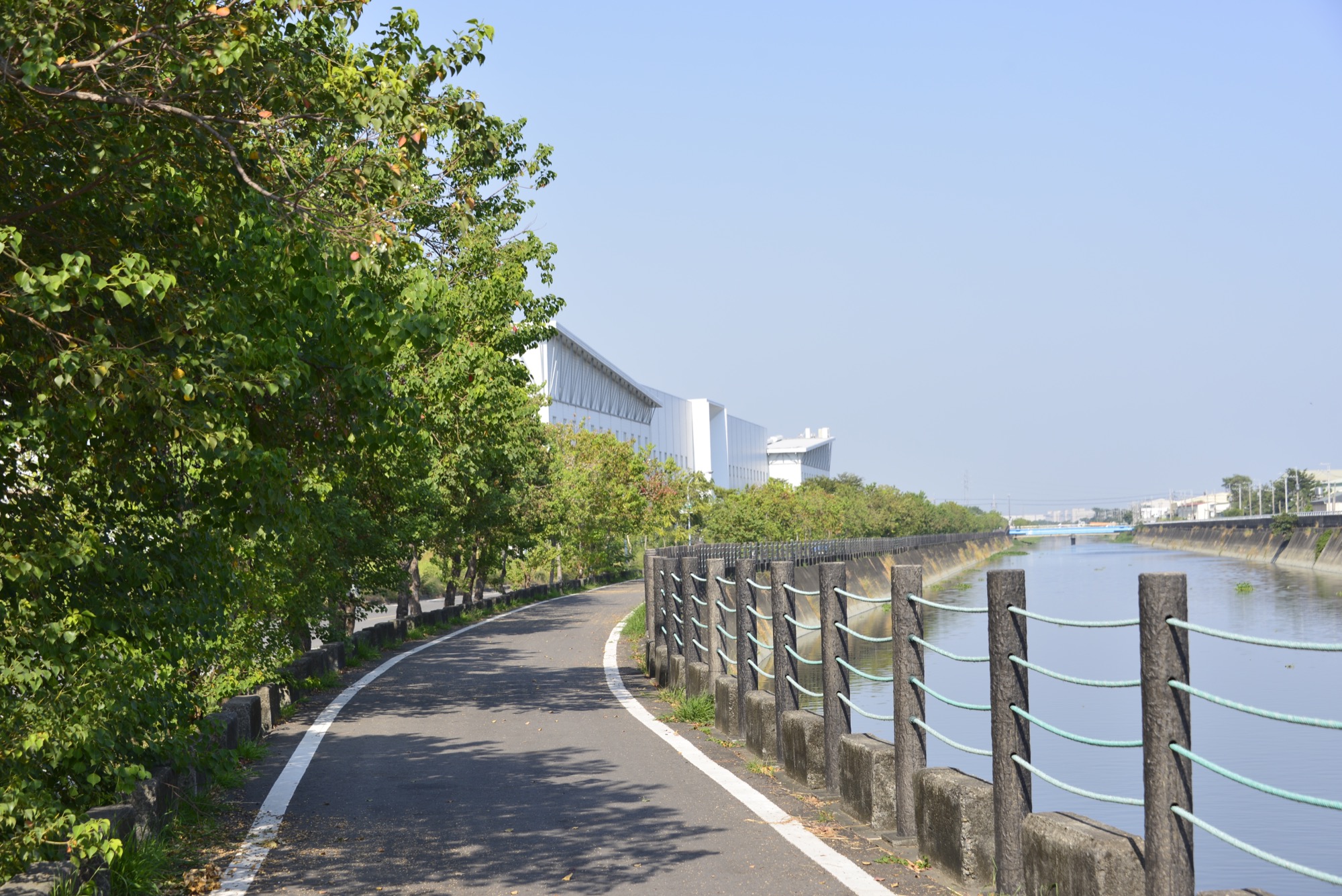
Xidingliao - A Local Seaside Community
Xidingliao was once a part of Taijiang Inner Sea; however, the rechanneling of the Zengwen River silted up this section of the sea and created new land. The first inhabitants built a thatched shrine which eventually grew into a center of belief that served both as a place to worship Baosheng Dadi and a private school.
Distance
Industrial road 3.7 km
Difficulty
Grade 0
(
Check Difficulty Level
)
Time required
50 min. walk
Starting and ending points
Bao-an Temple / National Museum of Taiwan History
Transportation
For Bao-an TempleBus stop: Take Line 9, 18, Blue Line and get off at Anshun Police Station Station and walk there.
Fro National Museum of Taiwan HistoryBus stop: Take 18 Extension to National Museum of Taiwan History (Qinghe Road) or 18 Extension, 20 and get off at National Museum of Taiwan History (Changhe Road).
T-Bike Station: National Museum of Taiwan History.
Fro National Museum of Taiwan HistoryBus stop: Take 18 Extension to National Museum of Taiwan History (Qinghe Road) or 18 Extension, 20 and get off at National Museum of Taiwan History (Changhe Road).
T-Bike Station: National Museum of Taiwan History.
Food
Restaurants and food stands are located around the National Museum of Taiwan History.
Surrounding attractions
Bao-an Temple and the National Museum of Taiwan History.
Route
Sidingliao Bao-an Temple was built on a piece of land donated by Chun Hsu in the 1850s. Initially, a simple shrine was built on the spot. Later, as the community grew, the temple was moved to another location and then moved back in 1923, when it was rebuilt in brick. Starting from the temple, pass by the residential area and down the cycling route along the main channel of the Yanshuei River. Following the route, hikers then go past Heshun Industrial Park and cross a white arch bridge to reach the National Museum of Taiwan History.
Features
The middle point of this section is where the Yanshuei River comes closest to the drainage channel of the Chianan Canal. Along this route, you will pass by a white arch bridge and see Chinese tallowtrees. The leaves of the Chinese tallowtree change color with the seasons and the tree bears small fruit in dark pods toward the end of summer and start of autumn.
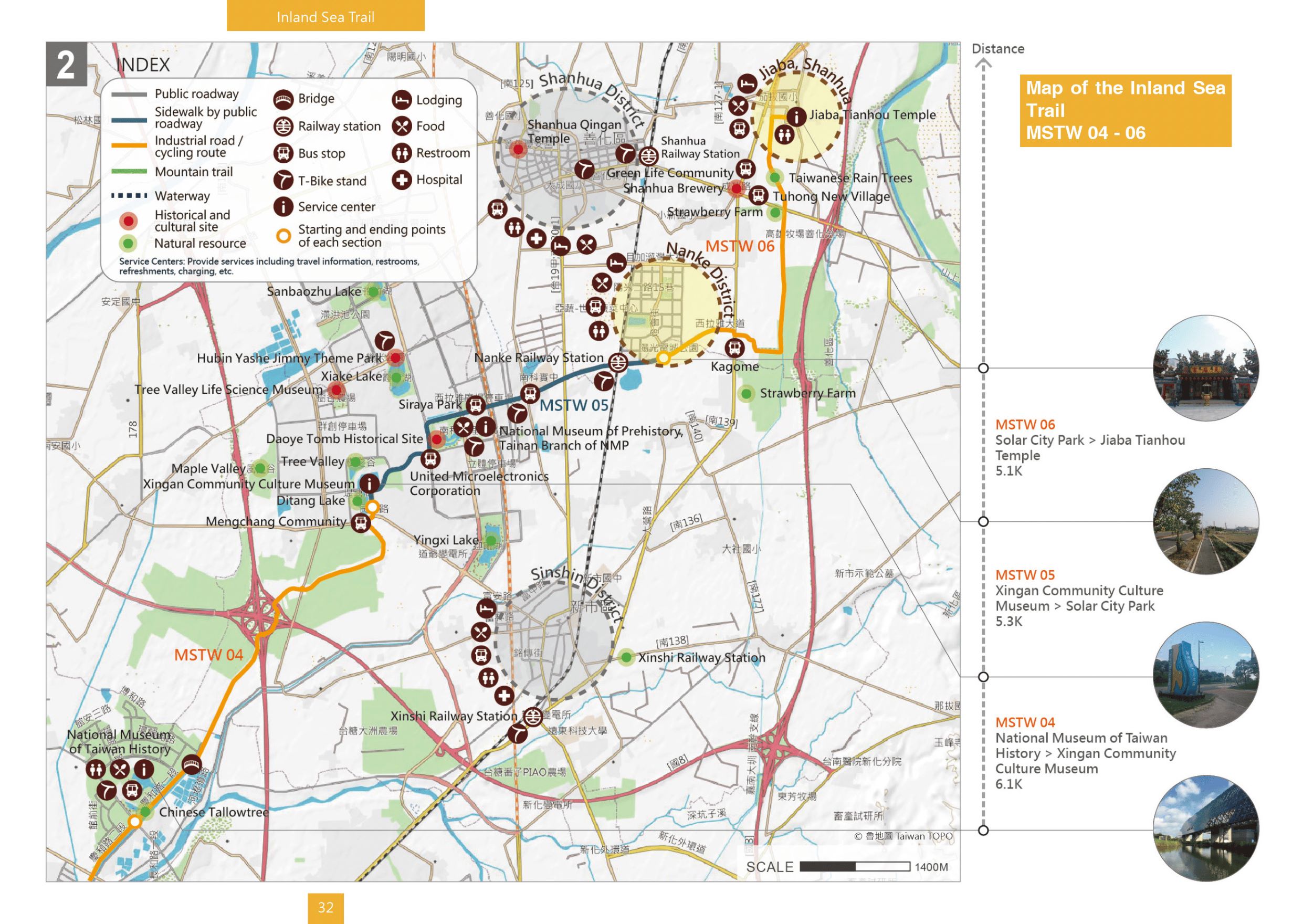
MSTW 04 National Museum of Taiwan History → Xingan Community Culture Museum
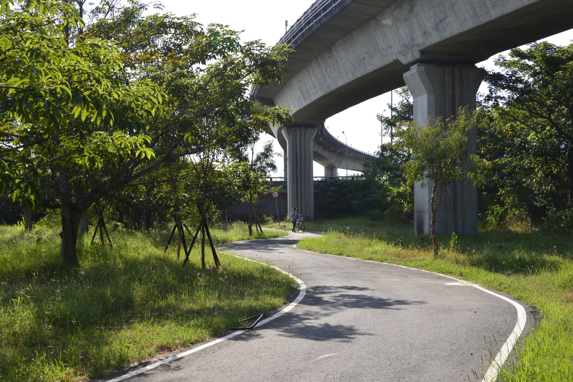
Taiwan - Mix of Different Seafaring Cultures and Their Stories
Taiwan is the product of its complex historical development which includes prehistoric culture, Taiwanese indigenous cultures, Dutch rule, Chinese settlement under Zheng Chenggong (Koxinga), Qing Dynasty rule, and Japanese ruling period. Every historical period and culture has had an impact on shaping our modern-day society.
Distance
Industrial road 6.1 km
Difficulty
Grade 0
(
Check Difficulty Level
)
Time required
1 hr 15 min. walk
Starting and ending points
National Museum of Taiwan History / Xingan Community Culture Museum
Transportation
Fro National Museum of Taiwan HistoryBus stop: Take 18 Extension to National Museum of Taiwan History (Qinghe Road) or 18 Extension, 20 and get off at National Museum of Taiwan History (Changhe Road).
T-Bike Station: National Museum of Taiwan History.
For Xingan Community Culture MuseumBus stop: Take Green 3 via Shugu Park and get off at Mengchang Community Station and walk there.
T-Bike Station: Nanke Administration Station.
T-Bike Station: National Museum of Taiwan History.
For Xingan Community Culture MuseumBus stop: Take Green 3 via Shugu Park and get off at Mengchang Community Station and walk there.
T-Bike Station: Nanke Administration Station.
Food
restaurants and snacks bars are located around the National Museum of Taiwan History.
Surrounding attractions
National Museum of Taiwan History, Ditang Lake, and Xingan Community Culture Museum.
Route
The National Museum of Taiwan History, opened in 2011, focuses on exhibits related to the historical interactions between different ethnic groups and the natural environment of Taiwan. Starting from the National Museum of Taiwan History, go along the main drainage channel and past the Heding Bridge, where you will see livestock farms on the opposite bank. Keep going until you reach the green space under the viaduct where Freeway 1 and Freeway 8 meet. Continue along the trail past fields of sesame, sugarcane and mango plantations until you reach the Xingan Community Culture Museum.
Features
With a wide variety of collections, the exhibits of the NMTH aisplay the historical developments along the MSTW. Visitors will see mango, saseme and sugarcane plantation when they hike through this section. The scenery under the freeway viaduct has its own unique character.
MSTW 05 Xingan Community Culture Museum → Ernan Park
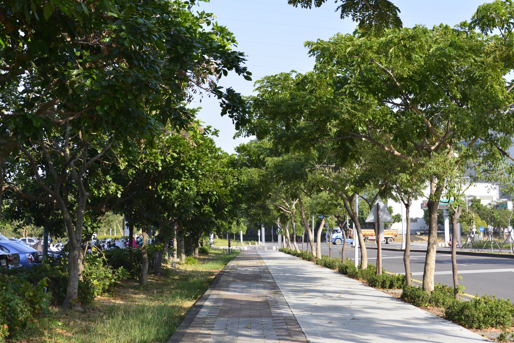
Explore Prehistoric Seafaring Cultures and the Science Park
Thousands of years ago, Nanke was under water, and the area’s earliest inhabitants fished for a living. From these first inhabitants through the Siraya Indigenous Culture, and all the way up to today’s Tainan Technology and Industrial Park, this land has been enriched by many peoples.
Distance
Pedestrian walkway 5.3 km
Difficulty
Grade 0
(
Check Difficulty Level
)
Time required
1 hr 10 min. walk
Starting and ending points
Xingan Community Culture Museum / Ernan Park
Transportation
For Xingan Community Culture MuseumBus stop: Take Green 3 via Shugu Park and get off at Mengchang Community Station and walk there.
T-Bike Station: Nanke Administration Station.
For Ernan ParkTaiwan Railway: Take the Nanke Railway Station and get off and walk there.
Bus stop: Take Green 4 via Ernan Park and get off at Ernan Park Station.
T-Bike Station: Taiwan Railway Nanke Station.
T-Bike Station: Nanke Administration Station.
For Ernan ParkTaiwan Railway: Take the Nanke Railway Station and get off and walk there.
Bus stop: Take Green 4 via Ernan Park and get off at Ernan Park Station.
T-Bike Station: Taiwan Railway Nanke Station.
Food
Conveniences stores and restaurants in the Tainan Science Park
Surrounding attractions
Ditang Lake, Xingan Community Culture Museum, Daoye Tomb Historical Site, Museum of Archaeology, Tainan Branch of National Museum of Prehistory, Ernan Park
Route
The Xingan Community Culture Museum’s permanent exhibits primarily showcase historical items and information related to the Siraya people, one of the most well-known Taiwan Plains Indigenous Tribes, as well as prehistoric archaeology; additionally, famous artists are regularly invited to display their works in special exhibitions held there. Ditang Lake is located outside the museum. Passing by the Daoye Tomb Historical Site and down the sidewalk, one will see the changes in the roadside trees. As the trail enters the Tainan Science Park, it passes by the National Museum of Prehistory (Tainan Branch), where prehistoric artifacts found at the site of the science park are on display. Keep going down the sidewalk along Siraya Boulevard and climb up to the bridge by Nanke Railway Station, finally reach the Ernan Park.
Features
This section showcases prehistoric cultures and the indigenous plains Siraya culture. The prehistoric artifacts found during the development of the Tainan Science Park belong to six different cultures across eleven distinct eras. The historical sites can still be seen today, and the National Museum of Prehistory (Tainan Branch) is an excellent educational and exhibition space.
MSTW 06 Ernan Park → Jiaba Tianhou Temple
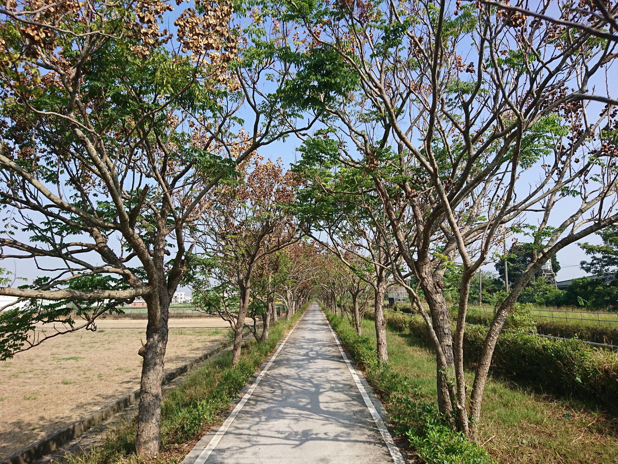
Mazu, the “Holy Heavenly Mother” crossing the sea to Taiwan with Koxinga’s Army
Jiaba was originally home to the Jiaba Tribe, a subgroup under the Siraya Backloun Tribe. Later, the first Chinese settlers sailed to Taiwan with Zheng Chenggong’s 1661 invasion force. When they arrived, they built a thatched shrine here dedicated to Mazu.
Distance
Industrial road 5.1 km
Difficulty
Grade 0
(
Check Difficulty Level
)
Time required
1 hr 10 min. walk
Starting and ending points
Ernan Park / Jiaba Tianhou Temple
Transportation
For Ernan ParkTaiwan Railway: Take the Nanke Railway Station and get off and walk there.
Bus stop: Take Green 4 via Ernan Park and get off at Ernan Park Station.
T-Bike Station: Taiwan Railway Nanke Station.
For JiabaBus stop: Take Orange 2, Orange 5 and get off at Jiaba (Provincial Highway) Station and walk there.
Bus stop: Take Green 4 via Ernan Park and get off at Ernan Park Station.
T-Bike Station: Taiwan Railway Nanke Station.
For JiabaBus stop: Take Orange 2, Orange 5 and get off at Jiaba (Provincial Highway) Station and walk there.
Food
Restaurants, snack bars, and conveniences stores can be found in the neighborhood of Ernan Park, the intersection of Provincial Highway 1 and County Highway 178, and the streets of Jiaba.
Surrounding attractions
Ernan Park, Jiaba Work Station floodgate, and Jiaba Tianhou Temple
Route
Go east from Ernan Park; follow the sidewalk next to Siraya Boulevard, then turn into the small road just past Provincial Highway 1, finally the route connects to the Chianan Irrigation System south branch line. Here, visitors can see two waterways along the southern branch line, a floodgate, beautiful farmland, verdant fields, sesame plantations with blooming white flowers, golden, waving rice paddies, and sugarcane plantations. Visitors will go past the floodgate of Jiaba Work Station before reaching Jiaba Tianhou Temple.
Features
Fields brimming with crops of every sort can be found along the way, and in the fall the elegant Taiwanese rain trees are in bloom. Jiaba Tianhou Temple is a local religious center featuring large banyan trees and it is an exquisite temple. Residents usually gather to chat and relax under the big tree.
Travel Information
Lodging
This section passes through older towns with a greater population density and more historical buildings. It is recommended that travelers seek lodgings at traditional Tainanstyle houses, bed and breakfasts, or hostels.
Local Specialties
Annan District
salt, tiger prawns, milkfish, grouper, sugarcane, corn, honeydew melon, and cherry tomatoes
Xinshi District
white jambu, rice, pineapple, cabbage, and watermelon
Shanhua District
edamame, sesame, strawberries
Notes
- Protect yourself from the sun during summer to prevent heatstroke and remember to stay hydrated.
- Follow proper etiquette when entering temples.
- Actively watch both sides of the road when cycling along levee paths to prevent yourself from falling. Remember to wear a helmet when cycling.
- Look out for cars behind you and use hand signals when turning.
- Watch out for leaves, branches, and fallen fruit on pedestrian walkway to prevent slips and falls.
- Watch out for low-hanging branches on roadside trees that may hit your head or eyes.
- Please stop walking or dismount from your bike when enjoying the beautiful scenery along the trail. Do not take your eyes off the road when walking or cycling.
- The approaches to some canal paths are steep or connect to motor vehicles throughways. It is recommended that you dismount from your bike and walk it across these areas when necessary.
Total Page Views:92

Trail difficulty level
The Forestry and Nature Conservation Agency has established a five-level trail classification system based on factors such as elevation, walking time, required equipment, and trail difficulty, matching each trail with suitable users. Level 1 is the easiest, while Level 5 is the most difficult. In addition to providing hikers with information on trail characteristics and difficulty, the classification system allows them to assess in advance whether a trail is suitable for them, thereby enhancing trail safety.
The National Greenway of Mountain and Sea (Shanhai National Greenway) adopts the trail classification system established by the Forestry and Nature Conservation Agency. However, because the route includes various types of paths, additional classifications have been introduced. Roads, industrial roads—including industrial roads, bicycle paths, trails along irrigation channels, and riverside embankment roads—roadside pedestrian paths, and waterways are classified as Level 0, representing routes generally suitable for the general public.
| Hiking Level |
|
|
|
|
|
|
|
||||||||||||||||||||||||||||||||||||||||||
|---|---|---|---|---|---|---|---|---|---|---|---|---|---|---|---|---|---|---|---|---|---|---|---|---|---|---|---|---|---|---|---|---|---|---|---|---|---|---|---|---|---|---|---|---|---|---|---|---|---|
| Target | General Public | General Public | Those who have better physical energy | Beginner mountain climber with good physical energy and map literacy. | Open to those who have good physical strength, map reading skills, and wild survival skills. | Open to well-trained mountain climbers. | Open to well-trained mountain climbers. | ||||||||||||||||||||||||||||||||||||||||||
| Elevation | Gently sloping area | In recreational areas, close to settlements or about 1,000 meters above sea level. | In recreational areas, close to settlements or between 1,000~2,000 meters above sea level. | Remote areas or between 2,000 to 3,000 meters above sea level | Remote areas, wilderness, or between 2,000 to 3,000 meters above sea level | Remote areas, wilderness, or more than 3,000 meters above sea level | Remote areas, wilderness, or more than 3,000 meters above sea level | ||||||||||||||||||||||||||||||||||||||||||
| Required Time | It takes half to one day. | It takes half to one day. | It can be done within one day. | It takes one or more days. | Overnight preparation required. | It takes up to three days. | It takes up to three days. | ||||||||||||||||||||||||||||||||||||||||||
| Equipment | Light backpacking (water and small amount of food) | Light backpacking (water and small amount of food) | Light backpacking (water and proper amount of food) | Overnight preparation required. (e.g. drinking water, food, map, warm clothing, first-aid medicine, etc.) Application for entrance permission in advance is required if there is access control. | Comprehensive Mountaineering Gear Required. (e.g. food, drinking water, cooking utensils, map, warm clothing, flashlight, sleeping bag, tent, etc.) Application for entrance permission in advance is required if there is access control. | Comprehensive Mountaineering Gear Required. (e.g. food, drinking water, cooking utensils, map, warm clothing, flashlight, sleeping bag, tent, etc.) Application for entrance permission in advance is required if there is access control. | Comprehensive Mountaineering Gear Required. (e.g. food, drinking water, cooking utensils, map, warm clothing, flashlight, sleeping bag, tent, etc.) Application for entrance permission in advance is required if there is access control. | ||||||||||||||||||||||||||||||||||||||||||
| Description | Flat hiking trails. Relatively even slopes with comprehensive facilities and smooth road surface. Accessible for handicapped assistive devices or baby strollers. | An open hiking trail with easy access. Relatively even slopes with comprehensive facilities and smooth road surface. It takes half a day or less than one day to complete. | An open hiking trail with easy access. Somewhat steep slope with some difficult sections, but has comprehensive facilities and smooth road surface. It takes less than one day to complete. | A hiking trail locates at remote area or with part of the route is in area which requires entrance permission. Application in advance is required. Part of the route is in relatively bad condition with steeper slopes, but basic facilities are provided. It takes one day or between one to three days to complete. | A hiking trail locates at remote area or with part of the route is in area which requires entrance permission. It’s located in high-altitude areas (higher than 3000 meters above sea level). The trail is relatively primitive, with steeper slopes and unstable weather conditions. Part of the route may be dangerous or difficult for climbers. It takes two to three days to complete. Lead from professionals is recommended. | A hiking trail locates at area with inconvenient traffic, and mostly with routes in area which requires entrance permission. It’s located in high-altitude areas (higher than 3000 meters above sea level). The trail is located at primitive area, with bad condition, steeper slopes, and unstable weather conditions. Many parts of the route may be dangerous or difficult for climbers. It takes three or more days to complete. Lead from professionals is recommended. | 1. Level 3, 4 or 5 trails when snow or ice accumulating 2. Informal trails, without clear subgrades or paths, belong to special routes such as original mountain trails, ancient trail relics, prospecting, or technical climbing. |
Hiking Level
Target
General Public
Elevation
Gently sloping area
Required Time
It takes half to one day.
Equipment
Light backpacking (water and small amount of food)
Description
Flat hiking trails. Relatively even slopes with comprehensive facilities and smooth road surface. Accessible for handicapped assistive devices or baby strollers.
Hiking Level
Target
General Public
Elevation
In recreational areas, close to settlements or about 1,000 meters above sea level.
Required Time
It takes half to one day.
Equipment
Light backpacking (water and small amount of food)
Description
An open hiking trail with easy access. Relatively even slopes with comprehensive facilities and smooth road surface. It takes half a day or less than one day to complete.
Hiking Level
Target
Those who have better physical energy
Elevation
In recreational areas, close to settlements or between 1,000~2,000 meters above sea level.
Required Time
It can be done within one day.
Equipment
Light backpacking (water and proper amount of food)
Description
An open hiking trail with easy access. Somewhat steep slope with some difficult sections, but has comprehensive facilities and smooth road surface. It takes less than one day to complete.
Hiking Level
Target
Beginner mountain climber with good physical energy and map literacy.
Elevation
Remote areas or between 2,000 to 3,000 meters above sea level
Required Time
It takes one or more days.
Equipment
Overnight preparation required. (e.g. drinking water, food, map, warm clothing, first-aid medicine, etc.)
Application for entrance permission in advance is required if there is access control.
Description
A hiking trail locates at remote area or with part of the route is in area which requires entrance permission. Application in advance is required. Part of the route is in relatively bad condition with steeper slopes, but basic facilities are provided. It takes one day or between one to three days to complete.
Hiking Level
Target
Open to those who have good physical strength, map reading skills, and wild survival skills.
Elevation
Remote areas, wilderness, or between 2,000 to 3,000 meters above sea level
Required Time
Overnight preparation required.
Equipment
Comprehensive Mountaineering Gear Required. (e.g. food, drinking water, cooking utensils, map, warm clothing, flashlight, sleeping bag, tent, etc.)
Application for entrance permission in advance is required if there is access control.
Description
A hiking trail locates at remote area or with part of the route is in area which requires entrance permission. It’s located in high-altitude areas (higher than 3000 meters above sea level). The trail is relatively primitive, with steeper slopes and unstable weather conditions. Part of the route may be dangerous or difficult for climbers. It takes two to three days to complete. Lead from professionals is recommended.
Hiking Level
Target
Open to well-trained mountain climbers.
Elevation
Remote areas, wilderness, or more than 3,000 meters above sea level
Required Time
It takes up to three days.
Equipment
Comprehensive Mountaineering Gear Required. (e.g. food, drinking water, cooking utensils, map, warm clothing, flashlight, sleeping bag, tent, etc.)
Application for entrance permission in advance is required if there is access control.
Description
A hiking trail locates at area with inconvenient traffic, and mostly with routes in area which requires entrance permission. It’s located in high-altitude areas (higher than 3000 meters above sea level). The trail is located at primitive area, with bad condition, steeper slopes, and unstable weather conditions. Many parts of the route may be dangerous or difficult for climbers. It takes three or more days to complete. Lead from professionals is recommended.
Hiking Level
Target
Open to well-trained mountain climbers.
Elevation
Remote areas, wilderness, or more than 3,000 meters above sea level
Required Time
It takes up to three days.
Equipment
Comprehensive Mountaineering Gear Required. (e.g. food, drinking water, cooking utensils, map, warm clothing, flashlight, sleeping bag, tent, etc.)
Application for entrance permission in advance is required if there is access control.
Description
1. Level 3, 4 or 5 trails when snow or ice accumulating
2. Informal trails, without clear subgrades or paths, belong to special routes such as original mountain trails, ancient trail relics, prospecting, or technical climbing.
 {action_date}
 {position}


