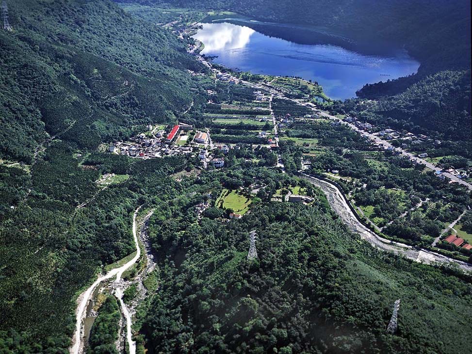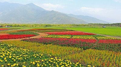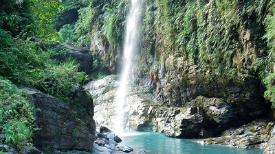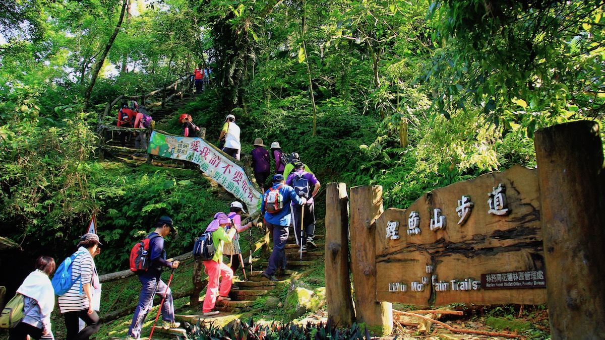
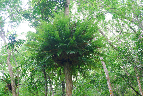
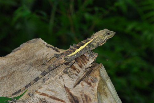
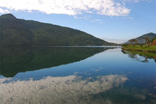
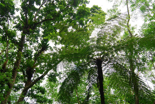
Liyu (carp) Mountain is so called because it looks like a carp lying curled up. The Liyutan Trail System includes several trails respectively for exercise, bird watching, having fun in the wild, mountain hiking, looking at distant views, picnicking and sightseeing. Visitors can make arrangements according to their physical condition and the time they have. Liyu Lake is right by the trail. The mountains and the water connect into an expansive area of green. “Jumping carps in the clear lake” is one of the Eight Attractions in Hualien. Low-altitude broadleaf forests and plantation forests extend along the trails. In spring when the cherry trees blossom and in autumn when the Taiwan golden rain trees flower, the mountain becomes bright with colors. April and May are the firefly season. It is a popular spot in Hualien for Firefly watching.
07/26 Sun.
Open
29°
25° / 33°
花蓮縣 / 壽豐鄉
More
Weather Forecast
|
07.27
Mon.
|
07.28
Tue.
|
07.29
Wed.
|
07.30
Thur.
|
07.31
Fri.
|
08.01
Sat.
|
08.02
Sun.
|
|
|---|---|---|---|---|---|---|---|
| Temperature |
25 ° / 33 °
|
25 ° / 33 °
|
25 ° / 34 °
|
25 ° / 34 °
|
25 ° / 33 °
|
25 ° / 34 °
|
25 ° / 34 °
|
| Feel like | 28 ° / 38 ° | 29 ° / 38 ° | 28 ° / 39 ° | 29 ° / 39 ° | 29 ° / 39 ° | 29 ° / 39 ° | 29 ° / 39 ° |
|
Probability of Precipitation |
30 % | 10 % | 10 % | - | - | - | - |
| Relative Humidity | 82 % | 82 % | 80 % | 83 % | 83 % | 80 % | 81 % |
|
Wind speed Wind direction |
2
SW
|
2
W
|
-
N
|
-
N
|
-
W
|
-
W
|
2
S
|
| UVI |
9
Very High
|
9
Very High
|
9
Very High
|
9
Very High
|
8
Very High
|
10
Very High
|
10
Very High
|
|
Sunrise Sunset |
|
|
|
|
|
|
|
Central Weather Bureau|Update Time:2026/07/26 17:19
Shoufong Township, Hualien County
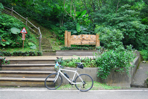
Liyu Shan Trails
Learn about the Trail
Application
Transportation
Driving
Provincial Highway no.9→Provincial Highway no9C→Pass Wen Lan Village, and you can reach the destination soon
By bus
Start from Hualian. Take Hualian buses bound for Shoufeng or Chihnan, and get off at Liyu Lake Stop.
Trail difficulty level
| Hiking Level |
|
|
|
|
|
|
|
||||||||||||||||||||||||||||||||||||||||||
|---|---|---|---|---|---|---|---|---|---|---|---|---|---|---|---|---|---|---|---|---|---|---|---|---|---|---|---|---|---|---|---|---|---|---|---|---|---|---|---|---|---|---|---|---|---|---|---|---|---|
| Target | General Public | General Public | Those who have better physical energy | Beginner mountain climber with good physical energy and map literacy. | Open to those who have good physical strength, map reading skills, and wild survival skills. | Open to well-trained mountain climbers. | Open to well-trained mountain climbers. | ||||||||||||||||||||||||||||||||||||||||||
| Elevation | Gently sloping area | In recreational areas, close to settlements or about 1,000 meters above sea level. | In recreational areas, close to settlements or between 1,000~2,000 meters above sea level. | Remote areas or between 2,000 to 3,000 meters above sea level | Remote areas, wilderness, or between 2,000 to 3,000 meters above sea level | Remote areas, wilderness, or more than 3,000 meters above sea level | Remote areas, wilderness, or more than 3,000 meters above sea level | ||||||||||||||||||||||||||||||||||||||||||
| Required Time | It takes half to one day. | It takes half to one day. | It can be done within one day. | It takes one or more days. | Overnight preparation required. | It takes up to three days. | It takes up to three days. | ||||||||||||||||||||||||||||||||||||||||||
| Equipment | Light backpacking (water and small amount of food) | Light backpacking (water and small amount of food) | Light backpacking (water and proper amount of food) | Overnight preparation required. (e.g. drinking water, food, map, warm clothing, first-aid medicine, etc.) Application for entrance permission in advance is required if there is access control. | Comprehensive Mountaineering Gear Required. (e.g. food, drinking water, cooking utensils, map, warm clothing, flashlight, sleeping bag, tent, etc.) Application for entrance permission in advance is required if there is access control. | Comprehensive Mountaineering Gear Required. (e.g. food, drinking water, cooking utensils, map, warm clothing, flashlight, sleeping bag, tent, etc.) Application for entrance permission in advance is required if there is access control. | Comprehensive Mountaineering Gear Required. (e.g. food, drinking water, cooking utensils, map, warm clothing, flashlight, sleeping bag, tent, etc.) Application for entrance permission in advance is required if there is access control. | ||||||||||||||||||||||||||||||||||||||||||
| Description | Flat hiking trails. Relatively even slopes with comprehensive facilities and smooth road surface. Accessible for handicapped assistive devices or baby strollers. | An open hiking trail with easy access. Relatively even slopes with comprehensive facilities and smooth road surface. It takes half a day or less than one day to complete. | An open hiking trail with easy access. Somewhat steep slope with some difficult sections, but has comprehensive facilities and smooth road surface. It takes less than one day to complete. | A hiking trail locates at remote area or with part of the route is in area which requires entrance permission. Application in advance is required. Part of the route is in relatively bad condition with steeper slopes, but basic facilities are provided. It takes one day or between one to three days to complete. | A hiking trail locates at remote area or with part of the route is in area which requires entrance permission. It’s located in high-altitude areas (higher than 3000 meters above sea level). The trail is relatively primitive, with steeper slopes and unstable weather conditions. Part of the route may be dangerous or difficult for climbers. It takes two to three days to complete. Lead from professionals is recommended. | A hiking trail locates at area with inconvenient traffic, and mostly with routes in area which requires entrance permission. It’s located in high-altitude areas (higher than 3000 meters above sea level). The trail is located at primitive area, with bad condition, steeper slopes, and unstable weather conditions. Many parts of the route may be dangerous or difficult for climbers. It takes three or more days to complete. Lead from professionals is recommended. | 1. Level 3, 4 or 5 trails when snow or ice accumulating 2. Informal trails, without clear subgrades or paths, belong to special routes such as original mountain trails, ancient trail relics, prospecting, or technical climbing. |
Hiking Level
Target
General Public
Elevation
Gently sloping area
Required Time
It takes half to one day.
Equipment
Light backpacking (water and small amount of food)
Description
Flat hiking trails. Relatively even slopes with comprehensive facilities and smooth road surface. Accessible for handicapped assistive devices or baby strollers.
Hiking Level
Target
General Public
Elevation
In recreational areas, close to settlements or about 1,000 meters above sea level.
Required Time
It takes half to one day.
Equipment
Light backpacking (water and small amount of food)
Description
An open hiking trail with easy access. Relatively even slopes with comprehensive facilities and smooth road surface. It takes half a day or less than one day to complete.
Hiking Level
Target
Those who have better physical energy
Elevation
In recreational areas, close to settlements or between 1,000~2,000 meters above sea level.
Required Time
It can be done within one day.
Equipment
Light backpacking (water and proper amount of food)
Description
An open hiking trail with easy access. Somewhat steep slope with some difficult sections, but has comprehensive facilities and smooth road surface. It takes less than one day to complete.
Hiking Level
Target
Beginner mountain climber with good physical energy and map literacy.
Elevation
Remote areas or between 2,000 to 3,000 meters above sea level
Required Time
It takes one or more days.
Equipment
Overnight preparation required. (e.g. drinking water, food, map, warm clothing, first-aid medicine, etc.)
Application for entrance permission in advance is required if there is access control.
Description
A hiking trail locates at remote area or with part of the route is in area which requires entrance permission. Application in advance is required. Part of the route is in relatively bad condition with steeper slopes, but basic facilities are provided. It takes one day or between one to three days to complete.
Hiking Level
Target
Open to those who have good physical strength, map reading skills, and wild survival skills.
Elevation
Remote areas, wilderness, or between 2,000 to 3,000 meters above sea level
Required Time
Overnight preparation required.
Equipment
Comprehensive Mountaineering Gear Required. (e.g. food, drinking water, cooking utensils, map, warm clothing, flashlight, sleeping bag, tent, etc.)
Application for entrance permission in advance is required if there is access control.
Description
A hiking trail locates at remote area or with part of the route is in area which requires entrance permission. It’s located in high-altitude areas (higher than 3000 meters above sea level). The trail is relatively primitive, with steeper slopes and unstable weather conditions. Part of the route may be dangerous or difficult for climbers. It takes two to three days to complete. Lead from professionals is recommended.
Hiking Level
Target
Open to well-trained mountain climbers.
Elevation
Remote areas, wilderness, or more than 3,000 meters above sea level
Required Time
It takes up to three days.
Equipment
Comprehensive Mountaineering Gear Required. (e.g. food, drinking water, cooking utensils, map, warm clothing, flashlight, sleeping bag, tent, etc.)
Application for entrance permission in advance is required if there is access control.
Description
A hiking trail locates at area with inconvenient traffic, and mostly with routes in area which requires entrance permission. It’s located in high-altitude areas (higher than 3000 meters above sea level). The trail is located at primitive area, with bad condition, steeper slopes, and unstable weather conditions. Many parts of the route may be dangerous or difficult for climbers. It takes three or more days to complete. Lead from professionals is recommended.
Hiking Level
Target
Open to well-trained mountain climbers.
Elevation
Remote areas, wilderness, or more than 3,000 meters above sea level
Required Time
It takes up to three days.
Equipment
Comprehensive Mountaineering Gear Required. (e.g. food, drinking water, cooking utensils, map, warm clothing, flashlight, sleeping bag, tent, etc.)
Application for entrance permission in advance is required if there is access control.
Description
1. Level 3, 4 or 5 trails when snow or ice accumulating
2. Informal trails, without clear subgrades or paths, belong to special routes such as original mountain trails, ancient trail relics, prospecting, or technical climbing.
Reachable by Vehicle
O:Cars、Microbus、Coach Bus
Mountain system
Central Mountain Range-Yagan Mountain Sub-range
Administer
Hualien Forest Dist. Office
Elevation
140 ~ 601 m
Service Line
+886 38325141
Altitude Difference
461 m
Huts
-
Length of the Trail
10.04 KM
Entry Permit
No
Trail type
-
Via Nature Reserve
No
Road condition
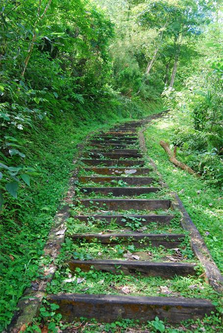
Stairway,Macadam
Geologically Sensitive Area
No
Route planning
Half day - 1 day
Debris Flow Torrents
No
Trail Track
Trail route
Trailhead / Trig
Mobile coverage
Observations (From iNaturalist)
Trailhead / Trig
Mobile coverage
Observations (From iNaturalist)
Reminders
Go with your companions and don't take shortcuts.
To ensure your safety, please go with your companions, follow the indicators, do not take shortcuts or self-directed routes, and do not leave your team and walk alone.
Carry Global Positioning System and communication equipment
For hiking, please plan your trip and bring enough equipment and food with you. It is suggested that you should carry Global Positioning System (GPS) and communication equipment such as a satellite phone, mobile phone, radio or satellite positioning equipment such as Personal Locator Beacon (PLB), etc., and should carry enough batteries to ensure emergency communication.
Quickly pass dangerous areas
The road condition in the mountainous area is unstable. Please do not stay or take pictures in dangerous areas such as collapsed or falling rocks and pay attention to your own safety at any time.
It is recommended to complete the mountaineering insurance
There are certain risks in mountain activities. It is recommended that you should complete mountaineering insurance before departure. (Note: General travel insurance does not necessarily cover mountaineering accidents. Please refer to the policy details before applying for insurance. For the mountaineering insurance, please refer to the following instructions in Financial Supervisory Commission's press release and choose the appropriate insurance.)
Information on mountaineering safety
For information on mountaineering safety, mountaineering equipment, and tips for using maps, please visit the website http://goo.gl/QUnv160u. It is recommended to read the information before the trip to ensure your outdoor activities are safe.
Travel Guide

Travel Guide
Featured Landscape
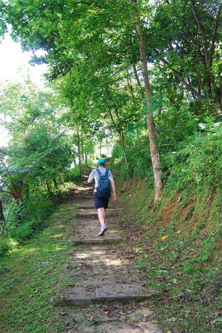
Spring cherry blossoms and autumn maples: four seasons
Source|葉品妤
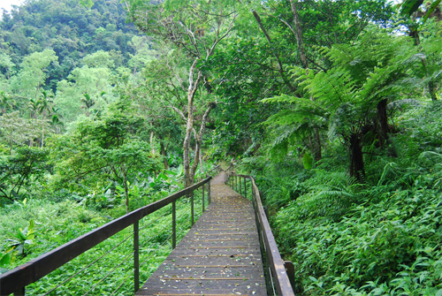
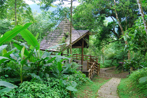
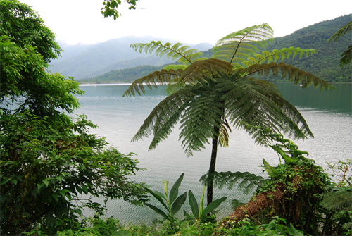
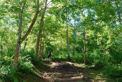
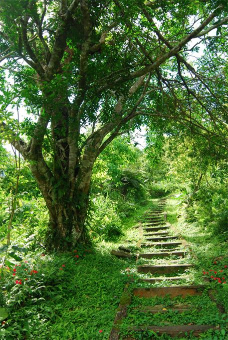
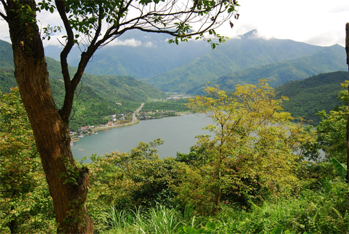
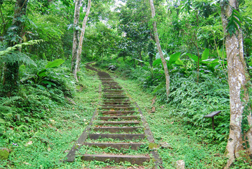
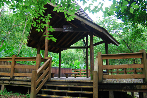
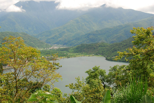
Start from the bird watching trail (main trail) of the forest bathing area and climb for about 200 meters to Yangxin Pavilion. In spring, when the mountain cherry blossoms are in full bloom, the red and green are intertwined like a colorful array; in autumn, the sweetgum turns yellow, creating a unique desolate atmosphere. Continue along the bird-watching trail, passing through the lush forest. After passing the banana grove, the view gradually becomes wider, overlooking the beautiful mountains and waters and the vast blue waters of the Carp Pond.
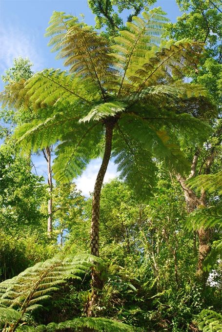
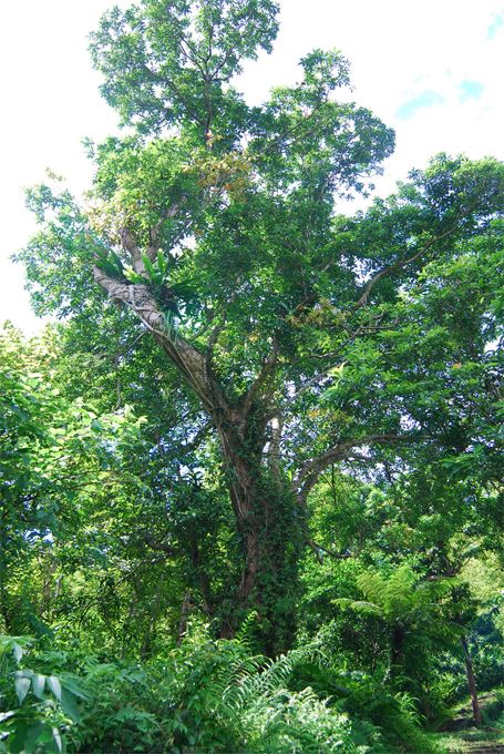
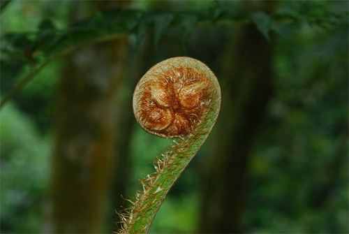
The top of the mountain is rich in natural ecology
Source|葉品妤
The highest point of the trail is a viewing platform at an altitude of 600 meters, which has rich natural ecology and a Xiaobaiyue triangulation point for people to take photos.
Nearby Attractions