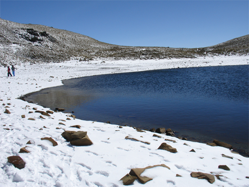
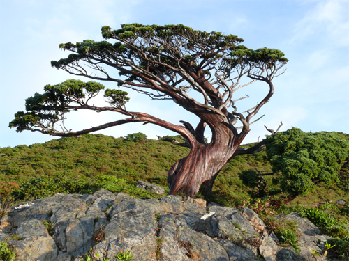
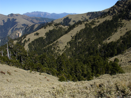
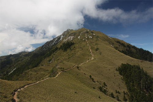
The Jiaminghu National Trail is in the South Second Section of the Central Mountain Range. The trail is clear to see and the high-mountain ecology is rich and changeful. It runs through a Taiwan hemlock forest and a fir forest, high mountains and deep valleys, broken cliffs and collapsed mountain walls and a arrow bamboo grassland and along the ridgeline. The deer in the valleys, one after another mountain peak, snow in winter, silver moon and sky full of stars have long been beautiful sights that attract hikers. The ecology and landscape on Xiangyang Mountain and Sancha Mountain the trail passes by have their own characteristics. Xiangyang Mountain is the southernmost border of the spread of high-mountain ecology in the Central Mountains, and Sancha Mountain is famous for the vast and magnificent high-mountain grassland and the sapphire-like Jiaming Lake. Meanwhile, the bright and colorful blossoms in spring and summer and the snow in winter on the two mountains are beautiful views not to be missed.
06/14 Sun.
Open
27°
22° / 31°
臺東縣 / 海端鄉
More
Weather Forecast
|
06.14
Today
|
06.15
Mon.
|
06.16
Tue.
|
06.17
Wed.
|
06.18
Thur.
|
06.19
Fri.
|
06.20
Sat.
|
|
|---|---|---|---|---|---|---|---|
| Temperature |
22 ° / 31 °
|
22 ° / 26 °
|
22 ° / 29 °
|
22 ° / 31 °
|
22 ° / 32 °
|
22 ° / 32 °
|
21 ° / 33 °
|
| Feel like | 24 ° / 35 ° | 23 ° / 29 ° | 24 ° / 32 ° | 23 ° / 36 ° | 24 ° / 39 ° | 25 ° / 37 ° | 23 ° / 37 ° |
|
Probability of Precipitation |
30 % | 60 % | 80 % | - | - | - | - |
| Relative Humidity | 90 % | 92 % | 91 % | 89 % | 85 % | 84 % | 78 % |
|
Wind speed Wind direction |
2
E
|
3
E
|
2
W
|
2
SW
|
2
NW
|
2
NW
|
2
NE
|
| UVI |
8
Very High
|
5
Moderate
|
8
Very High
|
9
Very High
|
9
Very High
|
9
Very High
|
9
Very High
|
|
Sunrise Sunset |
|
|
|
|
|
|
|
Central Weather Bureau|Update Time:2026/06/14 04:46
Haiduan Township, Taitung County
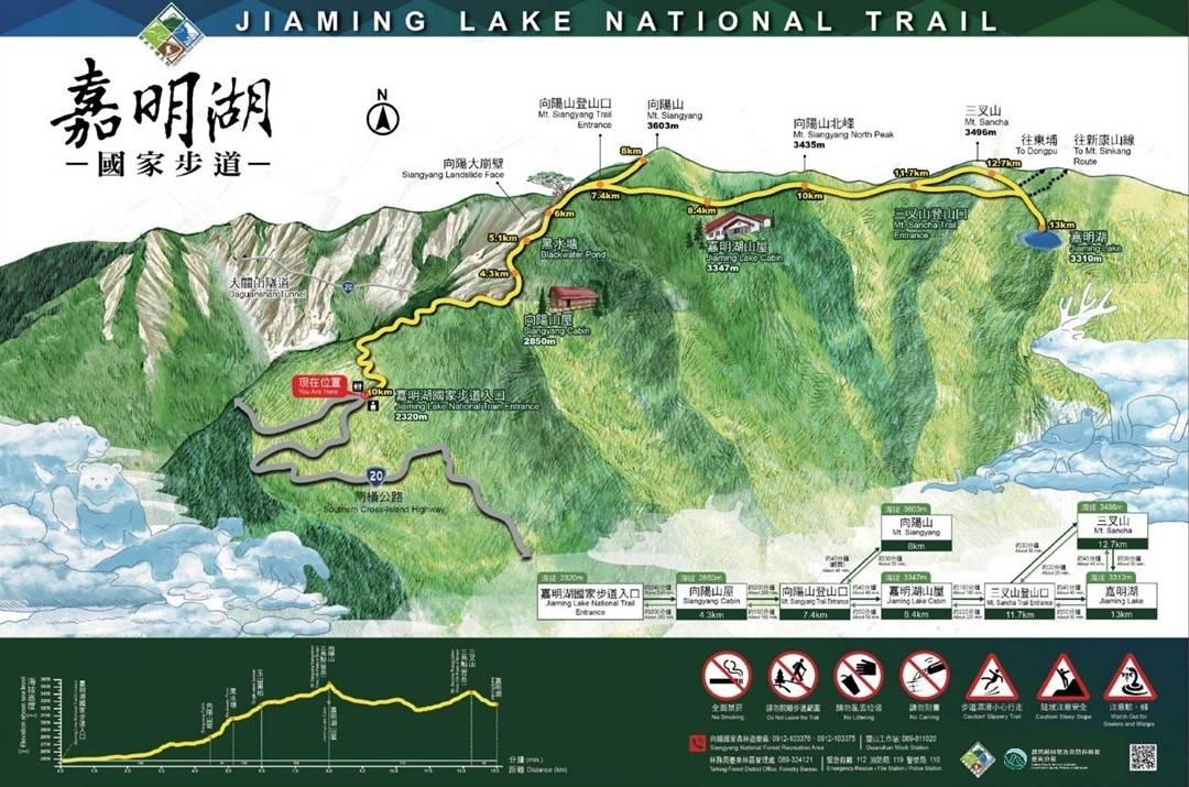
Lake Jiaming National Trail
Learn about the Trail
Application
Transportation
Eastern route
Take Provincial Highway no.9 toward Chishang Town→Turn to Provincial Highway no.20A, and go for 5 kilometers→Turn right to Provincial highway no.20 to Southern cross-island Highway→head to Xiangyang National Forest Recreation Area at 154.5kilometers→entrance of Chiaming Lake national hiking trail
Western route
Start from Guan Tian system of Provincial Highway no.3→transfer to Expressway no. 84→to Yujing and take shared line of Provincial Highway no.3 and Provincial Highway no. 20→head toward Bei Liao and Nanhua, passing through Jiashiang, baolai, Tianchih, and Yakou→Xaingyang National Forest Recreational Area (The Yakou section is closed, so the west route is not open for now. )
None.
None.
Trail difficulty level
| Hiking Level |
|
|
|
|
|
|
|
||||||||||||||||||||||||||||||||||||||||||
|---|---|---|---|---|---|---|---|---|---|---|---|---|---|---|---|---|---|---|---|---|---|---|---|---|---|---|---|---|---|---|---|---|---|---|---|---|---|---|---|---|---|---|---|---|---|---|---|---|---|
| Target | General Public | General Public | Those who have better physical energy | Beginner mountain climber with good physical energy and map literacy. | Open to those who have good physical strength, map reading skills, and wild survival skills. | Open to well-trained mountain climbers. | Open to well-trained mountain climbers. | ||||||||||||||||||||||||||||||||||||||||||
| Elevation | Gently sloping area | In recreational areas, close to settlements or about 1,000 meters above sea level. | In recreational areas, close to settlements or between 1,000~2,000 meters above sea level. | Remote areas or between 2,000 to 3,000 meters above sea level | Remote areas, wilderness, or between 2,000 to 3,000 meters above sea level | Remote areas, wilderness, or more than 3,000 meters above sea level | Remote areas, wilderness, or more than 3,000 meters above sea level | ||||||||||||||||||||||||||||||||||||||||||
| Required Time | It takes half to one day. | It takes half to one day. | It can be done within one day. | It takes one or more days. | Overnight preparation required. | It takes up to three days. | It takes up to three days. | ||||||||||||||||||||||||||||||||||||||||||
| Equipment | Light backpacking (water and small amount of food) | Light backpacking (water and small amount of food) | Light backpacking (water and proper amount of food) | Overnight preparation required. (e.g. drinking water, food, map, warm clothing, first-aid medicine, etc.) Application for entrance permission in advance is required if there is access control. | Comprehensive Mountaineering Gear Required. (e.g. food, drinking water, cooking utensils, map, warm clothing, flashlight, sleeping bag, tent, etc.) Application for entrance permission in advance is required if there is access control. | Comprehensive Mountaineering Gear Required. (e.g. food, drinking water, cooking utensils, map, warm clothing, flashlight, sleeping bag, tent, etc.) Application for entrance permission in advance is required if there is access control. | Comprehensive Mountaineering Gear Required. (e.g. food, drinking water, cooking utensils, map, warm clothing, flashlight, sleeping bag, tent, etc.) Application for entrance permission in advance is required if there is access control. | ||||||||||||||||||||||||||||||||||||||||||
| Description | Flat hiking trails. Relatively even slopes with comprehensive facilities and smooth road surface. Accessible for handicapped assistive devices or baby strollers. | An open hiking trail with easy access. Relatively even slopes with comprehensive facilities and smooth road surface. It takes half a day or less than one day to complete. | An open hiking trail with easy access. Somewhat steep slope with some difficult sections, but has comprehensive facilities and smooth road surface. It takes less than one day to complete. | A hiking trail locates at remote area or with part of the route is in area which requires entrance permission. Application in advance is required. Part of the route is in relatively bad condition with steeper slopes, but basic facilities are provided. It takes one day or between one to three days to complete. | A hiking trail locates at remote area or with part of the route is in area which requires entrance permission. It’s located in high-altitude areas (higher than 3000 meters above sea level). The trail is relatively primitive, with steeper slopes and unstable weather conditions. Part of the route may be dangerous or difficult for climbers. It takes two to three days to complete. Lead from professionals is recommended. | A hiking trail locates at area with inconvenient traffic, and mostly with routes in area which requires entrance permission. It’s located in high-altitude areas (higher than 3000 meters above sea level). The trail is located at primitive area, with bad condition, steeper slopes, and unstable weather conditions. Many parts of the route may be dangerous or difficult for climbers. It takes three or more days to complete. Lead from professionals is recommended. | 1. Level 3, 4 or 5 trails when snow or ice accumulating 2. Informal trails, without clear subgrades or paths, belong to special routes such as original mountain trails, ancient trail relics, prospecting, or technical climbing. |
Hiking Level
Target
General Public
Elevation
Gently sloping area
Required Time
It takes half to one day.
Equipment
Light backpacking (water and small amount of food)
Description
Flat hiking trails. Relatively even slopes with comprehensive facilities and smooth road surface. Accessible for handicapped assistive devices or baby strollers.
Hiking Level
Target
General Public
Elevation
In recreational areas, close to settlements or about 1,000 meters above sea level.
Required Time
It takes half to one day.
Equipment
Light backpacking (water and small amount of food)
Description
An open hiking trail with easy access. Relatively even slopes with comprehensive facilities and smooth road surface. It takes half a day or less than one day to complete.
Hiking Level
Target
Those who have better physical energy
Elevation
In recreational areas, close to settlements or between 1,000~2,000 meters above sea level.
Required Time
It can be done within one day.
Equipment
Light backpacking (water and proper amount of food)
Description
An open hiking trail with easy access. Somewhat steep slope with some difficult sections, but has comprehensive facilities and smooth road surface. It takes less than one day to complete.
Hiking Level
Target
Beginner mountain climber with good physical energy and map literacy.
Elevation
Remote areas or between 2,000 to 3,000 meters above sea level
Required Time
It takes one or more days.
Equipment
Overnight preparation required. (e.g. drinking water, food, map, warm clothing, first-aid medicine, etc.)
Application for entrance permission in advance is required if there is access control.
Description
A hiking trail locates at remote area or with part of the route is in area which requires entrance permission. Application in advance is required. Part of the route is in relatively bad condition with steeper slopes, but basic facilities are provided. It takes one day or between one to three days to complete.
Hiking Level
Target
Open to those who have good physical strength, map reading skills, and wild survival skills.
Elevation
Remote areas, wilderness, or between 2,000 to 3,000 meters above sea level
Required Time
Overnight preparation required.
Equipment
Comprehensive Mountaineering Gear Required. (e.g. food, drinking water, cooking utensils, map, warm clothing, flashlight, sleeping bag, tent, etc.)
Application for entrance permission in advance is required if there is access control.
Description
A hiking trail locates at remote area or with part of the route is in area which requires entrance permission. It’s located in high-altitude areas (higher than 3000 meters above sea level). The trail is relatively primitive, with steeper slopes and unstable weather conditions. Part of the route may be dangerous or difficult for climbers. It takes two to three days to complete. Lead from professionals is recommended.
Hiking Level
Target
Open to well-trained mountain climbers.
Elevation
Remote areas, wilderness, or more than 3,000 meters above sea level
Required Time
It takes up to three days.
Equipment
Comprehensive Mountaineering Gear Required. (e.g. food, drinking water, cooking utensils, map, warm clothing, flashlight, sleeping bag, tent, etc.)
Application for entrance permission in advance is required if there is access control.
Description
A hiking trail locates at area with inconvenient traffic, and mostly with routes in area which requires entrance permission. It’s located in high-altitude areas (higher than 3000 meters above sea level). The trail is located at primitive area, with bad condition, steeper slopes, and unstable weather conditions. Many parts of the route may be dangerous or difficult for climbers. It takes three or more days to complete. Lead from professionals is recommended.
Hiking Level
Target
Open to well-trained mountain climbers.
Elevation
Remote areas, wilderness, or more than 3,000 meters above sea level
Required Time
It takes up to three days.
Equipment
Comprehensive Mountaineering Gear Required. (e.g. food, drinking water, cooking utensils, map, warm clothing, flashlight, sleeping bag, tent, etc.)
Application for entrance permission in advance is required if there is access control.
Description
1. Level 3, 4 or 5 trails when snow or ice accumulating
2. Informal trails, without clear subgrades or paths, belong to special routes such as original mountain trails, ancient trail relics, prospecting, or technical climbing.
Reachable by Vehicle
O:Cars、Microbus , X:Coach Bus
Mountain system
Siangyang Mountain, Sancha Mountain
Administer
Taitung Forest Dist. Office
Elevation
2,327 ~ 3,603 m
Service Line
+886 893241214
Altitude Difference
1,276 m
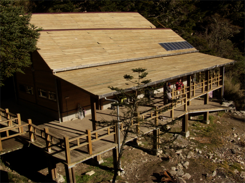
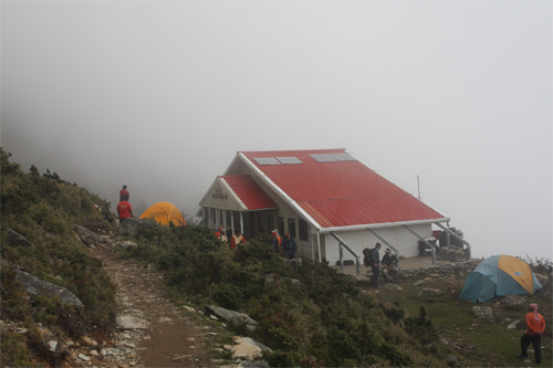
Huts
-
Length of the Trail
13 KM
Entry Permit
是
,
Entry Permit
Trail type
Linear two-way
Via Nature Reserve
No
Service Line
Soil trail,Grassy slope,Macadam road
Geologically Sensitive Area
Yes
Route planning
Over a day
Debris Flow Torrents
No
Trail Track
Trail route
Trailhead / Trig
Mobile coverage
Observations (From iNaturalist)
Trailhead / Trig
Mobile coverage
Observations (From iNaturalist)
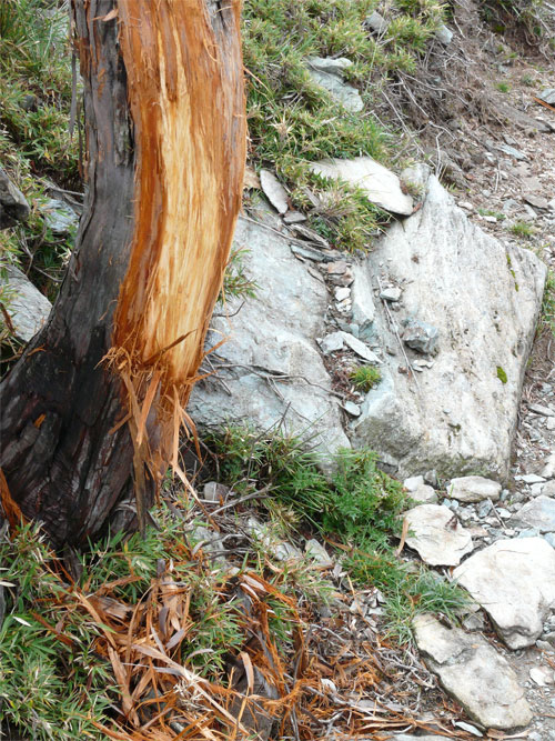
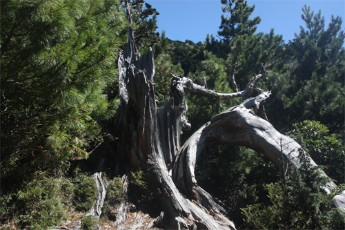
Day 1: Xiangyang National Forest Recreation Area → (2.7K, 70 minutes) → Forest Road 2.7K Trailhead → (1.6K, 60 minutes) → Xiangyang Mountain House → (1.6K, 100 minutes) → Xiangyang Famous Trees → (1.5K, 80 minutes) → Xiangyang Mountain West Trailhead → (1.0K, 40 minutes) → Jiaming Lake Refuge Hut
Day 2: Jiaming Lake Refuge Hut → (3.3K, 90 minutes) → Sancha Mountain Trailhead → (1.3K, 35 minutes) → Jiaming Lake → (4.6K, 180 minutes) → Jiaming Lake Refuge Hut → (4.1K, 150 minutes) → Xiangyang Mountain House
Day 3: Xiangyang Mountain House → (4.3K, 100 minutes) → Xiangyang National Forest Recreation Area
Reminders
Go with your companions and don't take shortcuts.
To ensure your safety, please go with your companions, follow the indicators, do not take shortcuts or self-directed routes, and do not leave your team and walk alone.
Carry Global Positioning System and communication equipment
For hiking, please plan your trip and bring enough equipment and food with you. It is suggested that you should carry Global Positioning System (GPS) and communication equipment such as a satellite phone, mobile phone, radio or satellite positioning equipment such as Personal Locator Beacon (PLB), etc., and should carry enough batteries to ensure emergency communication.
Quickly pass dangerous areas
The road condition in the mountainous area is unstable. Please do not stay or take pictures in dangerous areas such as collapsed or falling rocks and pay attention to your own safety at any time.
It is recommended to complete the mountaineering insurance
There are certain risks in mountain activities. It is recommended that you should complete mountaineering insurance before departure. (Note: General travel insurance does not necessarily cover mountaineering accidents. Please refer to the policy details before applying for insurance. For the mountaineering insurance, please refer to the following instructions in Financial Supervisory Commission's press release and choose the appropriate insurance.)
Information on mountaineering safety
For information on mountaineering safety, mountaineering equipment, and tips for using maps, please visit the website http://goo.gl/QUnv143u. It is recommended to read the information before the trip to ensure your outdoor activities are safe.
申請入山管制說明
事前辦妥入山證和備妥登山裝備及口糧,並規劃2~3天行程,若有任何疑問可電洽台東林區管理處育樂課:089-345493。
大型遊覽車不可進入
(測試資料)大雪山林道目前實施車輛管制,僅開放乙類大客車以下車輛通行。
申請自然保護(留)區說明
(測試資料)請先至林務局自然保留區暨自然保護區進入申請系統申請
Travel Guide

Travel Guide
Featured Landscape
The majestic peaks and steep cliffs - Xiangyang Collapse Cliff
Source|臺東分署
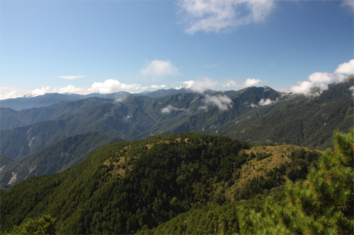
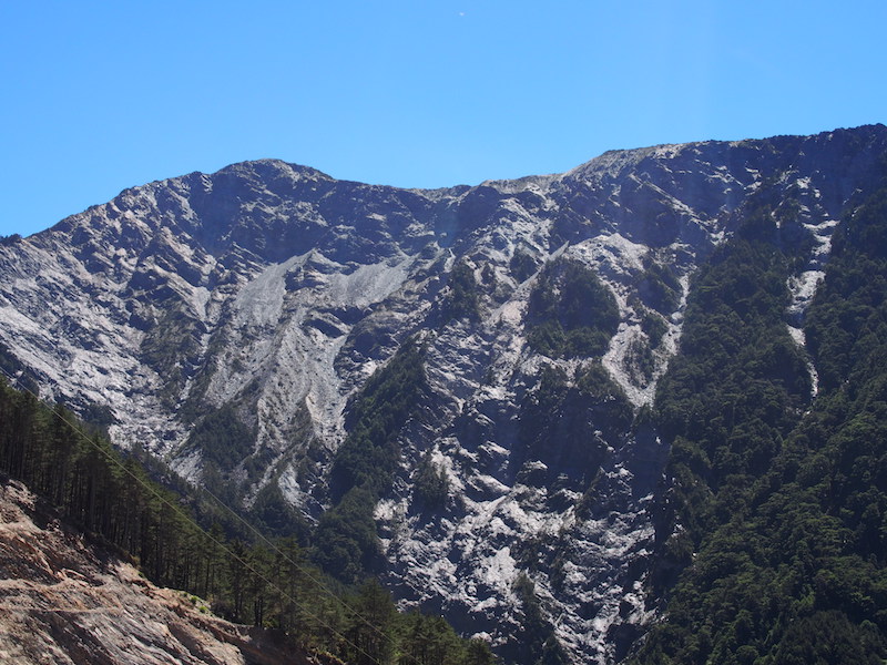
Due to geological reasons, natural phenomena such as mountain wall collapse often occur in the southern section of the Central Mountain Range. A ridge starting from the Xiangyang Collapse Cliff in the north appears and disappears like a giant dragon, rising and falling, raising its head and wagging its tail as it rushes towards Guanshan, the first peak of the Nantai Mountain! Especially the sharp and broken ridges between Guanshan and Yingzaizui Mountain, and the steep slope that rushes down to the Xinwulu River, are so breathtaking and fascinating! This is the most dangerous ridge on the main ridge of the southern section of the Central Mountain Range, the famous "Guanshan Cliff".
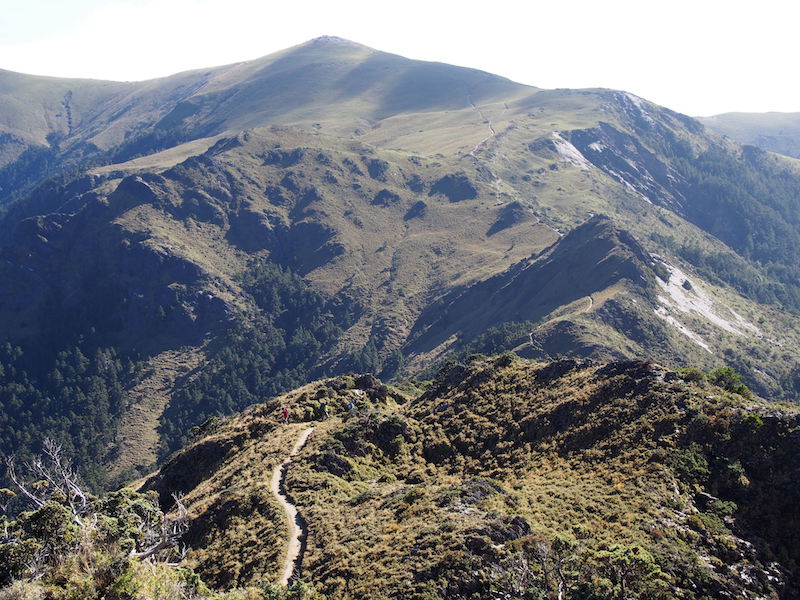
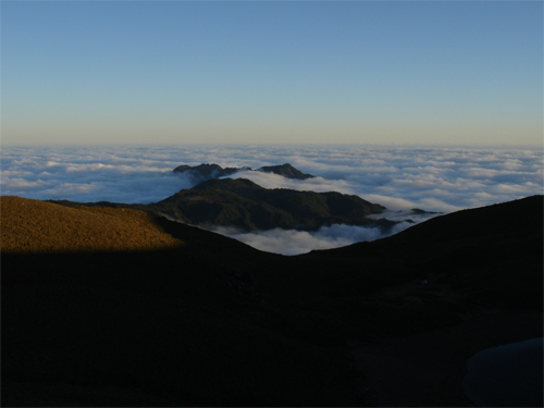
Magnificent and continuous alpine grassland-Sancha Mountain
Source|臺東分署
Sancha Mountain is 3,496 meters high and is also known as "Xiayun Sand Mountain". It is one of the ten highest mountains in Taiwan. The highest point is the vast and continuous Arrow Bamboo Grassland, which is lush and green and undulating like waves. It is known as the "Taiwan Pamir" in the mountaineering community. It is also the best paradise for wild sambar deer. There is a first-class triangulation point on the top of the mountain, with an excellent view. You can see the famous mountains such as Xiuguluan Mountain, Xinkang Mountain, Yunfeng Mountain, Xiangyang Mountain, and Yushan Peaks in the distance.
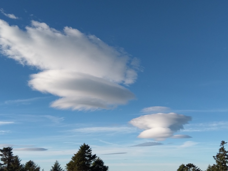
A variety of high-altitude clouds
Source|臺東分署
Lenticular clouds usually appear in mountainous areas at an altitude of about 2,000 to 5,000 meters. They are formed because the air is forced to rise to the condensation layer due to the influence of high mountains and other terrain. The weather pattern of this type of cloud is related to light rain and strong winds. Due to moderate turbulence near the clouds, there may be some flight risks.
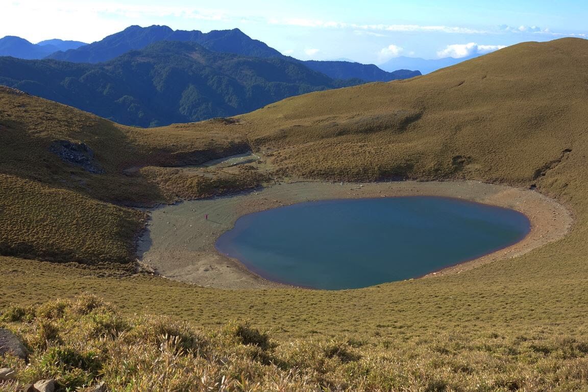
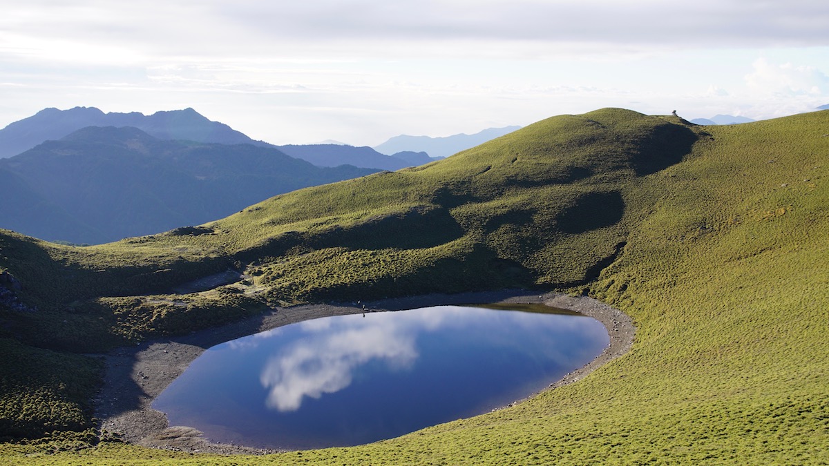
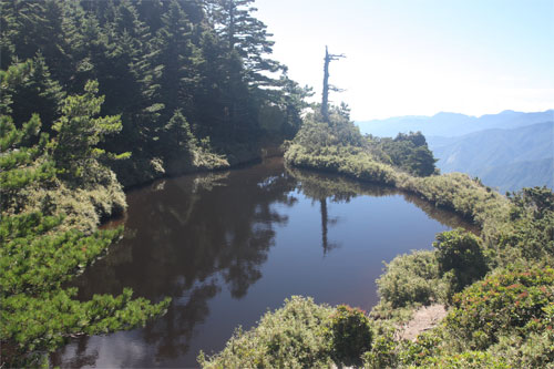
A apphire inlaid on green velvet - Jiaming Lake
Source|臺東分署
Jiaming Lake is located on the grassland on the southeast side of Sancha Mountain, with an altitude of about 3,310 meters. It is the second highest alpine lake in Taiwan after Xueshan Cuichi. It is called the "Egg Pond" because of its oval shape. Because the water is clear and blue against the sky, it is called "Angel's Tears" by climbers. Although there is no mountain stream or creek to feed the lake, the water is abundant all year round; on sunny days, the lake surface is shimmering, like a sapphire inlaid on the green grassland, exuding a quiet beauty.
Look closely at Yunfeng and overlook the Yushan peaks
Source|臺東分署
The Yushan peaks include the Yushan Main Peak, Front Peak, West Peak, North Peak, East Peak, Beibei Peak, South Peak, Lushan, East Xiaonan Mountain, Xiaonan Mountain, and South Yushan. They are arranged in a double cross shape with the Yushan Main Peak as the center. Except for Beibei Peak and Xiaonan Mountain, the rest are all famous mountains. Not only are they coveted by climbers, but the Yushan Main Peak is also a popular climbing route at home and abroad.

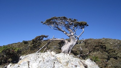
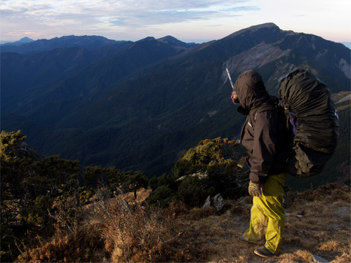
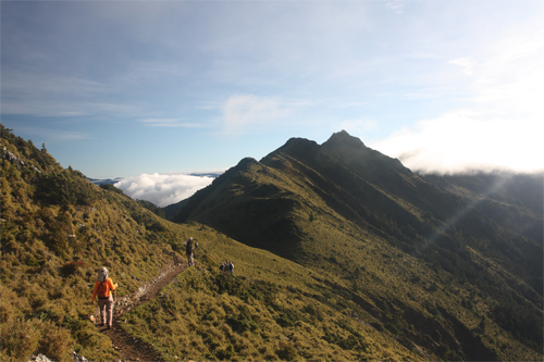
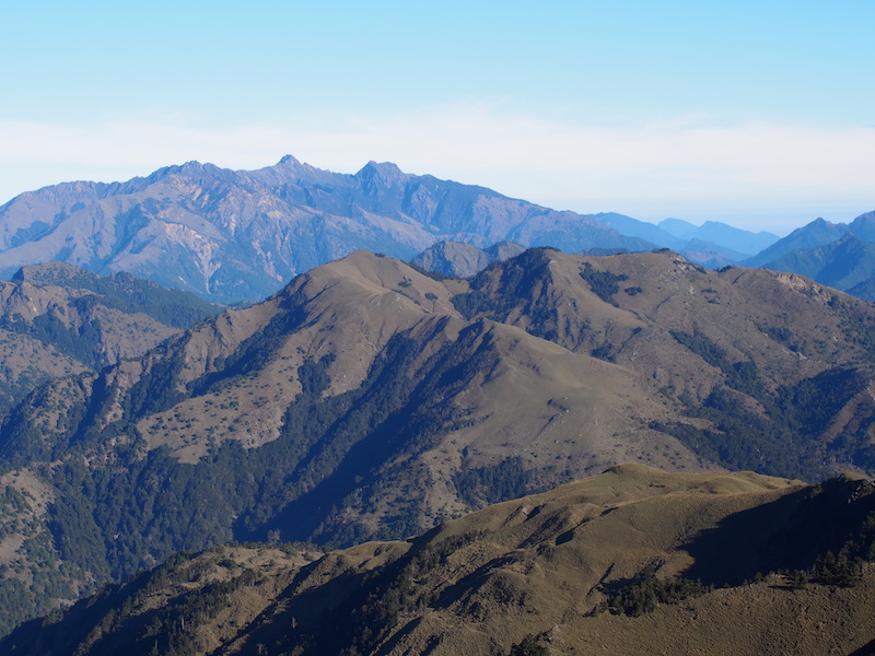
The second highest peak in Taitung County - Xiangyang Mountain
Source|臺東分署
Xiangyang Mountain, formerly known as Hongye Mountain, is a famous mountain in Taiwan and one of the 100 Great Mountains in Taiwan, ranking 17th. Xiangyang Mountain is 3,602 meters above sea level and belongs to the Central Mountain Range, one of the five major mountain ranges in Taiwan. It is administratively located in Kaohsiung City and Taitung County.
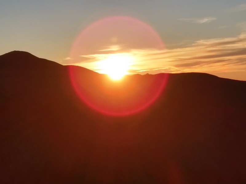
Beautiful mountain sunrise
Source|臺東分署
The sunrise is like a torch that replaces the darkness of the night. The sunlight shines on the earth, and the biting cold wind suddenly becomes warm. The sky gradually turns blue, and the sunrise in the mountains is picturesque, showing the beauty of the morning light in the mountains and also foreshadowing sunny weather for the day.
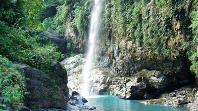
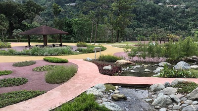
Nearby Attractions