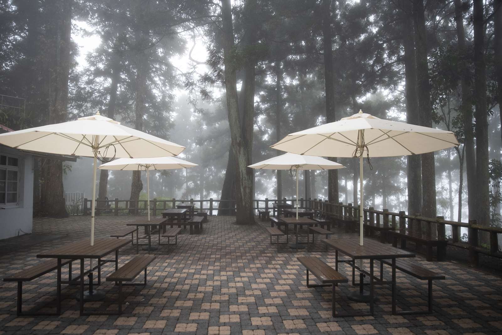


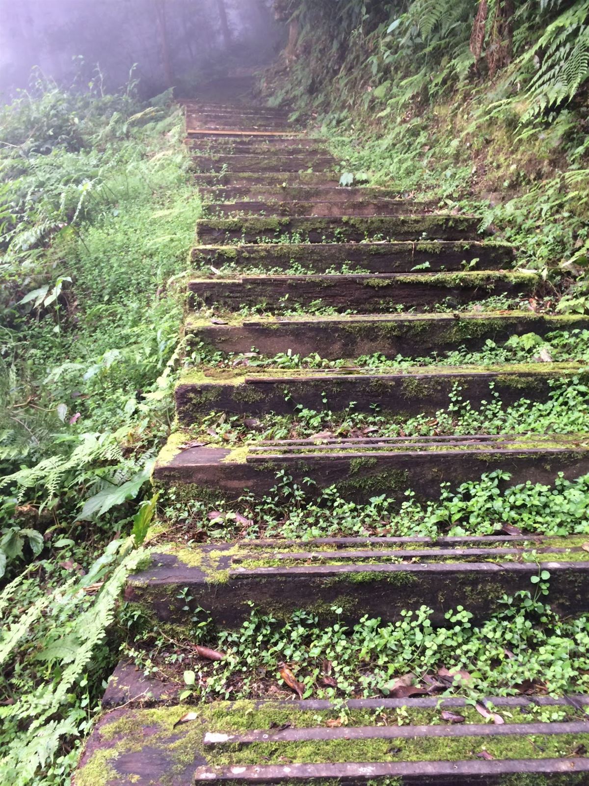
Nicknamed “Little Xitou”, Tengjhih (Vine Branch) National Forest Recreation Area, with its large field of forest-plantation and the title of “Pine Billow”, is the best destination for residents of Kaohsiung to enjoy a forest bath, escape the summer heat, and appreciate the ecology.
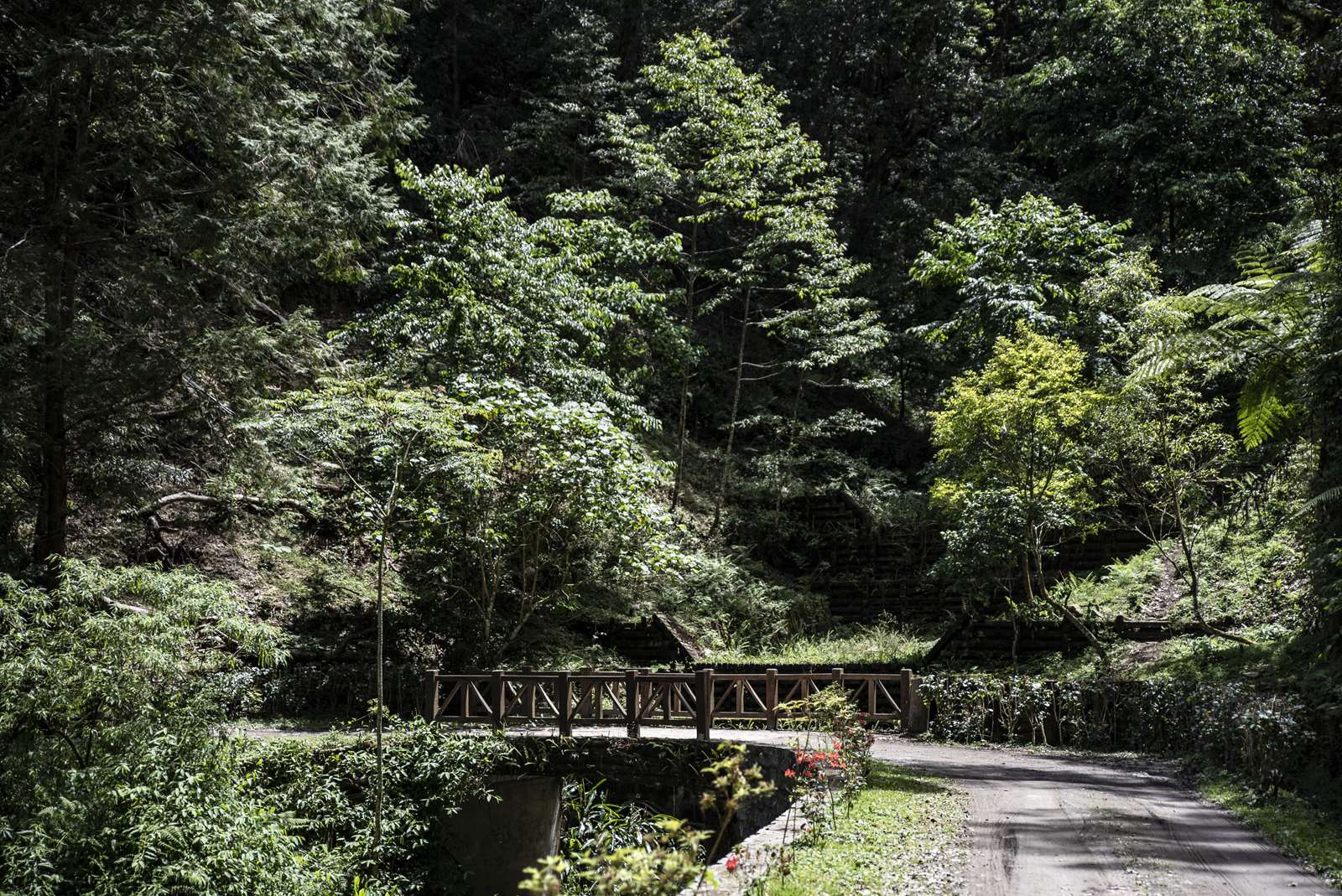
Approximately a 2-hour drive from Kaohsiung City, Tengjhih used to be a habitat of the Bunun Tribe. Back in the Japanese Colonial Period, an experimental forest for Kyoto University, Japan, was established here. Hence, there is a forest-plantation of Hinoki Falsecypress, which is rarely seen in Taiwan. As vital paths, such as the famous Liugui Security Path and Neibenlu Cross Mountain Trail pass through here, historical ruins can be found here and there.
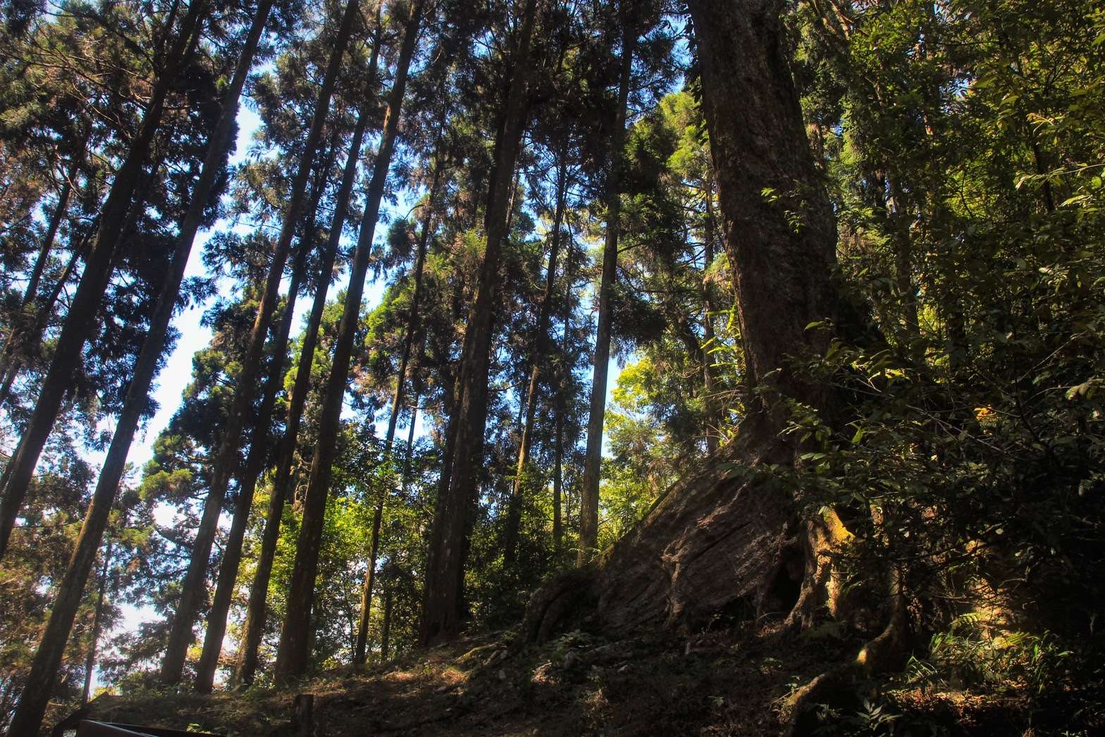
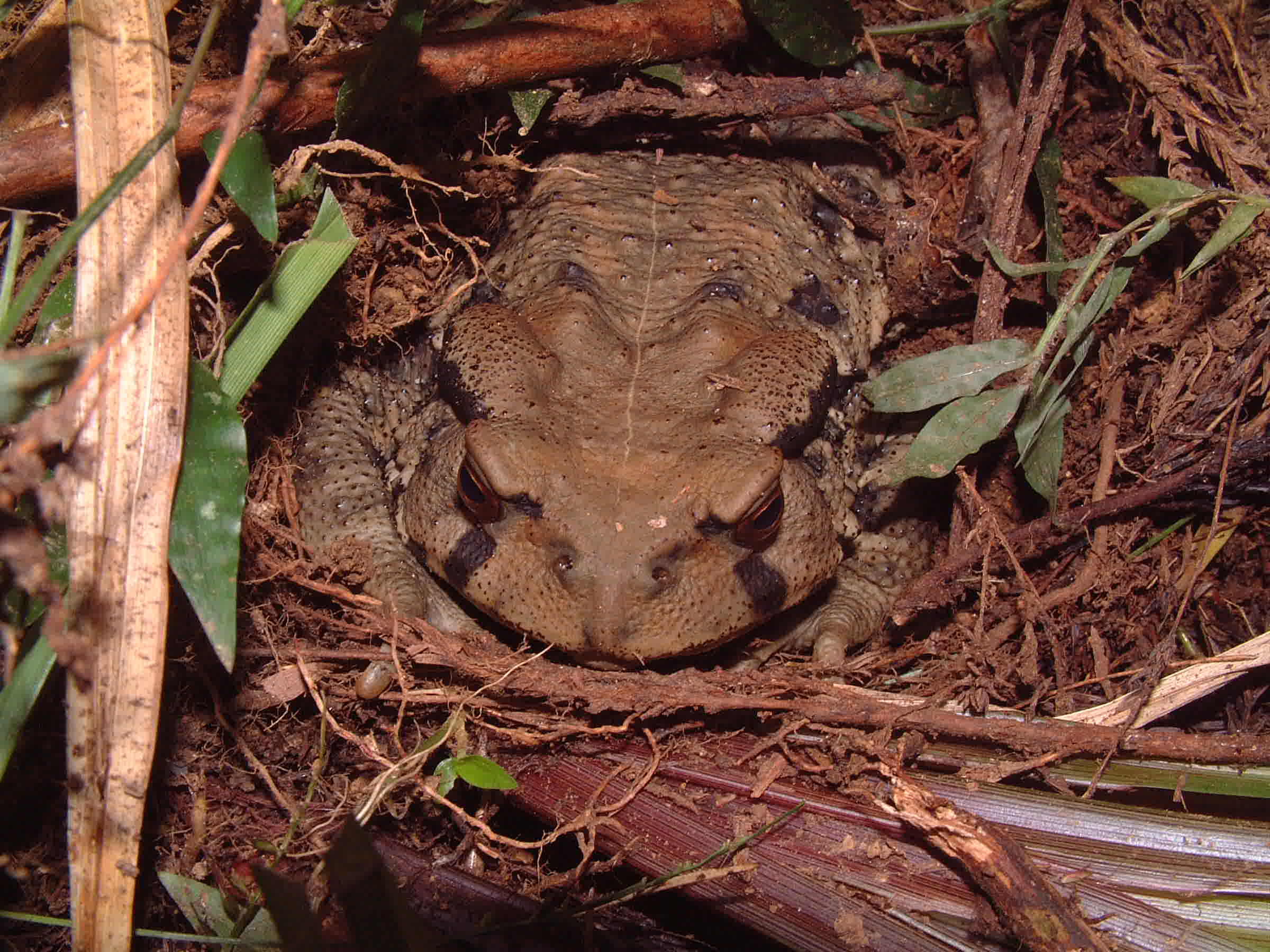
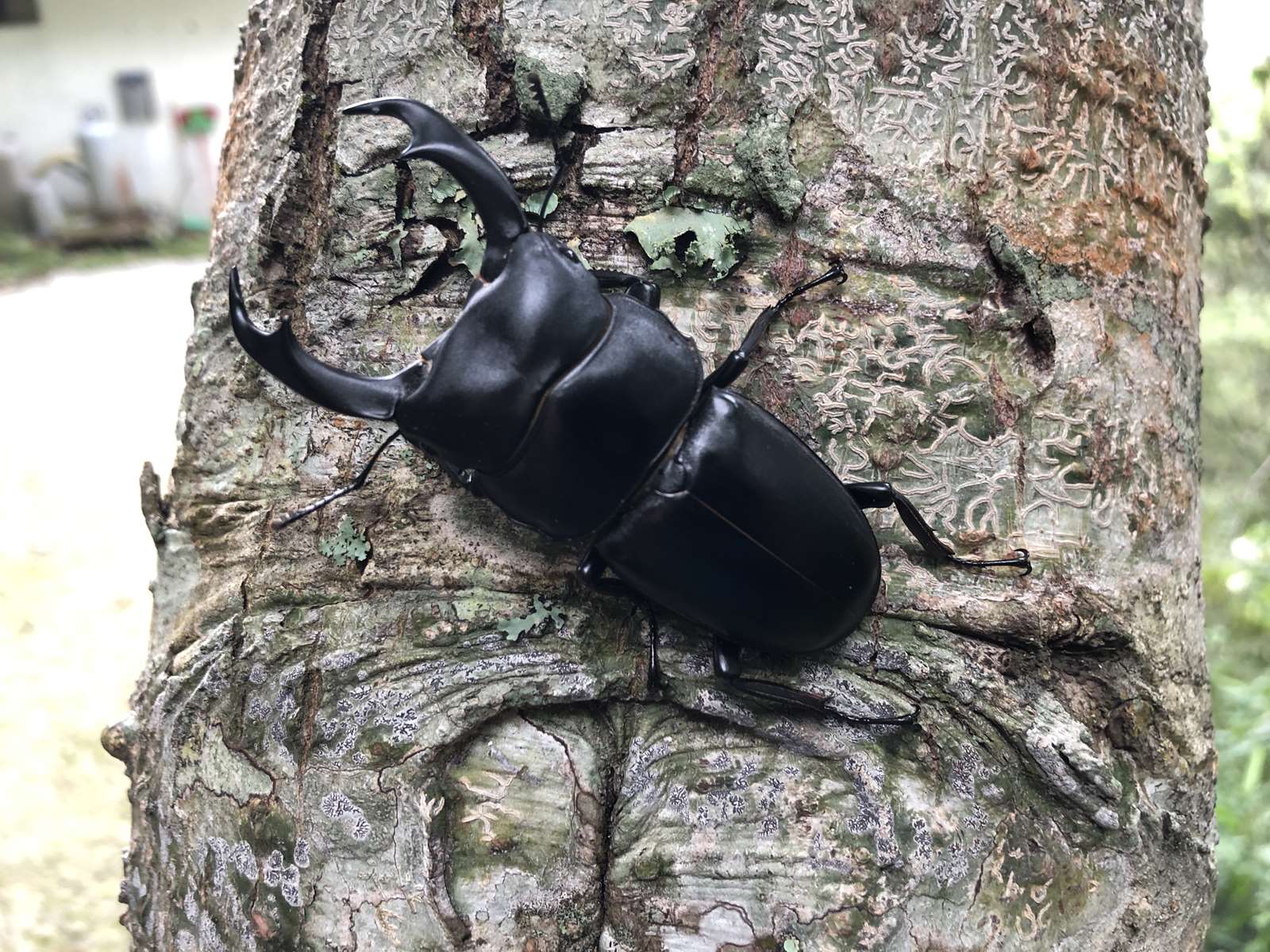
The Recreation Area is situated at an elevation between 1,500 to 1,840 meters with a pleasant, cool climate. The tropical alpine broad-leaved mist forest there became a home to big tree species like Stout Camphor Tree and Chinese Guger-tree. In addition, there is the precious species, “Tengjhih Begonia”, which is named after the place, in addition to numerous rare ferns. The rich ecosystem also nurtures many uncommon insects, such as Nigidius lewisi, Caligula thibeta okurai, and Formotosema siebohmi (Distant). Tengjhih is among the locations where Yellow Tits are spotted the most; this is truly an excellent destination for hiking and bird-watching!
Approximately a 2-hour drive from Kaohsiung City, Tengjhih used to be a habitat of the Bunun Tribe. Back in the Japanese Colonial Period, an experimental forest for Kyoto University, Japan, was established here. Hence, there is a forest-plantation of Hinoki Falsecypress, which is rarely seen in Taiwan. As vital paths, such as the famous Liugui Security Path and Neibenlu Cross Mountain Trail pass through here, historical ruins can be found here and there.
The Recreation Area is situated at an elevation between 1,500 to 1,840 meters with a pleasant, cool climate. The tropical alpine broad-leaved mist forest there became a home to big tree species like Stout Camphor Tree and Chinese Guger-tree. In addition, there is the precious species, “Tengjhih Begonia”, which is named after the place, in addition to numerous rare ferns. The rich ecosystem also nurtures many uncommon insects, such as Nigidius lewisi, Caligula thibeta okurai, and Formotosema siebohmi (Distant). Tengjhih is among the locations where Yellow Tits are spotted the most; this is truly an excellent destination for hiking and bird-watching!
06/27 Sat.
Closed
20°
18° / 22°
More
Weather Forecast
|
06.27
Today
|
06.28
Sun.
|
06.29
Mon.
|
06.30
Tue.
|
07.01
Wed.
|
07.02
Thur.
|
07.03
Fri.
|
|
|---|---|---|---|---|---|---|---|
| Temperature |
18 ° / 22 °
|
18 ° / 24 °
|
18 ° / 25 °
|
18 ° / 26 °
|
18 ° / 26 °
|
18 ° / 26 °
|
18 ° / 27 °
|
| Feel like | 19 ° / 25 ° | 19 ° / 25 ° | 20 ° / 28 ° | 19 ° / 29 ° | 19 ° / 29 ° | 19 ° / 29 ° | 19 ° / 30 ° |
|
Probability of Precipitation |
100 % | 70 % | 50 % | - | - | - | - |
| Relative Humidity | 97 % | 91 % | 94 % | 92 % | 89 % | 88 % | 91 % |
|
Wind speed Wind direction |
2
E
|
2
E
|
2
E
|
2
E
|
2
E
|
-
E
|
2
E
|
| UVI |
8
Very High
|
9
Very High
|
10
Very High
|
11
危險級
|
11
危險級
|
11
危險級
|
11
危險級
|
|
Sunrise Sunset |
|
|
|
|
|
|
|
Central Weather Bureau|Update Time:2026/06/27 05:27
Taoyuan Dist., Kaohsiung City
Tengjhih National Forest Recreation Area
Admission Fees
Park Ticket
| Ticket Type | Price (NT$) | Description |
|---|---|---|
|
Ticket Type
Full fare Ticket(Holiday)
|
Price (NT$)
120
|
Description
Adult
|
|
Ticket Type
Standard Discount Ticket
|
Price (NT$)
80
|
Description
1. Visitors entering the park on non-holidays.
2. Those who are riding on public transportation and hold a ticket stub. 3. Purchase of 20 or more full tickets. |
|
Ticket Type
Half fare Ticket
|
Price (NT$)
60
|
Description
1. Military or police personnel holding certificates.
2. Students (with student ID) and children aged 7-12 can enjoy half-price ticket discount. 3. Those who receive compensation due to official duties and hold a certificate. 4. Citizens of the county (city) where the amusement park is located, who hold certification documents. |
|
Ticket Type
Discount Ticket
|
Price (NT$)
10
|
Description
1. Persons aged 65 or above who hold a certificate of certification.
2. Children aged 3-6 can enjoy a NT$10 discount. 3. Outdoor teaching for primary school students other than on holidays, organized by the school, led by teachers and with an official letter. |
|
Ticket Type
No Charge Required
|
Price (NT$)
0
|
Description
1. Residents registered in the amusement park are exempt from the purchase of tickets by presenting their national ID cards. Children who do not have national ID cards and those who have resided but have not registered are exempt from the purchase of tickets by presenting relevant supporting documents.
2. Civil servants on business trips to the amusement park, with travel documents such as business trip receipts. 3. Representatives of the people at all levels, volunteer police, volunteer firefighters, and civil defense personnel who have business needs and need to enter the amusement area and have credentials. 4. Villagers living near the forest recreation area who pass through the area for forestry and agricultural work are exempt from purchasing tickets by presenting their ID cards. 5. Volunteers holding a "Volunteer Service Honor Card" can enter the park free of charge. 6. Persons with easily identifiable physical or mental disabilities or holding physical or mental disability certificates and their guardians or one necessary companion may enter the forest recreation area free of charge. 7. Children aged 0-2 are free of charge (must be accompanied by adult with ticket). 8. Personnel from outside the zone who have business needs in the park, such as agencies (institutions), public utilities or groups within the zone, and hold supporting documents. 9. Indigenous people registered in the administrative area (township, city, district) of a national forest recreation area may enter the local national forest recreation area free of charge by presenting relevant documents proving their indigenous identity. |
Travel Information
Opening Hours
Closed.
Opening Hours
Closed.
Transportation
Map
Tengjhih National Forest Recreation Area
No. 150, Baoshan Lane, Baoshan Village, Taoyuan District, Kaohsiung City Google Map
No. 150, Baoshan Lane, Baoshan Village, Taoyuan District, Kaohsiung City Google Map
By car
The Tengjhih Access Road leads to the entrance of the recreation area, Tengjhih National Forest Recreation Area (Access Road 19K), and the parking spaces along the route are 14.5K Second Group Parking Space (public parking lot), 16.5K Sakura Park Parking Space (public parking lot), and the entrance of the recreation area (only private parking space, cleaning fee is charged). Transfer to the paid shuttle service and enjoy a 50% discount on tickets by presenting your same-day ticket stub for the Strategic Alliance shuttle bus.
No direct public transportation to the park
If you need to take a paid shuttle bus, please contact:
1. Gold Medal Welfare Co., Ltd., Tel: 07-9763620, providing shuttle and package services.
2. Baoshan Community Development Association, Taoyuan District, Kaohsiung City, Tel: 0965-166-969, 0982-911-657, provides shuttle service.
Note: Recommended by the Kaohsiung City Government Transportation Bureau, Liugui District Office, and Taoyuan District Office.
Park Information
| No. | Park Information |
|---|---|
| 1. | Do not hunt or harass wildlife |
| 2. | Do not smoke, light fires or litter |
| 3. | Please keep quiet and walk lightly |
| 4. | To prevent the spread of rabies, please do not bring dogs, cats or other mammals into the park. |
| 5. | When taking a shuttle bus, be sure to check whether it is a legal shuttle bus. |
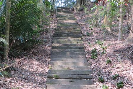
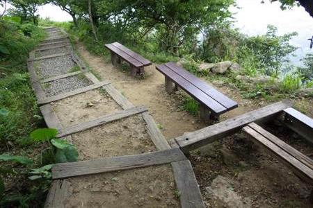
Travel Guide

Travel Guide
Attraction
Map
Trail
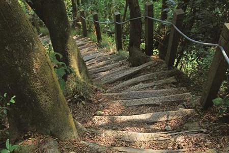
Begonia Trail
Source 屏東分署提供
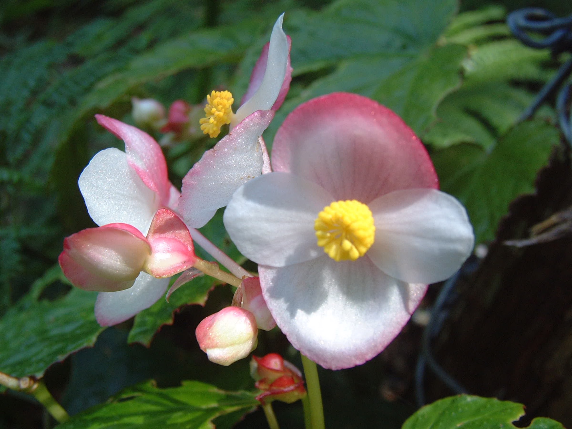
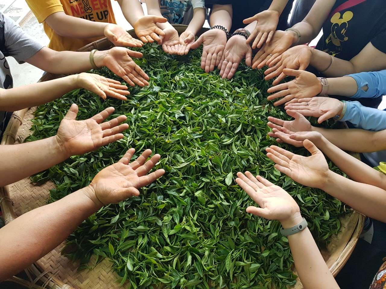
The native begonias here account for nearly half of all begonias in Taiwan, including Wuwei begonia, Izumoshan begonia, Luanda begonia, Taiwan begonia, and the "Tengzhi" begonia named after "Tengzhi", which is one of the characteristics of this area.
Trail
Xishi Flower Trail
Source 屏東分署提供
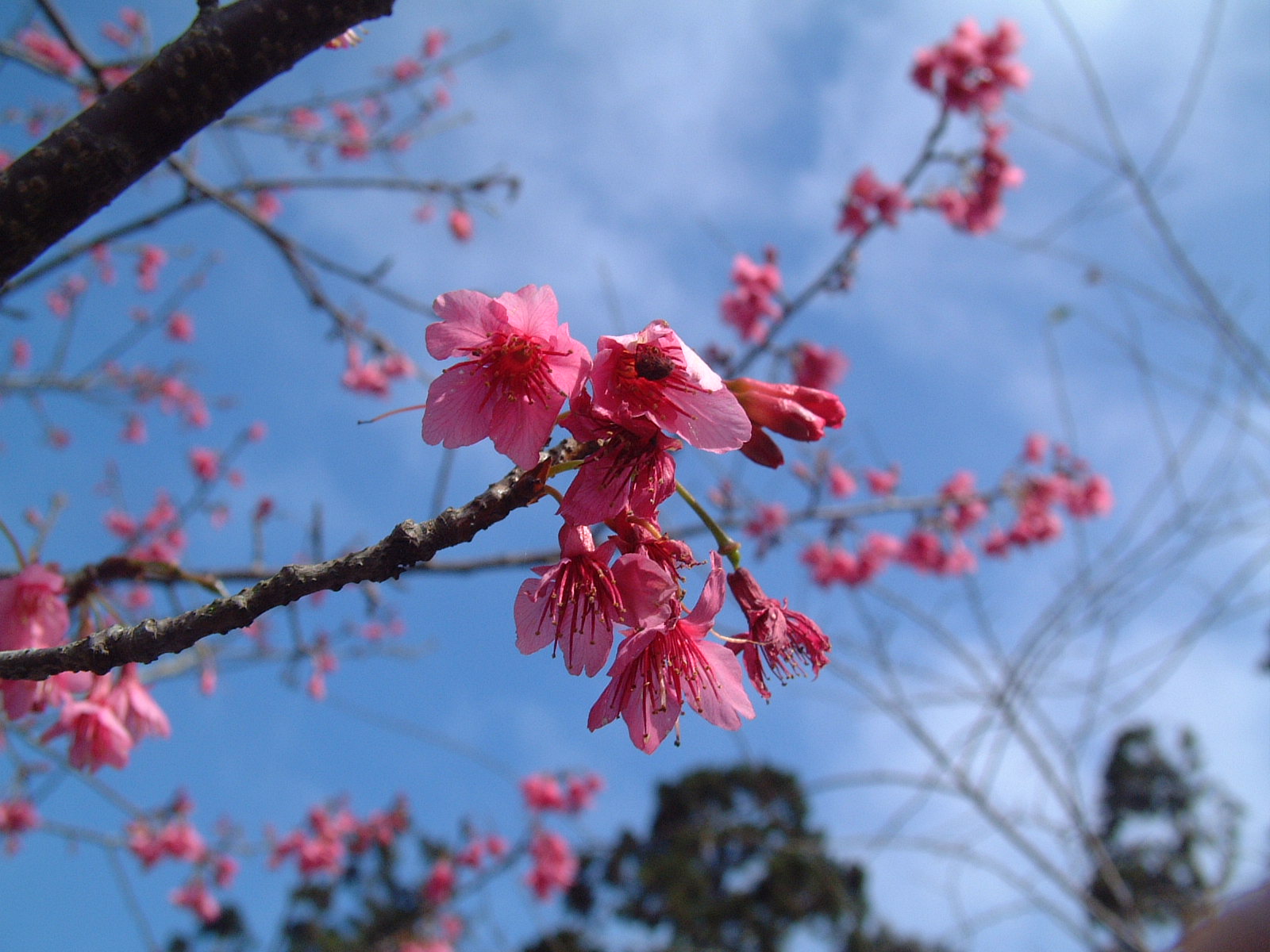
On the trail, you can see tree-like azaleas, which are different from the shrub-like azaleas on the plain. In spring, they bloom pink flowers on the branches, which are so beautiful that you can only see the flowers in the fog. Therefore, they are called Xishi flowers. The flowers on the trees are dotted in the green forest, reflecting the pink makeup of early spring every year.
Trail
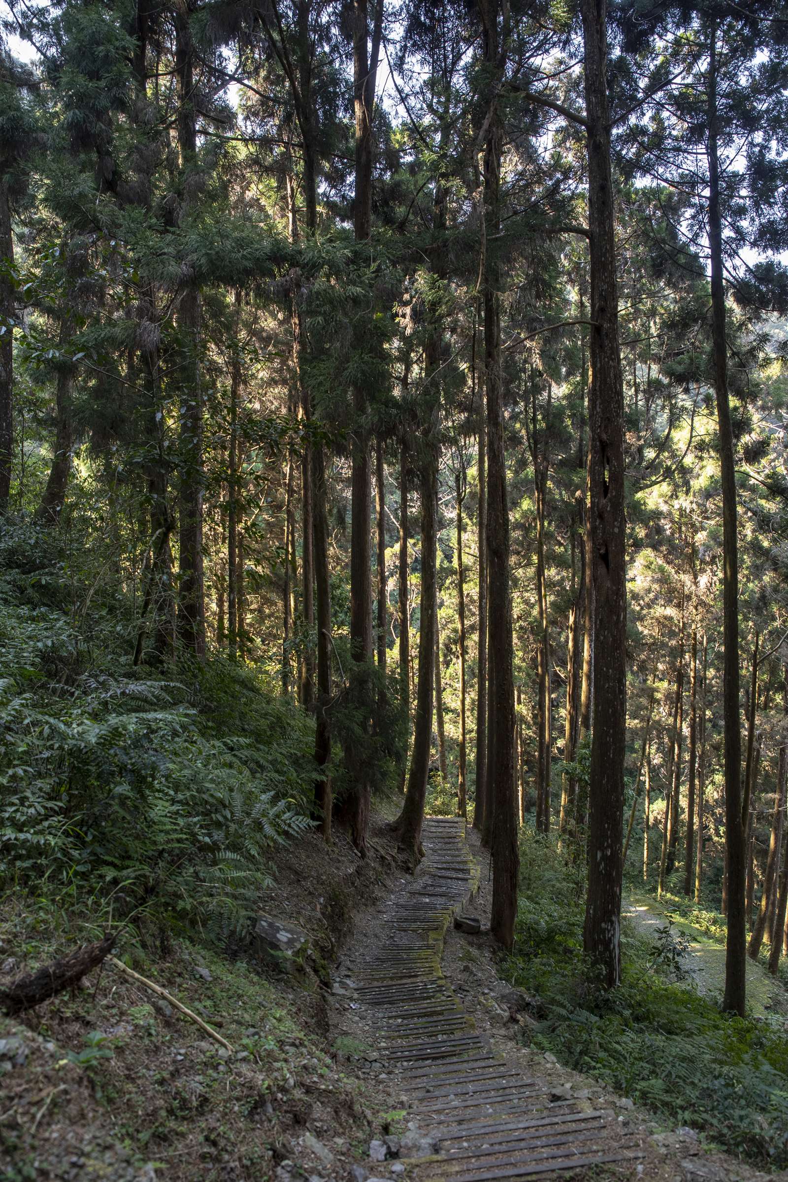
Spruce Trail
Source 屏東分署提供
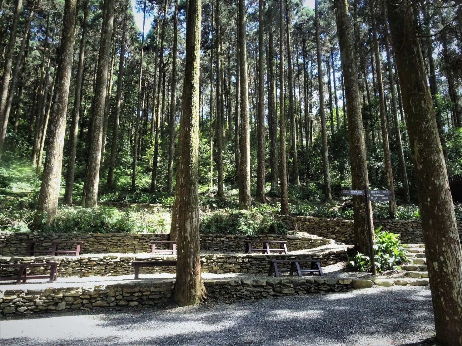
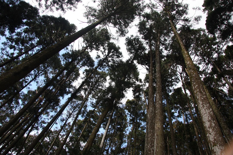
The spruce plantations in Tengzhi and the slender and dense Cryptomeria forests along the trail are evidence of human activities in the past, and may provide us with different experiences and feelings.
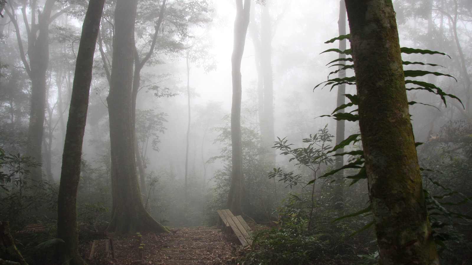
Trail
Sea of Trees Trail
Source 屏東分署提供
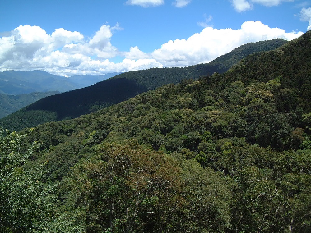
The forest is dense and lush, and whenever the breeze blows, the Taiwan fir is like the waves of the sea. You may want to slow down your pace when walking here. You may have discovered the tall and lush bamboo forest on the trail, and the unique elegant fragrance of the camphor nanmu plants, quietly in your breath; the great crested eagle circling in the blue sky, and the figures of elves jumping among the bushes, all of which add fresh vitality to the forest during the day or at night, making it the most abundant and lively trail.
Trail
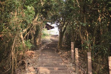
Visitor Center Trail
Source 屏東分署提供
It is a pedestrian trail from the main entrance to the artificial Cryptomeria japonica forest of Tengzhi Villa.
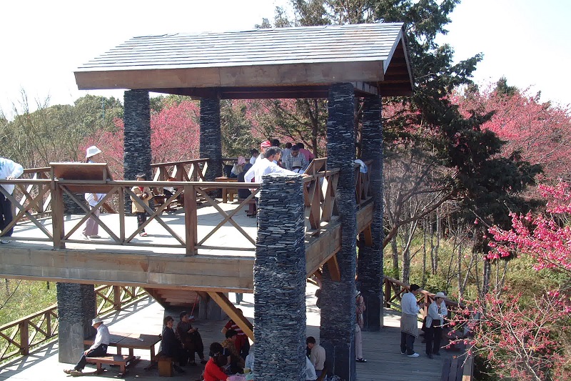
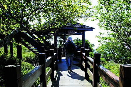
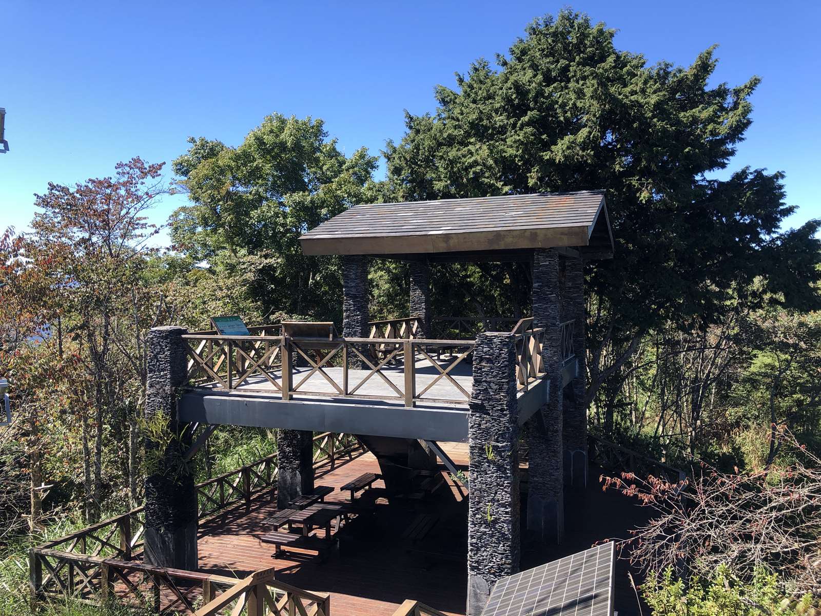
Featured Landscape
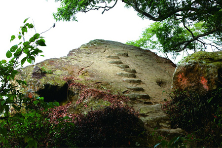
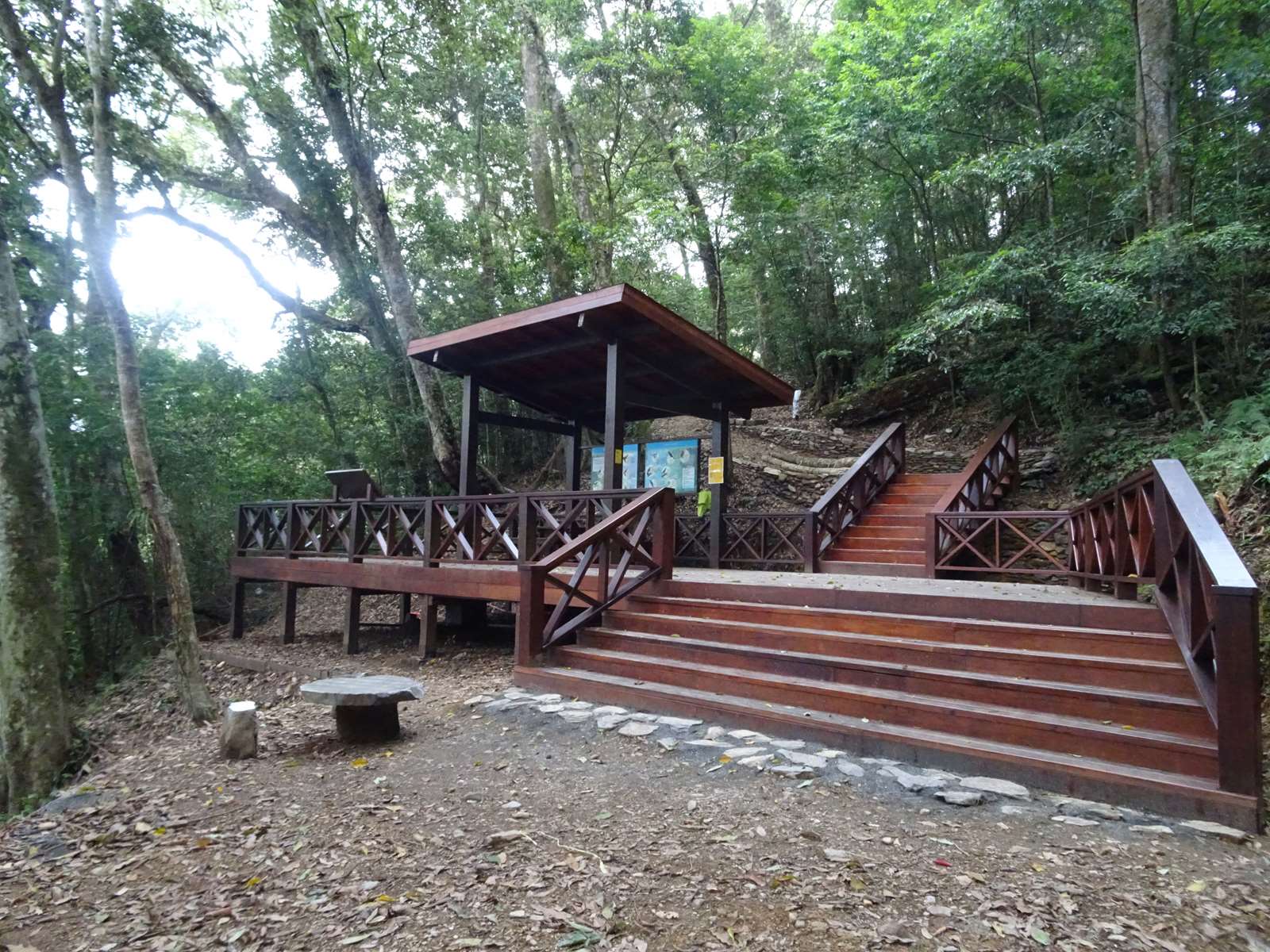
Observation Deck
Source 南投分署
Tengjhih was originally a training forest for Kyoto University in Japan. In 1950, the Laonong Forest Road (now Tengjhih Forest Road) was opened as a connecting road to the outside world. In 1966, the Forestry and Conservation Administration established the Laonong Work Station in Tengjhih. At that time, for the purpose of forest fire reporting and preventing illegal logging, six lookout towers were set up within the jurisdiction, located at Lunzaiding, Fenggang Mountain, Zumu Mountain (1,218 meters), Meilong Mountain (1,385 meters), Dongtengzhi Mountain (1,804 meters) and Shishan (2,818 meters). When fire smoke was discovered, the fire location was determined by two-point or three-point intersection method, and the work station was immediately notified by telephone. The Tengjhih Lookout is 1,804 meters above sea level. It was originally a two-story building made of steel frames and aluminum sheets. The first floor was the living room for the stationed personnel, and the second floor had glass windows on all four sides. There was a turntable inside to set the azimuth to locate the fire. There is a wired telephone inside for communication purposes. There are gutters on the roof to collect water for domestic use. After the establishment of Tengjhih National Forest Recreation Area in 1983, the purpose of the lookout tower changed from forest fire reporting to sightseeing. After the Baoshan checkpoint was withdrawn in 1997, the number of tourists increased rapidly. The area around the lookout tower and the trails along the way were severely damaged, with tree roots exposed. For the sake of land survival and tourist safety, it was rebuilt into the current viewing lookout tower in 2002.
Featured Landscape
Cryptomeria fortunei forest
Source 南投分署
The Cryptomeria japonica platform is the largest recreational area and was once one of the most frequently visited recreational areas by tourists.
Featured Landscape
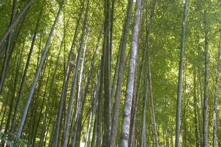
Mengzong Bamboo Forest
Source 南投分署
Mengzong bamboo prefers a relatively cool climate, so it will not completely stop growing in winter on plains or in medium and low altitude mountainous areas. It will still produce a small amount of shoots, but the shoots are smaller in size and are called "winter shoots." Winter bamboo shoots are certainly not the only bamboo shoots of Mengzong bamboo. The bamboo shoots mainly emerge in spring. Spring bamboo shoots can grow into straight and thick bamboo poles. A large bamboo forest is really charming!
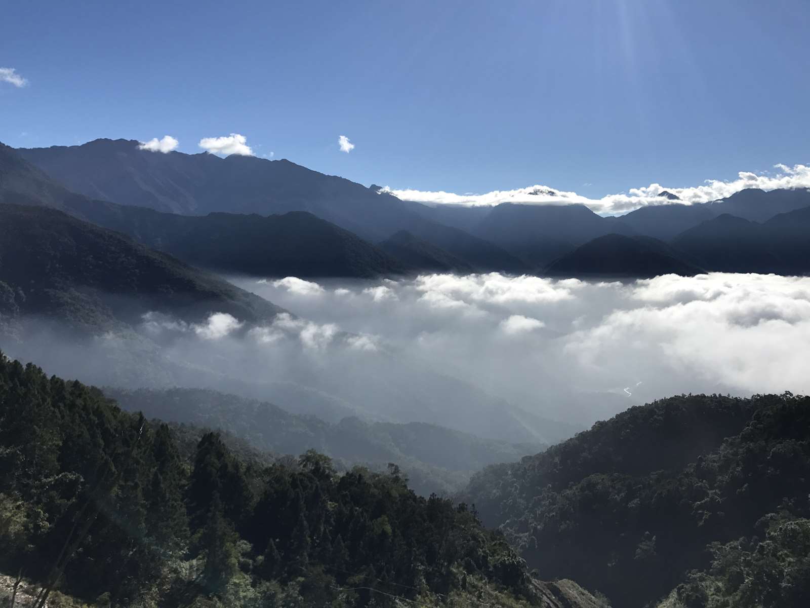
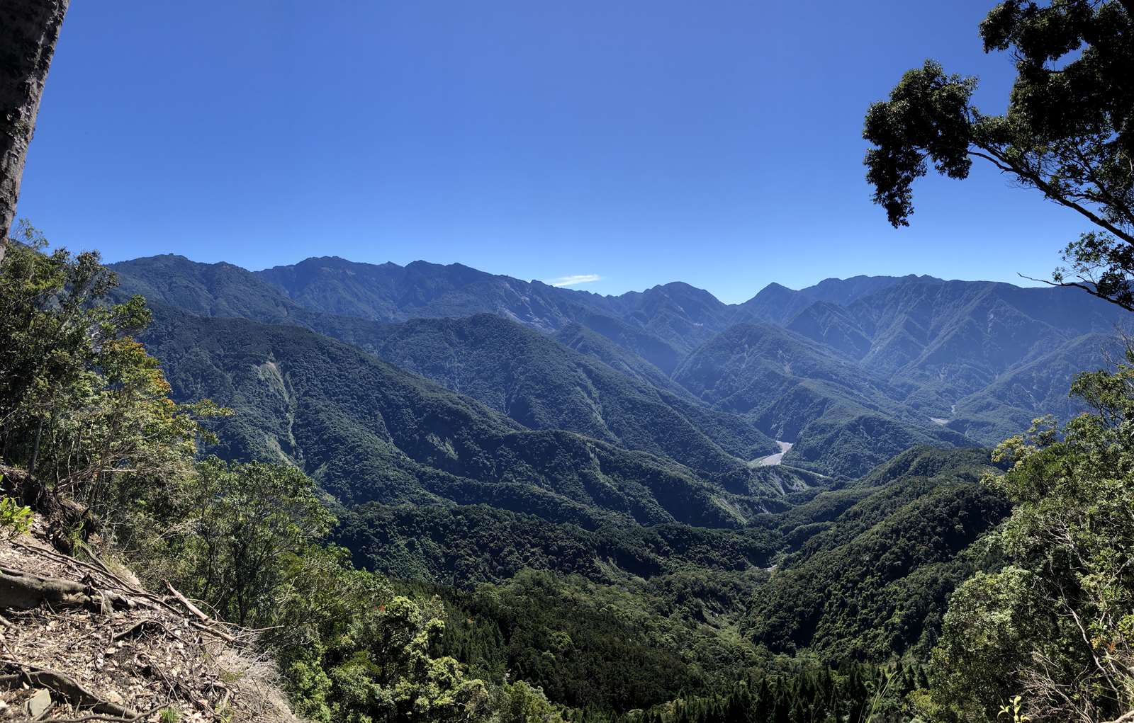
Featured Landscape
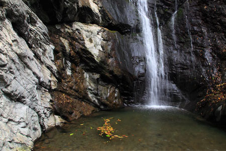
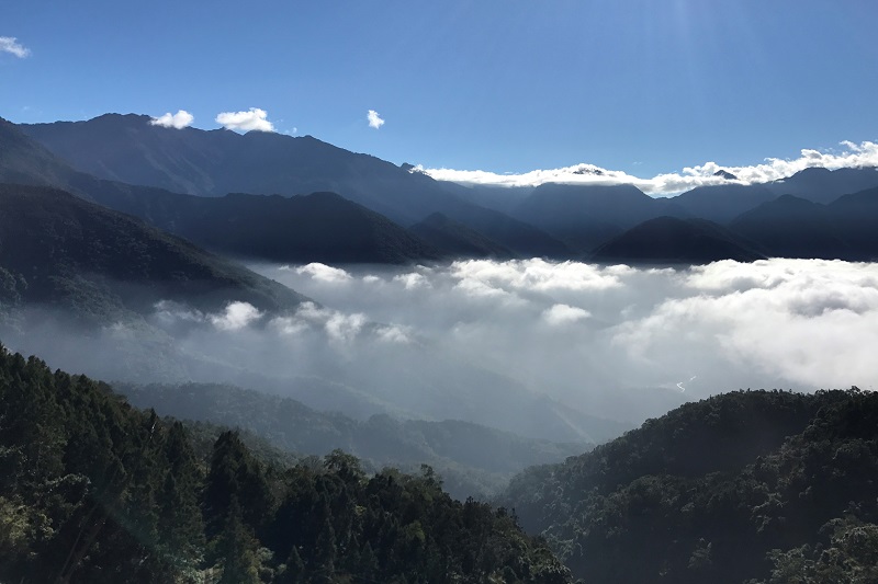
Tengjhih Sea of Clouds
Source 屏東分署
In winter, Tengjhih is covered with heavy fog, and you can climb up to see the sea of clouds over the mountains.
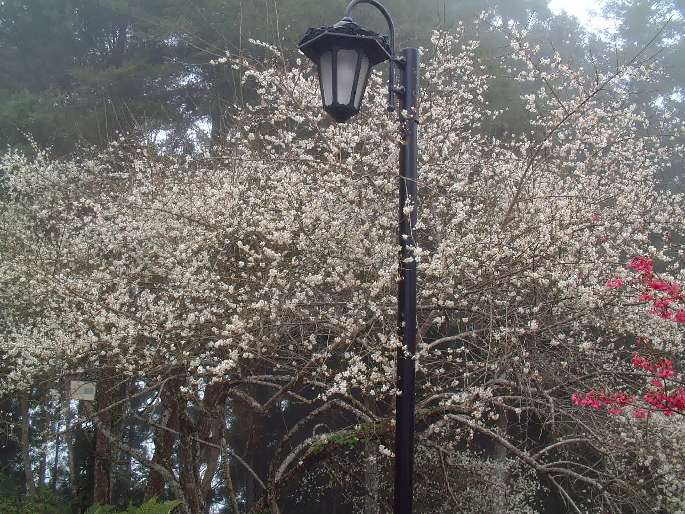
Featured Landscape
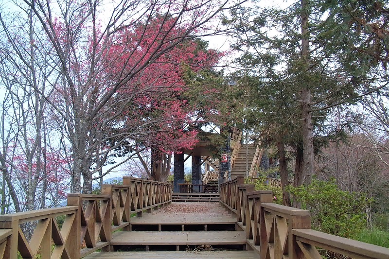
Observatory Trail
Source 屏東分署
The end of the Spruce Trail is connected to the observation deck, which is the best place to enjoy the cherry blossoms when they are in full bloom in February and March.
Service Facilities
Map
Park Facilities
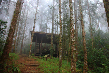
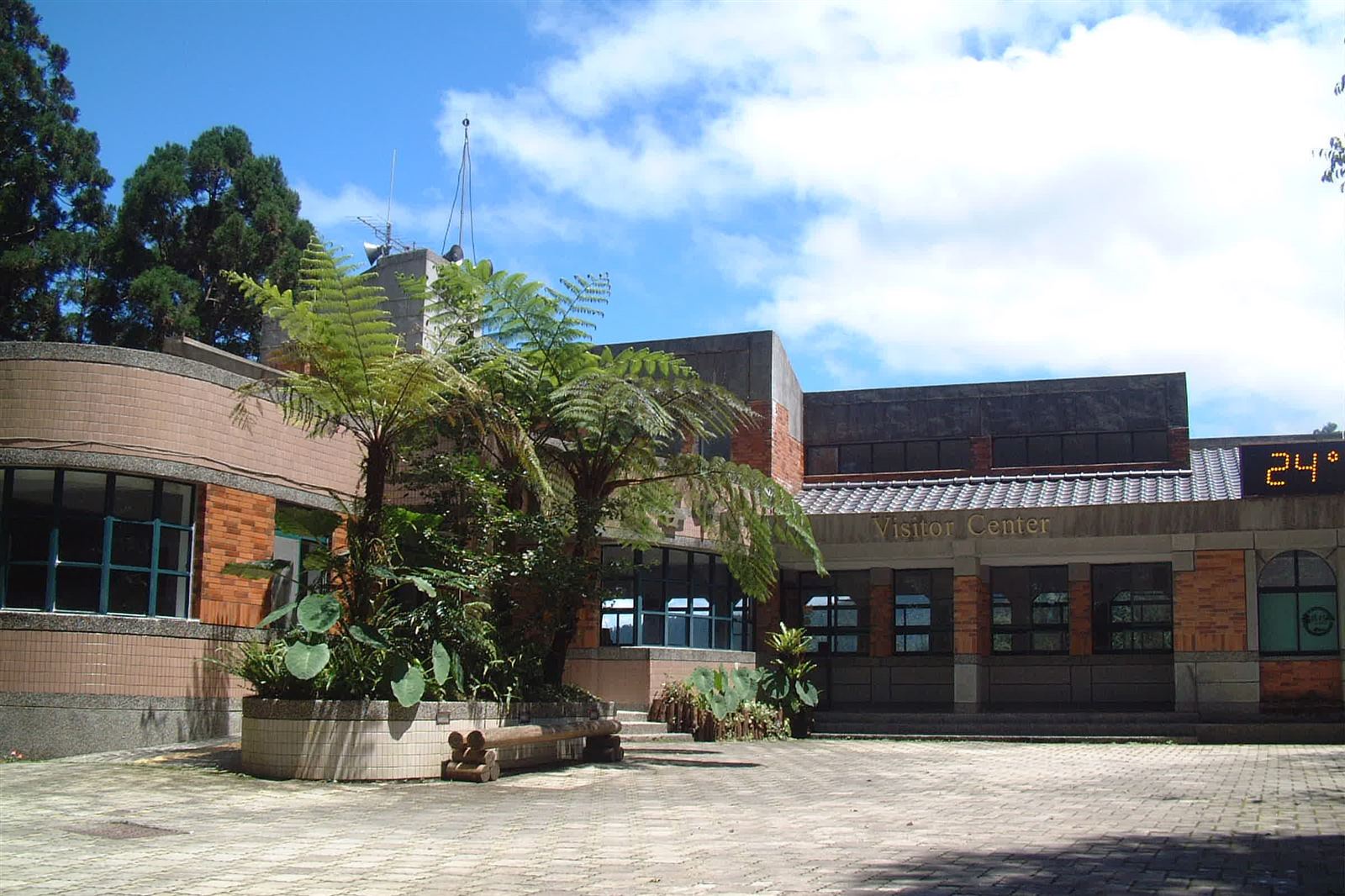
Visitor Center
Source 屏東分署
It is the largest three-story building in the park that follows the mountain terrain. The top floor houses offices, service counters, and restaurants.
Nearby Attractions