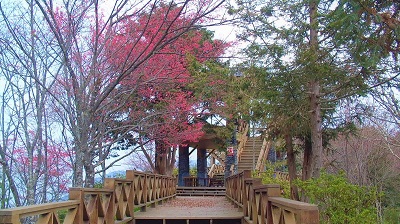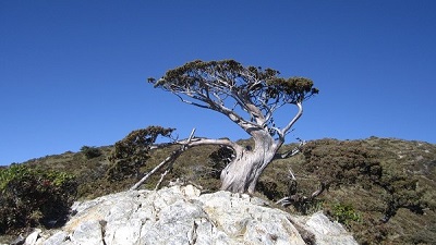
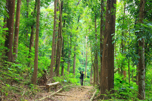
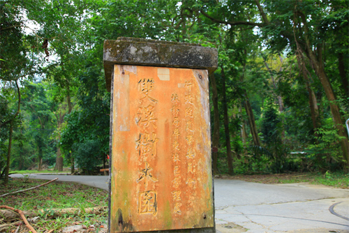
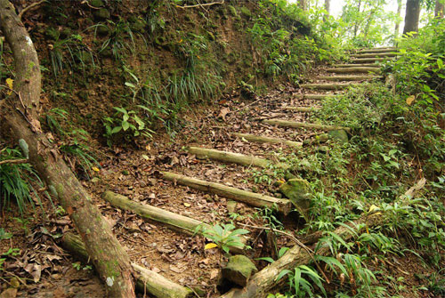
The Meinong Shuangxi Tree Garden Trail, so named because of the two creeks that converge and surround it, is located at the upstream of Meinong Creek in the northeast corner of Meinong Town. The garden originally was the 7.56-hectare Zhutoujiao Tropical Tree Garden built by the Japanese in 1935 to collect, bring in and cultivate precious or economically valuable trees. After Taiwan was recovered, not many new trees were planted, but there was not much man-made interference, either. Hence, the original tropical species were updated and some secondary Taiwanese species were also brought in. In the future, efforts will be made to turn it into a natural ecological park for educational and conservational purposes.
06/27 Sat.
Open
26°
25° / 27°
高雄市 / 美濃區
More
Weather Forecast
|
06.27
Today
|
06.28
Sun.
|
06.29
Mon.
|
06.30
Tue.
|
07.01
Wed.
|
07.02
Thur.
|
07.03
Fri.
|
|
|---|---|---|---|---|---|---|---|
| Temperature |
25 ° / 27 °
|
25 ° / 29 °
|
25 ° / 32 °
|
25 ° / 33 °
|
25 ° / 33 °
|
25 ° / 34 °
|
25 ° / 34 °
|
| Feel like | 27 ° / 31 ° | 28 ° / 33 ° | 28 ° / 37 ° | 28 ° / 37 ° | 28 ° / 38 ° | 28 ° / 38 ° | 28 ° / 38 ° |
|
Probability of Precipitation |
80 % | 50 % | 50 % | - | - | - | - |
| Relative Humidity | 92 % | 89 % | 86 % | 85 % | 85 % | 83 % | 85 % |
|
Wind speed Wind direction |
2
S
|
2
S
|
2
E
|
2
NE
|
2
NE
|
3
NE
|
3
NE
|
| UVI |
5
Moderate
|
7
High
|
9
Very High
|
10
Very High
|
9
Very High
|
9
Very High
|
9
Very High
|
|
Sunrise Sunset |
|
|
|
|
|
|
|
Central Weather Bureau|Update Time:2026/06/27 05:24
Meinong District, Kaohsiung City
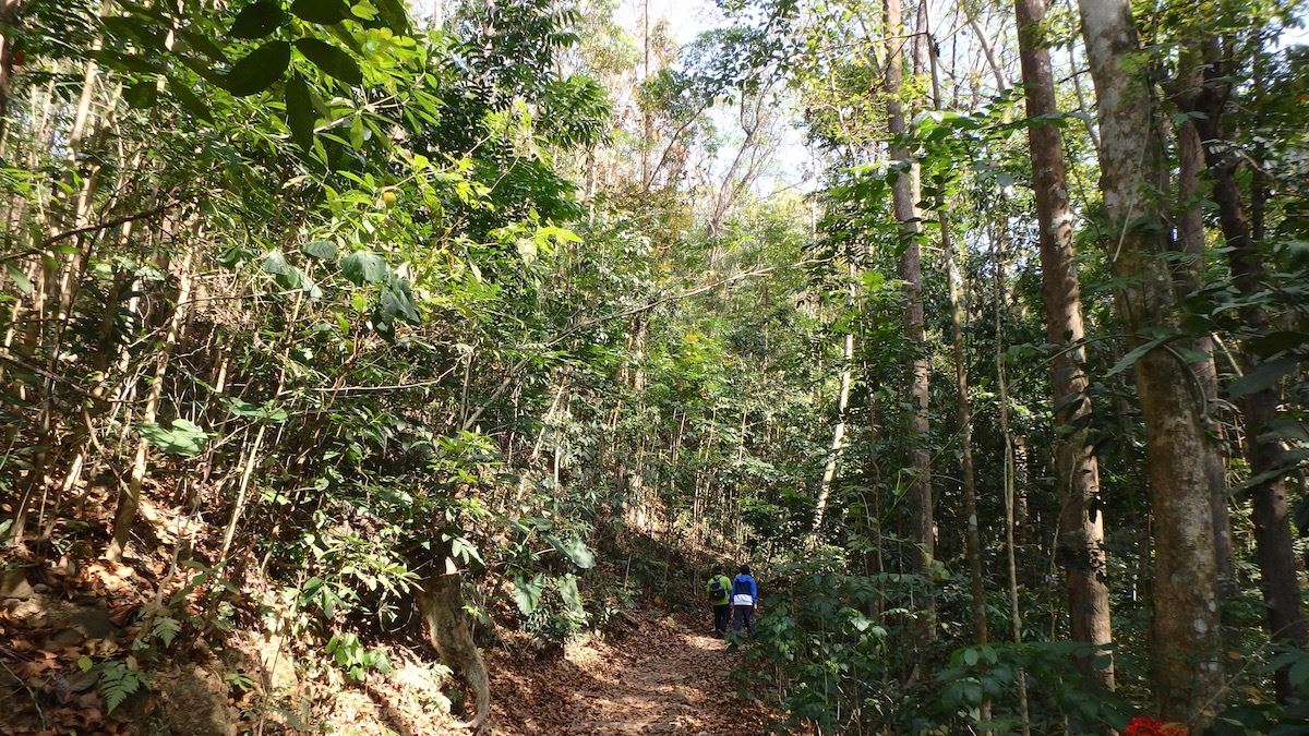
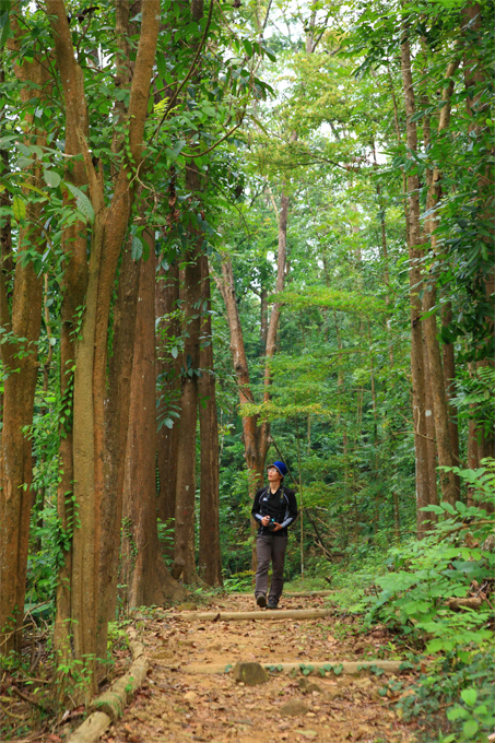
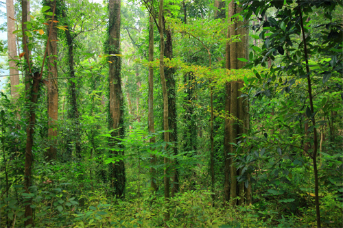
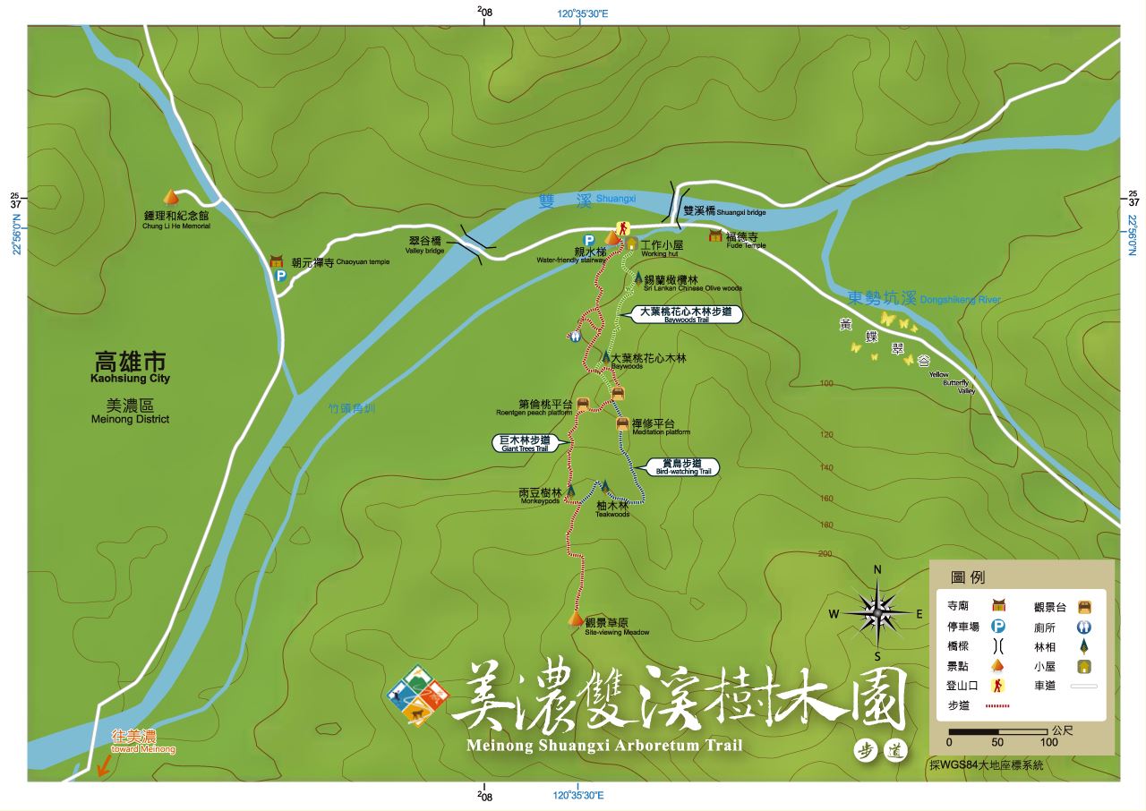
Meinong Shuangxi Arboretum Trail
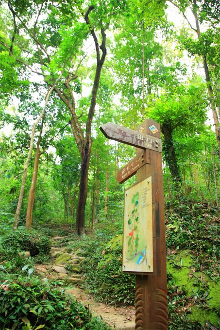
Learn about the Trail
Application
Transportation
National Highway no.3
1.Provincial Highway no.3, Tian Liao interchange→head west by Provincial Highway no.28→Chishan City→pass Chi Wei Brisge, take a left and enter County Road no, 140 (Rd. Shu Ren Heng, Rd. Shu Ren, Rd. Chung Shan, Rd. Tai An) to the end→take a left and enter Kaohsiung County highway no.106 (Rd. Min Tsu, St. Guang Xing )→take a left to Kaohsiung county highway no.109 (St. Guang Gu), go for about 3 kilometers and reach the destination <BR> 2.Provincial Highway no. 3, Yanchao system interchange→Provincial Highway no.10 to Chishan→ Kaohsiung County highway no.140 (Ciping 1st Rd.)→take Provincial Highway no.28 (Yanping 2nd Rd.), head east→turn left and take Kaohsiung Country highway no. 140 (Shu Ren Hen Rd., Shu Ren Rd., Chung Shan Rd., Tai An Rd.) to the end →Take a left to Kaohsiung County highway no. 106 (Min Tsu Rd., Guangxing St.)→Turn left to Kaohsiung highway no.109 (Guangfu st.), go for about 3 kilometers and reach the destination
None.
None.
Trail difficulty level
| Hiking Level |
|
|
|
|
|
|
|
||||||||||||||||||||||||||||||||||||||||||
|---|---|---|---|---|---|---|---|---|---|---|---|---|---|---|---|---|---|---|---|---|---|---|---|---|---|---|---|---|---|---|---|---|---|---|---|---|---|---|---|---|---|---|---|---|---|---|---|---|---|
| Target | General Public | General Public | Those who have better physical energy | Beginner mountain climber with good physical energy and map literacy. | Open to those who have good physical strength, map reading skills, and wild survival skills. | Open to well-trained mountain climbers. | Open to well-trained mountain climbers. | ||||||||||||||||||||||||||||||||||||||||||
| Elevation | Gently sloping area | In recreational areas, close to settlements or about 1,000 meters above sea level. | In recreational areas, close to settlements or between 1,000~2,000 meters above sea level. | Remote areas or between 2,000 to 3,000 meters above sea level | Remote areas, wilderness, or between 2,000 to 3,000 meters above sea level | Remote areas, wilderness, or more than 3,000 meters above sea level | Remote areas, wilderness, or more than 3,000 meters above sea level | ||||||||||||||||||||||||||||||||||||||||||
| Required Time | It takes half to one day. | It takes half to one day. | It can be done within one day. | It takes one or more days. | Overnight preparation required. | It takes up to three days. | It takes up to three days. | ||||||||||||||||||||||||||||||||||||||||||
| Equipment | Light backpacking (water and small amount of food) | Light backpacking (water and small amount of food) | Light backpacking (water and proper amount of food) | Overnight preparation required. (e.g. drinking water, food, map, warm clothing, first-aid medicine, etc.) Application for entrance permission in advance is required if there is access control. | Comprehensive Mountaineering Gear Required. (e.g. food, drinking water, cooking utensils, map, warm clothing, flashlight, sleeping bag, tent, etc.) Application for entrance permission in advance is required if there is access control. | Comprehensive Mountaineering Gear Required. (e.g. food, drinking water, cooking utensils, map, warm clothing, flashlight, sleeping bag, tent, etc.) Application for entrance permission in advance is required if there is access control. | Comprehensive Mountaineering Gear Required. (e.g. food, drinking water, cooking utensils, map, warm clothing, flashlight, sleeping bag, tent, etc.) Application for entrance permission in advance is required if there is access control. | ||||||||||||||||||||||||||||||||||||||||||
| Description | Flat hiking trails. Relatively even slopes with comprehensive facilities and smooth road surface. Accessible for handicapped assistive devices or baby strollers. | An open hiking trail with easy access. Relatively even slopes with comprehensive facilities and smooth road surface. It takes half a day or less than one day to complete. | An open hiking trail with easy access. Somewhat steep slope with some difficult sections, but has comprehensive facilities and smooth road surface. It takes less than one day to complete. | A hiking trail locates at remote area or with part of the route is in area which requires entrance permission. Application in advance is required. Part of the route is in relatively bad condition with steeper slopes, but basic facilities are provided. It takes one day or between one to three days to complete. | A hiking trail locates at remote area or with part of the route is in area which requires entrance permission. It’s located in high-altitude areas (higher than 3000 meters above sea level). The trail is relatively primitive, with steeper slopes and unstable weather conditions. Part of the route may be dangerous or difficult for climbers. It takes two to three days to complete. Lead from professionals is recommended. | A hiking trail locates at area with inconvenient traffic, and mostly with routes in area which requires entrance permission. It’s located in high-altitude areas (higher than 3000 meters above sea level). The trail is located at primitive area, with bad condition, steeper slopes, and unstable weather conditions. Many parts of the route may be dangerous or difficult for climbers. It takes three or more days to complete. Lead from professionals is recommended. | 1. Level 3, 4 or 5 trails when snow or ice accumulating 2. Informal trails, without clear subgrades or paths, belong to special routes such as original mountain trails, ancient trail relics, prospecting, or technical climbing. |
Hiking Level
Target
General Public
Elevation
Gently sloping area
Required Time
It takes half to one day.
Equipment
Light backpacking (water and small amount of food)
Description
Flat hiking trails. Relatively even slopes with comprehensive facilities and smooth road surface. Accessible for handicapped assistive devices or baby strollers.
Hiking Level
Target
General Public
Elevation
In recreational areas, close to settlements or about 1,000 meters above sea level.
Required Time
It takes half to one day.
Equipment
Light backpacking (water and small amount of food)
Description
An open hiking trail with easy access. Relatively even slopes with comprehensive facilities and smooth road surface. It takes half a day or less than one day to complete.
Hiking Level
Target
Those who have better physical energy
Elevation
In recreational areas, close to settlements or between 1,000~2,000 meters above sea level.
Required Time
It can be done within one day.
Equipment
Light backpacking (water and proper amount of food)
Description
An open hiking trail with easy access. Somewhat steep slope with some difficult sections, but has comprehensive facilities and smooth road surface. It takes less than one day to complete.
Hiking Level
Target
Beginner mountain climber with good physical energy and map literacy.
Elevation
Remote areas or between 2,000 to 3,000 meters above sea level
Required Time
It takes one or more days.
Equipment
Overnight preparation required. (e.g. drinking water, food, map, warm clothing, first-aid medicine, etc.)
Application for entrance permission in advance is required if there is access control.
Description
A hiking trail locates at remote area or with part of the route is in area which requires entrance permission. Application in advance is required. Part of the route is in relatively bad condition with steeper slopes, but basic facilities are provided. It takes one day or between one to three days to complete.
Hiking Level
Target
Open to those who have good physical strength, map reading skills, and wild survival skills.
Elevation
Remote areas, wilderness, or between 2,000 to 3,000 meters above sea level
Required Time
Overnight preparation required.
Equipment
Comprehensive Mountaineering Gear Required. (e.g. food, drinking water, cooking utensils, map, warm clothing, flashlight, sleeping bag, tent, etc.)
Application for entrance permission in advance is required if there is access control.
Description
A hiking trail locates at remote area or with part of the route is in area which requires entrance permission. It’s located in high-altitude areas (higher than 3000 meters above sea level). The trail is relatively primitive, with steeper slopes and unstable weather conditions. Part of the route may be dangerous or difficult for climbers. It takes two to three days to complete. Lead from professionals is recommended.
Hiking Level
Target
Open to well-trained mountain climbers.
Elevation
Remote areas, wilderness, or more than 3,000 meters above sea level
Required Time
It takes up to three days.
Equipment
Comprehensive Mountaineering Gear Required. (e.g. food, drinking water, cooking utensils, map, warm clothing, flashlight, sleeping bag, tent, etc.)
Application for entrance permission in advance is required if there is access control.
Description
A hiking trail locates at area with inconvenient traffic, and mostly with routes in area which requires entrance permission. It’s located in high-altitude areas (higher than 3000 meters above sea level). The trail is located at primitive area, with bad condition, steeper slopes, and unstable weather conditions. Many parts of the route may be dangerous or difficult for climbers. It takes three or more days to complete. Lead from professionals is recommended.
Hiking Level
Target
Open to well-trained mountain climbers.
Elevation
Remote areas, wilderness, or more than 3,000 meters above sea level
Required Time
It takes up to three days.
Equipment
Comprehensive Mountaineering Gear Required. (e.g. food, drinking water, cooking utensils, map, warm clothing, flashlight, sleeping bag, tent, etc.)
Application for entrance permission in advance is required if there is access control.
Description
1. Level 3, 4 or 5 trails when snow or ice accumulating
2. Informal trails, without clear subgrades or paths, belong to special routes such as original mountain trails, ancient trail relics, prospecting, or technical climbing.
Reachable by Vehicle
O:Cars、Microbus、Coach Bus
Mountain system
Yuehguanshan Mountain System
Administer
Pingtung Forest Dist. Office
Elevation
100 ~ 200 m
Service Line
886-7-6612031
Altitude Difference
100 m
Huts
-
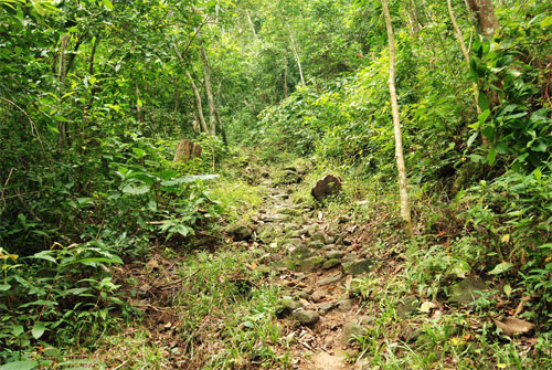
Length of the Trail
1.5 KM
Entry Permit
No
Trail type
Partial Ring
Via Nature Reserve
No
Road condition
Mountain trail
Geologically Sensitive Area
Yes
Route planning
Half day
Debris Flow Torrents
No
Trail Track
Trail route
Trailhead / Trig
Mobile coverage
Observations (From iNaturalist)
Trailhead / Trig
Mobile coverage
Observations (From iNaturalist)
Reminders
Go with your companions and don't take shortcuts.
To ensure your safety, please go with your companions, follow the indicators, do not take shortcuts or self-directed routes, and do not leave your team and walk alone.
Carry Global Positioning System and communication equipment
For hiking, please plan your trip and bring enough equipment and food with you. It is suggested that you should carry Global Positioning System (GPS) and communication equipment such as a satellite phone, mobile phone, radio or satellite positioning equipment such as Personal Locator Beacon (PLB), etc., and should carry enough batteries to ensure emergency communication.
Quickly pass dangerous areas
The road condition in the mountainous area is unstable. Please do not stay or take pictures in dangerous areas such as collapsed or falling rocks and pay attention to your own safety at any time.
It is recommended to complete the mountaineering insurance
There are certain risks in mountain activities. It is recommended that you should complete mountaineering insurance before departure. (Note: General travel insurance does not necessarily cover mountaineering accidents. Please refer to the policy details before applying for insurance. For the mountaineering insurance, please refer to the following instructions in Financial Supervisory Commission's press release and choose the appropriate insurance.)
Information on mountaineering safety
For information on mountaineering safety, mountaineering equipment, and tips for using maps, please visit the website http://goo.gl/QUnv129u. It is recommended to read the information before the trip to ensure your outdoor activities are safe.
Travel Guide

Travel Guide
Featured Landscape
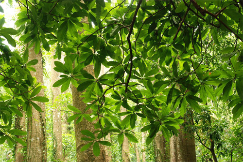
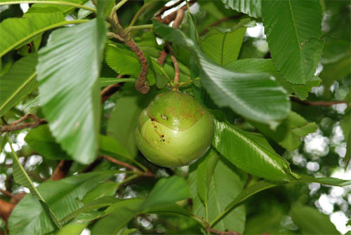
United Nations of Tropical Plants
Source|葉品妤
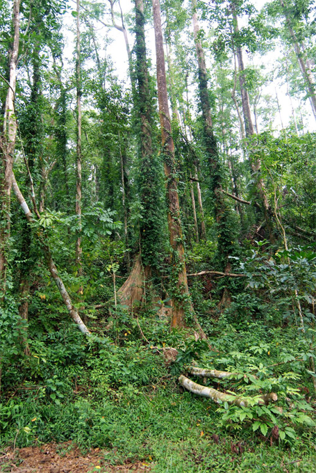
The park is a subtropical area with annual rainfall concentrated in summer, about 2,000 to 3,000 millimeters, which is suitable for the growth of tropical plants. In the past, attempts were made to introduce more than 270 tree species from the South Pacific Islands, Indochina, Australia, Africa and South America, but some species were unable to adapt. In addition, the Pacific War caused a shortage of funds and poor management, resulting in the death of more than half of the trees. There are now a total of 97 species, including many rare tropical species. The tree species that can adapt to natural growth in the park include Terminalia philadelphica, Typha latifolia, Hevea brasiliensis, Rubber Tree, Litsea cubeba, Litsea cubeba, Burmese ironwood, African bean tree, etc., and seedlings can be seen growing everywhere.
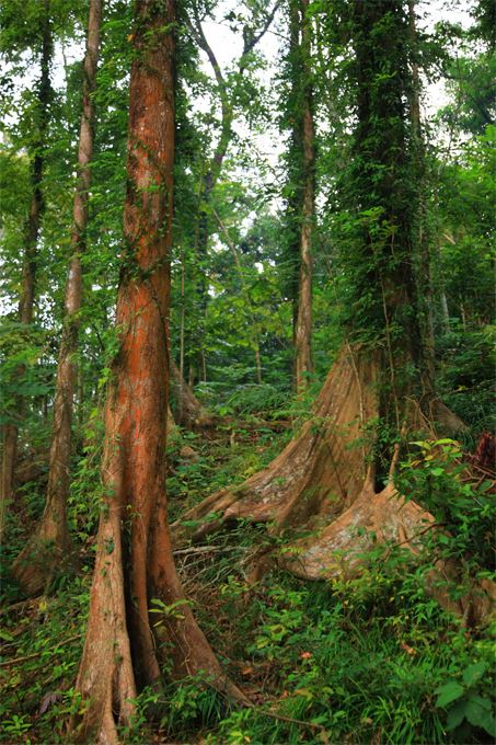
Unique rainforest tree species
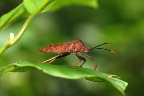
Source|謝宗宇
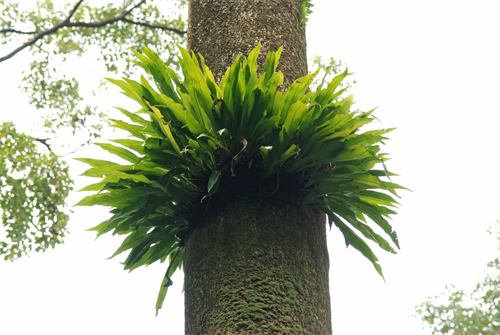
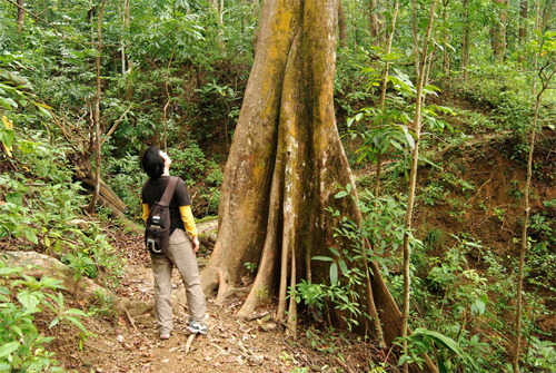
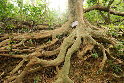
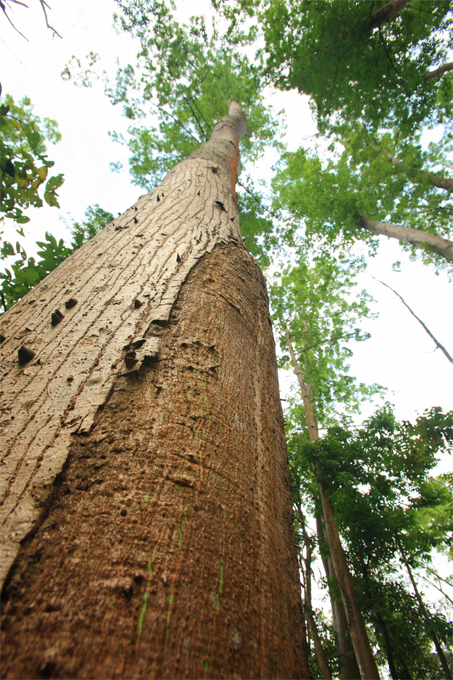
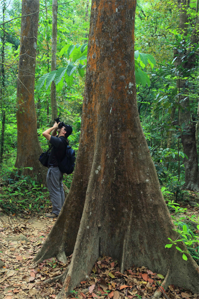
The park is home to the only Dipterocarpaceae plant in Taiwan that is found exclusively in tropical rainforests. The plant includes Dipterocarpaceae grandiflora, Dipterocarp slenderbranch, Eucalyptus nasutus, and Eucalyptus scalycopersicum, of which only one remains, and the Tengji red Eucalyptus rubra. The plants in this family have the tallest buttress roots seen in Taiwan.
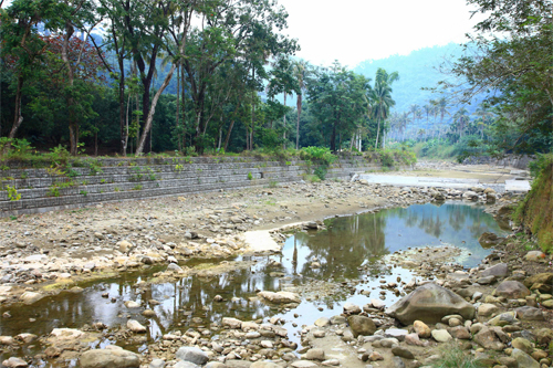
Nearby Attractions