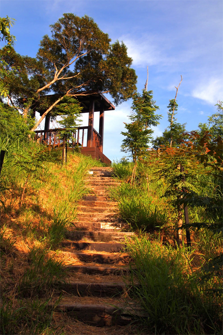
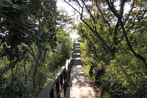
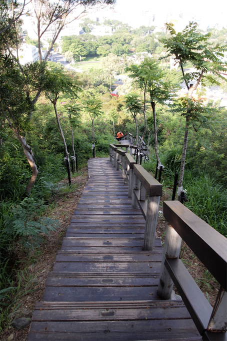
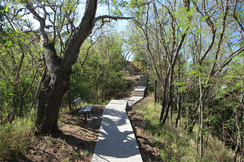
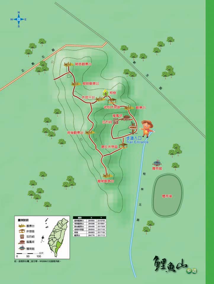
Liyu (carp) Mountain is so called because the formation resembles a carp. It is located behind the old Taitung City Train Station, serving as a green lung of the city. There are several trails and observation decks have been built along the way in accordance with the topography, respectively called Lishou (carp head), Liyan (carp eye), Beiling (back ridge) and Liwei (carp tail). The trails are sheltered by deep and peaceful forests where visitors can hear birds chirping and smell the fragrance of flowers. It is an extremely nice hiking trail in Taitung City.
06/30 Tue.
Open
29°
27° / 32°
臺東縣 / 臺東市
More
Weather Forecast
|
06.30
Today
|
07.01
Wed.
|
07.02
Thur.
|
07.03
Fri.
|
07.04
Sat.
|
07.05
Sun.
|
07.06
Mon.
|
|
|---|---|---|---|---|---|---|---|
| Temperature |
27 ° / 32 °
|
26 ° / 32 °
|
26 ° / 32 °
|
26 ° / 32 °
|
26 ° / 32 °
|
26 ° / 31 °
|
26 ° / 31 °
|
| Feel like | 31 ° / 36 ° | 29 ° / 36 ° | 28 ° / 36 ° | 29 ° / 36 ° | 28 ° / 36 ° | 28 ° / 35 ° | 28 ° / 35 ° |
|
Probability of Precipitation |
30 % | 20 % | 10 % | - | - | - | - |
| Relative Humidity | 86 % | 83 % | 81 % | 83 % | 82 % | 81 % | 84 % |
|
Wind speed Wind direction |
2
SW
|
2
NW
|
2
NW
|
2
NW
|
2
S
|
3
SW
|
2
SW
|
| UVI |
10
Very High
|
10
Very High
|
10
Very High
|
11
危險級
|
11
危險級
|
11
危險級
|
10
Very High
|
|
Sunrise Sunset |
|
|
|
|
|
|
|
Central Weather Bureau|Update Time:2026/06/30 11:13
Taitung City, Taitung County
Mt. Liyu Trail
Learn about the Trail
Application
Transportation
Driving
Provincial Highway no.9 or Provincial Highway no. 11→Taitung City→Bo Ai Rd.
By Ding Tung Bus
Start from Hualian. Take Ding Tung bus coastal line to Taitung City→walk to Boai Rd.
By Kuo Kuang Bus
Start from Fanlian. Take Kuo Kuang Bus to Taitung City→Walk to Boai Road
Trail difficulty level
| Hiking Level |
|
|
|
|
|
|
|
||||||||||||||||||||||||||||||||||||||||||
|---|---|---|---|---|---|---|---|---|---|---|---|---|---|---|---|---|---|---|---|---|---|---|---|---|---|---|---|---|---|---|---|---|---|---|---|---|---|---|---|---|---|---|---|---|---|---|---|---|---|
| Target | General Public | General Public | Those who have better physical energy | Beginner mountain climber with good physical energy and map literacy. | Open to those who have good physical strength, map reading skills, and wild survival skills. | Open to well-trained mountain climbers. | Open to well-trained mountain climbers. | ||||||||||||||||||||||||||||||||||||||||||
| Elevation | Gently sloping area | In recreational areas, close to settlements or about 1,000 meters above sea level. | In recreational areas, close to settlements or between 1,000~2,000 meters above sea level. | Remote areas or between 2,000 to 3,000 meters above sea level | Remote areas, wilderness, or between 2,000 to 3,000 meters above sea level | Remote areas, wilderness, or more than 3,000 meters above sea level | Remote areas, wilderness, or more than 3,000 meters above sea level | ||||||||||||||||||||||||||||||||||||||||||
| Required Time | It takes half to one day. | It takes half to one day. | It can be done within one day. | It takes one or more days. | Overnight preparation required. | It takes up to three days. | It takes up to three days. | ||||||||||||||||||||||||||||||||||||||||||
| Equipment | Light backpacking (water and small amount of food) | Light backpacking (water and small amount of food) | Light backpacking (water and proper amount of food) | Overnight preparation required. (e.g. drinking water, food, map, warm clothing, first-aid medicine, etc.) Application for entrance permission in advance is required if there is access control. | Comprehensive Mountaineering Gear Required. (e.g. food, drinking water, cooking utensils, map, warm clothing, flashlight, sleeping bag, tent, etc.) Application for entrance permission in advance is required if there is access control. | Comprehensive Mountaineering Gear Required. (e.g. food, drinking water, cooking utensils, map, warm clothing, flashlight, sleeping bag, tent, etc.) Application for entrance permission in advance is required if there is access control. | Comprehensive Mountaineering Gear Required. (e.g. food, drinking water, cooking utensils, map, warm clothing, flashlight, sleeping bag, tent, etc.) Application for entrance permission in advance is required if there is access control. | ||||||||||||||||||||||||||||||||||||||||||
| Description | Flat hiking trails. Relatively even slopes with comprehensive facilities and smooth road surface. Accessible for handicapped assistive devices or baby strollers. | An open hiking trail with easy access. Relatively even slopes with comprehensive facilities and smooth road surface. It takes half a day or less than one day to complete. | An open hiking trail with easy access. Somewhat steep slope with some difficult sections, but has comprehensive facilities and smooth road surface. It takes less than one day to complete. | A hiking trail locates at remote area or with part of the route is in area which requires entrance permission. Application in advance is required. Part of the route is in relatively bad condition with steeper slopes, but basic facilities are provided. It takes one day or between one to three days to complete. | A hiking trail locates at remote area or with part of the route is in area which requires entrance permission. It’s located in high-altitude areas (higher than 3000 meters above sea level). The trail is relatively primitive, with steeper slopes and unstable weather conditions. Part of the route may be dangerous or difficult for climbers. It takes two to three days to complete. Lead from professionals is recommended. | A hiking trail locates at area with inconvenient traffic, and mostly with routes in area which requires entrance permission. It’s located in high-altitude areas (higher than 3000 meters above sea level). The trail is located at primitive area, with bad condition, steeper slopes, and unstable weather conditions. Many parts of the route may be dangerous or difficult for climbers. It takes three or more days to complete. Lead from professionals is recommended. | 1. Level 3, 4 or 5 trails when snow or ice accumulating 2. Informal trails, without clear subgrades or paths, belong to special routes such as original mountain trails, ancient trail relics, prospecting, or technical climbing. |
Hiking Level
Target
General Public
Elevation
Gently sloping area
Required Time
It takes half to one day.
Equipment
Light backpacking (water and small amount of food)
Description
Flat hiking trails. Relatively even slopes with comprehensive facilities and smooth road surface. Accessible for handicapped assistive devices or baby strollers.
Hiking Level
Target
General Public
Elevation
In recreational areas, close to settlements or about 1,000 meters above sea level.
Required Time
It takes half to one day.
Equipment
Light backpacking (water and small amount of food)
Description
An open hiking trail with easy access. Relatively even slopes with comprehensive facilities and smooth road surface. It takes half a day or less than one day to complete.
Hiking Level
Target
Those who have better physical energy
Elevation
In recreational areas, close to settlements or between 1,000~2,000 meters above sea level.
Required Time
It can be done within one day.
Equipment
Light backpacking (water and proper amount of food)
Description
An open hiking trail with easy access. Somewhat steep slope with some difficult sections, but has comprehensive facilities and smooth road surface. It takes less than one day to complete.
Hiking Level
Target
Beginner mountain climber with good physical energy and map literacy.
Elevation
Remote areas or between 2,000 to 3,000 meters above sea level
Required Time
It takes one or more days.
Equipment
Overnight preparation required. (e.g. drinking water, food, map, warm clothing, first-aid medicine, etc.)
Application for entrance permission in advance is required if there is access control.
Description
A hiking trail locates at remote area or with part of the route is in area which requires entrance permission. Application in advance is required. Part of the route is in relatively bad condition with steeper slopes, but basic facilities are provided. It takes one day or between one to three days to complete.
Hiking Level
Target
Open to those who have good physical strength, map reading skills, and wild survival skills.
Elevation
Remote areas, wilderness, or between 2,000 to 3,000 meters above sea level
Required Time
Overnight preparation required.
Equipment
Comprehensive Mountaineering Gear Required. (e.g. food, drinking water, cooking utensils, map, warm clothing, flashlight, sleeping bag, tent, etc.)
Application for entrance permission in advance is required if there is access control.
Description
A hiking trail locates at remote area or with part of the route is in area which requires entrance permission. It’s located in high-altitude areas (higher than 3000 meters above sea level). The trail is relatively primitive, with steeper slopes and unstable weather conditions. Part of the route may be dangerous or difficult for climbers. It takes two to three days to complete. Lead from professionals is recommended.
Hiking Level
Target
Open to well-trained mountain climbers.
Elevation
Remote areas, wilderness, or more than 3,000 meters above sea level
Required Time
It takes up to three days.
Equipment
Comprehensive Mountaineering Gear Required. (e.g. food, drinking water, cooking utensils, map, warm clothing, flashlight, sleeping bag, tent, etc.)
Application for entrance permission in advance is required if there is access control.
Description
A hiking trail locates at area with inconvenient traffic, and mostly with routes in area which requires entrance permission. It’s located in high-altitude areas (higher than 3000 meters above sea level). The trail is located at primitive area, with bad condition, steeper slopes, and unstable weather conditions. Many parts of the route may be dangerous or difficult for climbers. It takes three or more days to complete. Lead from professionals is recommended.
Hiking Level
Target
Open to well-trained mountain climbers.
Elevation
Remote areas, wilderness, or more than 3,000 meters above sea level
Required Time
It takes up to three days.
Equipment
Comprehensive Mountaineering Gear Required. (e.g. food, drinking water, cooking utensils, map, warm clothing, flashlight, sleeping bag, tent, etc.)
Application for entrance permission in advance is required if there is access control.
Description
1. Level 3, 4 or 5 trails when snow or ice accumulating
2. Informal trails, without clear subgrades or paths, belong to special routes such as original mountain trails, ancient trail relics, prospecting, or technical climbing.
Reachable by Vehicle
X:Cars、Microbus、Coach Bus
Mountain system
Liyu Mountain
Administer
Taitung Forest Dist. Office
Elevation
10 ~ 80 m
Service Line
+886 893241214
Altitude Difference
70 m
Huts
-
Length of the Trail
1.7 KM
Entry Permit
No
Trail type
Ring
Via Nature Reserve
No
Service Line
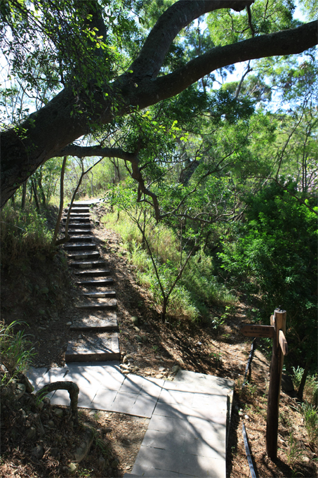
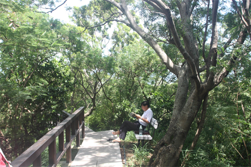
Stairway and Sleeper trail
Geologically Sensitive Area
No
Route planning
Half day
Debris Flow Torrents
No
Trail Track
Trail route
Trailhead / Trig
Mobile coverage
Observations (From iNaturalist)
Trailhead / Trig
Mobile coverage
Observations (From iNaturalist)
Reminders
Go with your companions and don't take shortcuts.
To ensure your safety, please go with your companions, follow the indicators, do not take shortcuts or self-directed routes, and do not leave your team and walk alone.
Carry Global Positioning System and communication equipment
For hiking, please plan your trip and bring enough equipment and food with you. It is suggested that you should carry Global Positioning System (GPS) and communication equipment such as a satellite phone, mobile phone, radio or satellite positioning equipment such as Personal Locator Beacon (PLB), etc., and should carry enough batteries to ensure emergency communication.
Quickly pass dangerous areas
The road condition in the mountainous area is unstable. Please do not stay or take pictures in dangerous areas such as collapsed or falling rocks and pay attention to your own safety at any time.
It is recommended to complete the mountaineering insurance
There are certain risks in mountain activities. It is recommended that you should complete mountaineering insurance before departure. (Note: General travel insurance does not necessarily cover mountaineering accidents. Please refer to the policy details before applying for insurance. For the mountaineering insurance, please refer to the following instructions in Financial Supervisory Commission's press release and choose the appropriate insurance.)
Information on mountaineering safety
For information on mountaineering safety, mountaineering equipment, and tips for using maps, please visit the website http://goo.gl/QUnv151u. It is recommended to read the information before the trip to ensure your outdoor activities are safe.
Travel Guide

Travel Guide
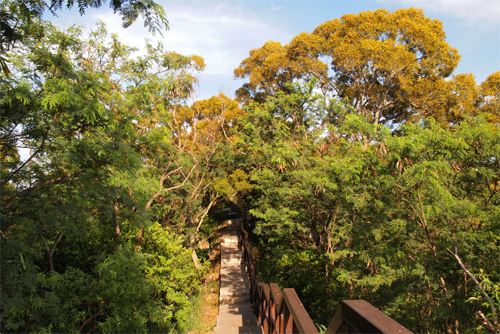
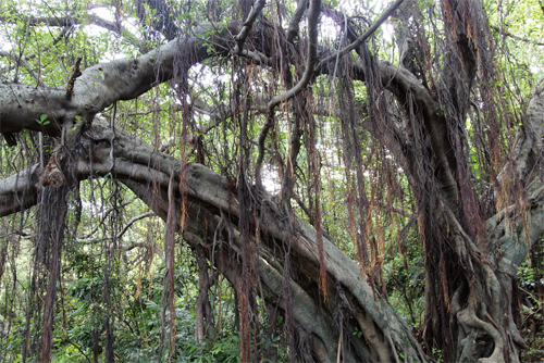
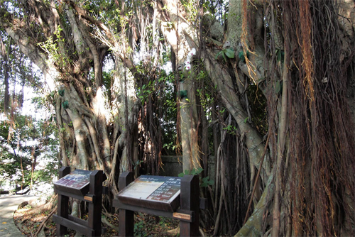
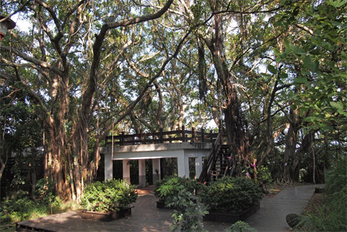
Featured Landscape
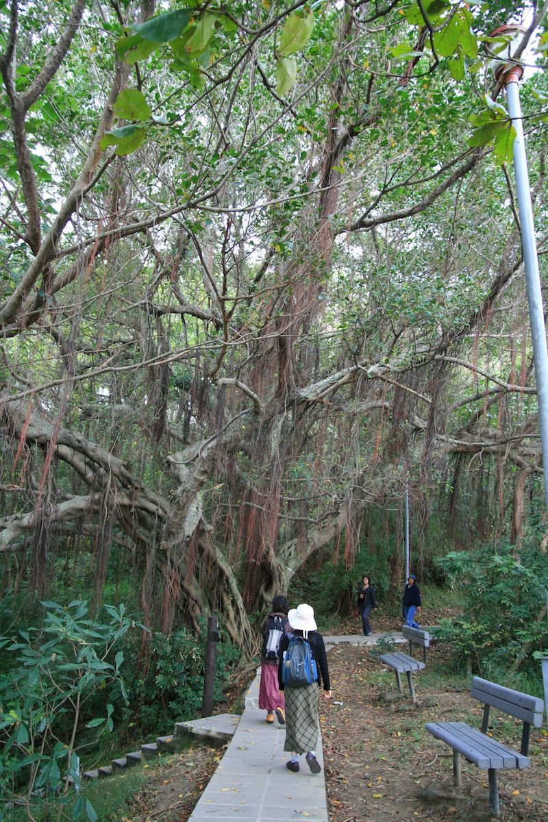
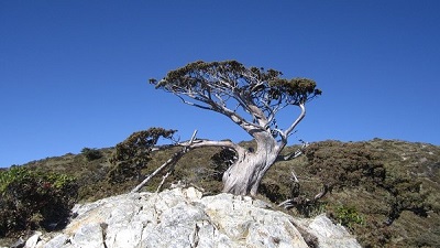
The century-old banyan tree is lush and lush
Source|許裕苗
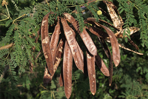
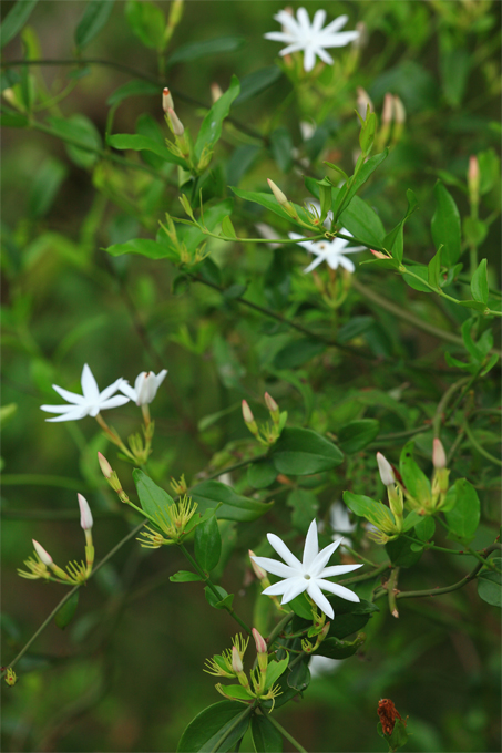
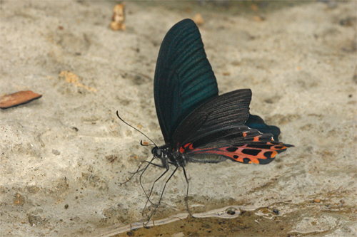
Along the trail, you can see centuries-old banyan trees, camphor trees, terminalia, kapok trees, and other plants that block out the sun. The old banyan trees with dense branches and leaves can be said to be the main plant feature of Liyushan. Each old banyan tree has dozens of supporting roots hanging down, creating the momentum of a forest. Once you climb up to the viewing platform, you will be surrounded by the supporting roots of the banyan trees, as if you have entered a city of banyan roots, and the deep shade of the trees provides visitors with a cool feeling. Lianas also have ecological and ornamental value. The Panlong tree, which is eaten by the larvae of small purple butterflies, clings to the trees beside the trail. When the fruits ripen in summer, they are bright red and quite eye-catching. The mountain holly that blooms in early spring is endemic to Taiwan. Its flowers are white and fragrant, and are shaped like a small sun, which is very pleasing.
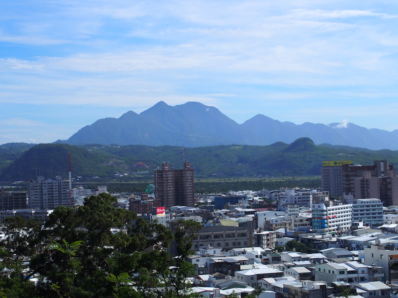
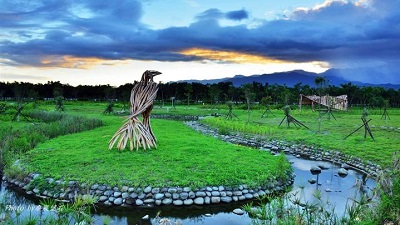
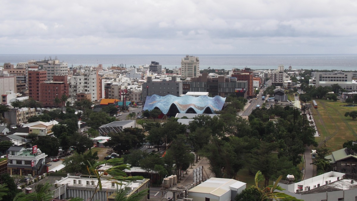
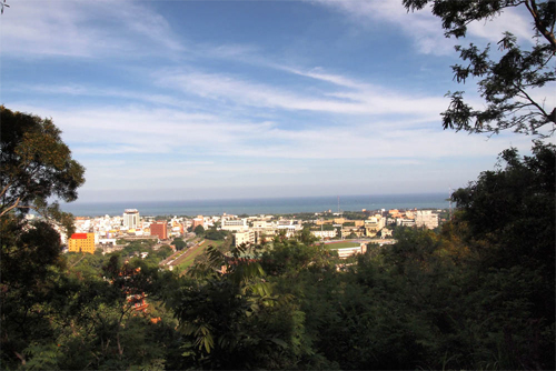
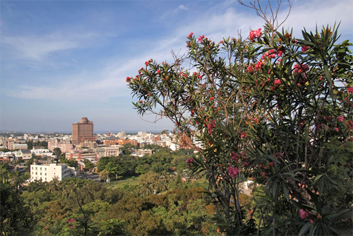
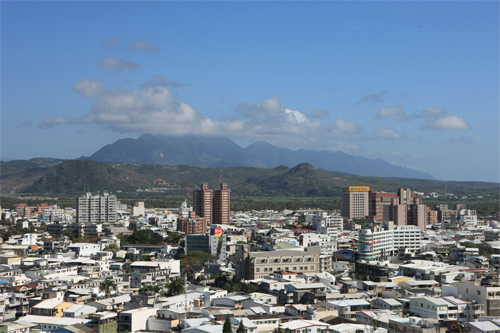
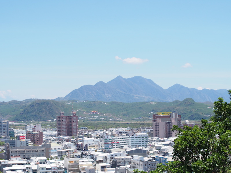
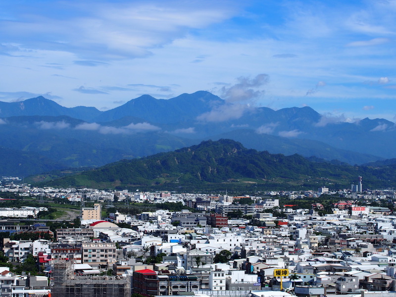
Climb high and see far, broad vision
Source|臺東分署
The viewing platform on the top of the mountain has an excellent view, overlooking Taitung City and the Pacific Ocean, and overlooking Dulan Mountain, Monkey Mountain, Stone Mountain, Tiger Head Mountain, Liji Badlands and Beinan Mountain Fault Cliff (commonly known as Little Yellow Mountain). When the weather is clear, Green Island and Orchid Island are in full view.
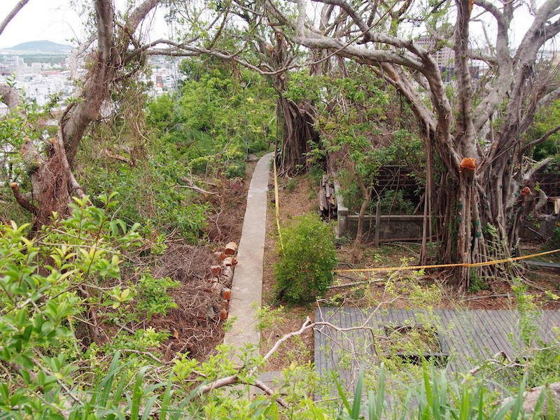
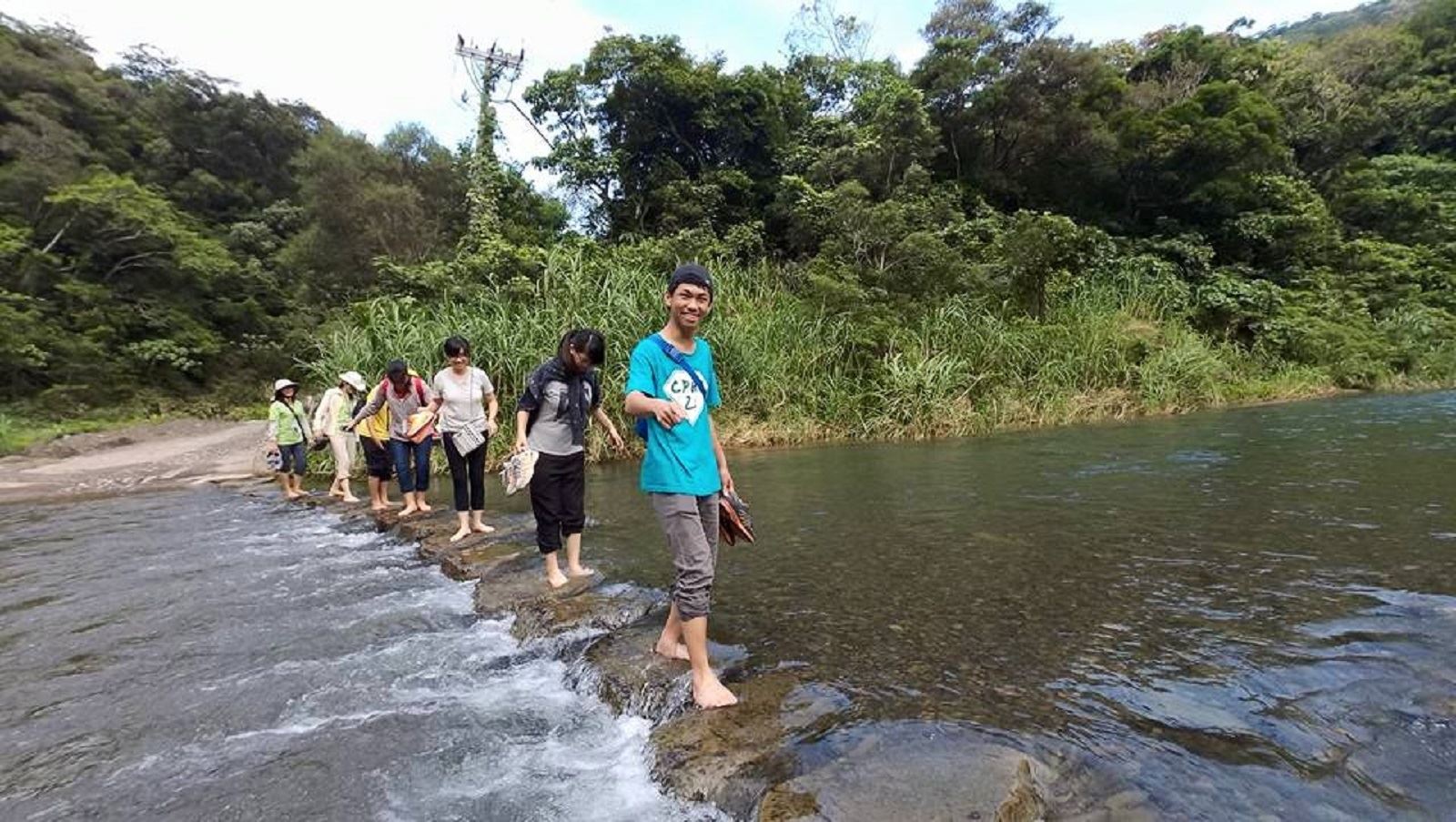
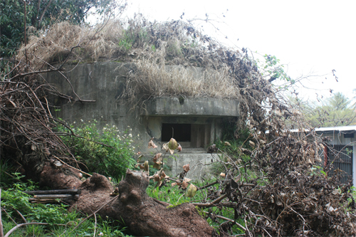
A century-old banyan tree survived a force 17 gust
Source|臺東分署
Typhoon Nepartak made landfall in Taimali, Taitung at 5:50 a.m. on July 8, 2016, and swept through the urban area of Taitung with strong winds. During the invasion of Taiwan by Typhoon Nepartak, the maximum gust speed ever recorded at the Taitung station was as high as 57.2m/s (17-level strong gust). The powerful winds brought by Typhoon Nepartak left the streets of Taitung City in ruins, with a large number of houses and roofs damaged, many signs and giant billboards blown down and scattered on the road, many cars overturned, and even train carriages blown down.
Nearby Attractions