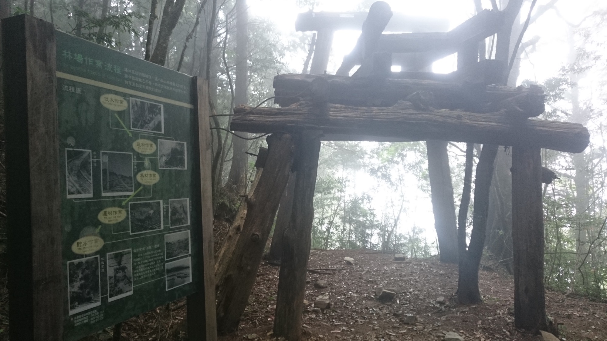


The tallest of the Seven Heroes of Guguan is Baxian Mountain which is 2,366m above sea level. It takes about 8 hours to walk the trail back and forth at a leisure pace. The first half is steeper. After the ridgeline, the walk is smooth and easy. The entire trail is sheltered by the forest. The vegetation changes from evergreen broadleaf forests to mixed conifer-broadleaf forests that go through obvious changes in different seasons and the colors are diverse and beautiful. Baxian Mountain used to be an important lumber yard in Taiwan. Many traces of lumbering operations can be seen along the trail. The even forest road used to be the railway for lumber transportation.
06/10 Wed.
Closed
24°
22° / 26°
臺中市 / 和平區
More
Weather Forecast
|
06.11
Thur.
|
06.12
Fri.
|
06.13
Sat.
|
06.14
Sun.
|
06.15
Mon.
|
06.16
Tue.
|
06.17
Wed.
|
|
|---|---|---|---|---|---|---|---|
| Temperature |
22 ° / 26 °
|
22 ° / 27 °
|
22 ° / 28 °
|
22 ° / 28 °
|
22 ° / 26 °
|
22 ° / 28 °
|
22 ° / 29 °
|
| Feel like | 24 ° / 29 ° | 25 ° / 31 ° | 24 ° / 32 ° | 23 ° / 31 ° | 24 ° / 30 ° | 24 ° / 31 ° | 24 ° / 33 ° |
|
Probability of Precipitation |
60 % | 70 % | 80 % | - | - | - | - |
| Relative Humidity | 91 % | 90 % | 89 % | 86 % | 90 % | 85 % | 85 % |
|
Wind speed Wind direction |
2
SW
|
2
SW
|
2
SW
|
3
SW
|
2
SW
|
2
SW
|
2
S
|
| UVI |
6
High
|
6
High
|
7
High
|
7
High
|
6
High
|
8
Very High
|
9
Very High
|
|
Sunrise Sunset |
|
|
|
|
|
|
|
Central Weather Bureau|Update Time:2026/06/10 17:02
Heping District, Taichung City
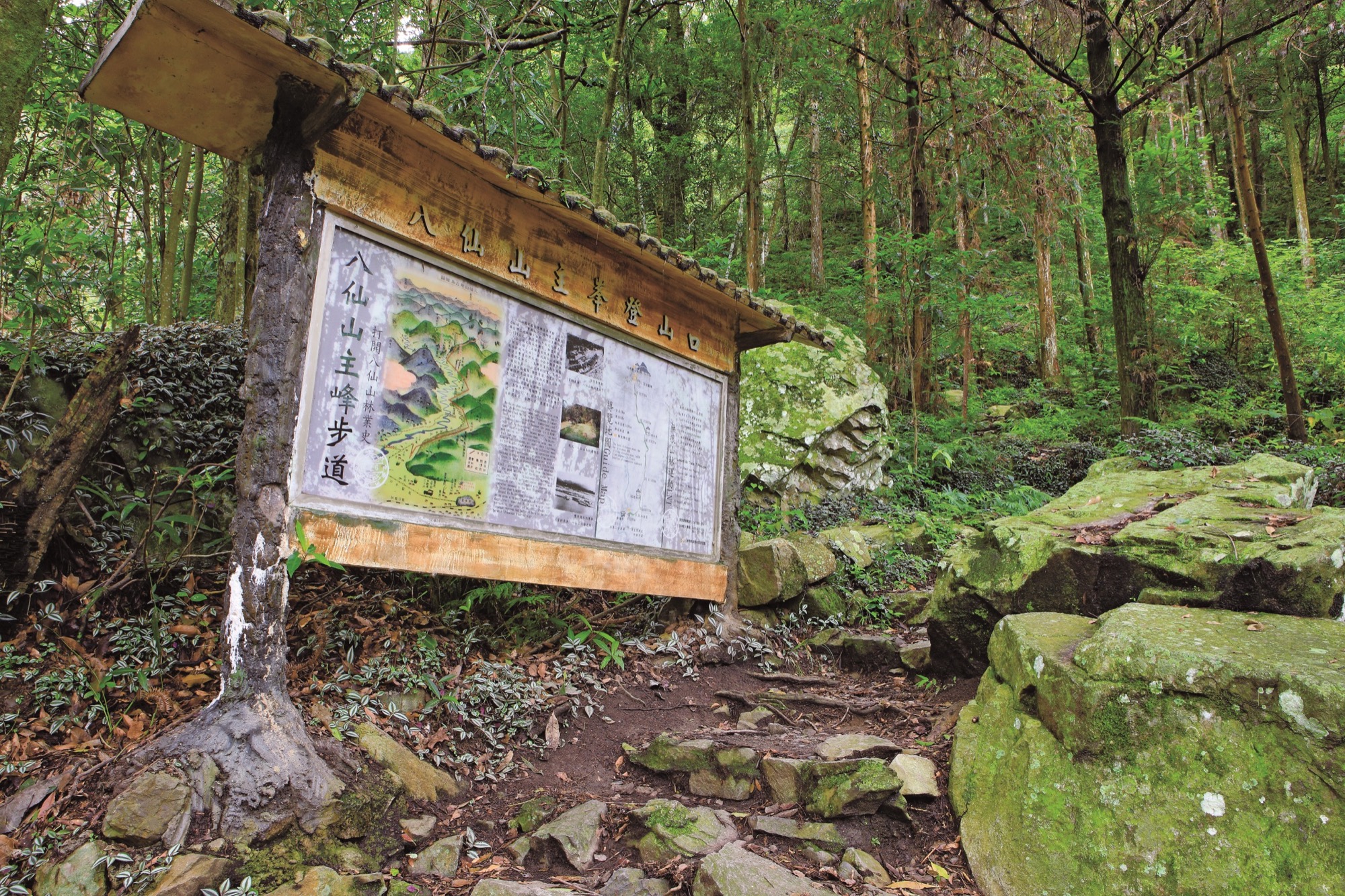
Basianshan Main Peak Trail
Learn about the Trail
Application
Transportation
Driving
National Highway no.1 or no.3→National Highway no. 4→exit to Tung-shih→cross Tung-shih Bridge→To Guguan→Pass through Heping and Liyang→turn right at Dumin Bridge→Basianshan National Forest Recreation Area→the hiking trail entrance is behind Jinghai temple
By bus
ake Fengyuan Bus bound for Guguan through Provincial Highway. Get off at Duming Bridge and walk toward the destination. <BR>Bus interval: one bus per hour between 6:35 and 18:00. <BR>Fengyuan Bus contact number: Provincial Highway Interval 04-22223454 / Fengyuan Station 04-25246603 / Tung Shih Station 04-25872043 (Departure time may be adjusted. Please check the latest information before taking the bus.)
Trail difficulty level
| Hiking Level |
|
|
|
|
|
|
|
||||||||||||||||||||||||||||||||||||||||||
|---|---|---|---|---|---|---|---|---|---|---|---|---|---|---|---|---|---|---|---|---|---|---|---|---|---|---|---|---|---|---|---|---|---|---|---|---|---|---|---|---|---|---|---|---|---|---|---|---|---|
| Target | General Public | General Public | Those who have better physical energy | Beginner mountain climber with good physical energy and map literacy. | Open to those who have good physical strength, map reading skills, and wild survival skills. | Open to well-trained mountain climbers. | Open to well-trained mountain climbers. | ||||||||||||||||||||||||||||||||||||||||||
| Elevation | Gently sloping area | In recreational areas, close to settlements or about 1,000 meters above sea level. | In recreational areas, close to settlements or between 1,000~2,000 meters above sea level. | Remote areas or between 2,000 to 3,000 meters above sea level | Remote areas, wilderness, or between 2,000 to 3,000 meters above sea level | Remote areas, wilderness, or more than 3,000 meters above sea level | Remote areas, wilderness, or more than 3,000 meters above sea level | ||||||||||||||||||||||||||||||||||||||||||
| Required Time | It takes half to one day. | It takes half to one day. | It can be done within one day. | It takes one or more days. | Overnight preparation required. | It takes up to three days. | It takes up to three days. | ||||||||||||||||||||||||||||||||||||||||||
| Equipment | Light backpacking (water and small amount of food) | Light backpacking (water and small amount of food) | Light backpacking (water and proper amount of food) | Overnight preparation required. (e.g. drinking water, food, map, warm clothing, first-aid medicine, etc.) Application for entrance permission in advance is required if there is access control. | Comprehensive Mountaineering Gear Required. (e.g. food, drinking water, cooking utensils, map, warm clothing, flashlight, sleeping bag, tent, etc.) Application for entrance permission in advance is required if there is access control. | Comprehensive Mountaineering Gear Required. (e.g. food, drinking water, cooking utensils, map, warm clothing, flashlight, sleeping bag, tent, etc.) Application for entrance permission in advance is required if there is access control. | Comprehensive Mountaineering Gear Required. (e.g. food, drinking water, cooking utensils, map, warm clothing, flashlight, sleeping bag, tent, etc.) Application for entrance permission in advance is required if there is access control. | ||||||||||||||||||||||||||||||||||||||||||
| Description | Flat hiking trails. Relatively even slopes with comprehensive facilities and smooth road surface. Accessible for handicapped assistive devices or baby strollers. | An open hiking trail with easy access. Relatively even slopes with comprehensive facilities and smooth road surface. It takes half a day or less than one day to complete. | An open hiking trail with easy access. Somewhat steep slope with some difficult sections, but has comprehensive facilities and smooth road surface. It takes less than one day to complete. | A hiking trail locates at remote area or with part of the route is in area which requires entrance permission. Application in advance is required. Part of the route is in relatively bad condition with steeper slopes, but basic facilities are provided. It takes one day or between one to three days to complete. | A hiking trail locates at remote area or with part of the route is in area which requires entrance permission. It’s located in high-altitude areas (higher than 3000 meters above sea level). The trail is relatively primitive, with steeper slopes and unstable weather conditions. Part of the route may be dangerous or difficult for climbers. It takes two to three days to complete. Lead from professionals is recommended. | A hiking trail locates at area with inconvenient traffic, and mostly with routes in area which requires entrance permission. It’s located in high-altitude areas (higher than 3000 meters above sea level). The trail is located at primitive area, with bad condition, steeper slopes, and unstable weather conditions. Many parts of the route may be dangerous or difficult for climbers. It takes three or more days to complete. Lead from professionals is recommended. | 1. Level 3, 4 or 5 trails when snow or ice accumulating 2. Informal trails, without clear subgrades or paths, belong to special routes such as original mountain trails, ancient trail relics, prospecting, or technical climbing. |
Hiking Level
Target
General Public
Elevation
Gently sloping area
Required Time
It takes half to one day.
Equipment
Light backpacking (water and small amount of food)
Description
Flat hiking trails. Relatively even slopes with comprehensive facilities and smooth road surface. Accessible for handicapped assistive devices or baby strollers.
Hiking Level
Target
General Public
Elevation
In recreational areas, close to settlements or about 1,000 meters above sea level.
Required Time
It takes half to one day.
Equipment
Light backpacking (water and small amount of food)
Description
An open hiking trail with easy access. Relatively even slopes with comprehensive facilities and smooth road surface. It takes half a day or less than one day to complete.
Hiking Level
Target
Those who have better physical energy
Elevation
In recreational areas, close to settlements or between 1,000~2,000 meters above sea level.
Required Time
It can be done within one day.
Equipment
Light backpacking (water and proper amount of food)
Description
An open hiking trail with easy access. Somewhat steep slope with some difficult sections, but has comprehensive facilities and smooth road surface. It takes less than one day to complete.
Hiking Level
Target
Beginner mountain climber with good physical energy and map literacy.
Elevation
Remote areas or between 2,000 to 3,000 meters above sea level
Required Time
It takes one or more days.
Equipment
Overnight preparation required. (e.g. drinking water, food, map, warm clothing, first-aid medicine, etc.)
Application for entrance permission in advance is required if there is access control.
Description
A hiking trail locates at remote area or with part of the route is in area which requires entrance permission. Application in advance is required. Part of the route is in relatively bad condition with steeper slopes, but basic facilities are provided. It takes one day or between one to three days to complete.
Hiking Level
Target
Open to those who have good physical strength, map reading skills, and wild survival skills.
Elevation
Remote areas, wilderness, or between 2,000 to 3,000 meters above sea level
Required Time
Overnight preparation required.
Equipment
Comprehensive Mountaineering Gear Required. (e.g. food, drinking water, cooking utensils, map, warm clothing, flashlight, sleeping bag, tent, etc.)
Application for entrance permission in advance is required if there is access control.
Description
A hiking trail locates at remote area or with part of the route is in area which requires entrance permission. It’s located in high-altitude areas (higher than 3000 meters above sea level). The trail is relatively primitive, with steeper slopes and unstable weather conditions. Part of the route may be dangerous or difficult for climbers. It takes two to three days to complete. Lead from professionals is recommended.
Hiking Level
Target
Open to well-trained mountain climbers.
Elevation
Remote areas, wilderness, or more than 3,000 meters above sea level
Required Time
It takes up to three days.
Equipment
Comprehensive Mountaineering Gear Required. (e.g. food, drinking water, cooking utensils, map, warm clothing, flashlight, sleeping bag, tent, etc.)
Application for entrance permission in advance is required if there is access control.
Description
A hiking trail locates at area with inconvenient traffic, and mostly with routes in area which requires entrance permission. It’s located in high-altitude areas (higher than 3000 meters above sea level). The trail is located at primitive area, with bad condition, steeper slopes, and unstable weather conditions. Many parts of the route may be dangerous or difficult for climbers. It takes three or more days to complete. Lead from professionals is recommended.
Hiking Level
Target
Open to well-trained mountain climbers.
Elevation
Remote areas, wilderness, or more than 3,000 meters above sea level
Required Time
It takes up to three days.
Equipment
Comprehensive Mountaineering Gear Required. (e.g. food, drinking water, cooking utensils, map, warm clothing, flashlight, sleeping bag, tent, etc.)
Application for entrance permission in advance is required if there is access control.
Description
1. Level 3, 4 or 5 trails when snow or ice accumulating
2. Informal trails, without clear subgrades or paths, belong to special routes such as original mountain trails, ancient trail relics, prospecting, or technical climbing.
Reachable by Vehicle
O:Cars、Microbus、Coach Bus
Mountain system
Zhongzhang Mountain Area Trail System
Administer
Tungshih Forest Dist. Office
Elevation
1,029 ~ 2,366 m
Service Line
+886 425150855
Altitude Difference
1,337 m
Huts
-
Length of the Trail
6 KM
Entry Permit
No
Trail type
Linear one way
Via Nature Reserve
No
Service Line
Rock terrace,Mountain trail,Wooden path
Geologically Sensitive Area
Yes
Route planning
1 day
Debris Flow Torrents
No
Trail Track
Trail route
Trailhead / Trig
Mobile coverage
Observations (From iNaturalist)
Trailhead / Trig
Mobile coverage
Observations (From iNaturalist)
Reminders
Go with your companions and don't take shortcuts.
To ensure your safety, please go with your companions, follow the indicators, do not take shortcuts or self-directed routes, and do not leave your team and walk alone.
Carry Global Positioning System and communication equipment
For hiking, please plan your trip and bring enough equipment and food with you. It is suggested that you should carry Global Positioning System (GPS) and communication equipment such as a satellite phone, mobile phone, radio or satellite positioning equipment such as Personal Locator Beacon (PLB), etc., and should carry enough batteries to ensure emergency communication.
Quickly pass dangerous areas
The road condition in the mountainous area is unstable. Please do not stay or take pictures in dangerous areas such as collapsed or falling rocks and pay attention to your own safety at any time.
It is recommended to complete the mountaineering insurance
There are certain risks in mountain activities. It is recommended that you should complete mountaineering insurance before departure. (Note: General travel insurance does not necessarily cover mountaineering accidents. Please refer to the policy details before applying for insurance. For the mountaineering insurance, please refer to the following instructions in Financial Supervisory Commission's press release and choose the appropriate insurance.)
Information on mountaineering safety
For information on mountaineering safety, mountaineering equipment, and tips for using maps, please visit the website http://goo.gl/QUnv56u. It is recommended to read the information before the trip to ensure your outdoor activities are safe.
Travel Guide

Travel Guide
Featured Landscape
Colorful canvas of four seasons
Source|林文智
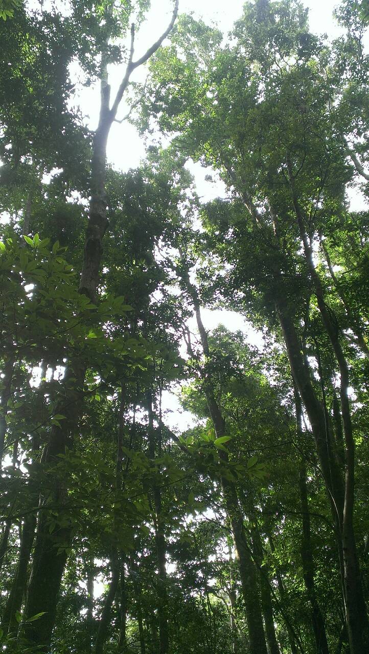
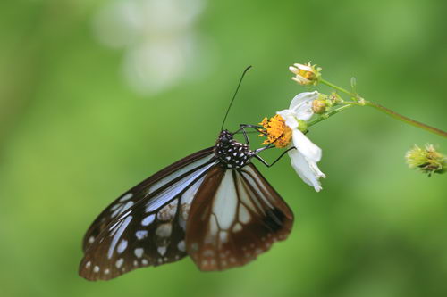
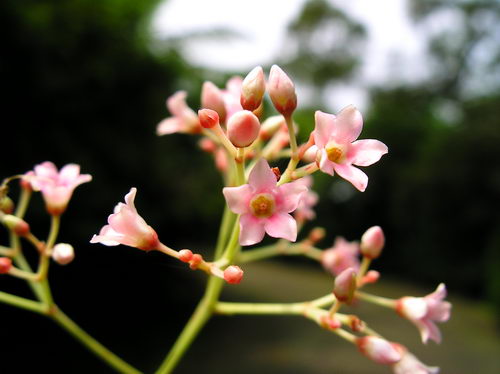
The vegetation at the entrance of the Baxianshan trail belongs to the common broad-leaved forest at medium and low altitudes. In spring and summer, tung trees, Fagaceae plants and sour vines bloom, adorning the mountaintops with white, yellow and pink blocks respectively. In autumn and winter, the mountaintops turn from green to yellow or red, and are colorful.
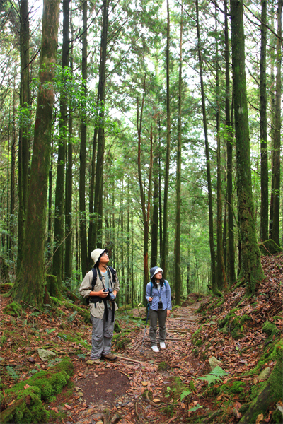
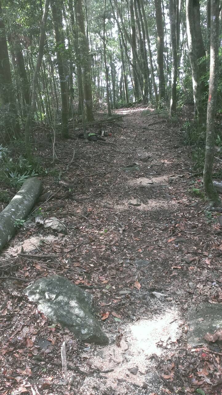
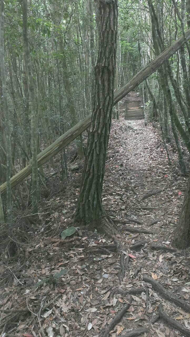
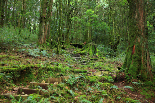
Diverse trail vegetation
Source|臺中分署
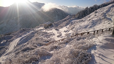
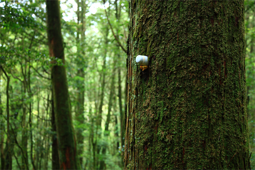
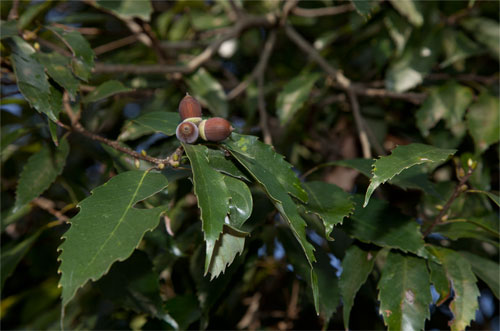
After the pavilion at about 1.5K on the trail, the broad-leaved forest begins to turn into coniferous species. The ridgeline is dominated by wind-swept dwarf forests composed of red nanmu, green oak, big-headed camellia, and small-leaved red nanmu. There are also large tracts of osmanthus forests along the way. Higher up, you enter the afforestation area, which is dominated by Cryptomeria fortunei. Due to the long-term afternoon fog, a fog forest climate is formed. A large number of knotty ferns and rare ferns grow under the forest. The tree trunks and the ground are covered with thick mosses. The epiphytes on them include fog forest indicator species such as Polypodiaceae, Graminaceae and Hymenopteris, or some more special orchids, such as the star orchid, Alishan bean orchid, hanging orchid, spider orchid, etc. After 1,800 meters above sea level, there are several giant red cypress and hinoki cypress trees.

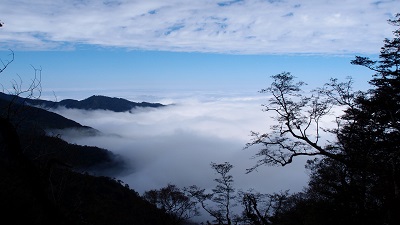
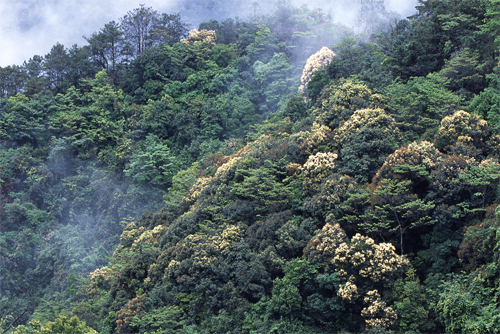
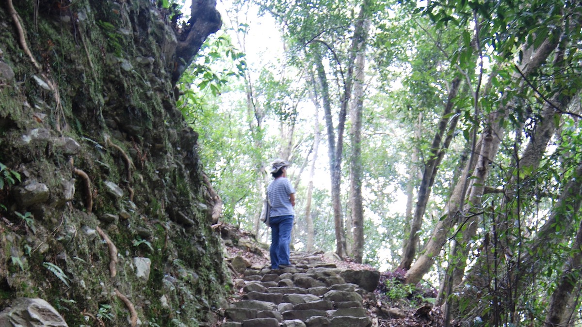
Overlooking the mountains and admiring the clouds
Source|臺中分署
At the 0.7K point on the trail, you can overlook the panoramic view of the "Jiabao River" and "Baxianshan" National Forest Recreation Area. 2K is the best location to overlook the ridges of "Dongmao Mountain" and "Wuwawei Mountain". When the weather conditions are good, you can see the famous "Yuanzui Shaolai" and "Hengling Mountain" of the Daxue Mountain range, and overlook the magnificent Dajia Valley. In the afternoon, clouds and mists curl around the mountaintops on the opposite bank, as majestic as a galloping horse.
Seven Peaks of Guguan
Source|臺中分署
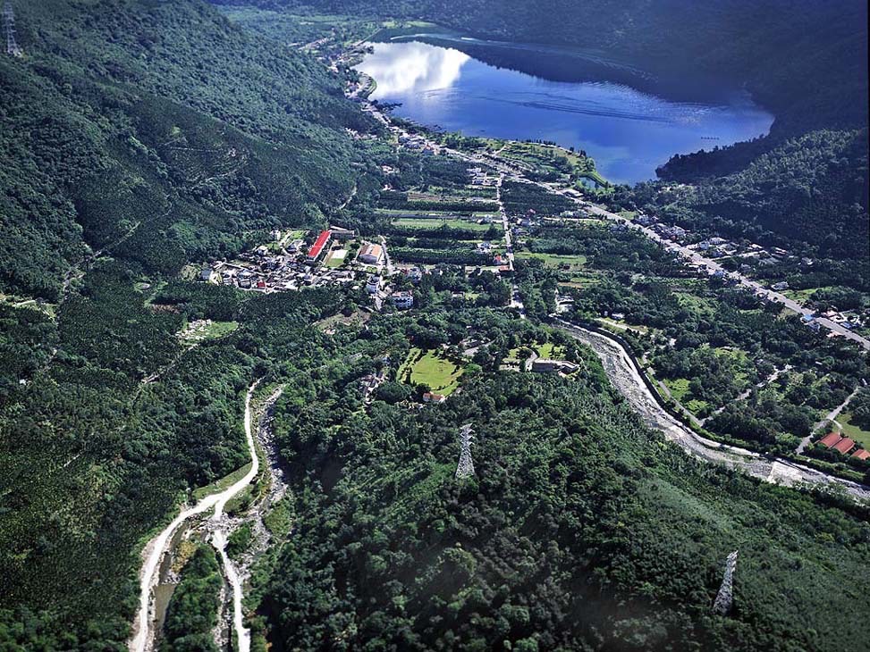
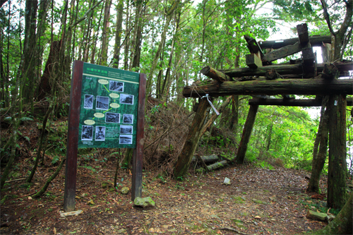
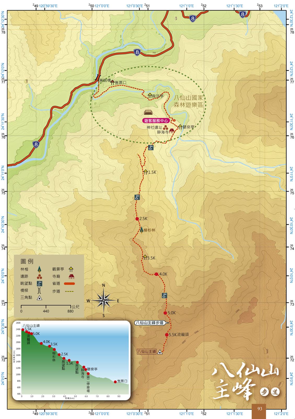
The mountains around Guguan are steep and rugged, and the main peaks form the famous "Seven Peaks of Guguan", namely "Baxian Mountain", "Malun Mountain", "Baimao Mountain", "Wuwowei Mountain", "Tangmadan Mountain", "Bojinga Mountain" and "Dongmao Mountain". Among them, "Baxian Mountain" has an altitude of 2,366 meters, making it the highest of the seven peaks, and its rich forest landscape is also the best among the seven peaks. Baxian Mountain is located between the south bank of Dajia River and the north bank of Beigang River. It is the southwest ridge of Baigu Mountain. This ridge is the county boundary of Taichung County and Nantou County. Due to the severe erosion and scouring of the valleys on both sides, the geology is quite unstable. Therefore, it is difficult to develop vertical hiking routes in this mountain area except for the traditional single mountain trail. Therefore, most of the intermediate mountains in this mountain area are mainly single-attack and round-trip on the same day.
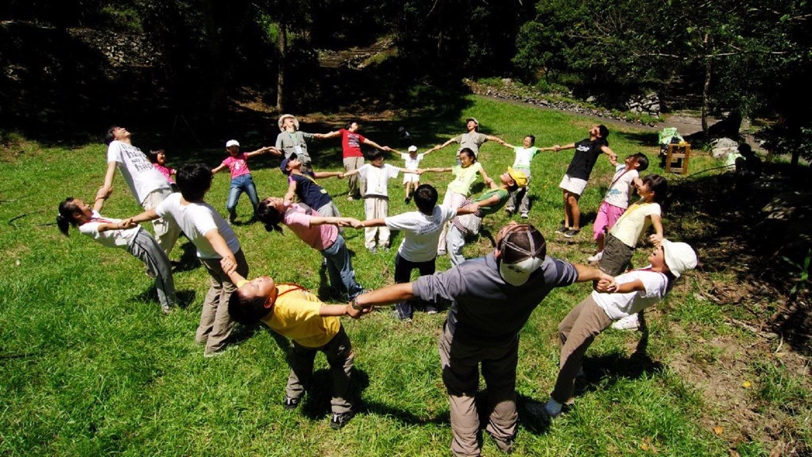
Nearby Attractions