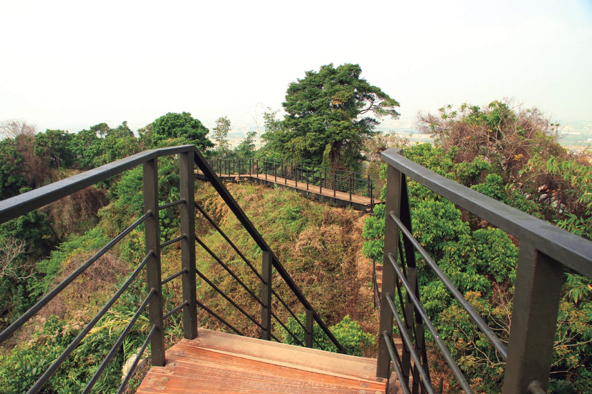
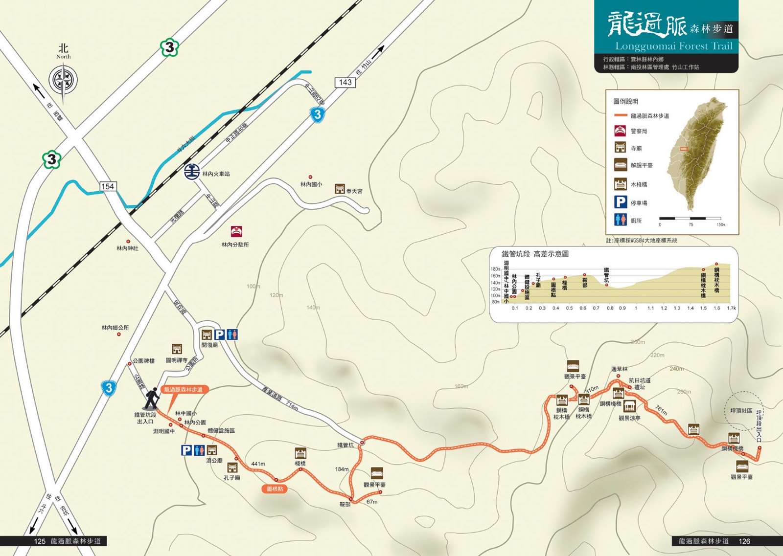
The Longguomai Forest Trail connects Linzhong, Linnan and Pingding Villages in Linnei Township. There are three entrances, respectively at Linnei Park (Shenshe Park), the Tieguankeng Section and the Pingding Section. Visitors can walk from Linnei Park to the Tieguankeng Section to connect to the Bukeng Section or from Kaifu Temple to the Tieguankeng Section and then Bukeng. The part from Pingding to the Tieguankeng Section was built along the ridgeline. From there, the view is excellent. There are century-old acacia trees, purple crow butterflies that come in particular seasons, trenches dug out to fight Japanese, and other rich and diverse natural and cultural attractions.
07/26 Sun.
Open
28°
25° / 33°
雲林縣 / 林內鄉
More
Weather Forecast
|
07.27
Mon.
|
07.28
Tue.
|
07.29
Wed.
|
07.30
Thur.
|
07.31
Fri.
|
08.01
Sat.
|
08.02
Sun.
|
|
|---|---|---|---|---|---|---|---|
| Temperature |
25 ° / 33 °
|
25 ° / 34 °
|
25 ° / 35 °
|
25 ° / 35 °
|
25 ° / 33 °
|
25 ° / 34 °
|
25 ° / 33 °
|
| Feel like | 28 ° / 37 ° | 27 ° / 38 ° | 28 ° / 39 ° | 29 ° / 39 ° | 29 ° / 37 ° | 28 ° / 39 ° | 28 ° / 38 ° |
|
Probability of Precipitation |
70 % | 30 % | 20 % | - | - | - | - |
| Relative Humidity | 88 % | 83 % | 82 % | 82 % | 83 % | 84 % | 84 % |
|
Wind speed Wind direction |
2
NE
|
2
NE
|
2
NE
|
2
E
|
2
SW
|
2
SW
|
2
W
|
| UVI |
8
Very High
|
9
Very High
|
9
Very High
|
9
Very High
|
8
Very High
|
9
Very High
|
9
Very High
|
|
Sunrise Sunset |
|
|
|
|
|
|
|
Central Weather Bureau|Update Time:2026/07/26 17:19
Linnei Township, Yunlin County
Longguomai Forest Trail
Learn about the Trail
Trail difficulty level
| Hiking Level |
|
|
|
|
|
|
|
||||||||||||||||||||||||||||||||||||||||||
|---|---|---|---|---|---|---|---|---|---|---|---|---|---|---|---|---|---|---|---|---|---|---|---|---|---|---|---|---|---|---|---|---|---|---|---|---|---|---|---|---|---|---|---|---|---|---|---|---|---|
| Target | General Public | General Public | Those who have better physical energy | Beginner mountain climber with good physical energy and map literacy. | Open to those who have good physical strength, map reading skills, and wild survival skills. | Open to well-trained mountain climbers. | Open to well-trained mountain climbers. | ||||||||||||||||||||||||||||||||||||||||||
| Elevation | Gently sloping area | In recreational areas, close to settlements or about 1,000 meters above sea level. | In recreational areas, close to settlements or between 1,000~2,000 meters above sea level. | Remote areas or between 2,000 to 3,000 meters above sea level | Remote areas, wilderness, or between 2,000 to 3,000 meters above sea level | Remote areas, wilderness, or more than 3,000 meters above sea level | Remote areas, wilderness, or more than 3,000 meters above sea level | ||||||||||||||||||||||||||||||||||||||||||
| Required Time | It takes half to one day. | It takes half to one day. | It can be done within one day. | It takes one or more days. | Overnight preparation required. | It takes up to three days. | It takes up to three days. | ||||||||||||||||||||||||||||||||||||||||||
| Equipment | Light backpacking (water and small amount of food) | Light backpacking (water and small amount of food) | Light backpacking (water and proper amount of food) | Overnight preparation required. (e.g. drinking water, food, map, warm clothing, first-aid medicine, etc.) Application for entrance permission in advance is required if there is access control. | Comprehensive Mountaineering Gear Required. (e.g. food, drinking water, cooking utensils, map, warm clothing, flashlight, sleeping bag, tent, etc.) Application for entrance permission in advance is required if there is access control. | Comprehensive Mountaineering Gear Required. (e.g. food, drinking water, cooking utensils, map, warm clothing, flashlight, sleeping bag, tent, etc.) Application for entrance permission in advance is required if there is access control. | Comprehensive Mountaineering Gear Required. (e.g. food, drinking water, cooking utensils, map, warm clothing, flashlight, sleeping bag, tent, etc.) Application for entrance permission in advance is required if there is access control. | ||||||||||||||||||||||||||||||||||||||||||
| Description | Flat hiking trails. Relatively even slopes with comprehensive facilities and smooth road surface. Accessible for handicapped assistive devices or baby strollers. | An open hiking trail with easy access. Relatively even slopes with comprehensive facilities and smooth road surface. It takes half a day or less than one day to complete. | An open hiking trail with easy access. Somewhat steep slope with some difficult sections, but has comprehensive facilities and smooth road surface. It takes less than one day to complete. | A hiking trail locates at remote area or with part of the route is in area which requires entrance permission. Application in advance is required. Part of the route is in relatively bad condition with steeper slopes, but basic facilities are provided. It takes one day or between one to three days to complete. | A hiking trail locates at remote area or with part of the route is in area which requires entrance permission. It’s located in high-altitude areas (higher than 3000 meters above sea level). The trail is relatively primitive, with steeper slopes and unstable weather conditions. Part of the route may be dangerous or difficult for climbers. It takes two to three days to complete. Lead from professionals is recommended. | A hiking trail locates at area with inconvenient traffic, and mostly with routes in area which requires entrance permission. It’s located in high-altitude areas (higher than 3000 meters above sea level). The trail is located at primitive area, with bad condition, steeper slopes, and unstable weather conditions. Many parts of the route may be dangerous or difficult for climbers. It takes three or more days to complete. Lead from professionals is recommended. | 1. Level 3, 4 or 5 trails when snow or ice accumulating 2. Informal trails, without clear subgrades or paths, belong to special routes such as original mountain trails, ancient trail relics, prospecting, or technical climbing. |
Hiking Level
Target
General Public
Elevation
Gently sloping area
Required Time
It takes half to one day.
Equipment
Light backpacking (water and small amount of food)
Description
Flat hiking trails. Relatively even slopes with comprehensive facilities and smooth road surface. Accessible for handicapped assistive devices or baby strollers.
Hiking Level
Target
General Public
Elevation
In recreational areas, close to settlements or about 1,000 meters above sea level.
Required Time
It takes half to one day.
Equipment
Light backpacking (water and small amount of food)
Description
An open hiking trail with easy access. Relatively even slopes with comprehensive facilities and smooth road surface. It takes half a day or less than one day to complete.
Hiking Level
Target
Those who have better physical energy
Elevation
In recreational areas, close to settlements or between 1,000~2,000 meters above sea level.
Required Time
It can be done within one day.
Equipment
Light backpacking (water and proper amount of food)
Description
An open hiking trail with easy access. Somewhat steep slope with some difficult sections, but has comprehensive facilities and smooth road surface. It takes less than one day to complete.
Hiking Level
Target
Beginner mountain climber with good physical energy and map literacy.
Elevation
Remote areas or between 2,000 to 3,000 meters above sea level
Required Time
It takes one or more days.
Equipment
Overnight preparation required. (e.g. drinking water, food, map, warm clothing, first-aid medicine, etc.)
Application for entrance permission in advance is required if there is access control.
Description
A hiking trail locates at remote area or with part of the route is in area which requires entrance permission. Application in advance is required. Part of the route is in relatively bad condition with steeper slopes, but basic facilities are provided. It takes one day or between one to three days to complete.
Hiking Level
Target
Open to those who have good physical strength, map reading skills, and wild survival skills.
Elevation
Remote areas, wilderness, or between 2,000 to 3,000 meters above sea level
Required Time
Overnight preparation required.
Equipment
Comprehensive Mountaineering Gear Required. (e.g. food, drinking water, cooking utensils, map, warm clothing, flashlight, sleeping bag, tent, etc.)
Application for entrance permission in advance is required if there is access control.
Description
A hiking trail locates at remote area or with part of the route is in area which requires entrance permission. It’s located in high-altitude areas (higher than 3000 meters above sea level). The trail is relatively primitive, with steeper slopes and unstable weather conditions. Part of the route may be dangerous or difficult for climbers. It takes two to three days to complete. Lead from professionals is recommended.
Hiking Level
Target
Open to well-trained mountain climbers.
Elevation
Remote areas, wilderness, or more than 3,000 meters above sea level
Required Time
It takes up to three days.
Equipment
Comprehensive Mountaineering Gear Required. (e.g. food, drinking water, cooking utensils, map, warm clothing, flashlight, sleeping bag, tent, etc.)
Application for entrance permission in advance is required if there is access control.
Description
A hiking trail locates at area with inconvenient traffic, and mostly with routes in area which requires entrance permission. It’s located in high-altitude areas (higher than 3000 meters above sea level). The trail is located at primitive area, with bad condition, steeper slopes, and unstable weather conditions. Many parts of the route may be dangerous or difficult for climbers. It takes three or more days to complete. Lead from professionals is recommended.
Hiking Level
Target
Open to well-trained mountain climbers.
Elevation
Remote areas, wilderness, or more than 3,000 meters above sea level
Required Time
It takes up to three days.
Equipment
Comprehensive Mountaineering Gear Required. (e.g. food, drinking water, cooking utensils, map, warm clothing, flashlight, sleeping bag, tent, etc.)
Application for entrance permission in advance is required if there is access control.
Description
1. Level 3, 4 or 5 trails when snow or ice accumulating
2. Informal trails, without clear subgrades or paths, belong to special routes such as original mountain trails, ancient trail relics, prospecting, or technical climbing.
Reachable by Vehicle
X:Cars、Microbus、Coach Bus
Mountain system
-
Administer
Nantou Forest Dist. Office
Elevation
90 ~ 200 m
Service Line
+886 492365226 #2508
Altitude Difference
110 m
Huts
-
Length of the Trail
2.22 KM
Entry Permit
No
Trail type
Linear bidirectional
Via Nature Reserve
No
Service Line
Soil pavement,Wooden path,Wooden stairway
Geologically Sensitive Area
Yes
Route planning
Half day
Debris Flow Torrents
No
Trail Track
Trail route
Trailhead / Trig
Mobile coverage
Observations (From iNaturalist)
Trailhead / Trig
Mobile coverage
Observations (From iNaturalist)
Entrance of Tieguankeng Section → (0.1K, 5 minutes) → Linnei Park → (0.1K, 5 minutes) → Jigong Temple, Confucius Temple → (0.2K, 10 minutes) → Nanlinnei Mountain → (0.4K, 15 minutes) → Anbu Fork → (0.06K, 5 minutes) → Observation Deck → (Turn back) → (0.06K, 5 minutes) → Anbu Fork → (0.2K, 10 minutes) → Tieguankeng → (0.6K, 30 minutes) → Observation Deck → (0.7K, 35 minutes) → Longguomai Observation Deck → (0.1K, 5 minutes) → Entrance of Pingding Section
Reminders
Mountain Encyclopedia
Please click below to view information
Travel Guide

Travel Guide
Nearby Attractions
Pingding Wufu Shenmu Centennial Mango Tree
Located in Pingding Community, Linnei Township, there are four mango trees that are more than 300 years old and one 100-year-old Jiuchongchui. The four old mango trees are about 15 meters tall, growing well, with dense branches and leaves, and still blooming and bearing fruit.
More
Pingding Ruins
The Pingding site, located in the tea garden of Pingding Village, dates back 3,000 years. The unearthed relics are mainly pottery and stone tools. The pottery is mainly gray-black sandy pottery, with patterns decorated on the rim, outer side of the abdomen and inner edge of the lips. It has the characteristics of Pingpu culture and has a rich variety of patterns.
More
Pingding Ancient Tombs
Located in the bamboo forest on the south slope of Pingding Village, residents have passed down from generation to generation that entry is prohibited. There are more than a dozen ancient tombs, some of which are stone tombs of the ancestors of the Pingpu people, and some are tombstones of the Han people in the Qing Dynasty. The stone tombs of the Pingpu people are distributed in the bamboo forest or next to the tea garden. They are surrounded by sandstone and gravel, with a large stone in the middle to mark the tombstone, and there is no text engraved on them.
More
Huben Village Eight-Colored Bird Ecological Cooperative
Huben Village is known as the "hometown of eight-colored birds". The cooperative is located in an ancient courtyard house on the bank of Tai Po River. Its business projects include homestays, guided tours, catering, and the sale of agricultural products. It is not only an information service center for tourists, but also an emotional networking center for residents.
Rinnai Shrine
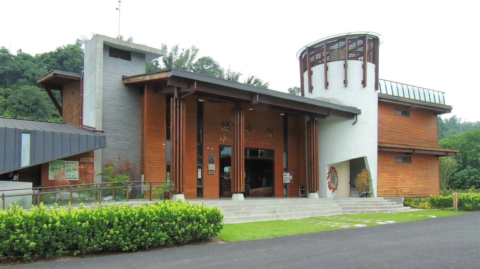
Located in Linnei Park opposite the Linnei Township Office, the site of the current Confucius Temple was the early "Rinnei Shrine" also known as the "Japanese Shrine". It was established in 1953 and renamed Linnei Park in 1939. It preserves the two torii gates and six stone lantern pavilions of that time. It is one of the more complete Japanese shrine ruins in Taiwan.
More
Giant Bamboo Forest of Hu Ben
Located in Zhuben Village, Linnei Township, the giant bamboo was originally called Douzhu. It was introduced to Huben 20 years ago. Due to its low practicality, it was allowed to grow naturally, forming many giant bamboo landscapes in the community.
Zhuoshui Power Plant
Located on the south bank of Zhuoshui River in Wutu Village, Linnei Township, it was formerly known as the "Linnei Power Plant" and the "Wutu Power Plant". It was built in 1921 and is the only hydroelectric power plant in the Yunlin-Chiayi area. It is also one of the few power plants in Taiwan located in the fields.
More
Farmland Irrigation Cultural Relics Exhibition Hall
The park consists of two parts: inside and outside the museum. Inside the museum, there is an exhibition room of the father of Taiwan's water conservancy, "Technician Yoichi Hatta", as well as water conservancy documents, the history of the development of farmland water conservancy irrigation, etc. It provides the public with an in-depth understanding of Taiwan's water conservancy stories and the great hardships of the ancestors who overcame difficulties to divert water for irrigation and fought against nature.
More
Travel Advice
Arrange a 1-2 day itinerary with various attractions in Linnai
Nearby Attractions