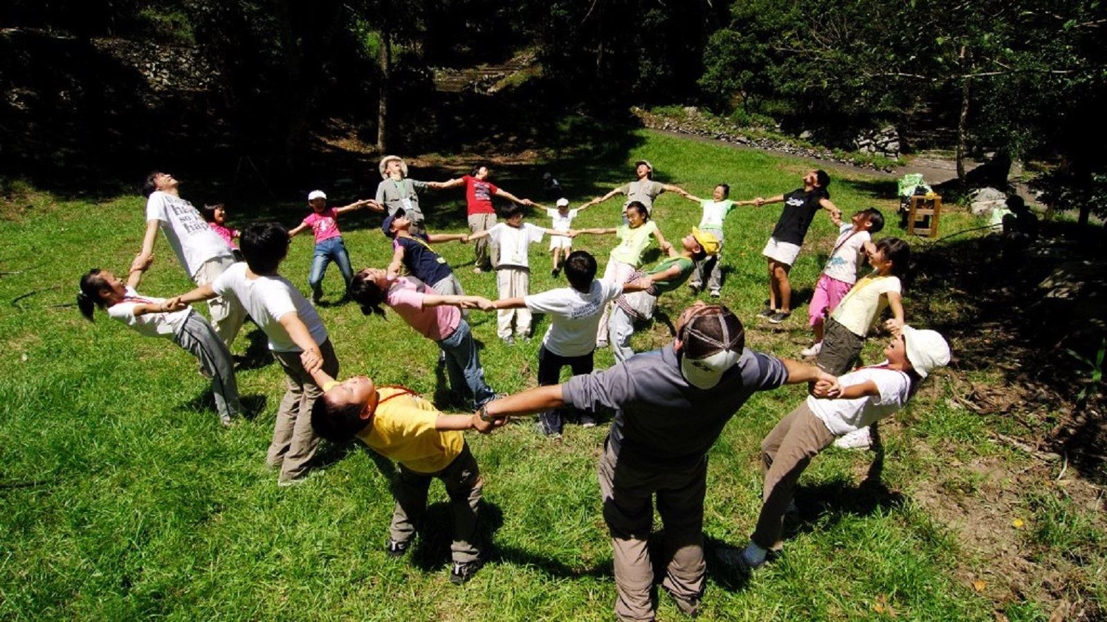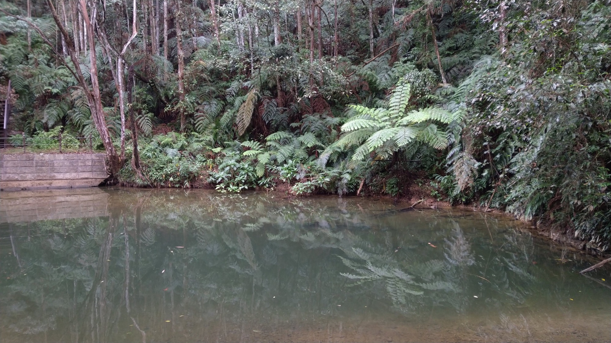
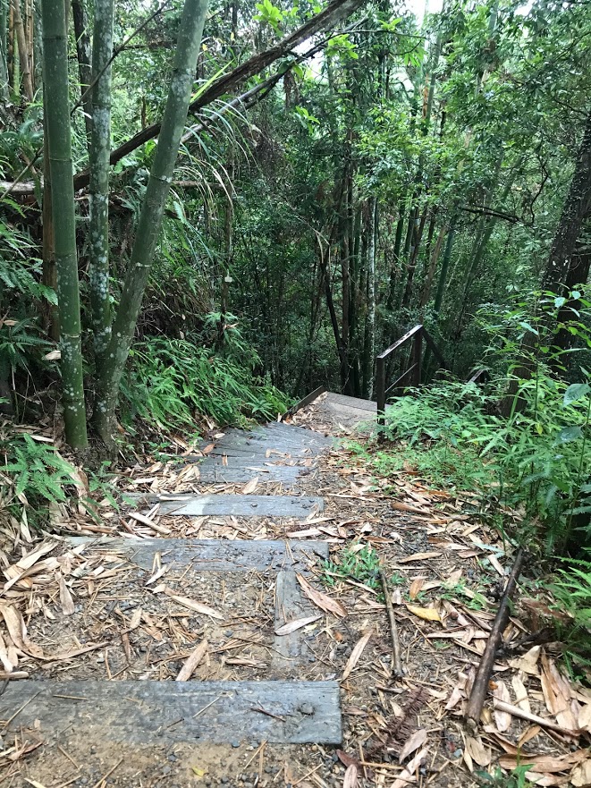
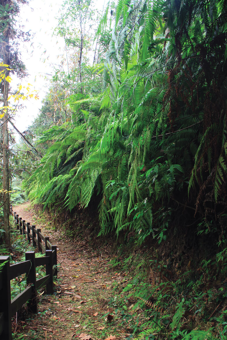
The Seshui Forest Trail is located in the Seshui Community by the Dayan Tunnel on the southwest side of Zhongtan Highway. Taking the trail surrounding the village, one can connect to the Forest Trail, Shuishang Trail, Wujimulin Trail, Tianding Trail and Zikanping Trail. All kinds of crops, green forests, natural wetlands, waterfalls, creeks and habitats of different animals can be seen along the way. As the area is near the upstream of the Taomikeng Creek and the Seshui Creek passes right through, there are large varieties of frogs, birds, mammals and insects.
07/26 Sun.
Open
25°
22° / 30°
南投縣 / 魚池鄉
More
Weather Forecast
|
07.27
Mon.
|
07.28
Tue.
|
07.29
Wed.
|
07.30
Thur.
|
07.31
Fri.
|
08.01
Sat.
|
08.02
Sun.
|
|
|---|---|---|---|---|---|---|---|
| Temperature |
22 ° / 30 °
|
21 ° / 31 °
|
21 ° / 31 °
|
22 ° / 30 °
|
22 ° / 30 °
|
21 ° / 30 °
|
20 ° / 30 °
|
| Feel like | 23 ° / 33 ° | 23 ° / 34 ° | 23 ° / 35 ° | 24 ° / 35 ° | 24 ° / 34 ° | 23 ° / 35 ° | 22 ° / 35 ° |
|
Probability of Precipitation |
80 % | 50 % | 40 % | - | - | - | - |
| Relative Humidity | 89 % | 88 % | 88 % | 90 % | 90 % | 89 % | 92 % |
|
Wind speed Wind direction |
2
E
|
2
E
|
2
E
|
-
SW
|
-
W
|
-
W
|
-
NE
|
| UVI |
8
Very High
|
9
Very High
|
9
Very High
|
9
Very High
|
8
Very High
|
9
Very High
|
9
Very High
|
|
Sunrise Sunset |
|
|
|
|
|
|
|
Central Weather Bureau|Update Time:2026/07/26 17:19
Yuchih Township, Changhua County
Seshui Forest Trail
Learn about the Trail
Trail difficulty level
| Hiking Level |
|
|
|
|
|
|
|
||||||||||||||||||||||||||||||||||||||||||
|---|---|---|---|---|---|---|---|---|---|---|---|---|---|---|---|---|---|---|---|---|---|---|---|---|---|---|---|---|---|---|---|---|---|---|---|---|---|---|---|---|---|---|---|---|---|---|---|---|---|
| Target | General Public | General Public | Those who have better physical energy | Beginner mountain climber with good physical energy and map literacy. | Open to those who have good physical strength, map reading skills, and wild survival skills. | Open to well-trained mountain climbers. | Open to well-trained mountain climbers. | ||||||||||||||||||||||||||||||||||||||||||
| Elevation | Gently sloping area | In recreational areas, close to settlements or about 1,000 meters above sea level. | In recreational areas, close to settlements or between 1,000~2,000 meters above sea level. | Remote areas or between 2,000 to 3,000 meters above sea level | Remote areas, wilderness, or between 2,000 to 3,000 meters above sea level | Remote areas, wilderness, or more than 3,000 meters above sea level | Remote areas, wilderness, or more than 3,000 meters above sea level | ||||||||||||||||||||||||||||||||||||||||||
| Required Time | It takes half to one day. | It takes half to one day. | It can be done within one day. | It takes one or more days. | Overnight preparation required. | It takes up to three days. | It takes up to three days. | ||||||||||||||||||||||||||||||||||||||||||
| Equipment | Light backpacking (water and small amount of food) | Light backpacking (water and small amount of food) | Light backpacking (water and proper amount of food) | Overnight preparation required. (e.g. drinking water, food, map, warm clothing, first-aid medicine, etc.) Application for entrance permission in advance is required if there is access control. | Comprehensive Mountaineering Gear Required. (e.g. food, drinking water, cooking utensils, map, warm clothing, flashlight, sleeping bag, tent, etc.) Application for entrance permission in advance is required if there is access control. | Comprehensive Mountaineering Gear Required. (e.g. food, drinking water, cooking utensils, map, warm clothing, flashlight, sleeping bag, tent, etc.) Application for entrance permission in advance is required if there is access control. | Comprehensive Mountaineering Gear Required. (e.g. food, drinking water, cooking utensils, map, warm clothing, flashlight, sleeping bag, tent, etc.) Application for entrance permission in advance is required if there is access control. | ||||||||||||||||||||||||||||||||||||||||||
| Description | Flat hiking trails. Relatively even slopes with comprehensive facilities and smooth road surface. Accessible for handicapped assistive devices or baby strollers. | An open hiking trail with easy access. Relatively even slopes with comprehensive facilities and smooth road surface. It takes half a day or less than one day to complete. | An open hiking trail with easy access. Somewhat steep slope with some difficult sections, but has comprehensive facilities and smooth road surface. It takes less than one day to complete. | A hiking trail locates at remote area or with part of the route is in area which requires entrance permission. Application in advance is required. Part of the route is in relatively bad condition with steeper slopes, but basic facilities are provided. It takes one day or between one to three days to complete. | A hiking trail locates at remote area or with part of the route is in area which requires entrance permission. It’s located in high-altitude areas (higher than 3000 meters above sea level). The trail is relatively primitive, with steeper slopes and unstable weather conditions. Part of the route may be dangerous or difficult for climbers. It takes two to three days to complete. Lead from professionals is recommended. | A hiking trail locates at area with inconvenient traffic, and mostly with routes in area which requires entrance permission. It’s located in high-altitude areas (higher than 3000 meters above sea level). The trail is located at primitive area, with bad condition, steeper slopes, and unstable weather conditions. Many parts of the route may be dangerous or difficult for climbers. It takes three or more days to complete. Lead from professionals is recommended. | 1. Level 3, 4 or 5 trails when snow or ice accumulating 2. Informal trails, without clear subgrades or paths, belong to special routes such as original mountain trails, ancient trail relics, prospecting, or technical climbing. |
Hiking Level
Target
General Public
Elevation
Gently sloping area
Required Time
It takes half to one day.
Equipment
Light backpacking (water and small amount of food)
Description
Flat hiking trails. Relatively even slopes with comprehensive facilities and smooth road surface. Accessible for handicapped assistive devices or baby strollers.
Hiking Level
Target
General Public
Elevation
In recreational areas, close to settlements or about 1,000 meters above sea level.
Required Time
It takes half to one day.
Equipment
Light backpacking (water and small amount of food)
Description
An open hiking trail with easy access. Relatively even slopes with comprehensive facilities and smooth road surface. It takes half a day or less than one day to complete.
Hiking Level
Target
Those who have better physical energy
Elevation
In recreational areas, close to settlements or between 1,000~2,000 meters above sea level.
Required Time
It can be done within one day.
Equipment
Light backpacking (water and proper amount of food)
Description
An open hiking trail with easy access. Somewhat steep slope with some difficult sections, but has comprehensive facilities and smooth road surface. It takes less than one day to complete.
Hiking Level
Target
Beginner mountain climber with good physical energy and map literacy.
Elevation
Remote areas or between 2,000 to 3,000 meters above sea level
Required Time
It takes one or more days.
Equipment
Overnight preparation required. (e.g. drinking water, food, map, warm clothing, first-aid medicine, etc.)
Application for entrance permission in advance is required if there is access control.
Description
A hiking trail locates at remote area or with part of the route is in area which requires entrance permission. Application in advance is required. Part of the route is in relatively bad condition with steeper slopes, but basic facilities are provided. It takes one day or between one to three days to complete.
Hiking Level
Target
Open to those who have good physical strength, map reading skills, and wild survival skills.
Elevation
Remote areas, wilderness, or between 2,000 to 3,000 meters above sea level
Required Time
Overnight preparation required.
Equipment
Comprehensive Mountaineering Gear Required. (e.g. food, drinking water, cooking utensils, map, warm clothing, flashlight, sleeping bag, tent, etc.)
Application for entrance permission in advance is required if there is access control.
Description
A hiking trail locates at remote area or with part of the route is in area which requires entrance permission. It’s located in high-altitude areas (higher than 3000 meters above sea level). The trail is relatively primitive, with steeper slopes and unstable weather conditions. Part of the route may be dangerous or difficult for climbers. It takes two to three days to complete. Lead from professionals is recommended.
Hiking Level
Target
Open to well-trained mountain climbers.
Elevation
Remote areas, wilderness, or more than 3,000 meters above sea level
Required Time
It takes up to three days.
Equipment
Comprehensive Mountaineering Gear Required. (e.g. food, drinking water, cooking utensils, map, warm clothing, flashlight, sleeping bag, tent, etc.)
Application for entrance permission in advance is required if there is access control.
Description
A hiking trail locates at area with inconvenient traffic, and mostly with routes in area which requires entrance permission. It’s located in high-altitude areas (higher than 3000 meters above sea level). The trail is located at primitive area, with bad condition, steeper slopes, and unstable weather conditions. Many parts of the route may be dangerous or difficult for climbers. It takes three or more days to complete. Lead from professionals is recommended.
Hiking Level
Target
Open to well-trained mountain climbers.
Elevation
Remote areas, wilderness, or more than 3,000 meters above sea level
Required Time
It takes up to three days.
Equipment
Comprehensive Mountaineering Gear Required. (e.g. food, drinking water, cooking utensils, map, warm clothing, flashlight, sleeping bag, tent, etc.)
Application for entrance permission in advance is required if there is access control.
Description
1. Level 3, 4 or 5 trails when snow or ice accumulating
2. Informal trails, without clear subgrades or paths, belong to special routes such as original mountain trails, ancient trail relics, prospecting, or technical climbing.
Reachable by Vehicle
X:Cars、Microbus、Coach Bus
Mountain system
-
Administer
Nantou Forest Dist. Office
Elevation
500 ~ 800 m
Service Line
+886 492365226 #2508
Altitude Difference
300 m
Huts
-
Length of the Trail
2.5 KM
Entry Permit
No
Trail type
Linear One-way
Via Nature Reserve
No
Service Line
Wooden path,Stairway,Industrial road
Geologically Sensitive Area
Yes
Route planning
Half day
Debris Flow Torrents
No
Trail Track
Trail route
Trailhead / Trig
Mobile coverage
Observations (From iNaturalist)
Trailhead / Trig
Mobile coverage
Observations (From iNaturalist)
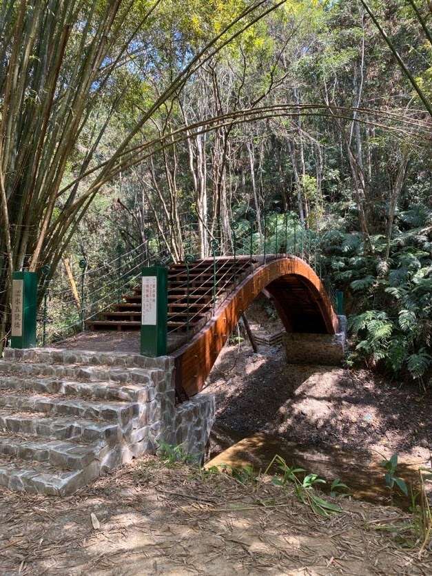
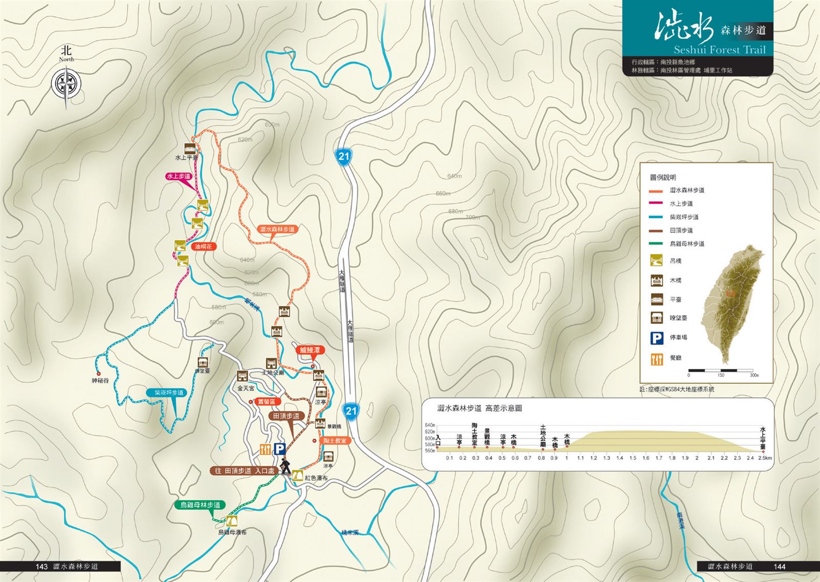
Seshui Community Tourism Service Station → (0.4K, 10 minutes) → Scenic Bridge → (0.4K, 10 minutes) → Tudigong Temple → (1.7K, 45 minutes) → Water Platform → (2.5K, 55 minutes) → Return to Seshui Community Tourism Service Station
Reminders
Mountain Encyclopedia
Please click below to view information
No Pets Allowed : "To prevent the spread of rabies and ensure the safety of pets and their owners, dogs, cats, and other mammals are not allowed on this trail."
https://www.baphiq.gov.tw/upload/baphiq//files/web_structure/10980/Rabies%20ppt%201100228.pdf
Travel Guide

Travel Guide
Nearby Attractions
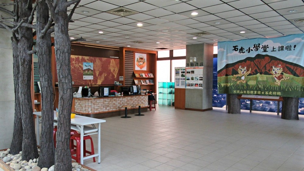
Seshui Community
After the 921 earthquake, the Seshui settlement introduced overall community construction, recovered the ancestral specialty farming "Assam black tea", and rebuilt the "Seshui Kiln", making the Seshui community a place to "drink black tea, play with clay, and experience ecology."
More
Sun Moon Lake National Scenic Area
Located in Yuchi Township, Nantou County, it is the largest freshwater lake in Taiwan. The lake is divided by Lalu Island, with the east side shaped like a sun wheel and the west side shaped like a crescent moon. The lake is clear and green, surrounded by mountains, and the mountains and waters are reflected in the lake, creating a poetic and picturesque scene. Other scenic spots around the lake include Yidashao (formerly known as Dehua Village), Xuanzang Temple and Ci'en Pagoda.
More
Liyu Lake
Liyu Lake, located at the foot of Huzi Mountain in Puli Township, Nantou, is known as the "Little West Lake". It covers an area of 20 hectares. The lake is divided into two parts by a dike bridge. Willow trees are like smoke, mountains are like fog, and the mountains are like clouds. You can go boating, fishing, hiking, cycling, etc.
Da Lin Ring Ridge Forest Trail
The "Da Lin" Ring Ridge Forest Trail is located to the left and rear of the "Jing Yuan Leisure Farm" in Jintian Lane, Da Lin Village, Yuchi Township. It is a circular route that passes through the shade of trees and flowers, rising slowly from 720 meters above sea level to 880 meters above sea level, and then slowly descending. The entire route is about 1.6 kilometers. The forest is a low-altitude coniferous and broad-leaved mixed forest with rich bird, insect and animal ecology; the bustling voices of the Formosan Aboriginal Cultural Village can be heard from time to time. The observation deck along the route overlooks the entire Da Lin Village and the scenery of Yuchi Township.
Travel Advice
Combine with nearby attractions in Puli, Nantou, and arrange a 1-2 day itinerary
Nearby Attractions