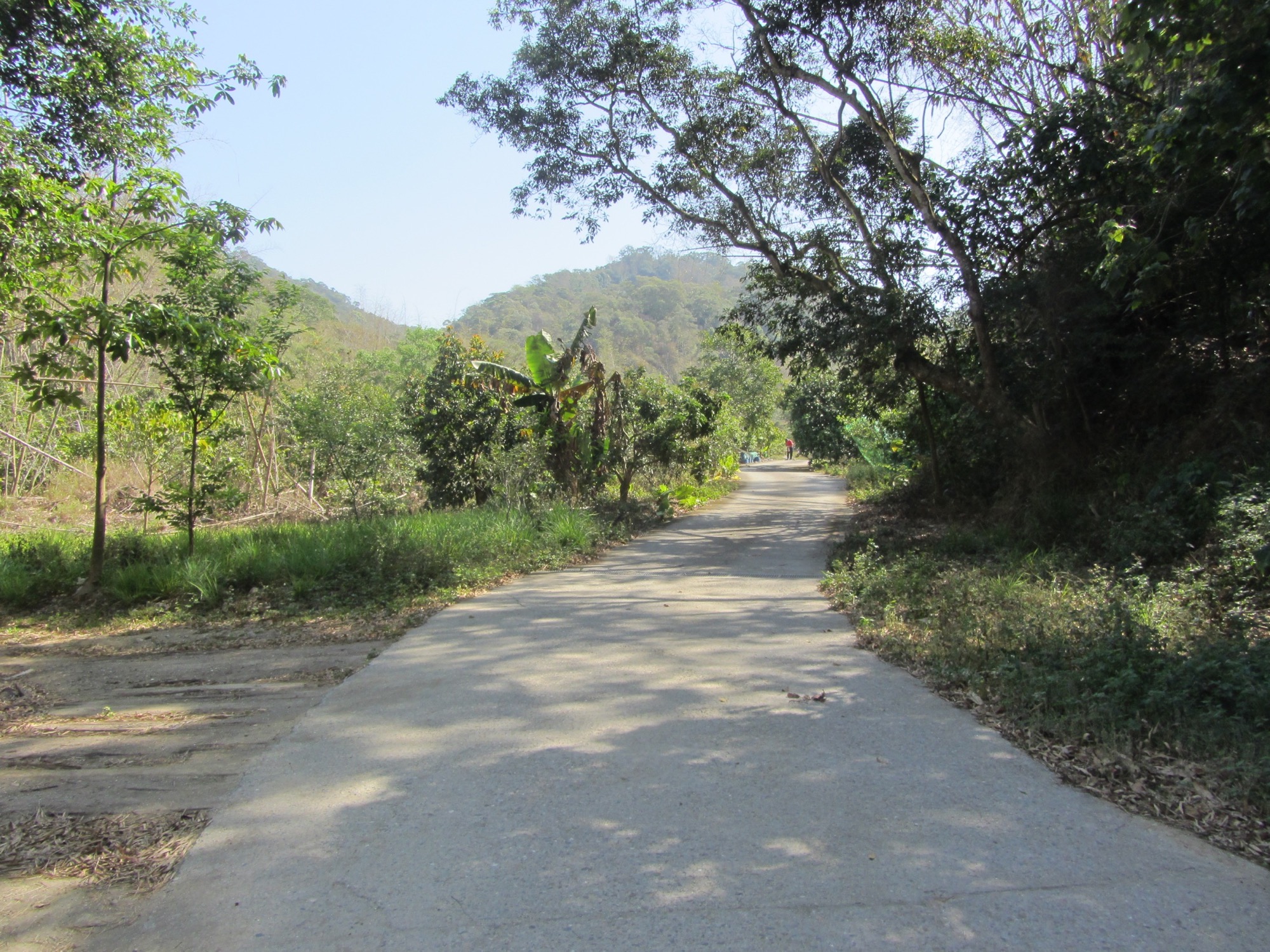
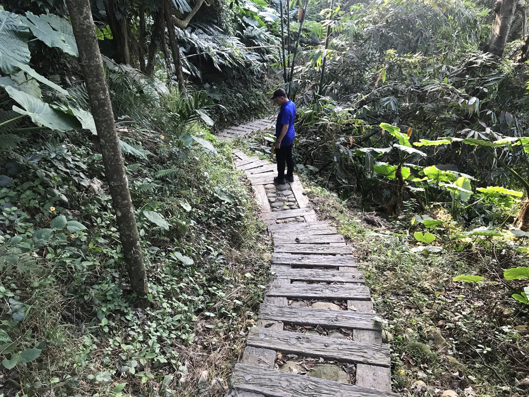
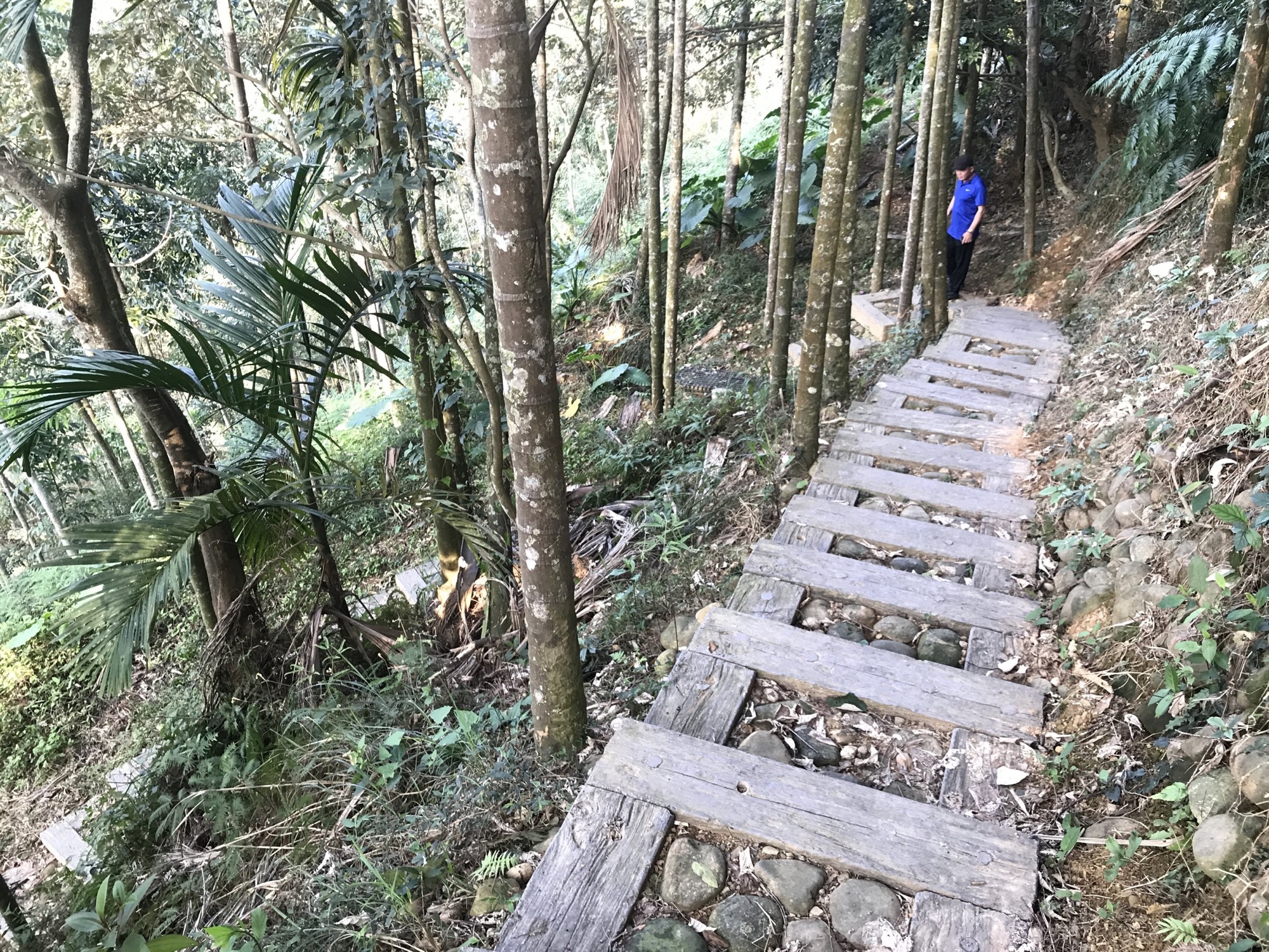
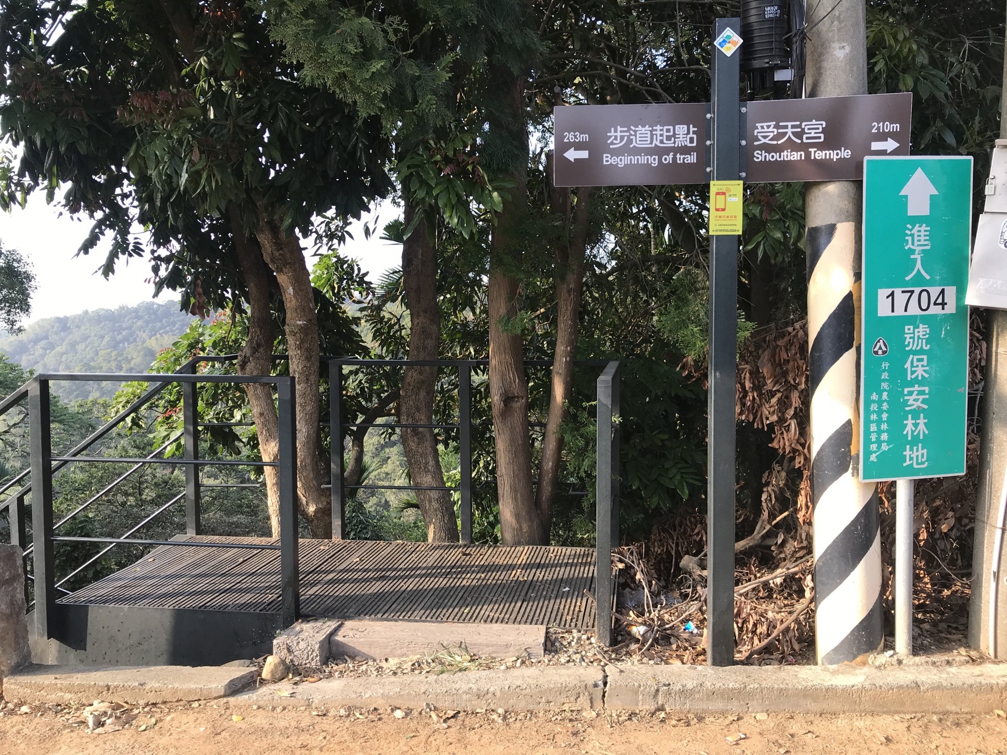
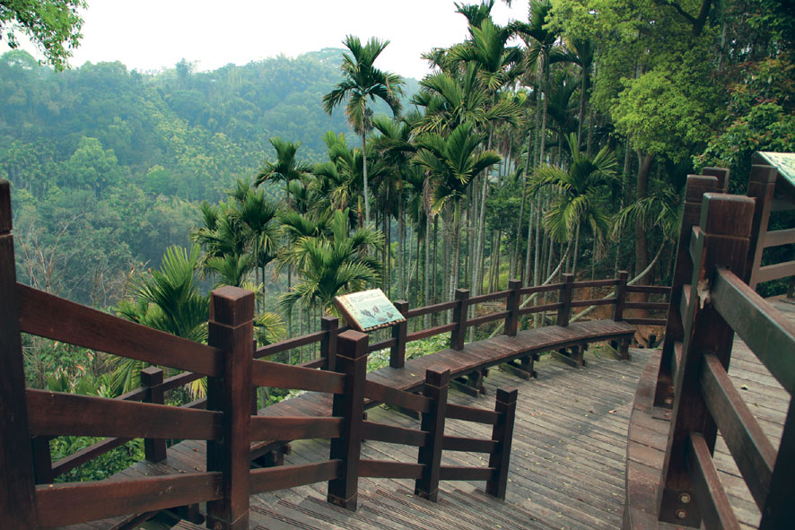
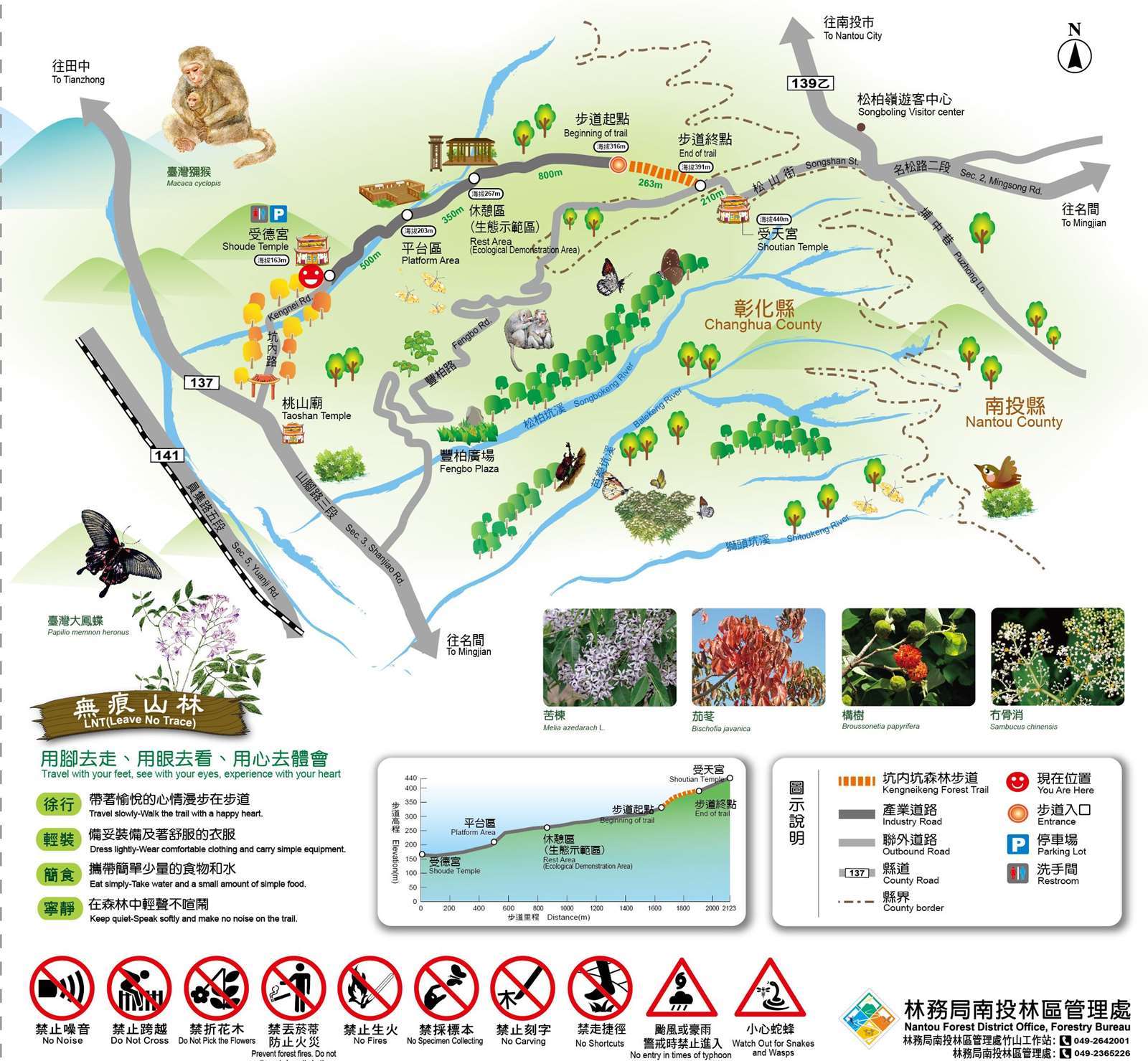
The trail begins at Shoude Temple in Fuxing Village of Ershui Township and ends at the wooden deck by Fengbo Road in Minjian Township, Nantou County. It connects Changhua County and Nanatou County. Hikers can follow the signs to reach Shoutian Temple at Songboling. One way takes about 50 minutes. Plans can also be made to include the peripheral trails to form a loop. Along the way are the Ecological Engineering Demonstration Zone, the Ecological Observation Zone, observation decks and rich plant and animal ecology. It is a great place from hiking and sightseeing.
07/26 Sun.
Open
29°
26° / 33°
彰化縣 / 二水鄉
More
Weather Forecast
|
07.27
Mon.
|
07.28
Tue.
|
07.29
Wed.
|
07.30
Thur.
|
07.31
Fri.
|
08.01
Sat.
|
08.02
Sun.
|
|
|---|---|---|---|---|---|---|---|
| Temperature |
26 ° / 33 °
|
25 ° / 34 °
|
26 ° / 35 °
|
26 ° / 35 °
|
26 ° / 33 °
|
25 ° / 34 °
|
25 ° / 34 °
|
| Feel like | 28 ° / 38 ° | 28 ° / 39 ° | 28 ° / 39 ° | 29 ° / 40 ° | 29 ° / 38 ° | 28 ° / 40 ° | 29 ° / 39 ° |
|
Probability of Precipitation |
70 % | 30 % | 20 % | - | - | - | - |
| Relative Humidity | 88 % | 83 % | 82 % | 82 % | 82 % | 84 % | 85 % |
|
Wind speed Wind direction |
2
NE
|
2
NE
|
2
NE
|
2
E
|
2
SW
|
2
SW
|
2
W
|
| UVI |
8
Very High
|
9
Very High
|
9
Very High
|
9
Very High
|
8
Very High
|
9
Very High
|
9
Very High
|
|
Sunrise Sunset |
|
|
|
|
|
|
|
Central Weather Bureau|Update Time:2026/07/26 17:19
Ershuei Township, Changhua County
Kengneikeng Forest Trail
Learn about the Trail
Trail difficulty level
| Hiking Level |
|
|
|
|
|
|
|
||||||||||||||||||||||||||||||||||||||||||
|---|---|---|---|---|---|---|---|---|---|---|---|---|---|---|---|---|---|---|---|---|---|---|---|---|---|---|---|---|---|---|---|---|---|---|---|---|---|---|---|---|---|---|---|---|---|---|---|---|---|
| Target | General Public | General Public | Those who have better physical energy | Beginner mountain climber with good physical energy and map literacy. | Open to those who have good physical strength, map reading skills, and wild survival skills. | Open to well-trained mountain climbers. | Open to well-trained mountain climbers. | ||||||||||||||||||||||||||||||||||||||||||
| Elevation | Gently sloping area | In recreational areas, close to settlements or about 1,000 meters above sea level. | In recreational areas, close to settlements or between 1,000~2,000 meters above sea level. | Remote areas or between 2,000 to 3,000 meters above sea level | Remote areas, wilderness, or between 2,000 to 3,000 meters above sea level | Remote areas, wilderness, or more than 3,000 meters above sea level | Remote areas, wilderness, or more than 3,000 meters above sea level | ||||||||||||||||||||||||||||||||||||||||||
| Required Time | It takes half to one day. | It takes half to one day. | It can be done within one day. | It takes one or more days. | Overnight preparation required. | It takes up to three days. | It takes up to three days. | ||||||||||||||||||||||||||||||||||||||||||
| Equipment | Light backpacking (water and small amount of food) | Light backpacking (water and small amount of food) | Light backpacking (water and proper amount of food) | Overnight preparation required. (e.g. drinking water, food, map, warm clothing, first-aid medicine, etc.) Application for entrance permission in advance is required if there is access control. | Comprehensive Mountaineering Gear Required. (e.g. food, drinking water, cooking utensils, map, warm clothing, flashlight, sleeping bag, tent, etc.) Application for entrance permission in advance is required if there is access control. | Comprehensive Mountaineering Gear Required. (e.g. food, drinking water, cooking utensils, map, warm clothing, flashlight, sleeping bag, tent, etc.) Application for entrance permission in advance is required if there is access control. | Comprehensive Mountaineering Gear Required. (e.g. food, drinking water, cooking utensils, map, warm clothing, flashlight, sleeping bag, tent, etc.) Application for entrance permission in advance is required if there is access control. | ||||||||||||||||||||||||||||||||||||||||||
| Description | Flat hiking trails. Relatively even slopes with comprehensive facilities and smooth road surface. Accessible for handicapped assistive devices or baby strollers. | An open hiking trail with easy access. Relatively even slopes with comprehensive facilities and smooth road surface. It takes half a day or less than one day to complete. | An open hiking trail with easy access. Somewhat steep slope with some difficult sections, but has comprehensive facilities and smooth road surface. It takes less than one day to complete. | A hiking trail locates at remote area or with part of the route is in area which requires entrance permission. Application in advance is required. Part of the route is in relatively bad condition with steeper slopes, but basic facilities are provided. It takes one day or between one to three days to complete. | A hiking trail locates at remote area or with part of the route is in area which requires entrance permission. It’s located in high-altitude areas (higher than 3000 meters above sea level). The trail is relatively primitive, with steeper slopes and unstable weather conditions. Part of the route may be dangerous or difficult for climbers. It takes two to three days to complete. Lead from professionals is recommended. | A hiking trail locates at area with inconvenient traffic, and mostly with routes in area which requires entrance permission. It’s located in high-altitude areas (higher than 3000 meters above sea level). The trail is located at primitive area, with bad condition, steeper slopes, and unstable weather conditions. Many parts of the route may be dangerous or difficult for climbers. It takes three or more days to complete. Lead from professionals is recommended. | 1. Level 3, 4 or 5 trails when snow or ice accumulating 2. Informal trails, without clear subgrades or paths, belong to special routes such as original mountain trails, ancient trail relics, prospecting, or technical climbing. |
Hiking Level
Target
General Public
Elevation
Gently sloping area
Required Time
It takes half to one day.
Equipment
Light backpacking (water and small amount of food)
Description
Flat hiking trails. Relatively even slopes with comprehensive facilities and smooth road surface. Accessible for handicapped assistive devices or baby strollers.
Hiking Level
Target
General Public
Elevation
In recreational areas, close to settlements or about 1,000 meters above sea level.
Required Time
It takes half to one day.
Equipment
Light backpacking (water and small amount of food)
Description
An open hiking trail with easy access. Relatively even slopes with comprehensive facilities and smooth road surface. It takes half a day or less than one day to complete.
Hiking Level
Target
Those who have better physical energy
Elevation
In recreational areas, close to settlements or between 1,000~2,000 meters above sea level.
Required Time
It can be done within one day.
Equipment
Light backpacking (water and proper amount of food)
Description
An open hiking trail with easy access. Somewhat steep slope with some difficult sections, but has comprehensive facilities and smooth road surface. It takes less than one day to complete.
Hiking Level
Target
Beginner mountain climber with good physical energy and map literacy.
Elevation
Remote areas or between 2,000 to 3,000 meters above sea level
Required Time
It takes one or more days.
Equipment
Overnight preparation required. (e.g. drinking water, food, map, warm clothing, first-aid medicine, etc.)
Application for entrance permission in advance is required if there is access control.
Description
A hiking trail locates at remote area or with part of the route is in area which requires entrance permission. Application in advance is required. Part of the route is in relatively bad condition with steeper slopes, but basic facilities are provided. It takes one day or between one to three days to complete.
Hiking Level
Target
Open to those who have good physical strength, map reading skills, and wild survival skills.
Elevation
Remote areas, wilderness, or between 2,000 to 3,000 meters above sea level
Required Time
Overnight preparation required.
Equipment
Comprehensive Mountaineering Gear Required. (e.g. food, drinking water, cooking utensils, map, warm clothing, flashlight, sleeping bag, tent, etc.)
Application for entrance permission in advance is required if there is access control.
Description
A hiking trail locates at remote area or with part of the route is in area which requires entrance permission. It’s located in high-altitude areas (higher than 3000 meters above sea level). The trail is relatively primitive, with steeper slopes and unstable weather conditions. Part of the route may be dangerous or difficult for climbers. It takes two to three days to complete. Lead from professionals is recommended.
Hiking Level
Target
Open to well-trained mountain climbers.
Elevation
Remote areas, wilderness, or more than 3,000 meters above sea level
Required Time
It takes up to three days.
Equipment
Comprehensive Mountaineering Gear Required. (e.g. food, drinking water, cooking utensils, map, warm clothing, flashlight, sleeping bag, tent, etc.)
Application for entrance permission in advance is required if there is access control.
Description
A hiking trail locates at area with inconvenient traffic, and mostly with routes in area which requires entrance permission. It’s located in high-altitude areas (higher than 3000 meters above sea level). The trail is located at primitive area, with bad condition, steeper slopes, and unstable weather conditions. Many parts of the route may be dangerous or difficult for climbers. It takes three or more days to complete. Lead from professionals is recommended.
Hiking Level
Target
Open to well-trained mountain climbers.
Elevation
Remote areas, wilderness, or more than 3,000 meters above sea level
Required Time
It takes up to three days.
Equipment
Comprehensive Mountaineering Gear Required. (e.g. food, drinking water, cooking utensils, map, warm clothing, flashlight, sleeping bag, tent, etc.)
Application for entrance permission in advance is required if there is access control.
Description
1. Level 3, 4 or 5 trails when snow or ice accumulating
2. Informal trails, without clear subgrades or paths, belong to special routes such as original mountain trails, ancient trail relics, prospecting, or technical climbing.
Reachable by Vehicle
X:Cars、Microbus、Coach Bus
Mountain system
-
Administer
Nantou Forest Dist. Office
Elevation
140 ~ 380 m
Service Line
+886 492365226 #2508
Altitude Difference
240 m
Huts
-
Length of the Trail
0.26 KM
Entry Permit
No
Trail type
-
Via Nature Reserve
No
Service Line
Soil pavement,Wooden path,Wooden stairway,Suspension Bridge
Geologically Sensitive Area
No
Route planning
Half day
Debris Flow Torrents
No
Trail Track
Trail route
Trailhead / Trig
Mobile coverage
Observations (From iNaturalist)
Trailhead / Trig
Mobile coverage
Observations (From iNaturalist)
Reminders
Mountain Encyclopedia
Please click below to view information
Travel Guide

Travel Guide
Nearby Attractions
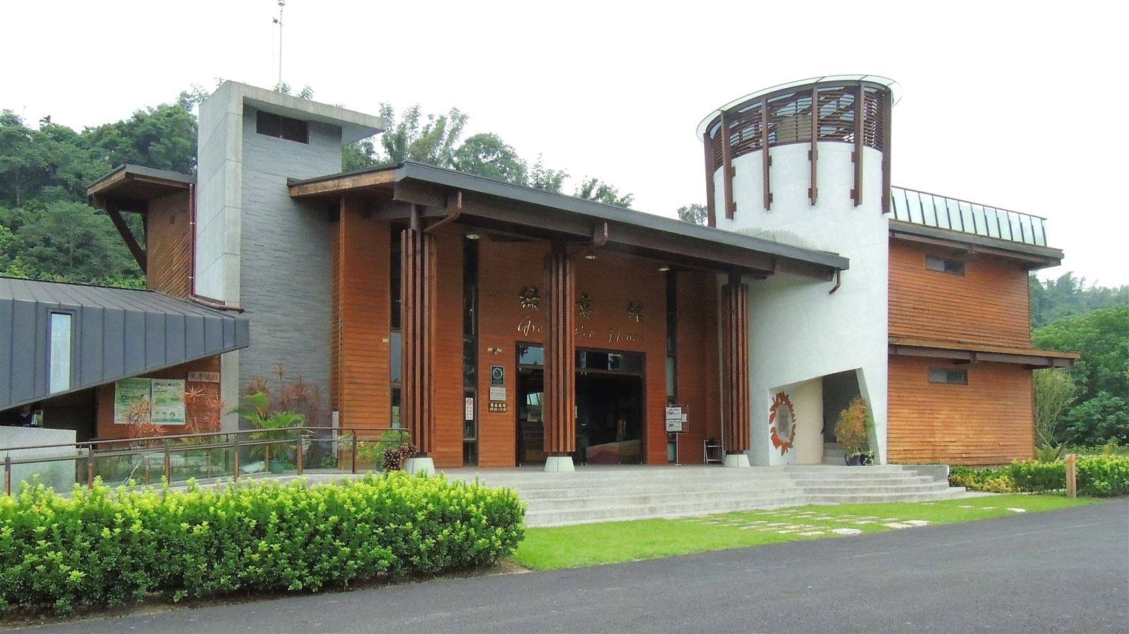
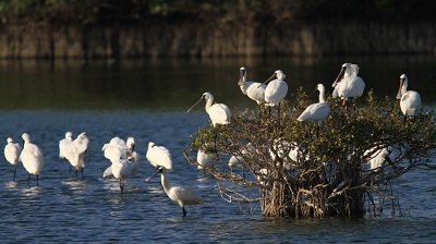
Ershui Taiwan Macaque Ecological Education Center
Located in the Bitouzi section of Ershui Township, Changhua County, the area is suitable for climate and rich and diverse plants, attracting Formosan macaques to inhabit and live. Along with Kaohsiung's Chaishan, it is one of the rare areas where Formosan macaques live at low altitudes. The Nantou Branch Office rebuilt the original Formosan macaque monitoring station into Taiwan's first ecological education center with the theme of Formosan macaque ecological education.
More
Songbailing Recreation Area
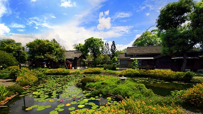
Located in Mingjian Township, Nantou County, at an altitude of about 500 meters at the southern end of Bagua Mountain, the tea production volume is the highest in the country, and it is famous for its Songbai Changqing tea. The recreation area has planned a tea village trail, where you can learn about tea and enjoy the tea garden landscape. The Shoutian Temple near the visitor center was built in the 14th year of Shunzhi in the Qing Dynasty. The main deity is Xuantian Shangdi. In front of the temple, you can overlook the Jianan Plain, Qingshui River and Zhuoshui River. When the weather is good, you can see the coastline.
Akasizaki Park
Located beside Tianzhong Zhongnan Road (County Road 150), the park was built to make use of the abandoned section of the old Zhongnan Road and is adjacent to Tianzhong Forest Park. Flowers and plants of all seasons are planted on both sides of the trail, and the original forest landscape is preserved, with abundant bird resources.
More
Ershui Station
During the Japanese occupation, Ershui Township was a place where three types of railways, namely the Longitudinal Railway, the Jiji Line Railway, and the Taiwan Sugar Railway, were gathered in one township. Therefore, the development and prosperity of the township are closely related to trains. Ershui Station is the starting point of the Jiji Branch Line, which runs along the north bank of the Zhuoshui River Valley and has a green tunnel that is several kilometers long.
More
Sanshan National Scenic Area
The scope of the Shenshan National Scenic Area includes three scenic areas, namely Shitou Mountain, Lishan Mountain and Bagua Mountain, covering urban, rural and mountainous areas.
Now please follow us to Shenshan. From now on, you will fall in love with this beautiful place that is approachable but has a variety of styles.
More
Travel Advice
Combined with the famous scenic spots in Ershui, Changhua and Nantou, a 1-2 day itinerary is arranged.
Nearby Attractions