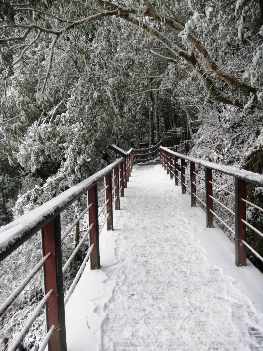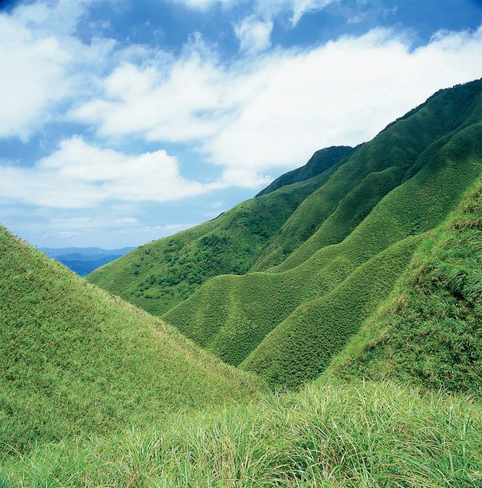


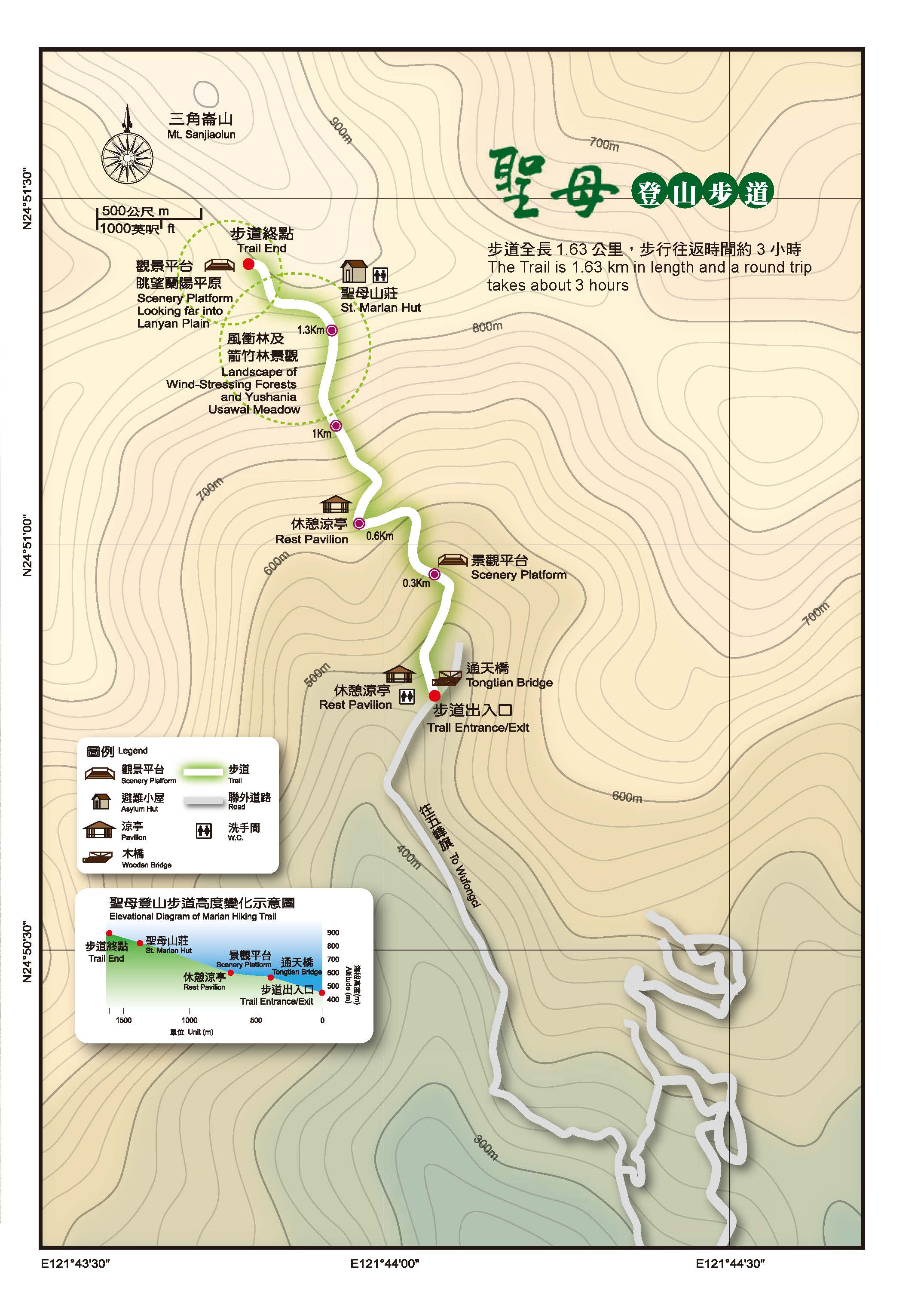
The Sacred Mother Trail is located above the Wufengqi Waterfall Scenic Area in Jiaoxi Township, Yilan County. It is a pilgrimage road for Catholics and also a relay station for people going to Sanjiaolun Mountain, one of the five major mountains in the Lanyang area. To reach the trail, one has to pass a 3.7km-long country road with a gentle climb that takes about an hour. There are secondary and plantation forests along the way and large varieties of birds and insects. Then a steep climb follows. The journey takes about 3 hours back and fort. Tiered waterfalls, broadleaf forests, dwarf forests and arrow bamboo groves can be seen along the way. Finally, there is the observation deck on the ridge overlooking the Pacific. In winter, the northeasterly monsoon wind brings a lot of rain. In the afternoon in summer, wind often picks up and the area becomes foggy. The climate is changeful and the spectacular view of raining in one place and sun shining just not so far away is a common sight.
07/25 Sat.
Closed
29°
27° / 32°
宜蘭縣 / 礁溪鄉
More
Weather Forecast
|
07.25
Today
|
07.26
Sun.
|
07.27
Mon.
|
07.28
Tue.
|
07.29
Wed.
|
07.30
Thur.
|
07.31
Fri.
|
|
|---|---|---|---|---|---|---|---|
| Temperature |
27 ° / 32 °
|
26 ° / 32 °
|
26 ° / 32 °
|
25 ° / 32 °
|
25 ° / 33 °
|
26 ° / 33 °
|
26 ° / 33 °
|
| Feel like | 25 ° / 32 ° | 26 ° / 34 ° | 29 ° / 35 ° | 29 ° / 36 ° | 28 ° / 37 ° | 29 ° / 38 ° | 29 ° / 39 ° |
|
Probability of Precipitation |
20 % | 20 % | 10 % | - | - | - | - |
| Relative Humidity | 81 % | 83 % | 83 % | 83 % | 81 % | 82 % | 81 % |
|
Wind speed Wind direction |
5
E
|
4
NE
|
3
E
|
3
E
|
2
E
|
-
SW
|
2
SW
|
| UVI |
9
Very High
|
9
Very High
|
9
Very High
|
11
危險級
|
11
危險級
|
10
Very High
|
10
Very High
|
|
Sunrise Sunset |
|
|
|
|
|
|
|
Central Weather Bureau|Update Time:2026/07/25 04:55
Sacred Mother Trail
Learn about the Trail
Application
Transportation
Provincial Highway 9
Provincial Highway no.9→Jiaoxi→Follow the signage of Wufengci Waterfall, turn right to Yilan County Highway no.2→Wufengci Scenic Area
By train
Exit Jiaoxi Station, cross provincial Highway no.9→go along De Yang Rd. and turn left to Wu Feng Rd. Follow the signage and head to Wu Feng Chi Waterfall
Trail difficulty level
| Hiking Level |
|
|
|
|
|
|
|
||||||||||||||||||||||||||||||||||||||||||
|---|---|---|---|---|---|---|---|---|---|---|---|---|---|---|---|---|---|---|---|---|---|---|---|---|---|---|---|---|---|---|---|---|---|---|---|---|---|---|---|---|---|---|---|---|---|---|---|---|---|
| Target | General Public | General Public | Those who have better physical energy | Beginner mountain climber with good physical energy and map literacy. | Open to those who have good physical strength, map reading skills, and wild survival skills. | Open to well-trained mountain climbers. | Open to well-trained mountain climbers. | ||||||||||||||||||||||||||||||||||||||||||
| Elevation | Gently sloping area | In recreational areas, close to settlements or about 1,000 meters above sea level. | In recreational areas, close to settlements or between 1,000~2,000 meters above sea level. | Remote areas or between 2,000 to 3,000 meters above sea level | Remote areas, wilderness, or between 2,000 to 3,000 meters above sea level | Remote areas, wilderness, or more than 3,000 meters above sea level | Remote areas, wilderness, or more than 3,000 meters above sea level | ||||||||||||||||||||||||||||||||||||||||||
| Required Time | It takes half to one day. | It takes half to one day. | It can be done within one day. | It takes one or more days. | Overnight preparation required. | It takes up to three days. | It takes up to three days. | ||||||||||||||||||||||||||||||||||||||||||
| Equipment | Light backpacking (water and small amount of food) | Light backpacking (water and small amount of food) | Light backpacking (water and proper amount of food) | Overnight preparation required. (e.g. drinking water, food, map, warm clothing, first-aid medicine, etc.) Application for entrance permission in advance is required if there is access control. | Comprehensive Mountaineering Gear Required. (e.g. food, drinking water, cooking utensils, map, warm clothing, flashlight, sleeping bag, tent, etc.) Application for entrance permission in advance is required if there is access control. | Comprehensive Mountaineering Gear Required. (e.g. food, drinking water, cooking utensils, map, warm clothing, flashlight, sleeping bag, tent, etc.) Application for entrance permission in advance is required if there is access control. | Comprehensive Mountaineering Gear Required. (e.g. food, drinking water, cooking utensils, map, warm clothing, flashlight, sleeping bag, tent, etc.) Application for entrance permission in advance is required if there is access control. | ||||||||||||||||||||||||||||||||||||||||||
| Description | Flat hiking trails. Relatively even slopes with comprehensive facilities and smooth road surface. Accessible for handicapped assistive devices or baby strollers. | An open hiking trail with easy access. Relatively even slopes with comprehensive facilities and smooth road surface. It takes half a day or less than one day to complete. | An open hiking trail with easy access. Somewhat steep slope with some difficult sections, but has comprehensive facilities and smooth road surface. It takes less than one day to complete. | A hiking trail locates at remote area or with part of the route is in area which requires entrance permission. Application in advance is required. Part of the route is in relatively bad condition with steeper slopes, but basic facilities are provided. It takes one day or between one to three days to complete. | A hiking trail locates at remote area or with part of the route is in area which requires entrance permission. It’s located in high-altitude areas (higher than 3000 meters above sea level). The trail is relatively primitive, with steeper slopes and unstable weather conditions. Part of the route may be dangerous or difficult for climbers. It takes two to three days to complete. Lead from professionals is recommended. | A hiking trail locates at area with inconvenient traffic, and mostly with routes in area which requires entrance permission. It’s located in high-altitude areas (higher than 3000 meters above sea level). The trail is located at primitive area, with bad condition, steeper slopes, and unstable weather conditions. Many parts of the route may be dangerous or difficult for climbers. It takes three or more days to complete. Lead from professionals is recommended. | 1. Level 3, 4 or 5 trails when snow or ice accumulating 2. Informal trails, without clear subgrades or paths, belong to special routes such as original mountain trails, ancient trail relics, prospecting, or technical climbing. |
Hiking Level
Target
General Public
Elevation
Gently sloping area
Required Time
It takes half to one day.
Equipment
Light backpacking (water and small amount of food)
Description
Flat hiking trails. Relatively even slopes with comprehensive facilities and smooth road surface. Accessible for handicapped assistive devices or baby strollers.
Hiking Level
Target
General Public
Elevation
In recreational areas, close to settlements or about 1,000 meters above sea level.
Required Time
It takes half to one day.
Equipment
Light backpacking (water and small amount of food)
Description
An open hiking trail with easy access. Relatively even slopes with comprehensive facilities and smooth road surface. It takes half a day or less than one day to complete.
Hiking Level
Target
Those who have better physical energy
Elevation
In recreational areas, close to settlements or between 1,000~2,000 meters above sea level.
Required Time
It can be done within one day.
Equipment
Light backpacking (water and proper amount of food)
Description
An open hiking trail with easy access. Somewhat steep slope with some difficult sections, but has comprehensive facilities and smooth road surface. It takes less than one day to complete.
Hiking Level
Target
Beginner mountain climber with good physical energy and map literacy.
Elevation
Remote areas or between 2,000 to 3,000 meters above sea level
Required Time
It takes one or more days.
Equipment
Overnight preparation required. (e.g. drinking water, food, map, warm clothing, first-aid medicine, etc.)
Application for entrance permission in advance is required if there is access control.
Description
A hiking trail locates at remote area or with part of the route is in area which requires entrance permission. Application in advance is required. Part of the route is in relatively bad condition with steeper slopes, but basic facilities are provided. It takes one day or between one to three days to complete.
Hiking Level
Target
Open to those who have good physical strength, map reading skills, and wild survival skills.
Elevation
Remote areas, wilderness, or between 2,000 to 3,000 meters above sea level
Required Time
Overnight preparation required.
Equipment
Comprehensive Mountaineering Gear Required. (e.g. food, drinking water, cooking utensils, map, warm clothing, flashlight, sleeping bag, tent, etc.)
Application for entrance permission in advance is required if there is access control.
Description
A hiking trail locates at remote area or with part of the route is in area which requires entrance permission. It’s located in high-altitude areas (higher than 3000 meters above sea level). The trail is relatively primitive, with steeper slopes and unstable weather conditions. Part of the route may be dangerous or difficult for climbers. It takes two to three days to complete. Lead from professionals is recommended.
Hiking Level
Target
Open to well-trained mountain climbers.
Elevation
Remote areas, wilderness, or more than 3,000 meters above sea level
Required Time
It takes up to three days.
Equipment
Comprehensive Mountaineering Gear Required. (e.g. food, drinking water, cooking utensils, map, warm clothing, flashlight, sleeping bag, tent, etc.)
Application for entrance permission in advance is required if there is access control.
Description
A hiking trail locates at area with inconvenient traffic, and mostly with routes in area which requires entrance permission. It’s located in high-altitude areas (higher than 3000 meters above sea level). The trail is located at primitive area, with bad condition, steeper slopes, and unstable weather conditions. Many parts of the route may be dangerous or difficult for climbers. It takes three or more days to complete. Lead from professionals is recommended.
Hiking Level
Target
Open to well-trained mountain climbers.
Elevation
Remote areas, wilderness, or more than 3,000 meters above sea level
Required Time
It takes up to three days.
Equipment
Comprehensive Mountaineering Gear Required. (e.g. food, drinking water, cooking utensils, map, warm clothing, flashlight, sleeping bag, tent, etc.)
Application for entrance permission in advance is required if there is access control.
Description
1. Level 3, 4 or 5 trails when snow or ice accumulating
2. Informal trails, without clear subgrades or paths, belong to special routes such as original mountain trails, ancient trail relics, prospecting, or technical climbing.
Reachable by Vehicle
O:Cars , X:Microbus、Coach Bus
Mountain system
Xue Mountain Range
Administer
Yilan Forest Dist. Office
Elevation
400 ~ 950 m
Service Line
+886 39545114
Altitude Difference
550 m
Huts
-
Length of the Trail
1.6 KM
Entry Permit
No
Trail type
-
Via Nature Reserve
No
Service Line
Industrial road,Mountain trail
Geologically Sensitive Area
Yes
Route planning
1 day
Debris Flow Torrents
No
Trail Track
Trail route
Trailhead / Trig
Mobile coverage
Observations (From iNaturalist)
Trailhead / Trig
Mobile coverage
Observations (From iNaturalist)
Reminders
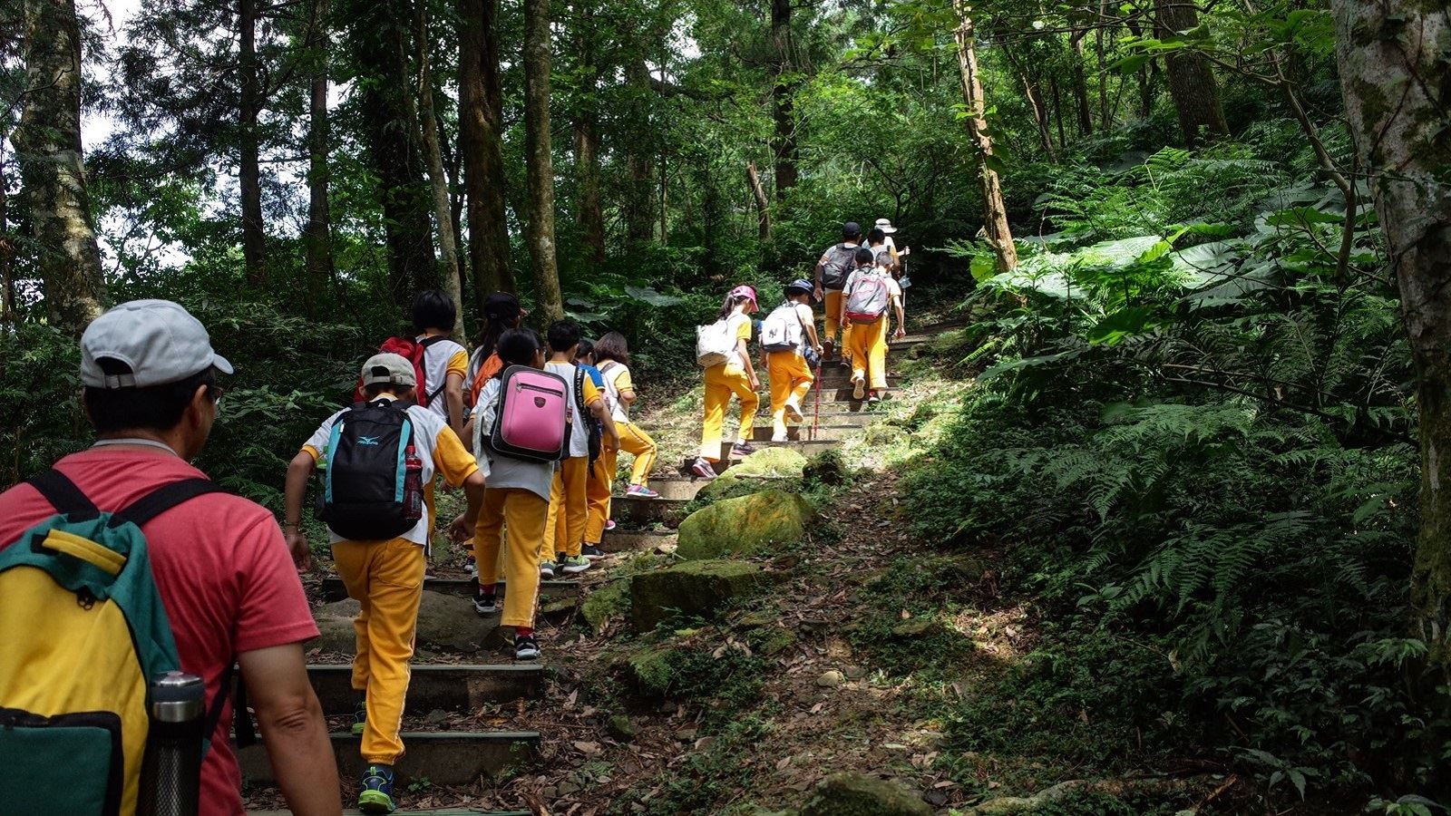
Go with your companions and don't take shortcuts.
To ensure your safety, please go with your companions, follow the indicators, do not take shortcuts or self-directed routes, and do not leave your team and walk alone.
Carry Global Positioning System and communication equipment
For hiking, please plan your trip and bring enough equipment and food with you. It is suggested that you should carry Global Positioning System (GPS) and communication equipment such as a satellite phone, mobile phone, radio or satellite positioning equipment such as Personal Locator Beacon (PLB), etc., and should carry enough batteries to ensure emergency communication.
Quickly pass dangerous areas
The road condition in the mountainous area is unstable. Please do not stay or take pictures in dangerous areas such as collapsed or falling rocks and pay attention to your own safety at any time.
It is recommended to complete the mountaineering insurance
There are certain risks in mountain activities. It is recommended that you should complete mountaineering insurance before departure. (Note: General travel insurance does not necessarily cover mountaineering accidents. Please refer to the policy details before applying for insurance. For the mountaineering insurance, please refer to the following instructions in Financial Supervisory Commission's press release and choose the appropriate insurance.)
Information on mountaineering safety
For information on mountaineering safety, mountaineering equipment, and tips for using maps, please visit the website http://goo.gl/QUnv13u. It is recommended to read the information before the trip to ensure your outdoor activities are safe.
Travel Guide

Travel Guide
Featured Landscape
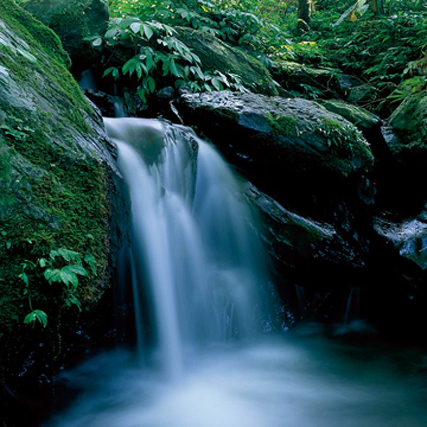
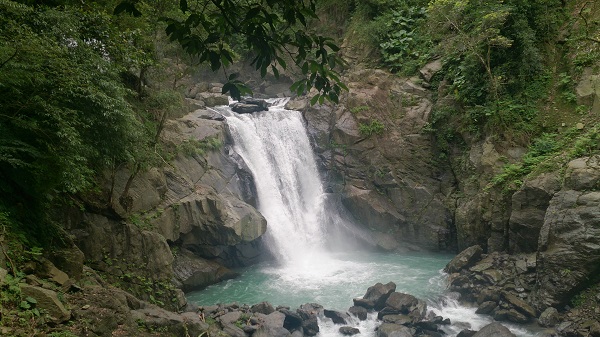
Rapids and rocks nourish the valley ecology
Source|宜蘭分署
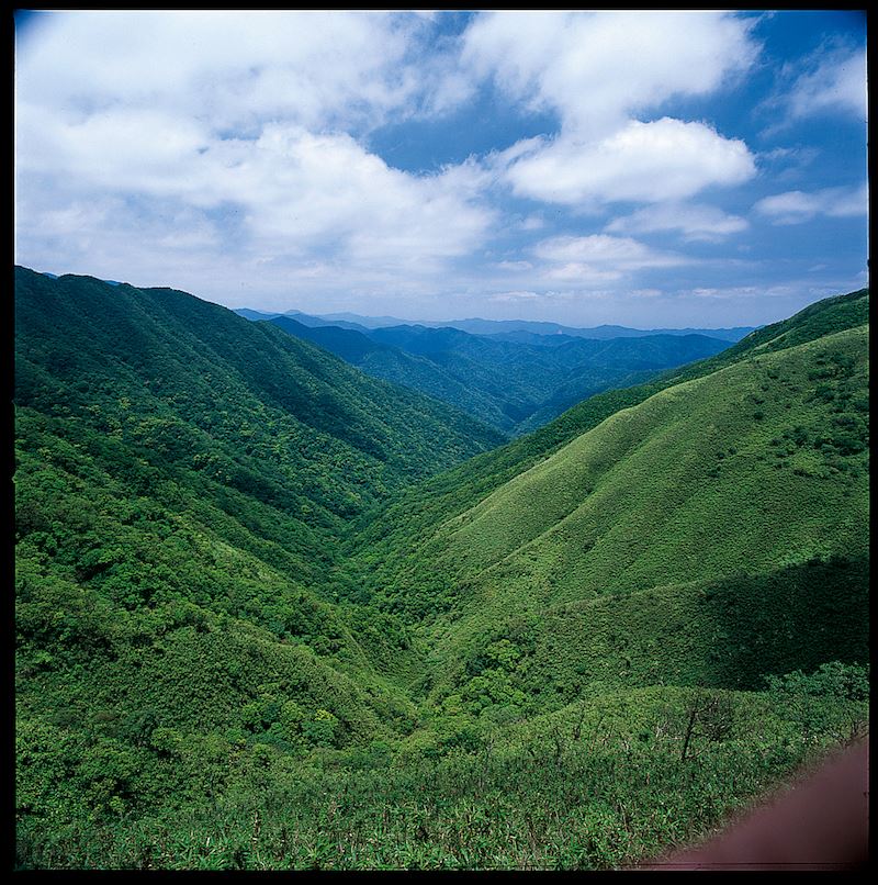
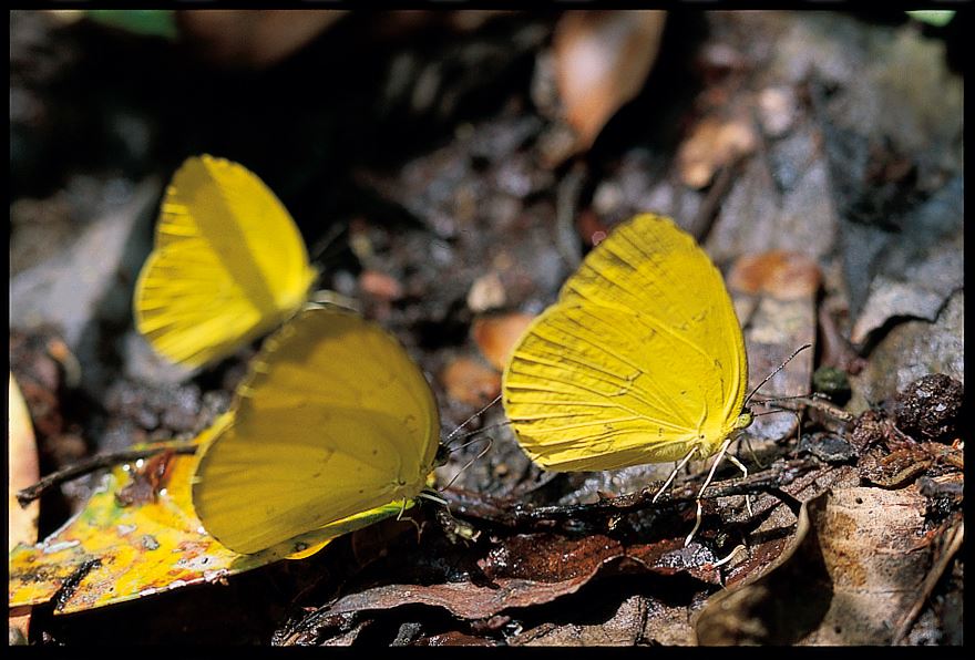
The end of the Industrial Road is Tongtian Bridge, which is the beginning of the Sacred Mother hiking trail. The first 300 meters of the trail runs along the Dezikou River. The strong water flow washes the rocks into sharp edges, and the fish and shrimps swimming in the water can be clearly counted. The moisture-loving and shade-tolerant valley vegetation provides a rich food source for birds and insects.
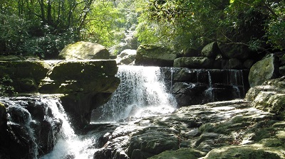
Forest flora changes with altitude
Source|宜蘭分署
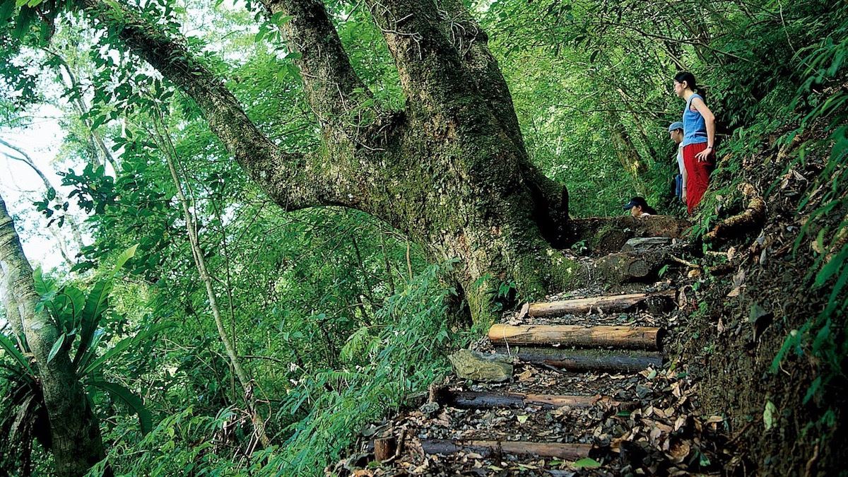
There is a large crape myrtle at 400 meters on the trail. From there, the slope rises dramatically, from 520 meters above sea level to a rest pavilion at 620 meters above sea level. The surrounding plant landscape also undergoes subtle changes as the altitude rises. Mid-altitude plants such as black cherry, wild peony, hornwort, long-leafed litsea cubeba, and three-leafed oak begin to appear.

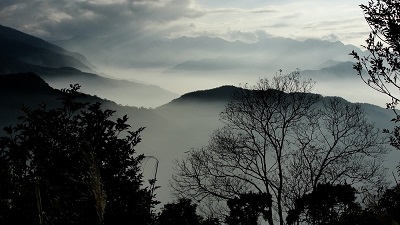
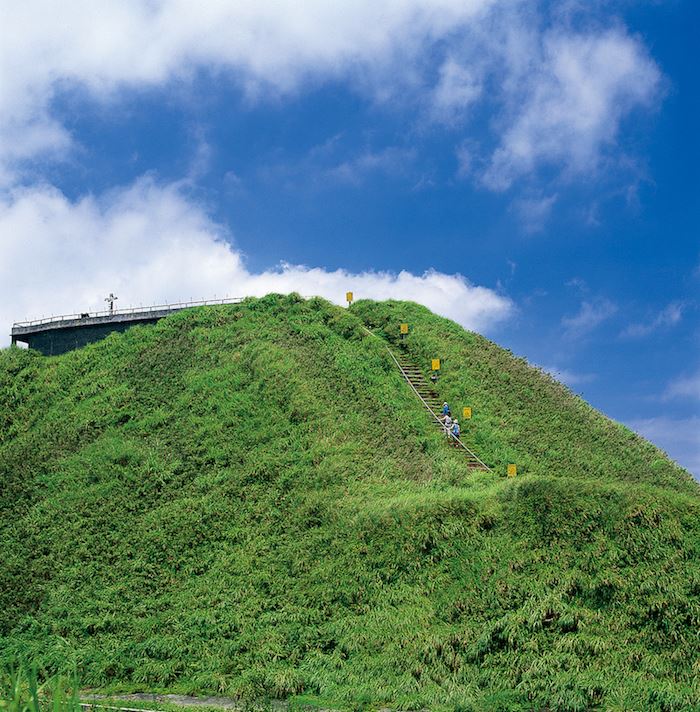
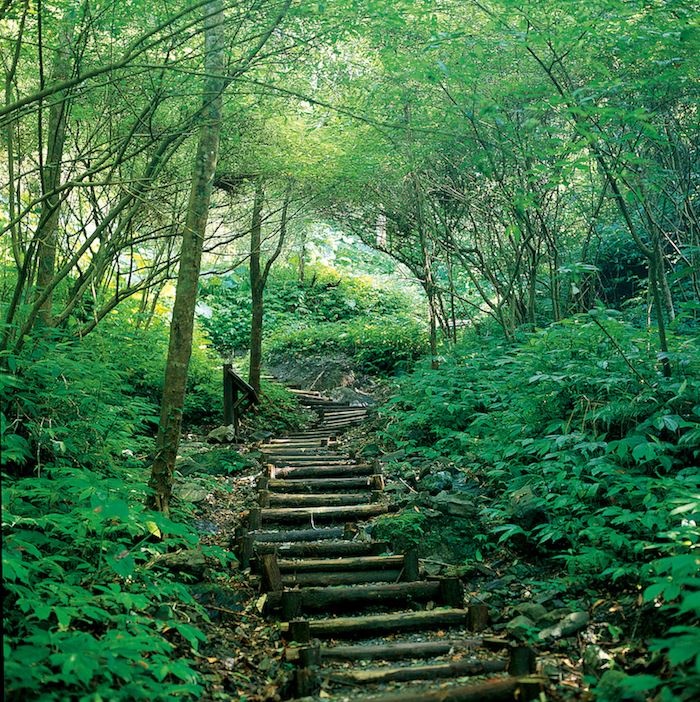
Step by step, towards the miracle on the mountain top
Source|宜蘭分署
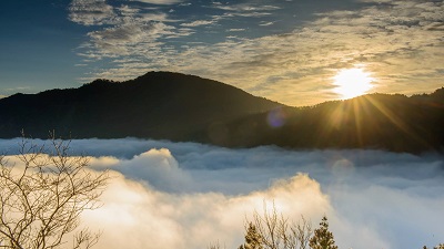
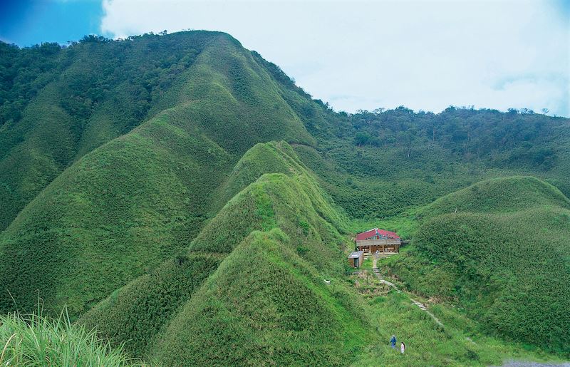
The viewing platform at the end of the trail faces the Lanyang Plain to the east and green mountains to the west. This platform is not only the administrative boundary between Yilan and Taipei, but also a meteorological dividing line, with clear distinctions between sunny and rainy days in front of and behind the mountain. The observation deck is also a worship platform for pilgrims. There stands a statue of the crucifixion of Jesus, and next to it are the Fourteen Stairs of Sorrow. Below the platform are statues of the Sacred Mother and Brother Barry. There is a path leading to the red-roofed wooden Sacred Mother Villa, which is a hut for mountaineers to rest.
Nearby Attractions