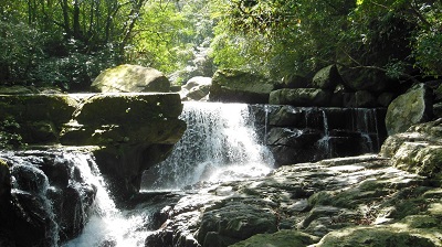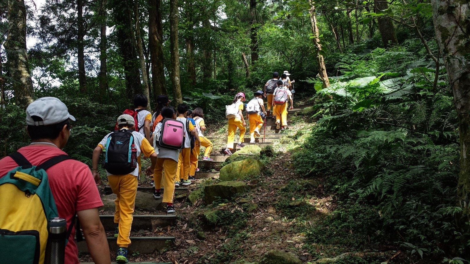
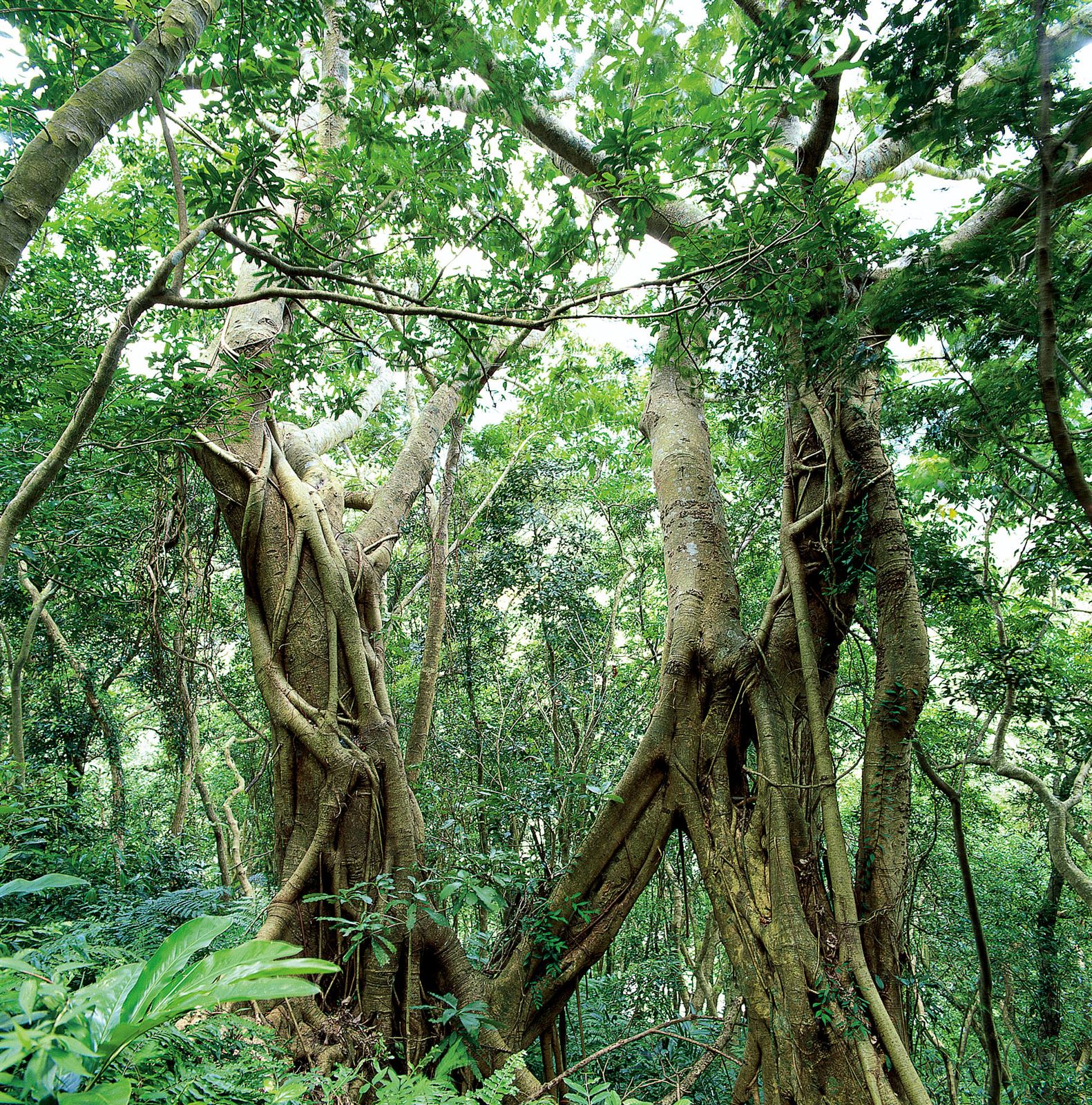
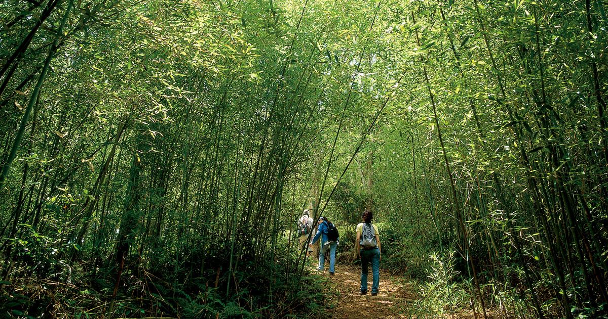
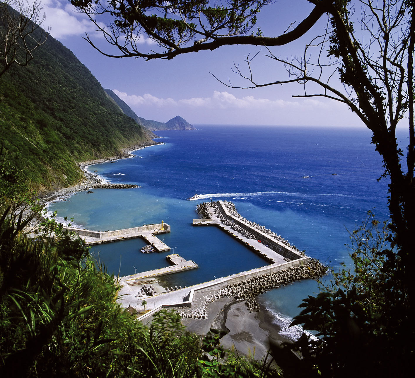

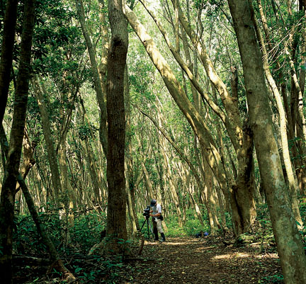
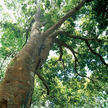
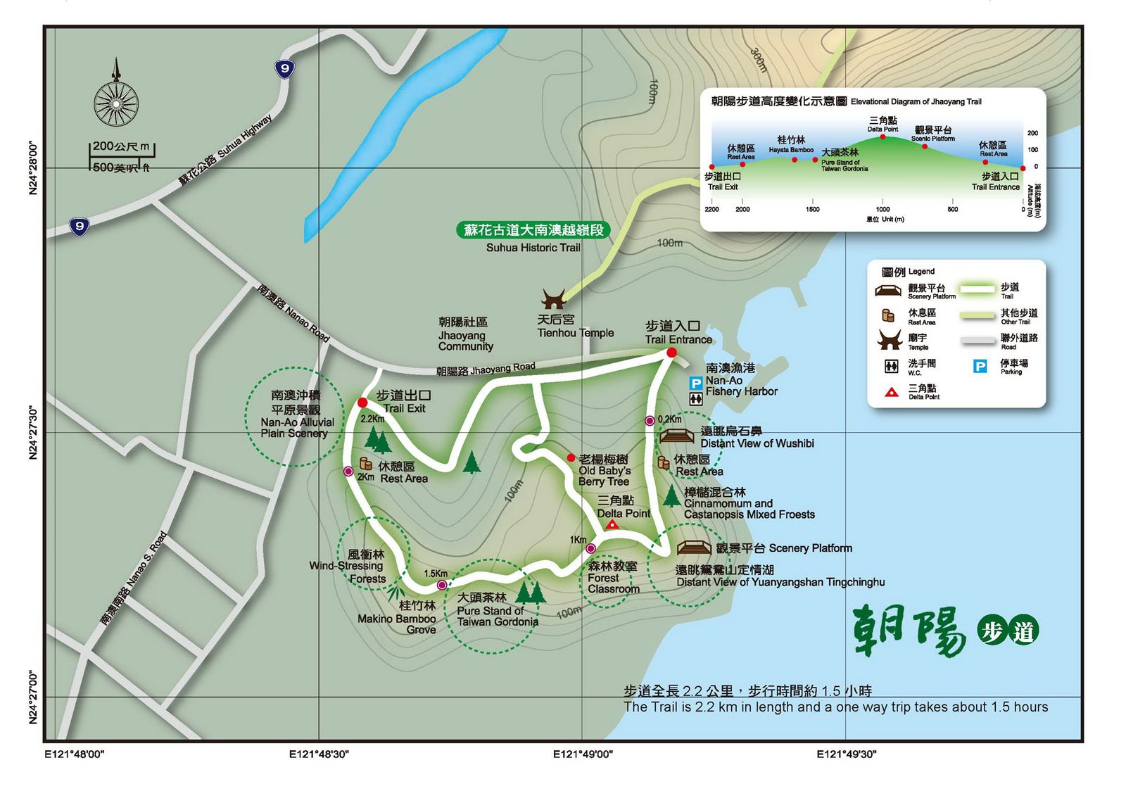
The Zhaoyang National Trail is on Guishan Hill in Nanao, Yilan County. Guishan Hill is to the south of the Zhaoyang Community, with the sea coast on the east side and farm villages and fishing villages scattering on the rolling hills to the west. When looked at from a distance, it seems to be a sea turtle between the ocean and the mountains. That is why it is called Guishan, Turtle Mountain. In the early days, the trail was the main passage for local residents to go up the hill to grow crops. Along the way, visitors can see changeful mountain and ocean views and idyllic scenes. On both sides are broadleaf forests of the Lauraceae and Fagaceae families. There is also a Taiwan Gordonia plantation taking up seven hectares of land. Going up Guishan Hill to watch the sunrise and listen to the waves is a most memorable experience.
07/19 Sat.
Caution
26°
26° / 26°
宜蘭縣 / 蘇澳鎮
More
Weather Forecast
|
07.19
Today
|
07.20
Sun.
|
07.21
Mon.
|
07.22
Tue.
|
07.23
Wed.
|
07.24
Thur.
|
07.25
Fri.
|
|
|---|---|---|---|---|---|---|---|
| Temperature |
26 ° / 26 °
|
26 ° / 29 °
|
26 ° / 29 °
|
26 ° / 28 °
|
26 ° / 28 °
|
26 ° / 30 °
|
26 ° / 30 °
|
| Feel like | 25 ° / 27 ° | 26 ° / 31 ° | 28 ° / 33 ° | 29 ° / 32 ° | 29 ° / 31 ° | 28 ° / 32 ° | 30 ° / 35 ° |
|
Probability of Precipitation |
90 % | 80 % | 70 % | - | - | - | - |
| Relative Humidity | 92 % | 83 % | 85 % | 89 % | 89 % | 89 % | 88 % |
|
Wind speed Wind direction |
5
SW
|
4
SW
|
4
SW
|
3
SW
|
3
NW
|
4
SW
|
3
W
|
| UVI |
6
High
|
8
Very High
|
7
High
|
6
High
|
6
High
|
8
Very High
|
8
Very High
|
|
Sunrise Sunset |
|
|
|
|
|
|
|
Central Weather Bureau|Update Time:2025/07/19 05:04
Su-ao Township, Yilan County
Jhaoyang Trail
Learn about the Trail
Application
Transportation
Route 1
1. Bei-Yi Highway→ take Suhua Highway (Provincial Highway no.9)through Dong’au→take a left and enter “Chaoyang mount-marine ecology park”→take Rd. Naniang, turn left at Rd. Chaoyang→reach Chaoyang Fisherman’s Harbor→entrance of hiking trail
Route 2
2.Bei Yi Highway→take Su Hua Highway (Provincial Highway no.9) and pass Tung ao→Turn left to Nan’ao Rd.→take Chao Yang Rd.→Reach Nan’ao Chaoyang Fisherman’s Harbor→hiking trail entrance
By train
Start from Nan’ao Train Station→walk from Nan’ao street and turn to Chaoyang Community. The distance is about 1 kilometer.
Trail difficulty level
| Hiking Level |
|
|
|
|
|
|
|
||||||||||||||||||||||||||||||||||||||||||
|---|---|---|---|---|---|---|---|---|---|---|---|---|---|---|---|---|---|---|---|---|---|---|---|---|---|---|---|---|---|---|---|---|---|---|---|---|---|---|---|---|---|---|---|---|---|---|---|---|---|
| Target | General Public | General Public | Those who have better physical energy | Beginner mountain climber with good physical energy and map literacy. | Open to those who have good physical strength, map reading skills, and wild survival skills. | Open to well-trained mountain climbers. | Open to well-trained mountain climbers. | ||||||||||||||||||||||||||||||||||||||||||
| Elevation | Gently sloping area | In recreational areas, close to settlements or about 1,000 meters above sea level. | In recreational areas, close to settlements or between 1,000~2,000 meters above sea level. | Remote areas or between 2,000 to 3,000 meters above sea level | Remote areas, wilderness, or between 2,000 to 3,000 meters above sea level | Remote areas, wilderness, or more than 3,000 meters above sea level | Remote areas, wilderness, or more than 3,000 meters above sea level | ||||||||||||||||||||||||||||||||||||||||||
| Required Time | It takes half to one day. | It takes half to one day. | It can be done within one day. | It takes one or more days. | Overnight preparation required. | It takes up to three days. | It takes up to three days. | ||||||||||||||||||||||||||||||||||||||||||
| Equipment | Light backpacking (water and small amount of food) | Light backpacking (water and small amount of food) | Light backpacking (water and proper amount of food) | Overnight preparation required. (e.g. drinking water, food, map, warm clothing, first-aid medicine, etc.) Application for entrance permission in advance is required if there is access control. | Comprehensive Mountaineering Gear Required. (e.g. food, drinking water, cooking utensils, map, warm clothing, flashlight, sleeping bag, tent, etc.) Application for entrance permission in advance is required if there is access control. | Comprehensive Mountaineering Gear Required. (e.g. food, drinking water, cooking utensils, map, warm clothing, flashlight, sleeping bag, tent, etc.) Application for entrance permission in advance is required if there is access control. | Comprehensive Mountaineering Gear Required. (e.g. food, drinking water, cooking utensils, map, warm clothing, flashlight, sleeping bag, tent, etc.) Application for entrance permission in advance is required if there is access control. | ||||||||||||||||||||||||||||||||||||||||||
| Description | Flat hiking trails. Relatively even slopes with comprehensive facilities and smooth road surface. Accessible for handicapped assistive devices or baby strollers. | An open hiking trail with easy access. Relatively even slopes with comprehensive facilities and smooth road surface. It takes half a day or less than one day to complete. | An open hiking trail with easy access. Somewhat steep slope with some difficult sections, but has comprehensive facilities and smooth road surface. It takes less than one day to complete. | A hiking trail locates at remote area or with part of the route is in area which requires entrance permission. Application in advance is required. Part of the route is in relatively bad condition with steeper slopes, but basic facilities are provided. It takes one day or between one to three days to complete. | A hiking trail locates at remote area or with part of the route is in area which requires entrance permission. It’s located in high-altitude areas (higher than 3000 meters above sea level). The trail is relatively primitive, with steeper slopes and unstable weather conditions. Part of the route may be dangerous or difficult for climbers. It takes two to three days to complete. Lead from professionals is recommended. | A hiking trail locates at area with inconvenient traffic, and mostly with routes in area which requires entrance permission. It’s located in high-altitude areas (higher than 3000 meters above sea level). The trail is located at primitive area, with bad condition, steeper slopes, and unstable weather conditions. Many parts of the route may be dangerous or difficult for climbers. It takes three or more days to complete. Lead from professionals is recommended. | 1. Level 3, 4 or 5 trails when snow or ice accumulating 2. Informal trails, without clear subgrades or paths, belong to special routes such as original mountain trails, ancient trail relics, prospecting, or technical climbing. |
Hiking Level
Target
General Public
Elevation
Gently sloping area
Required Time
It takes half to one day.
Equipment
Light backpacking (water and small amount of food)
Description
Flat hiking trails. Relatively even slopes with comprehensive facilities and smooth road surface. Accessible for handicapped assistive devices or baby strollers.
Hiking Level
Target
General Public
Elevation
In recreational areas, close to settlements or about 1,000 meters above sea level.
Required Time
It takes half to one day.
Equipment
Light backpacking (water and small amount of food)
Description
An open hiking trail with easy access. Relatively even slopes with comprehensive facilities and smooth road surface. It takes half a day or less than one day to complete.
Hiking Level
Target
Those who have better physical energy
Elevation
In recreational areas, close to settlements or between 1,000~2,000 meters above sea level.
Required Time
It can be done within one day.
Equipment
Light backpacking (water and proper amount of food)
Description
An open hiking trail with easy access. Somewhat steep slope with some difficult sections, but has comprehensive facilities and smooth road surface. It takes less than one day to complete.
Hiking Level
Target
Beginner mountain climber with good physical energy and map literacy.
Elevation
Remote areas or between 2,000 to 3,000 meters above sea level
Required Time
It takes one or more days.
Equipment
Overnight preparation required. (e.g. drinking water, food, map, warm clothing, first-aid medicine, etc.)
Application for entrance permission in advance is required if there is access control.
Description
A hiking trail locates at remote area or with part of the route is in area which requires entrance permission. Application in advance is required. Part of the route is in relatively bad condition with steeper slopes, but basic facilities are provided. It takes one day or between one to three days to complete.
Hiking Level
Target
Open to those who have good physical strength, map reading skills, and wild survival skills.
Elevation
Remote areas, wilderness, or between 2,000 to 3,000 meters above sea level
Required Time
Overnight preparation required.
Equipment
Comprehensive Mountaineering Gear Required. (e.g. food, drinking water, cooking utensils, map, warm clothing, flashlight, sleeping bag, tent, etc.)
Application for entrance permission in advance is required if there is access control.
Description
A hiking trail locates at remote area or with part of the route is in area which requires entrance permission. It’s located in high-altitude areas (higher than 3000 meters above sea level). The trail is relatively primitive, with steeper slopes and unstable weather conditions. Part of the route may be dangerous or difficult for climbers. It takes two to three days to complete. Lead from professionals is recommended.
Hiking Level
Target
Open to well-trained mountain climbers.
Elevation
Remote areas, wilderness, or more than 3,000 meters above sea level
Required Time
It takes up to three days.
Equipment
Comprehensive Mountaineering Gear Required. (e.g. food, drinking water, cooking utensils, map, warm clothing, flashlight, sleeping bag, tent, etc.)
Application for entrance permission in advance is required if there is access control.
Description
A hiking trail locates at area with inconvenient traffic, and mostly with routes in area which requires entrance permission. It’s located in high-altitude areas (higher than 3000 meters above sea level). The trail is located at primitive area, with bad condition, steeper slopes, and unstable weather conditions. Many parts of the route may be dangerous or difficult for climbers. It takes three or more days to complete. Lead from professionals is recommended.
Hiking Level
Target
Open to well-trained mountain climbers.
Elevation
Remote areas, wilderness, or more than 3,000 meters above sea level
Required Time
It takes up to three days.
Equipment
Comprehensive Mountaineering Gear Required. (e.g. food, drinking water, cooking utensils, map, warm clothing, flashlight, sleeping bag, tent, etc.)
Application for entrance permission in advance is required if there is access control.
Description
1. Level 3, 4 or 5 trails when snow or ice accumulating
2. Informal trails, without clear subgrades or paths, belong to special routes such as original mountain trails, ancient trail relics, prospecting, or technical climbing.
Reachable by Vehicle
O:Cars、Microbus、Coach Bus
Mountain system
Central Mountain Range
Administer
Luodong Forest Dist. Office
Elevation
0 ~ 182 m
Service Line
+886 39545114
Altitude Difference
182 m
Huts
-
Length of the Trail
2.2 KM
Entry Permit
No
Trail type
-
Via Nature Reserve
No
Service Line
Sleeper stairway,Soil trail
Geologically Sensitive Area
No
Route planning
Half day
Debris Flow Torrents
No
Trail Track
Trail route
Trailhead / Trig
Mobile coverage
Observations (From iNaturalist)
Trailhead / Trig
Mobile coverage
Observations (From iNaturalist)
Reminders
Go with your companions and don't take shortcuts.
To ensure your safety, please go with your companions, follow the indicators, do not take shortcuts or self-directed routes, and do not leave your team and walk alone.
Carry Global Positioning System and communication equipment
For hiking, please plan your trip and bring enough equipment and food with you. It is suggested that you should carry Global Positioning System (GPS) and communication equipment such as a satellite phone, mobile phone, radio or satellite positioning equipment such as Personal Locator Beacon (PLB), etc., and should carry enough batteries to ensure emergency communication.
Quickly pass dangerous areas
The road condition in the mountainous area is unstable. Please do not stay or take pictures in dangerous areas such as collapsed or falling rocks and pay attention to your own safety at any time.
It is recommended to complete the mountaineering insurance
There are certain risks in mountain activities. It is recommended that you should complete mountaineering insurance before departure. (Note: General travel insurance does not necessarily cover mountaineering accidents. Please refer to the policy details before applying for insurance. For the mountaineering insurance, please refer to the following instructions in Financial Supervisory Commission's press release and choose the appropriate insurance.)
Information on mountaineering safety
For information on mountaineering safety, mountaineering equipment, and tips for using maps, please visit the website http://goo.gl/QUnv26u. It is recommended to read the information before the trip to ensure your outdoor activities are safe.
Travel Guide

Travel Guide
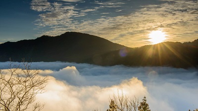
Featured Landscape

Climb high and take in the mountain and sea views
Source|宜蘭分署
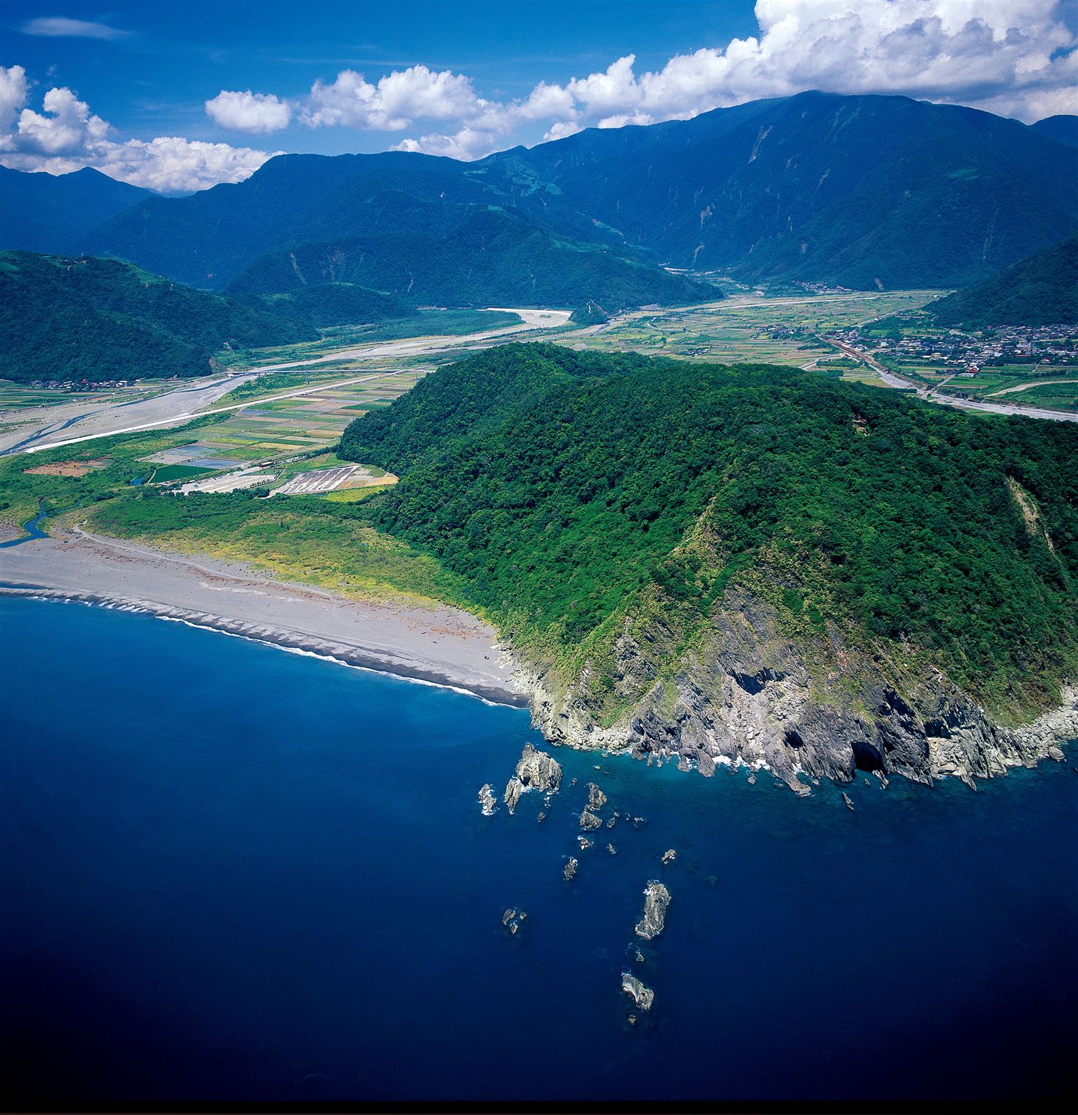
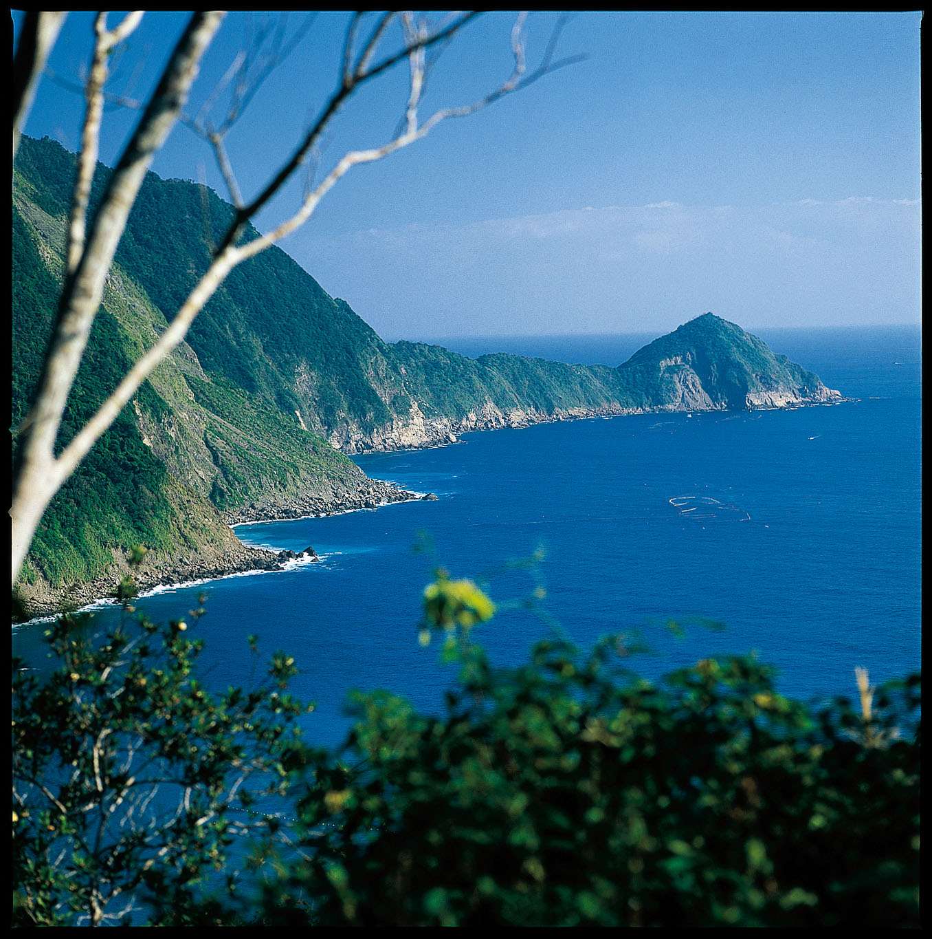
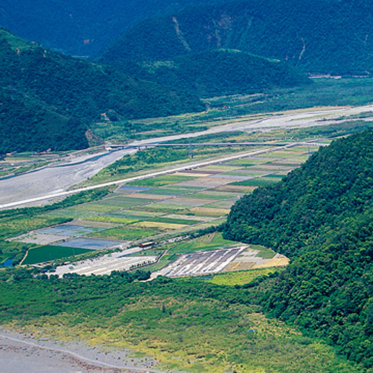
There are three entrances and exits on the Chaoyang Trail. The entrance is located next to the Nan'ao Fishing Port. From here, you climb all the way to the highest point of Guishan Mountain. After that, the trail splits into two. The main line is 2.2 kilometers long and takes about 90 minutes; the branch line is shorter and takes about 80 minutes. There are four viewing platforms on the trail. The first viewing platform has a 180-degree wide field of view, suitable for listening to the waves, watching the waves and smelling the sea breeze; the second is the best viewing position, where you can overlook the "Wushibi" coastal terrain, Nan'ao Fishing Port and the operation of its fixed fishing nets; the third is to the north of "Wushibi" and to the south to see the mysterious beach, Yuanyang Mountain and Dingqing Lake; the fourth is located on the other side of the hillside of Guishan Mountain, overlooking a field scenery. The third and fourth viewing platforms were originally the remains of artillery batteries from the Qing Dynasty, but the former was buried by a landslide, while the latter was stolen and is no longer visible.
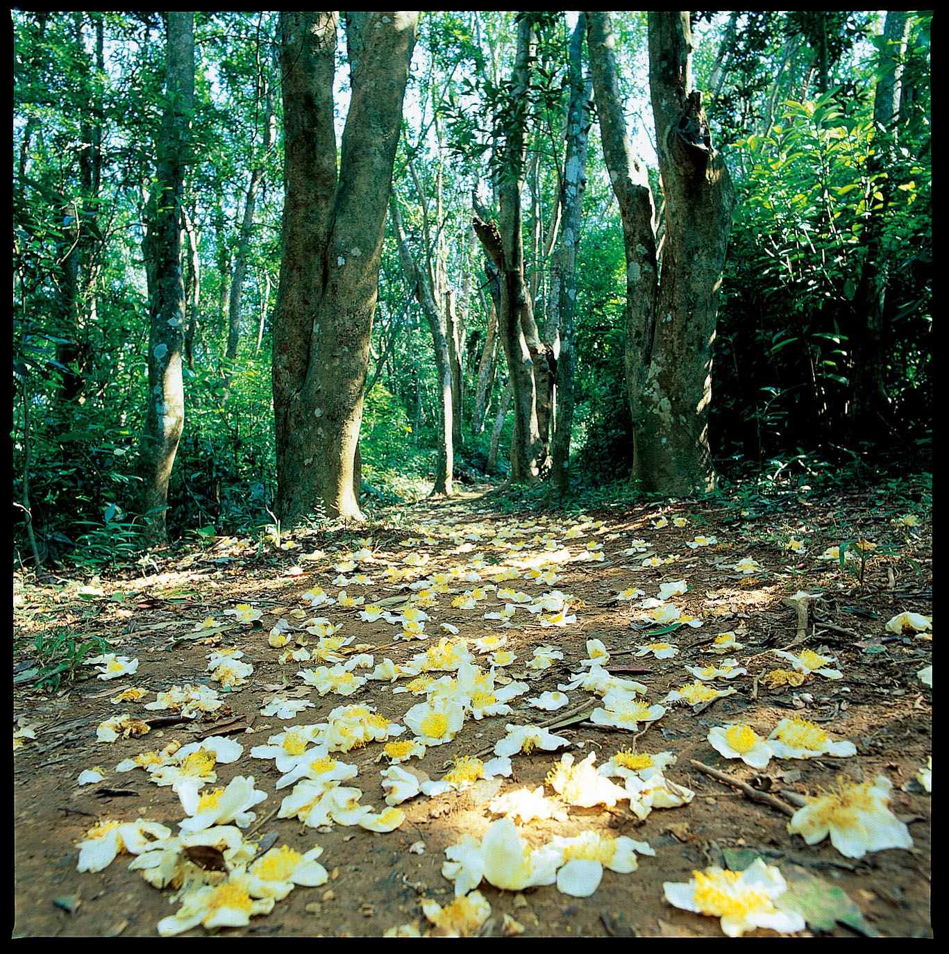
Snow-white Camellia
Source|宜蘭分署
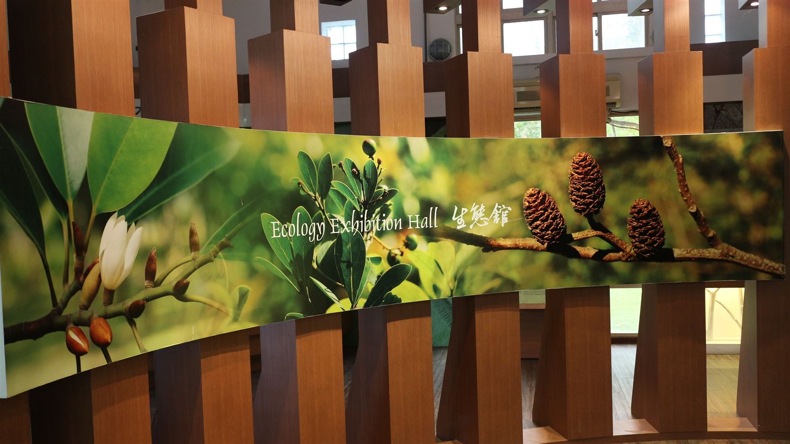
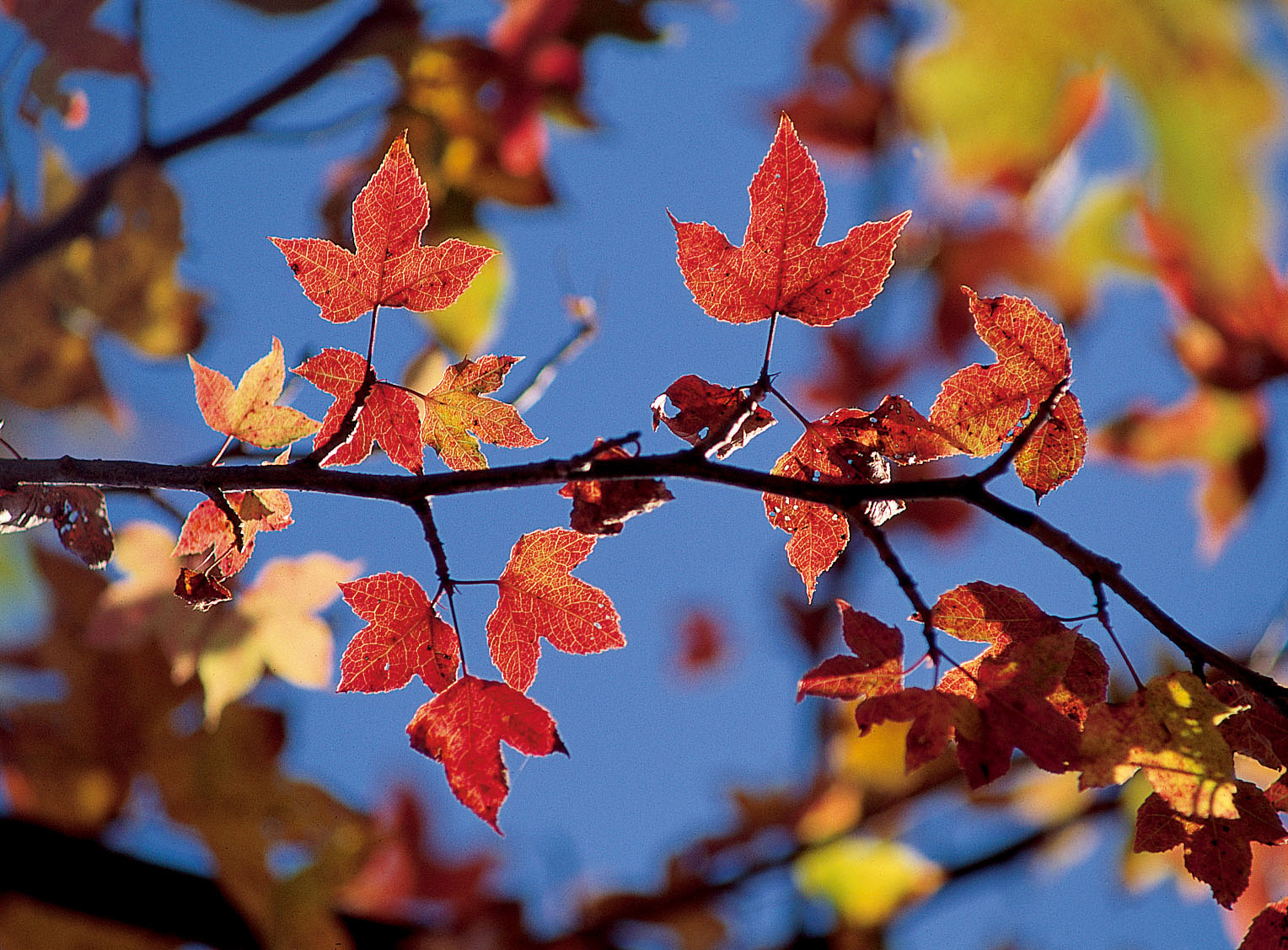
The highest point of Guishan Mountain is 181 meters above sea level. The triangulation point foundation stone is located at about 900 meters on the trail. There are thatched houses and forest classrooms on one side, and on the other side is a rare 7-hectare tea forest. When the fruits of the Camellia dahurica are ripe, they burst open and the winged seeds fly out to sow naturally, so that the plant grows particularly densely. When it blooms in autumn and winter, the snow-white Camellia dahurica flowers adorn the mountaintops and the fallen flowers cover the mountain paths like a white carpet, which is romantic and charming.
Nearby Attractions